Stay Updated Subscribe today for the latest research + reporting about environmental news. Subscribe Now

Stay Updated Subscribe today for the latest research + reporting about environmental news.

Subscribe Now

Dac Collins

Dac Collins

Dac Collins

About Dac Collins

This author has not yet filled in any details.
So far Dac Collins has created 71 blog entries.

Ordenanza sobre la bolsa de White Salmon, probable pero incierta

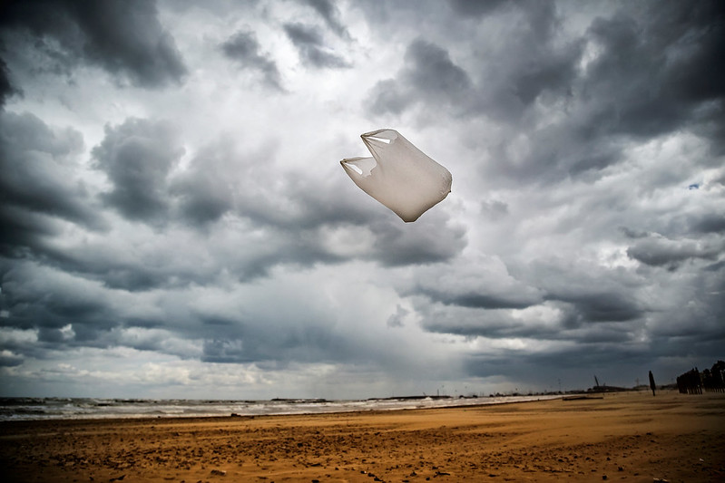
Foto cortesía de Flickr

Por Dac Collins. 10 de octubre de 2019. Parece probable que la Ciudad de White Salmón sea el 34° municipio del Estado de Washington en promulgar alguna variación de la prohibición de las bolsas de plástico. La gran mayoría de los residentes locales y las empresas apoyan la idea, ya que la mayoría de la gente puede estar de acuerdo en que deshacerse de las bolsas de plástico de uso sencillo es una buena estrategia de gestión de residuos y un paso importante para disminuir la abrumadora cantidad de plástico que actualmente afecta nuestro medio ambiente.

Pero debido a un punto de conflicto sobre cómo se debe implementar la política, la aprobación de la Ordenanza de Checkout Bag todavía no es una certeza.

Durante una audiencia pública que tuvo lugar el 2 de octubre, el alcalde David Poucher amenazó con vetar la decisión unánime del Consejo Municipal de aprobar la ordenanza, argumentando que estaba hablando por la mayoría silenciosa que no asistió a la audiencia. El alcalde tiene hasta el cierre de actividades el viernes 11 de octubre para decidir si vetará la decisión del Consejo Municipal o firmará la ordenanza.

Tomando forma

Este giro inesperado sorprendió a las casi 30 personas que se presentaron a la audiencia para apoyar la ordenanza. Ese grupo incluyó a Becky Miles, quien fundó el grupo Community Upcycle en enero para combatir el creciente problema del plástico de un solo uso y presionar por una legislación de sentido común sobre el tema.

Miles dice que su impulso para una prohibición local de bolsas se suspendió inicialmente cuando la legislatura de Washington consideró un proyecto de ley más expansivo que prohibiría las bolsas de plástico de un solo uso en todo el estado. Pero cuando el proyecto de ley 5323 del Senado murió en la Cámara durante la undécima hora de la sesión legislativa, Miles dice que el grupo “volvió a la acción”.

“Comenzamos a redactar una ordenanza”, explica Miles, “y trabajamos muy de cerca con la Asociación de Alimentos de la Industria de Washington y Zero Waste of Washington”.

La Ordenanza de bolsas de pago, tal como está escrita actualmente, no es una prohibición total de las bolsas de plástico. En cambio, aumenta los criterios para las bolsas de papel y plástico que están disponibles para los consumidores, lo que requiere que tanto las bolsas de papel como las de plástico sean reciclables, estén hechas con al menos un 40% de material reciclado y (en el caso del plástico) sea lo suficientemente resistente para ser reutilizado al menos 125 veces. La ordenanza también requeriría que los compradores paguen una tarifa de 10 centavos por cada bolsa utilizada durante el pago.

“La idea es elevar el nivel para que los productos ofrecidos estén hechos de más contenido reciclado y sean más reutilizables. Es una buena estrategia de gestión de residuos”, explica Anne Stringer, otra miembro de Community Upcycle. “Y luego entra la tarifa porque es un incentivo basado en el mercado que ha demostrado reducir el consumo. Entonces todo funciona en conjunto”.

“Y una vez que lo hicimos, nuestra siguiente preocupación fue:” ¿cómo va a afectar esto a nuestros negocios locales? ”

Stringer y Miles comenzaron a reunirse con dueños de negocios locales y descubrieron que casi todos apoyaban la idea. Y después de discutir estos resultados con la junta de desarrollo de la comunidad de White Salmon, volvieron y recogieron firmas de 28 de esos propietarios.

Miles dice que primero contactó a Jeff O’Neal, el dueño de Harvest Market, “quien tiene una tienda en San Francisco”. Así que ha pasado por esto y es totalmente solidario, 100 por ciento.”

Ella recibió respuestas similares de otros negocios en la ciudad, y “no había un solo negocio en White Salmón con el que hablé que tuviera que convencerse”, agrega.

Entonces, en la audiencia pública del 2 de octubre, los dos se mostraron optimistas de que la ordenanza pasaría, especialmente considerando que la Ciudad de Bingen aprobó lo que es esencialmente la misma ordenanza la noche anterior.

Pero un concejal de la ciudad, Jason Hartmann, llegaba tarde. Y mientras los miembros del consejo celebraron la votación y discutieron la ordenanza propuesta entre ellos, el alcalde anunció que, si decidían aprobar la legislación, él vetaría la decisión.

Luego, el Consejo Municipal votó por unanimidad (4-0) a favor de la Ordenanza Checkout Bag, momento en el cual el Alcalde Poucher dijo que tomaría los 10 días completos que se le asignaron como parte del proceso de veto para decidir si vetar o no oficialmente decisión.

Avanzando

“Nunca he vetado nada en 12 años”, dice Poucher, “y todavía no he vetado este”. Tengo hasta el cierre del dia viernes para decidirme”.

El alcalde explica que si bien apoya firmemente la prohibición de las bolsas de plástico de un solo uso, tiene problemas con el cargo de 10 centavos impuesto a los consumidores.

“Creo que White Salmon es muy diferente al resto de Oregón o Washington”, dice. “No somos una gran ciudad, conocemos prácticamente a toda nuestra gente y, sinceramente, creo que la gran mayoría de la gente cumpliría sin adherirse a los diez centavos. Siempre pienso que si puedes hacer algo más suave, es mucho mejor hacerlo de esa manera”.

Stringer y Miles no están de acuerdo, argumentando que un cargo de traspaso es crítico y la única forma de cambiar el comportamiento de las personas. “Fomenta la reutilización”, dicen, “y evita la transferencia de la carga ambiental al papel o plástico más grueso”.

Y comparan las ordenanzas que se han implementado en otros lugares como prueba de esta teoría. La ordenanza estatal de California (prohibición más un cargo de 10 centavos), por ejemplo, resultó en que los clientes llevaran sus propias bolsas el 84% del tiempo, y el uso de bolsas de papel se redujo en un 61%. Por el contrario, Portland promulgó una prohibición sin cargo en 2012, y el uso de bolsas de papel se disparó, aumentando en casi un 500%.

El aumento dramático en el uso de bolsas de papel también se observó en Hood River. Miles dice que habló con el director de operaciones de Rosauers, quien confirmó que después de que se implementó la prohibición de las bolsas de plástico en 2017, la tienda de comestibles usó 100.000 bolsas de papel adicionales durante el primer año.

El alcalde Poucher explica que ahora lamenta haber sacado la tarjeta de veto en el último minuto, diciendo: “Fue un error de mi parte, y desearía tener un botón de reinicio para que pudiéramos regresar y decir ‘esperemos y leamos esto nuevamente.”

“Pero, básicamente”, continúa, “había mucha gente que me había hablado antes de la reunión y estaban en contra del cargo obligatorio. Y sentí que había una gran cantidad de personas que por alguna razón u otra simplemente no aparecían”.

Poucher ahora espera recibir noticias de los residentes que se oponen al cargo de 10 centavos, y dice que la cantidad de respuestas escritas que reciba dictará si decide vetar o no la decisión del Consejo Municipal del 2 de octubre. Si veta, el ayuntamiento tendrá que votar la ordenanza nuevamente, y se requerirá una super mayoría para que se apruebe. De lo contrario, firmará la ordenanza en la ley, pero aun así, dice que está considerando agregar una resolución que evite que la carga de 10 centavos entre en vigencia hasta 6 meses a un año más adelante.

No está del todo claro si el Ayuntamiento aceptaría esa resolución, pero de cualquier manera, el alcalde tiene hasta el final del día de mañana para decidir cómo avanzar.

Columbia Riverkeeper Rings in the New Year With a Win on the Wenatchee

Photo courtesy of City of Cashmere

By Dac Collins. Jan. 9, 2020. On Jan. 7, Columbia Riverkeeper reached a court-approved settlement agreement with Crunch Pak, LLC that will address water pollution flowing into the Wenatchee River and will help improve water quality throughout the Columbia River Basin.

Crunch Pak owns and operates a fruit processing facility in Cashmere, Wash. and the facility has a permit with the Washington Dept. of Ecology to discharge industrial stormwater runoff into the nearby Wenatchee. But according to Simone Anter, an associate attorney with Riverkeeper, Crunch Pak has violated that permit repeatedly over the past five years by discharging unhealthy levels of copper, zinc and increased turbidity into the river — all of which can have adverse effects on threatened salmon stocks and local residents alike. She says the facility also failed to collect and analyze samples of the industrial runoff, thereby violating state and federal requirements and undermining regulators’ ability to hold the company accountable.

In light of these repeated violations, Riverkeeper moved to sue Crunch Pak on October 4, 2018. In December of that year, the watchdog group filed a complaint under section 505 of the Clean Water Act, and the two parties eventually reached the settlement agreement that was announced just yesterday.

As part of that agreement, Crunch Pak will pay $150,000 to the Rose Foundation for Communities and Environment. Those funds will go toward projects to improve water quality throughout the Basin — both on the Wenatchee and on some of the Columbia’s other major tributaries such as the Entiat, Chelan, Methow and Okanogan Rivers.

The food processing plant will also need to address the shortcomings in its stormwater pollution prevention plan.

“Under our court-approved agreement,” Anter explains, “they have around 90 days to revise their pollution prevention plan to include various upgrades to their stormwater filtration processes.”

“They will also have additional obligations to forward Riverkeeper their monitoring and reporting data for the next three years so that we can have an oversight role and really ensure that they are meeting the permit requirements,” she says.

Crunch Pak did not respond to requests for comment, but according to court documents, they “have [already] invested significant efforts and resources” in order to hold up their end of the bargain. The company recently brought in engineering consultants to reroute the stormwater, design an onsite infiltration pond and install advanced stormwater treatment systems.

“This agreement is a win for clean water,” Anter says. “We are holding industrial polluters accountable for releasing toxic water pollution, and the settlement will reduce harmful pollution and fund really important work to improve salmon habitat and water quality in the Columbia River Basin.”

By |2020-01-09T11:47:39-08:0001/09/2020|Natural Resources, News, Water|0 Comments

United by a River, Divided Over Management

Photo courtesy of River Drifters

A land sale proposed by Weyerhaeuser exposes the divide between two Wild and Scenic River advocates, private landowners, and federal river managers on the White Salmon River.

By Dac Collins. Nov. 28, 2019. If you paddle boats in whitewater, you will inevitably experience moments when tunnel vision sets in and living in the present is unavoidable. Moments when your field of vision narrows and your grip on the paddle tightens as you commit to a drop borne of water, rock and gravity.

It’s only after your boat crashes through the hole, seething with energy and spraying water in your eyes, that your surroundings re-appear. The trees, the shoreline and the sky come back into focus, and the ecstasy of living in the moment is replaced by the dull sense of self-awareness — the mind’s usual flitting between past and future — that permeates our day-to-day.

It’s no wonder, then, that so many of us return to the river again and again, paddling toward the brief escape into the present waiting at the next horizon line.

There is a danger, though, in succumbing to the hypnotic forces of moving water without occasionally taking the time to look around. Experiencing a river is one thing, but knowing a river and caring for it requires us to look beyond the confines of its banks to the tributary creeks, seeps and springs…the cliffs, trees, organisms and upland areas that are just as much a part of the river as the stream of cold water that shows up as a squiggly blue line on a map.

Wild and Scenic “in name only”

The White Salmon River is one of only three congressionally designated Wild and Scenic Rivers in the state of Washington. A 7.7 mile segment of the White Salmon (from Gilmer Creek at river mile 12.7 to Buck Creek at river mile 5) was brought into the National Wild and Scenic River System in 1986, after it was determined that this stretch possessed the following “outstandingly remarkable values”: whitewater boating, cultural resources, resident fisheries, hydrology and geology.

Many residents of the White Salmon River Valley — along with other proponents of healthy, free-flowing rivers — viewed this designation in a positive light, as the Wild and Scenic River System was established 18 years prior in order “to preserve certain rivers with outstanding natural, cultural and recreational values in a free-flowing condition for the enjoyment of present and future generations.”

Today, the White Salmon is still recognized as a hydrological wonder and whitewater mecca in the Northwest. Meltwater from glaciers on Mt. Adams, combined with a plethora of natural springs, provide in-stream flows that are consistent enough to paddle year-round. (It’s estimated that roughly 25,000 boaters use the river each year.) The breaching of Condit Dam in 2011 also brought national attention the river, as it opened up a new stretch for paddlers, and allowed salmon and steelhead to return to upriver areas that were inaccessible for nearly a century.

In an era when most of our nation’s rivers have either been dammed, diked, polluted, over-allocated or mistreated, the White Salmon River is still in a class of its own.

A summer steelhead jumps Husum Falls on the White Salmon River. Photo by Jurgen Hess

But two of the White Salmon’s longtime champions will tell you that the river is still in jeopardy. They say that due to a combination of corporate greed, increasing demand for residential development and a history of mismanagement by a federal agency, the White Salmon River has become Wild and Scenic “in name only”.

Dave Thies, president of the Columbia Gorge Audubon Society, and Dennis White, the Society’s Washington Conservation Chair, have fought for the protection of the White Salmon River for over 30 years now. White, along with his wife, Bonnie, and other residents of the Trout Lake Valley, founded Friends of the White Salmon in 1976 when the river was being threatened by hydropower development. And he was directly involved with efforts to add the White Salmon River — and also the nearby Klickitat River — to the National Wild and Scenic River System.

Securing that designation, though, was only the first in a series of contentious battles over how the river and its surrounding forests should be managed. Over the course of the last few decades, Thies and White have squabbled with developers and timber companies, as well as the US Forest Service, the federal agency that was chosen by Congress to manage the Wild and Scenic River.

“We’ve earned our reputation. And there’s a lot of opinions about us out there, some of which aren’t very nice,” says the soft-spoken Thies, a White Salmon resident who takes pride in having worked in nearly every phase of the wood product industry. “I’ve been a logger and a carpenter, and I’ve worked in tree nurseries and sawmills,” he continues.

Thies has also, at times, resorted to using his imposing 6’ 3” frame as an obstacle. He and White recall a battle in the late 1980’s over a tract of privately owned forest surrounding Spring Creek, which falls within the federally protected Wild and Scenic Corridor. The creek is one of the major fish-bearing tributaries of the White Salmon, and it flows through an area where the Forest Service was (at one point) planning to develop hiking trails and a picnic area. But the land was — and still is — owned by SDS, and the timber company intended to log the second-growth forest, just as it had done with many of its other holdings scattered throughout the White Salmon Valley.

So White and Thies dug their heels in. They picketed the Heathman Hotel in Portland, which, at the time, was owned by a member of the Stevenson family, and they formed a blockade against the logging trucks.

“We stopped that logging operation,” White says. “After we stopped it, the Forest Service wrote them a letter saying, ‘you can’t do that.’”

[perfectpullquote align=”full” bordertop=”false” cite=”” link=”” color=”” class=”” size=””]“Then a few years later, guess what? They came back in and logged the hell out of it.”[/perfectpullquote]

The logging that occurred around Spring Creek, which White calls the “crown jewel” of the Wild and Scenic White Salmon, is at the heart of his and Thies’ frustration with how the river has been managed over the years.

The Weyerhaeuser tract

Their most recent campaign involves another timber company: Weyerhaeuser, which is one of the world’s largest private landowners with over 12 million acres of commercial timberland in the United States. The publicly-traded corporation has always been a big name in the state (and especially in southwest Washington), but its presence in the White Salmon Valley increased substantially when, in 2013, it purchased Longview Fiber for $2.6 billion and acquired roughly 645,000 acres in the Mid-Columbia Region.

Weyerhaeuser is now attempting to sell off some of that land, including 240 acres located on the east side of the river. This acreage can be accessed via Oak Ridge Road, and it neighbors the property where the Whites have lived since 1979.

Weyerhaeuser has divided the 240 acres into three 80-acre tracts, and one of those tracts is currently listed with Copper West for $339,000. Of those 80 acres, 30 of them fall within the present boundary of the Wild and Scenic Corridor. The tract also straddles the White Salmon River, with a small chunk of it located on the river’s west bank.

The highlighted 160-acre tract, owned by Weyerhaeuser, has been divided into two 80-acre tracts, both of which are currently listed for sale. Map courtesy of Klickitat County

White brought the land sale to the attention of the Forest Service’s National Scenic Area Office this summer, as he believes the sale would lead to residential development on the property, which could threaten the overall health of the Wild and Scenic River Corridor. He is hoping the Forest Service will acquire the land, and has been in contact with the agency and the Weyerhaeuser Corporation in an effort to broker some sort of deal.

“We’re up against a big timber corporation that wants to sell off these lands for residential development,” he says. “First you have to get the Forest Service to even consider buying it. Then you gotta get Weyerhaeuser to agree to sell it to them at fair market value. And that’s a big leap.”

White and Thies view residential development as the worst possible use for this land. They say that aside from impacting wildlife habitat, and affecting the aesthetics and rural character of the Wild and Scenic Corridor, the development would require a number of wells to be drilled, which could impact the water table and potentially threaten one of the river’s outstandingly remarkable values: hydrology.

“This Weyerhaeuser property is full of springs that flow into the White Salmon River. Once the infrastructure is in there for housing development, each house will be on a permit-exempt well,” White explains. “And all those wells will be drawing down the water table”

Pat Arnold is the chair of the board of Friends of the White Salmon, and she echoes White’s concerns, saying, “All of this development really does damage the hydrology of the river. Everybody that drills a well drills into that shallow aquifer, and that’s where all those springs and seeps are coming from. And the springs and seeps are a very important part of the life of the White Salmon.”

She points to areas where wells have already been drilled close to the river, like the castle located on the east bank of the river south of Husum, and the newly constructed homes located north of Husum between the river and Highway 141.

“Trees grow back, but once the houses come in it’s lost,” Thies adds.

Satellite imagery of the area shows that Weyerhaeuser’s property has already been clearcut. The timber company did leave some Oregon white oaks on the property. 

Weyerhaeuser declined to comment for this story, as did the listing agent for Copper West who is representing Weyerhaeuser in the sale.

Rachel Pawlitz, the Public Affairs Officer for the Columbia River Gorge National Scenic Area (CRGNSA), says, “We have the authority to acquire some more lands within the Wild and Scenic Corridor, and were asked to potentially intervene in that [land sale]. So we entered into talks with the seller, and at the last update that I got, we were still in conversation.”

“Essentially,” Pawlitz says, “we have some tentative interest in acquiring particularly the part that’s inside the river boundary. However, it’s highly unlikely that we would acquire and in any long-term way maintain the full parcel.”

White sees this “tentative interest” as a positive development, but says that due to the troubled history of federal land acquisition within the Wild and Scenic Corridor, he’s not holding his breath.

The pitfalls of private land

Almost all of the Wild and Scenic Rivers in the American West are located on public land. Rivers like the Rogue, the Deschutes, the Flathead, the John Day and the Salmon are all surrounded by federally owned lands, with most of these lands falling under the purview of the Bureau of Land Management (BLM). So when the Management Plans for these rivers were drafted, the BLM became the de-facto agency responsible for implementing the plans and enforcing the protections that were, essentially, put in place by Congress.

The White Salmon, on the other hand, was surrounded entirely by private lands when the 7.7 mile stretch of the lower river was originally designated in ‘86. This made drafting a Management Plan for the river significantly more challenging and complex.

It was decided early on that because of the river’s proximity to the Columbia River Gorge National Scenic Area, the US Forest Service would be the federal agency tasked with managing the Wild and Scenic waterway. The agency then began studying the river, and after seeking input from Klickitat and Skamania Counties, Washington State, the Yakama Nation, local residents and private landowners, the agency drafted a Record of Decision for the National Wild and Scenic River Management Plan in November of 1991.

The Forest Service then adopted boundaries for the Wild and Scenic River Corridor, which, according to the Record of Decision itself, was a contentious process:

“The planning team was challenged to strike a balance between adequately protecting and enhancing the river by maintaining the current character of the river area and providing long-term protection and enhancement of its outstandingly remarkable values, without unduly limiting other uses, including private lands, that do not substantially interfere with public use and enjoyment of the river’s values.”

Thies says that federal and state wildlife agencies initially pressed the agency to incorporate the maximum amount of acreage allowed by the Wild and Scenic River Act — “an average of not more than 320 acres per mile on both sides of the river” — while others urged the Forest Service to constrict the corridor according to Washington State’s Shoreline Management Act, which provides a continuous buffer of 200 feet from the river’s shoreline. The Forest Service eventually adopted Alternative 6, which brought 1,874 acres into the Wild and Scenic Corridor — an average of 244 acres per river mile.

This map shows the current boundaries of the Wild and Scenic Corridor. Photo courtesy of the USFS

It’s important to keep in mind that all of this acreage was privately owned at the time. So the Forest Service came up with a plan that would bring more of this land into public ownership.

Pawlitz explains that at the heart of this plan was a three-way land exchange between SDS, the Washington Department of Natural Resources and the agency itself.

According to the Record of Decision: “A key decision is that the Federal government will acquire, through exchange, all lands within the boundary owned by SDS Lumber Company. This is more than 700 acres, amounting to almost 40% of the land within the boundary.”

But SDS backed out, and the land exchange never happened. Today, the Lumber Company still owns approximately 40 percent of all lands within the boundary. And in the time since the land exchange fell through, the Forest Service has acquired a total of 144 acres (or roughly 13 percent of the lands within the boundary) out of a potential 770 acres.

Casey Andrews is the Wild and Scenic River Coordinator for the CRGNSA, and she explains that, according to the Wild and Scenic River Act, “We’re only allowed to acquire 100 acres per river mile, and that would give us 770 acres that we could acquire.”

Pawlitz adds that the Management Plan “calls for us to work on a willing basis with sellers,” which means the agency has always avoided condemnation as a strategy for acquiring private lands.

According to the Record of Decision: “The Forest Service will not use condemnation to acquire scenic easements on, or fee title to, private lands unless that is necessary, as a last resort after all other measures have failed, and then only to prevent imminent, serious adverse effects to the river area.”

Pawlitz also explains that the Forest Service is not the sole authority in the valley. She says the agency is required to work hand-in-glove with Klickitat and Skamania Counties, as well as the State of Washington, when dealing with privately owned lands that fall within the Wild and Scenic River Corridor.

“The key here is that it’s a state, local and federal partnership,” Pawlitz says.

And according to Andrews, “It seems to be a common misunderstanding that we have the authority to regulate on private land along the river. Anything that is not the river itself, we monitor from the river. That’s the only legal place that we can monitor because we don’t have jurisdiction to go on the land.”

Andrews and Pawlitz say the CRGNSA Office is directing its limited resources toward monitoring activities on the river itself, and the agency runs an outfitter program that issues special use permits for commercial rafting trips down the iconic Wild and Scenic stretch.

As for purchasing private lands adjacent to the river, Pawlitz says they have a priority list of properties they’d like to acquire. At the top of that list is Northwestern Park, which is located at the southern terminus of the Wild and Scenic stretch (and is currently owned by PacifiCorp.) The park is a popular river access for rafters and kayakers, and it would be the third public river access acquired by the agency within the Wild and Scenic Corridor. The other two sites are located at BZ Corner and Husum Falls.

Rafters with Wet Planet get a taste of Husum Falls. Photo by Jurgen Hess

“We also have to work within our budget,” Pawlitz says, “and we recognize that there’s a balance between community needs, private landowners and the White Salmon River. The federal role primarily is to protect the river’s free-flowing character and the outstandingly remarkable values.”

Funding: the other F-word

For Thies and White, the controversy surrounding the Weyerhaeuser property is merely a symptom of a much larger problem: that the Forest Service has been either unable or unwilling to acquire enough private land to properly manage the Wild and Scenic River Corridor.

They also bring up the fact that in 28 years, the agency has never updated its Management Plan, even though the initial Record of Decision from ‘91 explicitly states that “the Plan will be revised no later than 15 years from the date of this Record of Decision.”

“The only way the Forest Service can implement their Management Plan is through land acquisition, fee title or conservation easements. With that in mind, they have failed miserably in acquiring necessary fee title lands and easements,” White says.

“Their record speaks for itself. 144 acres in almost 30 years, and not a single conservation easement.”

He says the management situation is even worse on the Klickitat River, where the Forest Service has only acquired one parcel of land that is within the Wild and Scenic Corridor but outside of the Scenic Area boundary.

Getting back to the White Salmon, though, Thies says he is still holding out hope that Weyerhaeuser will “do the right thing” and donate or sell the land to the Forest Service. He points to the corporation’s website, which states:

“We recognize that some lands have special value to the people who live in communities surrounding them. Respecting that, we seek opportunities to protect areas that have exceptional historic, visual, recreational, forestry or wildlife habitat attributes. We work with organizations like the Nature Conservancy, the Trust for Public Land and other environmental, recreational and wildlife organizations to complete conservation transactions. These transactions include conservation sales, conservation easements, land exchanges and the transfer of development rights.”

“If Weyerhaeuser were to say: ‘We really might be interested in bringing this property into public ownership, and we have already stated that we like to save special lands for communities.’ If they did that, well the Forest Service would have to start thinking about stepping up a little bit more. And conversely, if the Forest Service would say, publicly, ‘we’re interested,’ that would put Weyerhaeuser on the spot. But, so far, neither of them really want to go there,” Thies says.

Looking upstream at the confluence of Spring Creek and the White Salmon River. Photo by Dac Collins

One thing that the Forest Service, Thies and White can all agree on, however, is that an overall lack of funding lies at the root of these management concerns. White explains that since the CRGNSA Office is charged primarily with managing lands within the National Scenic Area, it is difficult for the agency to set aside enough funds for the Klickitat and White Salmon Rivers, which lie outside the boundaries of the Scenic Area.

“The problem is that because the Columbia River Gorge National Scenic Area is there, and because it’s big and it has a lot of needs, all the money goes there. And the Wild and Scenic Rivers just starve to death,” White says.

Arnold has noticed the same underlying problem during her tenure as executive director of Friends of the White Salmon:

[perfectpullquote align=”full” bordertop=”false” cite=”” link=”” color=”” class=”” size=””]“There’s many, many political currents that make these things go the way they go. And part of it is just the dearth of public funding.”[/perfectpullquote]

“Any Forest Service acquisition that can happen at this point is a good thing,” Arnold says. “A purchase would hopefully begin to get a ball rolling. And then there needs to be enough pressure coming from this direction saying, ‘This is important, this funding needs to happen, these purchases need to happen.’ And unfortunately, the way you do that is you show people how bad it’s getting, which is not too hard to do anymore.”

“It’s a real quandary for us,” White says. “What do we do? Just sit back and watch the degradation of the river corridor, or do we make it public and say, ‘Hey, this is what’s going on, people.’”

Yakama Nation and PacifiCorp reach agreement for lands along the Lower White Salmon River

Looking downstream toward Steelhead Falls on the White Salmon River. Photo by Emily DeCarlo

By Dac Collins. Nov. 28, 2019. It’s been a little over 8 years since PacifiCorp began the process of taking out Condit Dam on the White Salmon, thereby allowing the river to fun freely from its headwaters on Mt. Adams to its confluence with the Columbia. And in the time since the lower river re-opened to recreational use in 2012, thousands of boaters have floated down — and an uncountable number of salmon and steelhead have swam up — the narrow canyon stretch that lies below the old dam site.

I’ve witnessed both. And whether it’s a group of kayakers portaging around Steelhead Falls, or a summer steelhead holding in a deep pool above the falls, their presence conjures up similar emotional reactions. Optimism. Excitement. Hope for a future filled with less dams and more free-flowing rivers.

Beneath these positive feelings, however, lie the undercurrents of uncertainty. The awareness that the banks and upland portions of this stretch of river are still owned by PacifiCorp, the same publicly-traded utility that built the 125-foot dam in the first place. The knowledge that profit is what propels our society, and has traditionally been the standard metric by which we calculate how to manage our lands and waterways — our old-growth forests and sublime river canyons that have been cut, inundated or otherwise pushed to the wayside to make room for a pile of money.

Make no doubt about it…the lower 3 miles of the White Salmon — from the old dam site to its confluence with the Columbia — are in limbo. So when the Federal Energy Regulation Commission (FERC) formally acknowledged in August that PacifiCorp had completed all of its requirements for decommissioning the dam and restoring the lower river, these feelings of uncertainty and unease reverberated throughout the local river community. Questions began to arise. Does that mean PacifiCorp will sell its holdings now? And if so, who’s going to buy the land? The Forest Service? Developers? Timber companies? The Western Rivers Conservancy?

These are all possible scenarios, and some could prove more detrimental to the river than others. But now there appears to be another option on the table.

On Monday, Nov. 18, PacifiCorp announced that it had reached an agreement with the Yakama Nation giving them a Right of First Offer on the 289 acres of land between the old dam site and the mouth. (PacifiCorp also still owns a significant amount of acreage from the dam site upstream to Northwestern Park, and this acreage is not included within the agreement.)

Tribal Council Vice-Chairman Virgil Lewis Sr. said, “We are pleased to jointly announce this Right of First Offer of PacifiCorp’s lands along the Lower White Salmon River: a unique opportunity to preserve in perpetuity critical river and upland habitats that sustain our way of life.”

“We will continue to work with our partners throughout the Yakama Nation’s traditional territories in order to honor, protect and restore our culture and the natural resources on which it depends, and to uphold our promise to the Creator to speak for those resources that cannot speak for themselves.”

The press release makes it clear, though, that the Right of First Offer doesn’t mean the 289 acres are on the market quite yet.

“The agreement with the Nation is not a sale agreement, but demonstrates our intention and the values we share with the Yakama and the people who use and love this river,” said Todd Olson, PacifiCorp’s Director of hydro compliance.

So while the fate of the lower river is far from sealed, this recent announcement could bode well for the White Salmon. We’ve all witnessed what the White Man has done with the lower river in the time since the Yakama Nation and the United States entered into the Treaty of 1855.

Now it might be time to see what the Indian will do with it.

Hood River Passes Park Protection Measure

Photo by Darryl Lloyd

This article is related to a story we published in March: Morrison Park: Where habitat and housing collide

By Dac Collins. Nov. 14, 2019. Results from Hood River’s local election on Nov. 5 show that Measure 14-67 passed with 72% of the vote last Tuesday. Billed as the “Protect our Parks” measure by its supporters, it amends the city charter in order to prevent city parks from being sold without an authorizing vote by the people.

Until now, the city charter has given the City Council full discretion over how Hood River’s parks should be utilized. This can lead — and has led — to disagreements between city officials and residents (and between residents themselves), particularly when the development of a public green space has been proposed. The most recent and contentious example of this disharmony is the years-long controversy surrounding Morrison Park, also known as “Tax Lot 700” — which the City Council tried to sell to the Mid-Columbia Housing Authority for $1 in order to develop affordable housing there.

The City Council’s attempts to re-zone the park, which began in 2017, were vehemently opposed by a number of local residents from the start. That group included Susan Crowley, who appealed the City Council’s decision to the Oregon Land Use Board of Appeals (LUBA), and subsequently the state Court of Appeals, later that summer. And in September of 2017, the Court of Appeals remanded the City’s decision, finding its reasons for rezoning “implausible”.

This forced the city to revisit the issue earlier this year, and on March 11, the City Council held a lengthy public hearing that ended with Mayor Paul Blackburn casting the tie-breaking vote to rezone the 5.3 acre parcel from Open Space and Public Facilities (OS/PF) to Urban High Density Residential (R-3).

This move sparked a grassroots effort, led in part by Crowley, to amend the city charter in order to guarantee that voters would have the right to choose whether they want to sell or give away a city park in the future. It also motivated Crowley to file another appeal to LUBA, the results of which are still pending.

The measure that made it onto the November ballot arose out of an initiative petition that was filed by Brian Carlstrom and Tracey Tomashpol* in June.

“Many people told us how they valued parks as a place where kids could get to quickly and then safely play outside,” Tomashpol said, referring to the responses they received while explaining the measure to local voters.

“Parks belong to the people,” she added. “People should get a vote before a park is given up for other uses.”

Opponents to Measure 14-67 argued that its passage would undermine the democratic process and erode civil trust in elected officials. Casting the debate as an ideological divide between those in favor of affordable housing and those against it, some also claimed the ballot measure was little more than a legislative form of NIMBY-ism.

Meanwhile, supporters of the measure contended that greater public oversight would actually strengthen the democratic process by encouraging citizen involvement, and they pointed to the growing population of Hood River and the need to preserve and secure public green spaces. Some pointed out that the erosion of civil trust in elected officials had already begun, thanks in part to actions the City Council has taken regarding Morrison Park in recent years.

Newly elected Mayor Kate McBride told the Hood River News she was “disappointed that it passed, but not surprised as the petition supporters had a good campaign.”

“I think it may hinder the city’s ability to be flexible with land holdings in the future. Where we might want to obtain or trade a property, we’ll have to be very cautious in that respect. And with any temporary uses we’re going to be more constrained when it comes to parks,” McBride continued.

Council President Mark Zanmiller, who likewise opposed the measure, told the local newspaper that “the main focus of protecting parks resonated, and I agreed with that part. The question is, how do we go forward? We’ll find a way at the city to respect and fulfill the rule. It will be the rule we have and it’s not a matter of contesting it but of absorbing it into our process.”

“The most important thing to come out of this is how do we address the mistrust that was at the root of this thing,” Zanmiller said.

*In order to maintain transparency with our readers, we want to clarify that Tracey Tomashpol is on Columbia Insight’s Board of Directors.

By |2019-11-14T10:40:03-08:0011/14/2019|Conservation, News, Public Lands|0 Comments

Trees of the Gorge: Combating climate change at the local level

Photo by Jurgen Hess

“One generation plants the trees, another gets the shade.” – ancient Chinese proverb

By Dac Collins. Oct. 31, 2019. And if there’s one thing our planet could use more of right now, it’s shade. This past July was — globally speaking — the hottest month on record since record-keeping began in 1880.

Global problems

The effects of a rapidly changing climate were perhaps the starkest in Alaska, where the amount of Arctic sea ice had melted to a record low of 2.9 million square miles by the beginning of July. On Independence Day, temperatures reached 90 degrees in Anchorage, beating the previous all-time temperature record by five degrees. And by July 9th, the Hess Creek fire burning northwest of Fairbanks had grown to over 145,000 acres, making it the nation’s biggest wildfire.

Kenai, Palmer and King Salmon also experienced record high temperatures over the course of the month. But the most astonishing (and troubling) fact about July, 2019 being Alaska’s hottest month on record only becomes apparent when you look at the state’s second hottest month on record: June, 2019.

And while thousands of heat-stressed chum salmon were washing up dead on the banks of the Koyukuk, hordes of Parisians swam and splashed in the Trocadero fountains, seeking whatever relief they could find from the back-to-back, record-setting heat waves that hit Europe in June and July.

(It can be difficult to quantify the immediate effects of the climate crisis we’re currently witnessing, but the French Ministry of Health estimated that this summer’s heatwaves caused the deaths of more than 1,400 people across the country.)

Infrared imagery shows the land surface temperature across Europe on July 25. Photo courtesy of the European Space Agency

Signs of the problem are everywhere we look.

The trouble with the solutions, though, is not that they are far-fetched or unattainable — but that they are inconvenient. Ditching fossil fuels, re-designing our electrical grid, changing our eating habits, buying and using less stuff, having less children. These are all worthy, and perhaps necessary, strategies if we are to avoid surpassing the 1.5 degree C threshold of warming that the Intergovernmental Panel on Climate Change has cautioned against. They also run counter to our society’s preeminent values of comfort, convenience and consumerism.

And while reducing the overall amount of carbon we release into the atmosphere is paramount, there is another approach to staving off climate change: capturing that carbon before it enters our atmosphere.

We could achieve this by investing in Carbon Capture and Sequestration (CCS) technologies, which are extremely costly and even more controversial. Or we could look to the trees.

And according to a study that was published this summer in Science, planting roughly a trillion more of them around the world might be our most effective strategy.

In the study, researchers with the Crowther Lab in Switzerland pointed to forest restoration “as our most effective climate change solution to date.” They found that the six countries with the most potential for reforestation are (in this order): Russia, the United States, Canada, Australia, Brazil and China. They excluded the land being used for cities and agriculture in these countries and pointed to 0.9 billion hectares (or roughly 2.2 billion acres) of land that would be suitable for reforestation — enough room for an estimated trillion or more new trees.

Birch trees are a key part of Russia’s economy and culture, and they can play a critical role in mitigating the effects of climate change. Photo courtesy of Pixabay

“Once mature,” the study found, “these new forests could store 205 billion tonnes of carbon: about two thirds of the 300 billion tonnes of carbon that has been released into the atmosphere as a result of human activity since the Industrial Revolution.”

Prof. Thomas Crowther, who co-authored the study, emphasized that reforestation is only one part of a larger strategy that hinges on reducing global emissions and protecting our existing forests. And he said that when it comes to planting more trees, we can’t act fast enough.

[perfectpullquote align=”full” bordertop=”false” cite=”” link=”” color=”” class=”” size=””]“Our study shows that tree restoration can be a powerful tool for drawing carbon from the atmosphere. But we must act quickly, as new forests will take decades to mature and achieve their full potential as a source of natural carbon storage.”[/perfectpullquote]

Local solutions

Fortunately, some residents of the Columbia River Gorge have already gotten started.

A career wildlife biologist, Bill Weiler lives in Lyle, Wash. and works as the education coordinator for the Sandy River Watershed Council. Collaborating with the Forest Service and the Lower Columbia Estuary Partnership, he has helped plant around 1.5 million trees throughout the Sandy River Delta over the last decade.

And just last year, Weiler says, “I’m seeing all this stuff internationally with the UN, and everyone saying, ‘You know, one of the ways we might be able to help with climate change is to plant a billion trees.’ And I thought, ‘Okay. So let’s plant a million here and see if that helps.’”

He says that was around the same time his daughter Chelan and son-in-law Noah Harkin first approached him about starting Trees of the Gorge. They got the (root) ball rolling earlier this year, and the project’s sponsors include Peace Village, Columbia Gorge Ecology Institute, the US Forest Service and the Columbia Gorge Climate Action Network

The focus of the project is planting native trees and shrubs on public and private land in the middle and eastern parts of the Gorge. Weiler says they chose native plants in particular because they are more adaptable, better for wildlife, and relatively inexpensive.

“White oaks are definitely the best for wildlife,” he says, “because of the acorns. And because when there’s windstorms, frost and ice storms — which are frequent in the Gorge — the branches fall off and rot sets in. And it creates these cavities that are perfect habitat for a number of species.”

“We have a huge oak where we live that has bees, squirrels, and a raccoon all in the same tree. I don’t know how they coexist…but they do,” he laughs.

With an average lifespan of 300 years, native white oaks (Quercus garryana) provide excellent wildlife habitat. Photo by Jurgen Hess

The first Trees of the Gorge planting was on private land in Dallesport, Wash., where a couple who had recently purchased a home was looking to restore a buffer zone around a nearby wetland. And two weeks ago, the group linked up with elementary students from the Trout Lake School to plant pines, maples, spirea and oceanspray on public land in that part of the valley.

So far, they’ve planted around 500 trees and shrubs, and Weiler says they should have closer to 1,500 in the ground by the end of the season.

“There’s a really narrow window for planting here,” he says, explaining that October and November are really the best months to plant trees in the Gorge.

“You want to have a time where it’s either rained or about to rain, but not about to frost. And in Trout Lake, that could happen all in one day. Luckily we’re having this spate of good weather, and the day after we planted up there it rained an inch, which was perfect.”

Weiler says the next plantings are scheduled for Nov. 5 and Nov. 9. The planting on the 5th will take place at the Gorge Discovery Center, and they will be working with high school students from The Dalles to seed balsamroot and plant around 250 white oaks there.

The event on the 9th is open to the public, and it will involve planting a remembrance grove at the Great River Cemetery in honor of women who have had miscarriages. (Located on an 80 acre site near Mosier, Great River will open in 2020 as the first “green cemetery” in the state of Oregon.)

Another important location for the project is Balfour Park in Lyle.

“That’s gonna be the spot where we can plant most of our trees,” Weiler explains. “It’s really fragmented, really weedy, so we can only do good we think.”

[perfectpullquote align=”full” bordertop=”false” cite=”” link=”” color=”” class=”” size=””]“The real question is: when we do plant a million trees, how long will it take before they actually have a positive effect on the climate?”[/perfectpullquote]

It’s a good question, and one the next generation might be able to answer.

A crew of school age children plant trees in the Sandy River Delta. Photo courtesy of Trees of the Gorge

Learn More

  • To learn more about Trees of the Gorge, or to volunteer for one of the upcoming plantings, visit the group’s Facebook page.

  • Check out some of the other reforestation projects currently taking place around the world.

  • Request or purchase digital access to the Crowther Lab’s full report, entitled “The global tree restoration potential”.

© Copyright 2013-2025 Columbia Insight. All Rights Reserved.

As a 501(c)3 nonprofit organization, all donations to Columbia Insight are tax deductible to the full extent of the law. Our nonprofit federal tax-exempt number is 82-4504894.