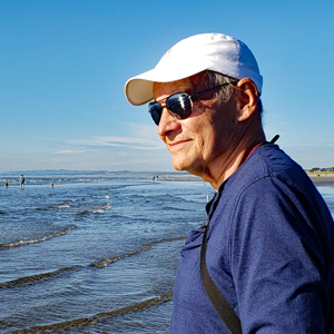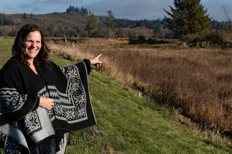
CREST Executive Director Denise Löfman looks over the Otter Point project area, located a mile upstream of Young’s Bay, and points out remnant Sitka spruce that were preserved on high ground. Photo by Jurgen Hess
By Jurgen Hess. Jan. 23, 2020. “Surrounded by quagmires,” William Clark wrote of their 1805 winter camp — the spot where the Lewis and Clark Discovery Corps ended their 8,000-mile westward trek. Three miles inland from where the Columbia River empties into the Pacific Ocean, the explorers found themselves in a wet and foggy landscape dominated by dense forests of Sitka Spruce, hemlock and thick brush.
“Meriwether Lewis found suitable site,” Clark recorded, “with Elk sufficient to winter on. Our officers named [site] after a nation of Indians who resided near us, called the Clatsop Nation.” The Corps built a log fort for their winter lodgings near a stream the Indians called Netul.
Settlers soon followed. These new people diked 95 percent of the river’s floodplains and drained the surrounding wetlands. From 1850 to the early 1900’s, they logged the Sitka spruce forests to exhaustion and replanted them with Douglas fir. They renamed the Netul the Lewis and Clark River.
In 1958, Fort Clatsop became part of the 3,300 acre Lewis and Clark National Historic Park, but the landscape would have been mostly unrecognizable to William Clark by then. That’s because in the 1930’s, the U.S. Army Corps of Engineers built a dike along the river to protect the town of Warrenton — along with the regional airport, nearby agricultural lands and homes — from flooding. Floodplains that stored floodwater and provided essential habitat for wetland creatures were drained. Loggers used the area as a dump site for sorting logs, and the “quagmires” that Clark wrote of were no more.
But the 21st century would bring about its own changes, and in 2006, the Park Service began rehabilitating the land to resemble the landscape the Discovery Corps encountered. Five years into the work, they began restoring a 34-acre floodplain adjacent to and west of the Lewis and Clark River. Called Otter Point, it is located a mile upstream of Young’s Bay on the Columbia River Estuary.
Restoring Otter Point’s natural estuary functions, its landscape, and reconnecting the floodplain-tidal wetlands to the river was the goal of the partnership that came together for this project. Their plan involved breaching the dike in five places. Channels would then be dug to wind through the site, allowing the twice daily eight-foot tides to course through the land.
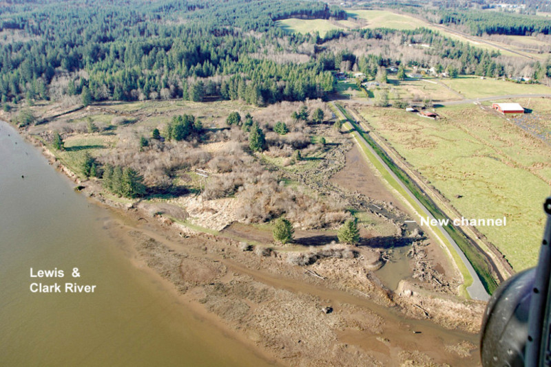
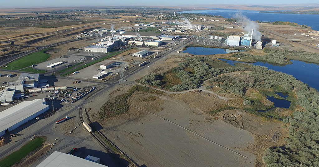
An aerial view of Otter Point shows the new channel flowing into the Lewis and Clark River. Photo courtesy of NPS
Before construction could start, though, the Corps required permits for the work, and breaching dikes was a sensitive subject in the U.S. at the time. The country was still reeling from the damage inflicted by Hurricane Katrina just five years before — when the Corps’ levees and flood walls failed, and Lake Pontchartrain flooded the city.
The Corps eventually granted the Otter Point project permits, and they were the first permits allowing dike breaching on the West Coast since Katrina.
At 34 acres, the Otter Point project was a small one, but it still required collaboration to design, fund and implement the restoration. The National Park Service (NPS) and Columbia River Estuary Study Taskforce (CREST) got the process started. “We do regional planning for environmental restoration, and we facilitated the project players working together,” says Denise Lofman, CREST’s Executive Director. The work group also included Lower Columbia Estuary Partnership, the Corps of Engineers, and the US Fish and Wildlife Service. Henderson Environmental Design, based in Portland, was hired to design and construct the restoration project.
The $1 million cost was chiefly financed by Bonneville Power Administration, which funds projects in order to offset environmental losses caused by Columbia River dams. Additional funds came from Oregon Watershed Enhancement Board, US Fish and Wildlife Service and Lewis and Clark National Park Association. Finally, in 2011, construction began.
Contractors created approximately 4,900 feet of channels across the floodplain to bring water into the site, restoring the natural floodplain. A number of logs with attached stumps were placed along the channels to provide fish habitat, cover and shade. The remnant Sitka spruce were preserved on the site’s high points. Willow thickets were thinned.
Ironically, a 1,400-foot-long new dike on the site’s north perimeter was required. Material excavated in making the channels was used to construct it. “This new dike was required to protect the adjacent farm and Warrenton from potential flood waters”, says Chris Clatterbuck, Chief of Resource Management for Lewis and Clark National Historic Park.
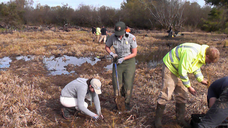
Volunteers and NPS employees plant natives adjacent to the new channel. Photo courtesy of NPS
After earth shaping was completed, volunteers and NPS employees planted 40,000 natives. “Native bulrush was planted,” Clatterbuck says, “and is doing well out-competing the invasive reed canary grass.”
Today, almost 10 years later, the project’s players speak highly of the results. “I am very proud of what was created,” says Project Manager Bruce Henderson. “This was the first dike breaching permit after Katrina. Fish came in immediately after the channels had water. Native plants are doing well. We have returned an area to a semblance of the historic landscape.”
“Quagmires were re-created. Reed canary grass doesn’t like inundation, and it’s being flooded out,” says CREST’s Denise Lofman. “No sprays are used to control invasives, rather, mowing is used. The adjacent farmer to the north is okay with the project.”
The Lewis and Clark River’s high tides now fill the new channels, providing habitat for juvenile fish moving downstream to the Columbia River estuary, and eventually, the ocean. On a site visit, Lofman pointed out a small tree frog hopping through native grass adjacent to one of the new channels.
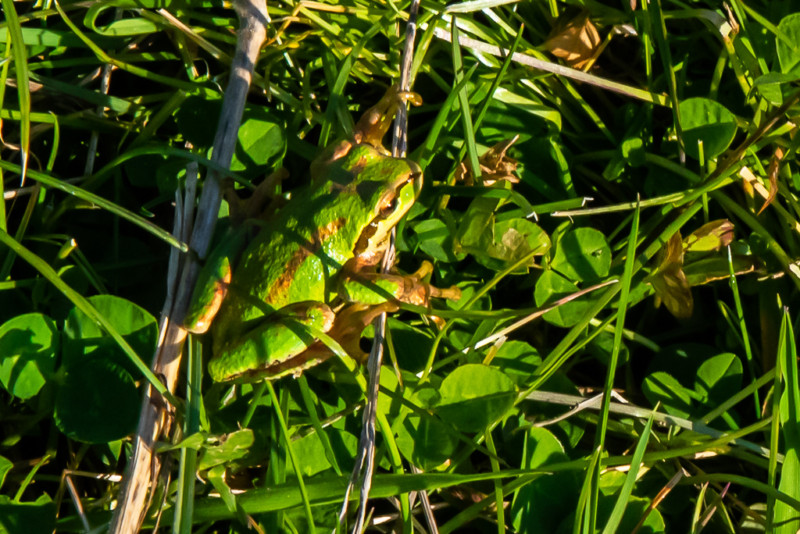
A Pacific tree frog blends into its natural environment. Photo by Jurgen Hess
“We give interpretive kayak tours of the site and explain the restoration,” says Chris Clatterbuck. We feel really good about the work. It met our goals to restore the landscape. People love it.”
Click here for an NPS Storymap, which includes the Otter Point project’s narrative, historic photos and maps.