With water content of snow as much as 26% below average, some farmers warn ‘this could be worse than last year’
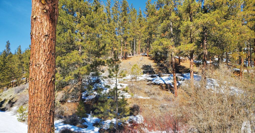
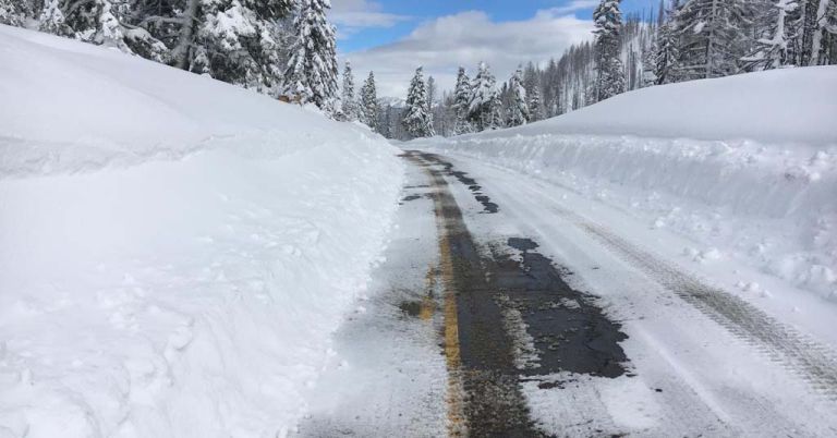
Winter is coming? Bare spots started to show up toward the end of a record-dry February in the Blue Mountains near Baker City, Oregon. Photo: Jayson Jacoby/Baker City Herald
By Jayson Jacoby (Baker City Herald), March 15, 2022. In a county plagued by drought, the phrase “driest February on record” sounds about as pleasant as a fork screeching across a chalkboard.
“Below average snowpack” isn’t exactly melodic, either.
That February was particularly parched might seem implausible considering the soggy piles of slush soaking Baker City, Ore.
But those rapidly melting bergs are largely the products of snow that fell in late December and early January.
Since then—and particularly during February—a persistent high-pressure pattern has shunted away most of the Pacific storms that typically bring precipitation to Northeastern Oregon during winter.
“A bubble, or dome, or whatever you want to call it,” is how Mark Ward, a frustrated Baker Valley farmer, described it.
“All the storms go around us,” Ward said in a phone interview on March 2.
MORE: Less snow is the new norm. That’s trouble for farmers
He was, by coincidence, speaking from Portland, there to attend a meeting of the Oregon Potato Commission, which he chairs.
Ward said rain was sluicing down as he spoke.
“We just can’t seem to get it across the mountains,” he said.
Driest February since 1943
Few of the storms that have pushed inland this winter have maintained much momentum, or brought much moisture, to the bulk of Oregon that lies east of the Cascade Mountains
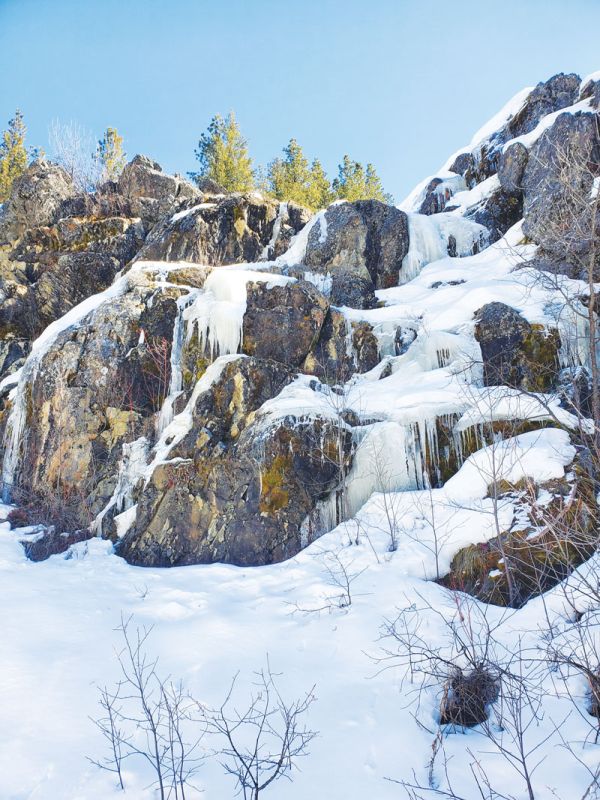
Rocky going: Cold temps persisted throughout February in much of Northeastern Oregon, but snowfall was scarce. Photo: Jayson Jacoby/Baker City Herald
The Baker City Airport’s rain gauge measured a paltry 0.01 of an inch of moisture for February.
And that meager amount—anything less wouldn’t even have qualified as measurable precipitation—came down on the final day of the month.
February is not notable for its deluges, to be sure.
The shortest month is also the third driest at the airport, with an average of 0.62 of an inch.
Only July (0.51) and September (0.57) are more desiccated. August is close behind, with an average of 0.63 of an inch.
But even for a month distinguished by a scarcity of moisture rather than a surfeit, this February stands alone.
The 0.01 total is the least measured at the airport since 1943, when record keeping began there.
The previous record was .10 of an inch, a dubious distinction shared by 1997 and 2006.
2002 was only slightly more moist, with 0.12 of an inch.
‘Concern level high’
The absence of any significant storms also is reflected in the mountain snowpack around Northeastern Oregon—a vital source of water for farms and ranches, fish habitat, recreation and some municipal water supplies.
Although the snowpack increased at most measuring sites, the rises were modest even by February’s standards.
As a result, the snowpack actually lost ground, in terms of percentage of average, during the month—dipping from 6% below average at the start of February to 15% below average at month’s end.
That’s a troubling trend for Ward and other farmers who depend on the snowpack to nourish their crops come summer. Ward’s family grows peppermint, wheat and alfalfa as well as potatoes.
“The concern level is high,” Ward said. “This could be worse than last year. And last year was the worst I’ve ever seen.”
MORE: So long, skiing? Study says Cascades could have no snowpack in 50 years
The snowpack certainly is well beyond where it was one year ago.
At the start of March 2021, the snowpack in Northeastern Oregon was about 29% above average.
But that bountiful snowpack didn’t translate into brimful reservoirs, mainly because the ground was so dry that much of the melting snow soaked into the soil.
If there’s a bright spot in the current situation, Ward said, it’s that widespread rain in the fall of 2021 partially replenished the desiccated soil before the ground froze and the snow fell.
“We’re ahead of where we were last year as far as ground moisture,” he said.
That could lead to more of the snowpack, paltry though it is at this point, trickling into streams and reservoirs compared with 2021.
Snowpack poor across region
The loss was more significant in some areas.
At Bourne, for instance, in the headwaters of the Powder River north of Sumpter, the water content of the snow—a more relevant metric than snow depth, since the moisture content of snow can vary greatly—actually shrank during February, from 9.8 inches (exactly average) to 9.2 inches, which is 26% below average.
Bourne is a bellwether measuring site for estimating the amount of water that will flow into Phillips Reservoir this spring and summer.
That vital source of irrigation water for about 30,000 acres in Baker Valley was depleted during the 2021 drought, more than in any year since it first filled in 1968.
MORE: How a federal program contributed to southern Oregon’s groundwater crisis
As of March 1, the reservoir was holding 2,500 acre-feet of water—just 3% of its capacity. (One acre-foot of water would cover one acre of flat ground to a depth of one foot.)
Elsewhere in the Elkhorn Mountains, the snowpack dropped during February from 5% below average at Anthony Lakes to 11% below average, and from 3% below average at Little Antone to 16% below average.
The decline was much less at Eilertson Meadow, one of the few places where the water content remains above average—12% above, almost identical to the 13% above at the start of February.
In the Wallowas, the water content at Schneider Meadow, which was just 7% below average on Feb. 1, is now 24% below average after growing by slightly less than one inch during the month.
Columbia Insight is publishing this story as part of the AP StoryShare program, which allows newsrooms and publishing partners to republish each other’s stories and photos.


