Two centuries of land management have created a landscape maladapted to severe weather events
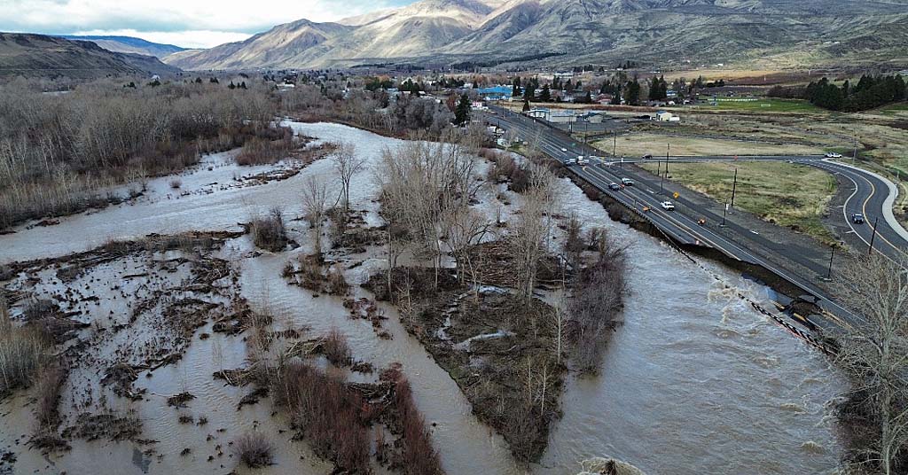
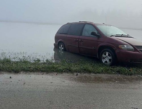
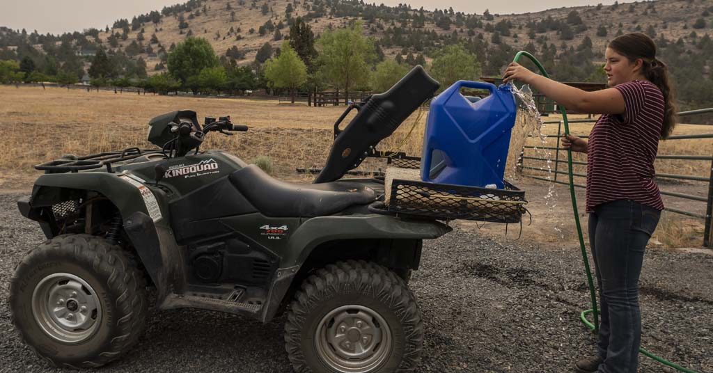
Earth mover: Traffic along Highway 12 in Washington wasn’t the only thing disrupted by December floods. Photo: Naches Fire Department
By Nick Engelfriend. December 31, 2025. The floods that drenched western Washington and Oregon this month may be receding, but their environmental impact will reverberate for years, potentially affecting everything from returning salmon to oyster fisheries.
Recent floods are an example of the type of extreme weather scientists have long warned will become common with climate change; similar flooding hit the region in 2021.
This month’s event stood out for its severity and reach, with flooding as far east as Wenatchee, Wash.
Relatively warm rain hitting the Cascades caused widespread snowmelt, adding to the surge of water.
“We had an atmospheric river dumping rain on snow that had already accumulated in the high mountains,” says Paul Hessburg, a recently retired researcher for the Forest Service. “That produced an event where rain, plus melted snow, suddenly flooded down into the valleys.”
The aftermath includes impacts Oregonians and Washingtonians will recognize from previous floods. Buildings in low-lying areas have been devastated by overflowed rivers, with the full extent of damage still being determined.
However, floods of this size affect the region in more subtle ways.
The consequences are compounded by decades of river engineering and forest management practices that have left landscapes more vulnerable to heavy rain.
Channelized rivers
The phenomenon that caused this month’s floods is sometimes called the “pineapple express.” Technically an atmospheric river, it involves a mass of warm, moisture-laden air moving up from tropical latitudes, colliding with the coast and depositing huge amounts of precipitation.
Scientists predict wetter atmospheric rivers will become more frequent as the climate warms from the buildup of carbon in the atmosphere.
“Just one or two degrees Fahrenheit of warming in the atmosphere and oceans allows more moisture to be picked up and carried by winds,” says David Fluharty, a professor emeritus at the University of Washington School of Marine and Environmental Affairs. “That water then gets dumped the first place it hits a bump, which is the West Coast.”
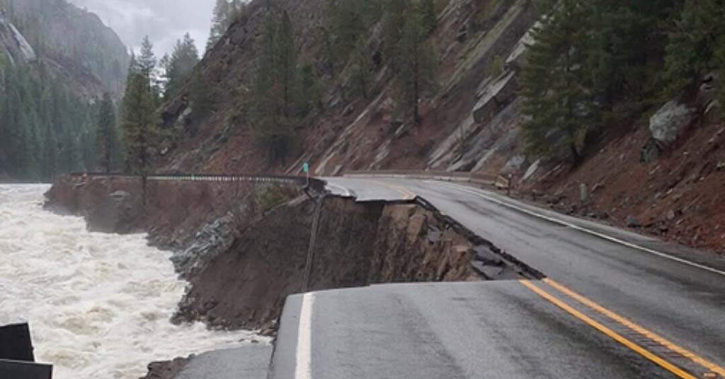
Washed away: Parts of U.S. 2, like this section in Tumwater Canyon east of Seattle, will likely remain closed for months due to December flood and slide damage. Photo: WSDOT
Atmospheric rivers would cause flooding under any conditions. However, nearly two centuries of land disturbance in the Northwest have created a landscape less able to absorb the water, worsening the severity and impacts of floods. One way this has happened is through engineering projects that use levees and dikes to straighten meandering rivers into channels.
During a flood, water in channelized rivers surges downstream without spilling into floodplains and pools that would normally interrupt and disperse its flow.
Powerful currents scour the riverbed, dislodging salmon spawning beds (or redds), or burying them in sediment.
This affects the amount of young salmon that hatch, and ultimately how many adults return to freshwater years later.
“This record-setting flood event will likely have severe impacts on salmon, particularly eggs laid earlier this fall, many of which will be lost,” says Harriet Morgan, climate change director for the Washington Department of Fish and Wildlife. “As a result, there will be effects on salmon returns in 2028-29.”
Swollen rivers also transport silt and woody debris downstream, where some of it gets deposited in bays or estuaries. Spreading layers of sediment affect marine environments, including economically important oyster beds.
“Natural and manmade shellfish beds along the coast may be overwhelmed with sediment or dislodged by currents,” says Kathleen Guillozet, of the Bonneville Environmental Foundation.
Some of these negative impacts could be mitigated if the region’s rivers were allowed to follow a more natural course.
“In a healthy river, floods are times of renewal for floodplains,” says Hessburg. “Their role is to allow a river at peak flow to spread out and drop its sediment. We’ve done everything to keep floodplains from functioning properly.”
Fire and snow
Straightening rivers and building over floodplains aren’t the only practices that make flooding worse.
Decades of forest management have contributed to making heavy rains more damaging than they’d normally be, even in places far inland from the coastal communities normally associated with flooding.
As Lake Chelan rose with the floods earlier this month, news in Stehekin, on the northern end of the lake, wasn’t good. Landslides and other damage from rains knocked out power and water infrastructure, leaving impassable every road leading into the remote community of fewer than two hundred people. Stehekin’s sewage treatment plant was severely damaged.
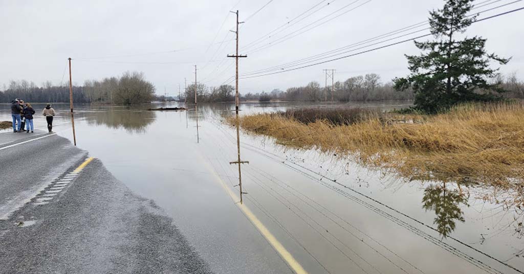
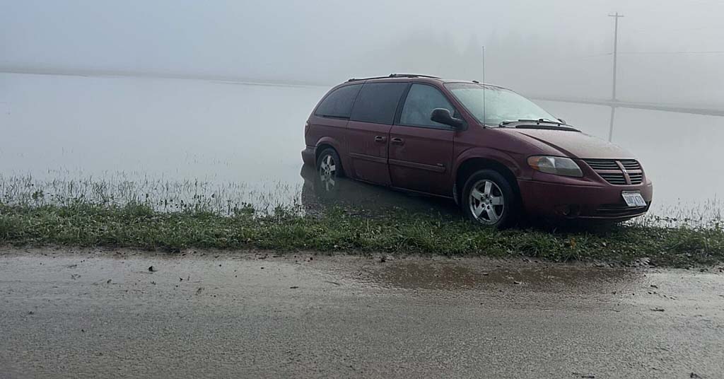
Pavement and plants: The Nooksack River flooded over Slater Road north of Bellingham. Photo: Nick Engelfried
Other Lake Chelan communities, like Lucern and Holden, suffered similar harm. Rebuilding won’t be easy and may require federal assistance.
“It could take two or three years, depending on federal budgets and priorities,” says Mike Kaputa, director of the Chelan County Natural Resources Department.
As the atmospheric river collided with the North Cascades, at least two underlying conditions made the floods more destructive.
One was relatively warm rain coming down on early snow that had already been deposited in the mountains.
Rain and melted snow flowed over ground still recovering from a series of major wildfires, including last year’s Pioneer Fire, which destroyed abundant duff and woody debris that could have helped absorb heavy rainfall. This created ideal conditions for flooding and landslides.
Fires are a natural part of life in the North Cascades, but successive severe fires have strained the ecosystem’s ability to bounce back.
“The Pioneer Fire burned very severely, and it burned in the footprint of other fires,” says Hessburg. “It basically re-burned the Rex Creek and Flint Creek fire scars.”
Severe fires around Lake Chelan are traceable to a combination of factors, including climate and human alteration of the landscape. Climate change has produced longer, hotter Northwest fire seasons even as heavy rain in winter increases. Meanwhile, decades of fire suppression around communities like Stehekin have left forests with dense, flammable understories.
“People think this is what forests are supposed to look like, but the forests around Lake Chelan were formerly very open, without lots of underbrush,” says Hessburg. “That’s the natural condition of a dry forest with a frequent fire regime.”
Climate change and fire suppression have created conditions where forest landscapes no longer act as natural sponges. Partly as a result, this month rain and melted snow surged down from the Cascades and flooded places as far east as Leavenworth and Wenatchee.
Mitigating damage
Climate change will likely mean atmospheric rivers continue to become more severe in years ahead.
The good news is flood events don’t have to be as destructive as they currently are, for people or the environment.
Maintaining floodplains as natural or agricultural areas, rather than for habitation, can let streams retain their ability to absorb and disperse floodwaters. With so much already built along rivers this isn’t a simple goal, but even small actions can help ease restrictions on rivers and have an impact.
“There’s not a whole lot you can do to mitigate the size of event we just saw,” says Kurt Nelson, environmental department manager for the Tulalip Tribe. “But for smaller flood events, damage could be reduced by moving levees back.”
Moving levees to widen riverbanks even slightly allows floodwaters to spread out more, reducing the channel effect.
Sometimes, flooding itself alters the landscape in ways that ultimately improve resiliency.
“In the short term, erosion during flooding is damaging for salmon,” says Nelson. “But when currents open up side channels and put more woody debris in streams, it can eventually create habitat for juvenile salmon.”
Farther inland, in the Cascades, prescribed burning can reduce severe fires that worsen impacts from flooding.
However, the politics of burning can get complicated, despite widespread agreement from policymakers and the public that it’s a desirable goal.
“Burning isn’t a partisan issue,” says Hessburg. “The left and right both want forests to be properly managed. But we get so tired of smoke during the fire season, people don’t want to put more smoke in the airshed before or after it. The healthy forest goals and smoke-free airshed values don’t match up well.”
For now, as communities across the Pacific Northwest recover from the floods, they can expect to be dealing with the repercussions for at least the next several years.
“We’ve broken our rivers, we broke the climate,” says Hessburg. “Now we have to brace for more of these extreme events.”


Nick, thank you for this excellent and timely article. It leaves one important thing out. The extent of logging in the mature upland forests of our watersheds over the past century is a big reason why our forests can no longer absorb runoff and percolate it downward as stored groundwater. This increased runoff caused by too much logging not only worsens flooding, it also worsens summer drought and wildfire. Given this, continuing to cut down remaining upland mature forest is crazy, yet it continues at an accelerated pace even on state DNR land. The public must tell the legislature and Commissioner Upthegrove to halt this madness and end unsustainable monetization of forests to fund schools and social services. This worked 100+ years ago when there were few people and vast pristine forests, but no longer do we have such a world! We have to make our leaders reckon with reality. People: tell your state legislators, Commissioner Upthegrove, and the Governor how urgent it is to stop cutting mature upland forests in our watersheds, and to find other revenue to support education and social services. The Evergreen state will rapidly become Everbrown if we don’t. We cannot, must not, leave such a wrecked, dysfunctional natural world to our children and grandchildren. Young plantation forests do not function hydrologically as mature, complex forests do. Scientists have shown this. The few remaining mature upland forests are far more valuable left standing.
This article I think is right on the money. My first job was working for the SCS in Yakima County as an engineering tech in 1973. The winter of 73-74 the Yakima basin flooded, I’ll say worse than this past one in this area. I was taught and was to learn that all these valley bottom lands were to act exactly as you’ve described and that interrupting those open flats was and is harming the natural flow of water and the natural recharging of aquafers. Federal, state, county and others in land planning must know or should know all of these factors and use sound environmental engineering. Tgey should be screaming about all of the rape and pillage on the lands. And yet, if we look just a little, we see new homes built by lakes, rivers and streams and roadways and housing developments built and being built across all of the natural waterways and valleys. And then when the floods come every mistake is pretty clear and all those that bought there and all those that said build there all want bailed out of something that should never have happened in the first place. I saw enough in my 1st year of work that water will go where it wants and don’t build where that can happen. All the planners have access to nearly 100 years of Arial photos and it’s very easy to look at those and see the changes in every creek and river. But I guess they don’t.
Forestry is not my profession but over the past 50 years I have watched how logging or timber haven’t has changed in the Naches, Nile and nearby areas. In the 60s and into the 70s, yes a fairly narrow stretch of time, most all of the logging consisted of selective cutting, taking the larger more mature trees and leaving plenty of medium and smaller ones. That provided slower snow melt earth stability and yet a thinner more groomed floor with less understory as compared to clear cutting and growing a mass of brush and trees. My observations of different forest regrowth is that once it is all destroyed, it may take 200 years for the process to completely play out where as selective harvests I believe in eastern Washington could be 50 to 70 years. Question is all natural or allowing timber harvest. Properly managed, less fire damage and more harvest and better recovery from either.