USFS releases initial assessment of 22 miles of Gorge-area trails within Eagle Creek Burned Area
By Dac Collins. Feb. 1, 2018. Nearly two months after the Eagle Creek Fire was declared contained, we are just now beginning to comprehend the damage that was done to our beloved Gorge. A report released by the Columbia River Gorge National Scenic Area on January 18 focuses on assessing the damage done to the roughly 122 miles of trails that lie within the Eagle Creek Burned Area.
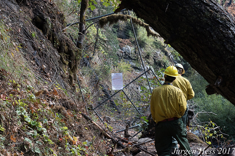
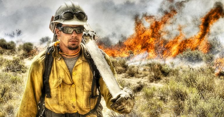
Forest service staff assess Eagle Creek Trail conditions
The current conditions of these trails are varied, with some described as ‘fair’ and others ‘poor’, and others still waiting to be seen. The bottom line is that all National Forest trails located within the burned portion of the Scenic Area—South of I-84, West of Starvation Creek, and East of Alex Barr Road and Thompson Mill Road—will remain closed to the public until further notice. (Click here to see a map of the closed area.)
Mt. Hood National Forest District Ranger Janeen Tervo reported that the areas around Wahtum Lake and Rainy Lake are now open to the public.
These closures are necessary to protect hikers from falling trees, smoldering stumps and other post-fire hazards, but they also serve to protect the native flora and fauna from the damaging effects of hikers.
By merely walking on the scarred terrain, human visitors can damage fragile root systems and nesting sites. They can also exacerbate the processes of erosion and contribute to the spread of invasive species. A number of invasive plant species, including false brome and garlic mustard, have adapted to colonizing in recently burned forests and are of particular concern to botanists in the region.
According to the CRGNSA report, the U.S. Forest Service and its partners have so far been able to assess approximately 22 miles of trail within the burned area. The remaining hundred miles will not be assessed until sometime in late spring of this year.
This initial trail assessment examines sections of the Pacific Crest National Scenic Trail, as well as parts of Oneonta, Horsetail Falls, Wahlclella, Wahkeena, Gorge, Herman Creek, Larch Mountain, Gorton Creek, Ridge Cutoff, Return and Nick Eaton Trails.
“One of the key things about this [assessment] is that it’s not normal for us to do this type of work this time of year,” says CRGNSA spokeswoman Rachel Pawlitz. “Fortunately, both the weather and our resources have aligned so that we’ve been able to really get a jump on this because we know it really matters.”
Pawlitz tells EnviroGorge that repair work has already begun on some trails on the eastern end of the burned area, and that the trails around Multnomah Falls “are also very high priorities for us because they’re very popular.”
“However,” Pawlitz continues, “there will be considerable work needed there, so we’re not really speculating on timelines for that.”
Although it does not give a timeline for the reopening of any trails within the burned area, the initial assessment does show that some trails fared better than others. The Gorge Trail (# 400), for example, is described as a ‘walkable trail’ with light burning in the area, very little tree mortality and minimal debris along the path. The Nick Eaton Trail (# 447), however, is described as ‘nearly indistinguishable’. Trail crews found down trees blocking the path and noted unstable footing caused by loose rocks and soil sloughing on steeper sections. Likewise, the Horsetail-Oneonta Loop is, according to the initial assessment, ‘in treacherous shape’, with washouts, burnt signs and unstable snags posing significant risks to hikers.
The indefinite closure of these trails is disheartening, and Pawlitz acknowledges the fact that the Eagle Creek Fire affected people on an emotional level, but we must remind ourselves that these forests are well-adapted to wildfires. In fact, they depend on them in order to regenerate naturally.
“I don’t want to skip too quickly to the positives, because I know there are a lot of people still grieving,” she said, “but this reminds us that fire is a natural phenomenon and this is a wilderness area. And fire has restorative effects on the landscape. There are some plants and tree species that regenerate after fires. There will be more open space and a lot of species, particularly birds, will actually see an increase in the short-term. And in the long-term, some of the larger mammals will begin returning.”
Until then, there is plenty of work to be done, and Pawlitz recommends that those looking to volunteer directly with the trail restoration efforts
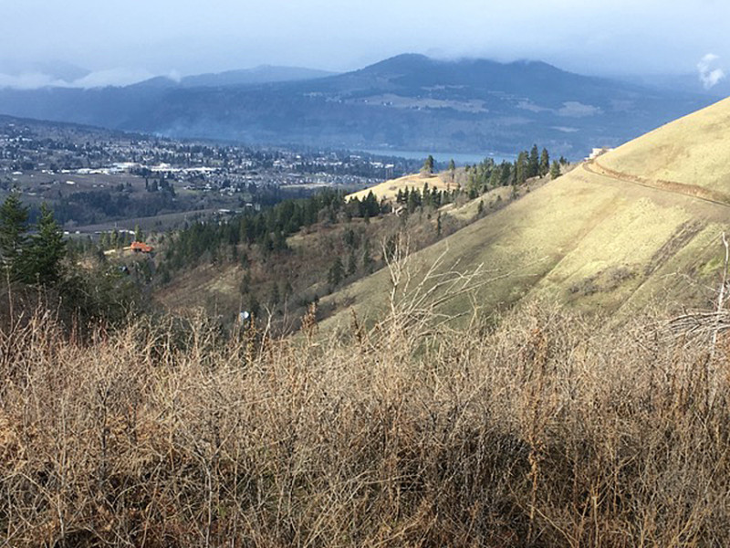
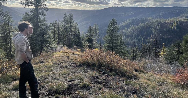
[/media-credit] This trail can be reached by driving east from Hood River on Old Dalles Road, where a number of county-owned public access gates permit hiking. Photo: Emily DeCarlo.
reach out to the Gorge Trails Recovery Team, a collaborative effort between the Trailkeepers of Oregon, Pacific Crest Trail Association, Friends of the Columbia Gorge and Washington Trails Association. These partnering agencies are working with the Forest Service to identify projects and organize volunteers into work parties as the projects move forward.
Crowdfunding campaigns create yet another avenue for those wanting to help. The National Forest Foundation?s Eagle Creek Fire Restoration Fund is currently accepting online donations, and there are other campaigns with roots closer to home.
‘Be There For the Gorge’ is one example. The fundraiser, organized by Oregon’s Kitchen Table in Portland, will run until March 15. The goal is to raise enough money to repair three trails in the iconic Multnomah Falls area: the Multnomah Falls Trail to upper Benson Bridge, the Wahkeena Falls Loop and Angels’ Rest Trail. Check out their website to get involved.
In the meantime, don’t let the amount of closed trails in the Gorge keep you trapped indoors. There are plenty of beautiful places nearby that offer great hiking this time of year, especially if you venture east of Hood River. A number of low-elevation trails leading to wide-open vistas can be found in the foothills around Mosier, and they are just begging to be explored.


Thanks for the dispatch, Dac and EnviroGorge. Can’t wait to hear more about the post-fire conditions, trail conditions, etc. Thanks for being out there.
Thanks for the positive feedback, Dan. We will continue to provide information about post-fire conditions and trail conditions as it emerges. See you out there!