Stay Updated Subscribe today for the latest research + reporting about environmental news. Subscribe Now

Stay Updated Subscribe today for the latest research + reporting about environmental news.

Subscribe Now

Susan Hess

Susan Hess

About Valerie Brown

Valerie Brown, lives near Portland, Oregon. She specializes in science and environment writing, particularly environmental health and climate change, including the health effects of chemical and radiation exposures, carbon sequestration, and climate change’s effects on forests and oceans.

Water Rights – The Pretzel Logic

By Valerie Brown. Feb. 6, 2017. By 2100 there will be next to no glaciers at the headwaters of the Columbia River in British Columbia. Mount Hood’s glaciers have already retreated by more than 61% over the last 100 years and will likely be gone by 2100 as well. Their loss will sharply reduce late summer water flow in the Hood River, right when growers need it most. Cities, too, will be thirsty and baking at the same time.

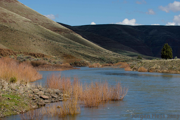
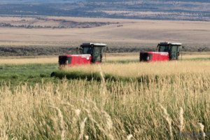
The John Day River in Eastern Oregon is used extensively for agricultural irrigation

The handwriting is on the wall: naturally frozen water is no longer going to be a storage mechanism for the Columbia Basin. Nor will we be able to store as much liquid water as we are losing in snow and ice. And most experts anticipate less overall precipitation, even if there are also more extreme precipitation events.

That’s about as much as we can predict about future water supply in a rapidly warming climate. In the new regime we are facing, how are we going to distribute water fairly among city and country, farm and factory? What adjustments to our current system of water rights will be necessary?


WATER RIGHTS HAVE A LONG AND WINDING PAST, and their future is likely to be similar. There was a chance for western water management to be set upon a rational footing in the nineteenth century after renowned geologist and explorer John Wesley Powell completed his ‘Report on the Lands of the Arid Region of the United States’ in 1879, in which he begged the nation to organize the region—including at least half the Columbia’s drainage from about The Dalles eastward—according to watersheds and not according to arbitrary political divisions.

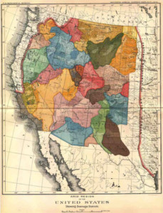
Figure 1. John Wesley Powell Watershed Map. Image Credit: U.S. Geological Survey

Powell urged the government to ensure that water rights stayed with the land and that all landowners should be guaranteed access to water. He didn’t want entities like railroads and irrigation companies that had no particular interest in actually using the land to get hold of water rights. He even drew a map of his suggested organizing principle. (See Figure 1.)

Sadly, but not surprisingly, politicians and bureaucrats mostly failed to follow Powell’s advice. They were from the East, where water was almost always available from rain, springs, rivers and groundwater, and they used rules brought from Europe. These were usually riparian rights, where owners of land bordering a waterway owned the water rights. Perhaps more tellingly, American policymakers thought Powell’s ideas too regulatory, stifled free enterprise. Lawmakers also built into the system the right of water rights holders to sell or lease water to other users—within some constraints.

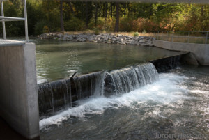
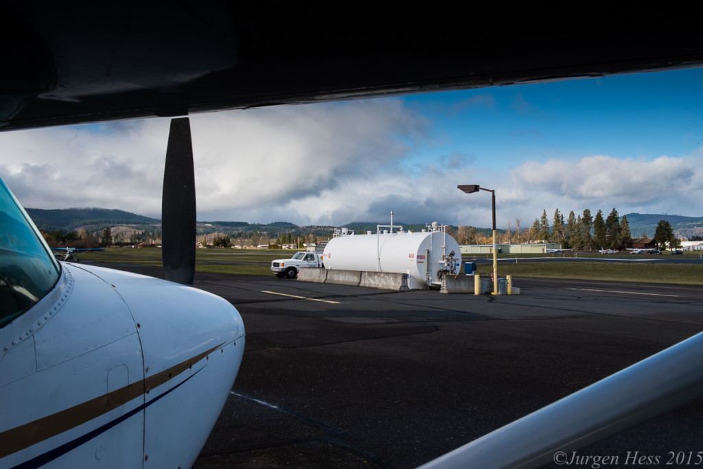
East Fork Irrigation District withdrawal

So the West got a byzantine water rights management system —incredibly inefficient and, some say, shot through with illogic and inequities. In Washington and Oregon, water belongs to the public, and the states grant usage rights. The State of Oregon requires irrigation districts to meter water use. So far, so good.

But both northwest states countered this enlightened practice by the prior appropriation rule, under which the person who first uses the water gets first access if there’s a shortage. Junior users may be out of luck, unless: in severe drought a governor steps in to keep urban dwellers and livestock alive. Prior appropriation was adopted during the west’s mining era, when desperately competitive prospectors staked claims right and left and needed water to sluice gold or silver.

A SECOND OLD RULE IS ‘USE IT OR LOSE IT.’ This means that if you have rights to a certain amount of water every year but you don’t remove that water from the flow, somebody else can use it. If you don’t use all the water you’re entitled to, you will eventually (usually in about five years) lose the right to the amount you are not using. This is an obvious recipe for waste.

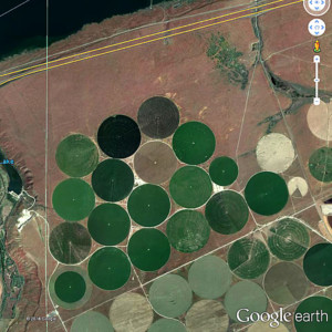
Irrigation Circles in Eastern Oregon adjacent to the Columbia River.

THE THIRD TRADITIONAL RULE: Water must go for ‘beneficial uses.’ Historically, these have been agriculture, agriculture, agriculture, industry, mining, municipalities, and, more recently, power generation. Agriculture, you may have noticed, is by far the preferred use. What if you want to leave the water in the stream for the benefit of the fish, the frogs, the water skippers, your own esthetic satisfaction and so on? That’s not so high up on the totem pole.

Historically, the only beneficial use for leaving water in-stream was to keep the stream navigable.

Defining beneficial use to include leaving water in its bed may be the rule that has changed the most. In the Pacific Northwest, protecting fish is required by law and is seen by more and more citizens as a positive value. For the legal muscle to help do this, we owe a lot to the Native American tribes, which represent a kind of wild card in the system. As sovereign nations, they stand between the federal government and the states in the legal pecking order. Northwest tribes have treaty fishing rights with the feds that make keeping water in rivers and streams a necessity.

In fact, there’s a big difference between the Northwest and the Southwest in this respect, says Douglas Kenney, director of the Western Water Policy Program at the University of Colorado Law School in Boulder. Southwest Native Americans have no such fishing rights in their treaties, so their ability to argue that not taking the water out constitutes a beneficial use is much weakened, he says.

BECAUSE TRIBES ALSO HAVE THE OLDEST CLAIM to prior appropriation, their water rights technically precede the states’ ability to regulate water usage, and they shouldn’t have to prove beneficial use to retain their rights, either, writes Robert Anderson, director of the Native American Law Center at the University of Washington School of Law. But, says Kenney, tribes are highly restricted in how they can use their water. They can’t sell it across state lines, for example, and they can’t use its value as collateral for building reservation infrastructure.

Further, he adds, “If they’re not currently using that water, somewhere on the system there is a current user that fears their supply is going to go away.” Thus there are built-in costs and benefits that may be illogical or even technically illegal, but have been standard practice for so long that they would be very difficult to dislodge.

Nobody thinks there’s any chance that we’ll ever circle back to Powell’s watershed organizational scheme. No, it’s capitalist economics that appears to be the favored solution, says Kenney. “The obvious way to deal with the problems of shortages and water being allocated in ways that might not suit modern needs,” he says, “is to reallocate through market mechanisms.” In some parts of the West, farmers are already selling most of their water to municipalities.

Many tribes would like to share in this opportunity, says Jeanette Wolfley, a Shoshone-Bannock tribal member and assistant professor at the University of New Mexico School of Law in Albuquerque. Wolfley says states want tribes to use their water on reservations instead. Tribes usually don’t have the infrastructure or the interest in using all their water rights that way, and they could use the money.

Another way tribes could be helpful, Wolfley says, would be to save up water banks that could be tapped in times of shortage for uses like irrigation. But, she adds, “When the feds and state policymakers are considering water use, tribes aren’t at the table. If tribes were at the table, junior water users, meaning oftentimes states and irrigators and others, would have more certainty.”

WHATEVER HAPPENS, THE GORGE’S FATE will depend on that of the vast Columbia River Basin, which is governed by two countries, seven states, hundreds of smaller governmental and advisory entities, 13 Indian tribes, and eight federal agencies with water-related responsibilities. Getting all stakeholders to feel they’ve been fairly treated will be a massive undertaking, and some of the old water rights structures may have to be dissolved.

For example, the priority system doesn’t guarantee that everybody will get a proportional amount of what water there is, and a market system means only those who can afford it will get water. But, Kenney says, the Pacific Northwest is known for being creative in managing land management resources and achieving the spirit of what Powell talked about without literally implementing it. We can only hope when the going gets especially tough that spirit prevails.

Subscribe

Get new stories bi-monthly in your inbox!

You can also find us on Facebook, Instagram, and Twitter.
Subscribe

Paid Advertisement:


Interested in reading more about Gorge water issues?

Irrigating our Future in the Midst of Climate Change

Columbia River Dams and Salmon


Weeds: The Slow Moving Wildfire

Knapweed: pretty buy dangerous

[/media-credit] Knapweed: pretty but dangerous

Every spring brings the chance to gaze at a wildflower meadow and allow a feeling of peace and optimism to wash over the soul. From the bright yellow of balsam root and scotch broom in the freeway medians to purple lupine and those things in irrigation ditches, everything shouts joy and zest. Weekend drives in the country and hikes in the Gorge become ecstatic experiences.

But many of these striking blooms are not native. And unlike the jingoism sweeping through human politics, in the case of invasive plants it’s appropriate to try to stop them in their tracks. It behooves us all to know the difference between a newcomer greedily hoovering up all the available resources and a native plant that has established itself in a particular place without human action. In fact, our awareness of the difference could be what preserves our region’s unique beauty and bounty.

But humans have been moving plants around on most continents for thousands of years. No ecosystem is entirely pristine.

What difference could a few more transplants possibly make any more?

The answer is really simple. Take the Gorge, for example. We do want to preserve its unique character, which is equivalent to its biodiversity. Biodiversity is an interdependent network of animals, invertebrates, water and nutrients that have co-evolved over eons. Introduced species usually have unintended effects on that balance. They can exacerbate erosion and suck up far more water than the natives. Often when placed in a new environment, a seemingly innocuous plant goes ‘viral,’ elbowing its neighbors out of the way, stressing the other organisms in the network.

Non-native plants are more than mere weeds. They’re often called ‘noxious’ — generally defined as highly destructive, invasive, and difficult to control by chemical or physical means. Some are poisonous. Noxious weeds are enthusiastic colonizers of disturbed ground, prolific seed producers, highly adaptable to different conditions, and fast growers, according to Noxious Weeds in the Interior Columbia Basin and Portions of the Klamath and Great Basin: Science Assessment of Selected Species.

Thistle removal in progress. See result below.

[/media-credit] Thistle removal in progress. See result below.

By contrast, “A weed is a plant where you don’t want it to be” — not necessarily an invader, says Tania Siemens, who works with the Oregon Sea Grant Watershed and Invasive Species Education Program at Oregon State University. “Plenty of native species are weedy,” she adds. But native weeds don’t have the ecosystem and economic impacts of invasive species.

A 2014 Oregon Department of Agriculture study estimated that noxious weeds cost Oregon residents about $83.5 million in personal income and, left unchecked, could cause the loss of nearly 2,000 private sector jobs.

These losses are caused by factors like degradation of forest land by Scotch broom, preventing regrowth of desirable trees; supplanting of crop seeds in fields by invading noxious plants; and reduced forage for wildlife and livestock.

It’s harder to quantify recreational impacts, but one 1994 study found that leafy spurge (Euphorbia esula) reduced wildlife-related recreation expenditures in Montana, North Dakota, South Dakota, and Wyoming by $2.4 million annually. Much of this loss was likely related to the reduction of wildlife numbers owing to the loss of native forage plants after leafy spurge invaded.  And in places where herbicides have been used to control leafy spurge (which also drive up costs), the herbicides also killed off the native forage plants, causing researchers to note that “the treatment can be worse than the disease.”

Now for the Worst Weeds of the Gorge.

  • Bindweed
  • Cheat grass
  • Dalmatian toad flax
  • English ivy
  • Garlic mustard
    Giant hogweed
  • Himalayan blackberry
  • Italian Arum
  • Knotweeds: giant, Japanese
  • Knapweeds: meadow, Russian, spotted
  • Kochia
  • Leavy spurge
  • Puncturevine or goathead
  • Purple loosestrife
  • Reed canary grass
  • Rush skeleton weed
  • Scotch broom
  • Thistles: yellow star, bull, Canadian, musk
  • Tansy ragwort
English ivy

[/media-credit] English ivy

It’s no accident that noxious invasives are often pretty; about half of them are escapees from gardens, according to the Washington State Noxious Weed Control Board. Thus it’s important, while you’re indulging your landscaping fantasies, to learn about the bad actors before you plant, so you aren’t making the invasive problem worse. Scotch broom got here this way. So did purple loosestrife, English ivy, butterfly bush, yellow iris, and that aptly-named Paterson’s curse, which was probably introduced in wildflower mix in 2003. Speaking of which, it’s not a good idea to use any commercial wildflower mixes, as most have been found to contain noxious weeds.

Humans have a lot more to do with the influx of non-native species than just planting something (Scotch broom, English ivy) because it reminds one of the Old Country, or because we thought it would make good fodder for livestock (reed canarygrass). No, we are on the hook for a lot, because much of the time we’re oblivious to the consequences of our actions, such as hacking up undeveloped land into a housing tract. A disturbed landscape like this is a vulnerable landscape, says Marty Hudson of the Klickitat County Noxious Weed Control Board. Naturally occurring events like floods and wildfires can also disturb landscapes and invite invasion.

Reed canary grass dominates riparian zone

[/media-credit] Reed canary grass dominates riparian zone

Hudson works with landowners, who are legally responsible for controlling noxious weeds on their property. “Often the weed is just a symptom of something else,” he says, such as a landowner’s failure to think through how his uses of the land will affect the ecosystem and actually make responsible care of the property more burdensome. Livestock ripping up the pasture, developers stripping the top layer of soil to lay out homesites — even people just spraying herbicide along their fence lines — this can create open season for the weeds,” he says. But instead of doling out fines, Hudson prefers to help landowners “develop a management change” on the land. (See tips below.)

In wilderness areas, even the most devoted tree-hugger can contribute to the spread of noxious weeds, which hitchhike on boat propellers, boots, pant cuffs, and in tents and tarps. To help control the problem, there are now 25 boot brushes installed at trailheads in the Gorge courtesy of the Columbia Gorge Cooperative Weed Management Area, a group of 17 land management organizations including the Oregon and Washington noxious weed control boards, the Yakima Nation, Hood River and Wasco Counties’ soil and water conservation districts, and the US Army Corps of Engineers.

Reading a list of invasives can be discouraging. “We are faced with the loss of what we consider to be our beautiful Oregon that we cherish,” says Siemens.  But, she adds, expanding public awareness and an increasing number of official resources are pushing back at the large and growing inventory of invaders.  “Everybody can make a difference and it’s not that hard,” she says.

Himalayan blackberry can quickly take over large swaths

[/media-credit] Himalayan blackberry can quickly take over large swaths

Hudson is likewise optimistic. “This is my 25th year doing this and I feel like there’s a lot more awareness than there used to be,” he says. And his office is happy to provide Washington residents with a free packet of bee-friendly ‘noninvasive flower mix’ containing plants like sunflowers, coreopsis, lupine, crimson clover, partridge pea, and sage. These are also available from the Washington State Noxious Weed Control Board.

In the end it may be an educated citizenry that tips the balance between natives and invaders. The digital age makes identifying, locating, mapping, communicating about, and removing noxious weeds faster.

Here are some ways to pitch in:

  • Learn to identify noxious weeds; check out the Oregon site http://www.oregon.gov/oda/plant/weeds and the Washington site http://www.nwcb.wa.gov/.
  • If you see a plant you think might be invasive, take a picture and send it to: http://www.imapinvasives.org/. You can also report to the Oregon Invasives Hotline, 1-866-INVADER.
  • Consider using herbicides selectively on non-native species rather than indiscriminately killing everything.
  • Be aware that you may be carrying invasive plant seeds on your boots, clothing, boat and other gear. Boot brushes available at:
  • Don’t buy invasive ornamental plants. Investigate before you buy. Learn about the plants on your property.
  • If you clear a plot of land for any reason and don’t re-landscape right away, plant a benign cover crop so invasive weeds have competition. When you re-plant, use native plants first, non-invasive non-natives second. The Oregon State University Extension Service can suggest substitutes for common ornamental invasives for uses like groundcover.
  • Think about the difference between ‘weeds’ and ‘invasive species.’ Many weeds, such as dandelions, are actually food sources for native insects and animals.
  • Volunteer to help control invasives in your area. And if you do start pulling plants, check to see if the ones you’re removing are toxic and if so, wear protective clothing.
Thistle pull completed. Gorge Ecology Institute crew.

[/media-credit] Thistle pull completed. Gorge Ecology Institute crew.

We are faced with the loss of what we consider to be our beautiful Oregon that we cherish...but everybody can make a difference and it’s not that hard.” -Tania Siemens

Oil Brings Struggles for Farmers and Consumers

This is the second in a series of two articles on the exportation of agricultural goods versus fossil fuels in the Columbia River Gorge. See “First Came Ag. Then Came Oil” for the first installment.

By Valerie Brown. Mar. 4, 2016. The farmers most affected were those east of the Rockies, says grain grower David Brewer of Emerson Dell Farm south of The Dalles. He says he is “not aware of any concerns with competition for transportation with the energy sector” among Northwest farmers and notes that most of his wheat goes by barge to the Port of Portland.

David Brewer of Emerson Dell Farm.

[/media-credit] David Brewer of Emerson Dell Farm.

However, agricultural shippers may soon encounter a bottleneck in a different place; total marine traffic on the lower Columbia is expected to double should all the fossil fuel projects come online, possibly reaching about 6,000 major vessel transits a year, according to a study by the Seattle think tank Sightline Institute. The tank vessel traffic alone could triple. This could cause significant congestion in the lower Columbia– already a tricky environment.

In addition to possible train derailments, collisions, and leaks, fossil fuels pose further risks once they are transferred to ships and oceangoing barges. To reach and depart from the ports, seagoing vessels must have a certified bar pilot aboard to negotiate the seas that roil where the powerful Pacific Ocean meets the massive Columbia River. This is one of the most dangerous bar crossings in the world, and weather often forces ships to wait offshore until conditions improve. On the river proper, big ships must be escorted by a river pilot to the ports and grain depots upstream.

Captain Phillip Massey, a retired river pilot, once inadvertently rammed a ship carrying logs into the paper mill at Wauna, Oregon when the ship’s steering failed. “If I’d lost steering another two miles down the river,” he says, “and if that [ship] had been a tanker, it would have been the worst oil spill ever, probably equal to or greater than the Exxon Valdez.”

Other near misses are plentiful. For example, Sightline cites nine separate equipment failures on vessels in Washington and Oregon waters during just two months in 2011, as well as three incidents where laden oil tankers drifted into collision courses. The latter were rescued from disaster by alert Coast Guard staff. Since 1994 there have been at least five other narrowly averted accidents. Although actual accidents may be infrequent, even one could affect the environment for decades.

Dan Serres, conservation director for Columbia Riverkeeper, describes a worst-case accident scenario near the river mouth: “Oil tankers will be passing within a couple of hundred yards of parked LNG tankers. One tanker carrying crude oil–and another carrying liquefied natural gas–if there was a spill and a rupture you could have a flammable vapor cloud a couple of miles across.”

[media-credit name=”Jared Smith” align=”alignright” width=”200″]Jared Smith of ILWU[/media-credit]

Safety also concerns Jared Smith, president of International Longshore and Warehouse Union  Local 4. “The local is unanimously opposed to the [Vancouver Energy] project,” he says. At first the union was “concerned that an oil spill on the river would shut down the river traffic, which would mean no work at the ports,” he adds, but the union also became wary of working with the volatile and potentially explosive Bakken crude. And as an avid fisherman who processed 150 pounds of salmon last year, Smith worries about environmental impacts, especially of the heavy tar sands oil. There would be “no cleaning up” of such a spill, he believes.

Even in the absence of accidents, more ship traffic means more stress on the river ecosystem. The lower Columbia is a complex mix of navigable channels, sloughs, islands, wetlands, and tidal estuary –ideal habitat for young salmon, provided they are not contaminated with hydrocarbons, stranded onshore by the wakes of oceangoing vessels, or simply made homeless by development of terminals, docks and other infrastructure, including impervious surfaces. The National Marine Fisheries Service and other state and federal agencies have identified 47 species at risk on the Pacific coast, Columbia River, and Puget Sound, including 19 salmonid species, whales, sea turtles, smelt, sturgeon, and rockfish.

Serres says the liquefied natural gas terminal at Warrenton threatens not only the at-risk species but also the commercial and sport fishermen and crabbers in the area, because it will block access to the river when LNG ships are moving in and out of the terminal.

But some stakeholders are confident of river accident prevention practices. Jared Larrabee, Vancouver Energy general manager, stresses that the company is participating in the region’s plans for ensuring the safety of oil transport on the river, adding that “the bar pilots have never indicated any concerns about safety in the lower Columbia River.” Washington Department of Ecology Spills Prevention Manager Scott Ferguson echoes his confidence. “The Columbia River system is one of the safest systems that we have in the country as far as how the pilots operate together, how the community works to manage the traffic,” he says. (Neither the Columbia River Bar Pilots nor the Columbia River Pilots responded to EnviroGorge’s requests for interviews.)

The Bar, nicknamed "Graveyard of the Pacific," where the Columbia River (right) meets the Pacific Ocean (left) is one of the most dangerous harbor entrances in the world.

[/media-credit] The Bar, nicknamed “Graveyard of the Pacific,” where the Columbia River (right) meets the Pacific Ocean (left) is one of the most dangerous harbor entrances in the world.

While oil prices remain low and unstable and the environmental impact studies for both the Vancouver Energy and the OregonLNG terminals await completion, river traffic remains relatively uncongested. But soon the ultimate deciders for both of these projects–the governors of Washington and Oregon, respectively–will have to choose. No one will hazard a confident guess as to which way either will go, but Serres says it will be a fateful moment for the Columbia River’s future. “We’re at a really critical point for both governors to lead on this issue,” he says. “They’ve certainly said the right things, but now it’s decision time.”

First Came Ag. Then Came Oil

This is the first in a series of two articles on the exportation of agricultural goods versus fossil fuels in the Columbia River Gorge.

Looking east through the Columbia River Gorge from above Cascade Locks, OR.

[/media-credit] Looking east through the Columbia River Gorge from above Cascade Locks, OR.

The Columbia River is a source of bounty: beauty, fish, wind, waves, electricity. It is also a transportation corridor.

There has long been conflict between the river’s natural elements and their associated human values on one hand, and the river’s economic uses on the other; but it wasn’t until the mid-2000s, when hydraulic fracturing and other technologies opened up the Bakken formation in North Dakota and the tar sands in Alberta, that the Northwest became the bullseye for fossil fuel transport. Within the next couple of years, state officials will be saying yea or nay to fossil fuel projects that could profoundly change the river’s character.

Pressure on the river has been escalating over the last three years as fossil fuel transportation by train and ship has increased dramatically, including a sharp rise in the number of oil and coal trains traveling the Gorge. West Coast refineries are looking to replace the declining output of Alaska’s North Slope oilfields. Further, Congress recently lifted the ban on exporting crude oil, so petroleum interests have joined coal in wanting to do business in Asia. Currently facing regulators are proposals that would radically expand the infrastructure required to transport coal, oil and liquefied natural gas (LNG) to both domestic and foreign processors.

Right now there are four crude oil terminals and one each for coal, LNG and propane either proposed or already operating along the lower Columbia River. There are two that environmental stakeholders such as Columbia Riverkeeper and Friends of the Columbia Gorge see as especially significant. Should both projects come to fruition and operate simultaneously, many fear they would be risky for the environment, the climate, the agricultural economy, and human health.

These are: the Vancouver Energy oil terminal at the Port of Vancouver and the OregonLNG natural gas terminal at Warrenton. The Vancouver Energy terminal expects to receive up to 360,000 barrels of crude a day by train for transfer to ocean tankers. The OregonLNG terminal anticipates exporting about 456 billion cubic feet a year. (For comparison, the average U.S. driver used 663 gallons of gasoline in 2013–about 15 barrels of oil; Oregonians consumed 220 million cubic feet of natural gas in 2014; Washingtonians, about 307 million.)

Approximate locations of fossil fuel terminals.

[/media-credit] Approximate locations of fossil fuel terminals.

Then there’s the carbon footprint: A year’s worth of Vancouver Energy oil, when burned, would release more than 56 million metric tons of carbon dioxide annually, according to Columbia Riverkeeper. While burning natural gas affects the climate far less than do oil and coal, if the gas has been produced by fracking–as the gas coming to OregonLNG would be–its global warming advantage over these fuels is sharply reduced. At present the forces countering the economic impetus are the ‘thin green line’ of Pacific Northwest environmentalism; the slow pace of permitting and approval processes by the states of Washington and Oregon and federal agencies; and the radical slump in oil and coal prices globally.

Historically, most downriver commercial traffic on the Columbia has been agricultural products for export–grain, soybeans, hay, apples, potatoes–from Washington, Oregon, and Idaho. Most wheat goes by barge, but a significant portion goes by rail: the Burlington Northern Santa Fe (BNSF) railway on the Washington side and the Union Pacific rails on the Oregon side of the river. Fossil fuels have typically moved upriver as refined products like gasoline and diesel for use in the region.

Although the westbound fossil fuel traffic is new, pressure to increase the river’s economic role has been building for a long time. In 1989 various groups ranging from the ports of Portland and Vancouver to the Pacific Northwest Waterways Association and other river and maritime organizations began to push for deepening the Columbia River navigation channel to accommodate bigger ships. The next year the Army Corps of Engineers began to dredge the channel from 40 feet to 43 feet. Finished in 2010, the project has been credited by the Pacific Northwest Waterways Association with bringing more than a billion dollars in new investment to the region.

[media-credit name=”Jurgen Hess” align=”aligncenter” width=”500″]Oil train[/media-credit]

Then came oil. By 2014 the U.S. was producing an average of 8.7 million barrels of crude oil a day; from January to June last year the average was more than 9.4 billion barrels a day. And the heavy crude from the Alberta tar sands reached the export market. The oil and coal industries began to eye the Pacific Northwest as an attractive route to the Pacific. On the Columbia, the combination of a deeper channel and the prospect of sharply increased petrochemical traffic brought safety and environmental issues to the fore–and unsettled the established agricultural users of the river.

In the fall of 2014, according to the Seattle Times, grain producers’ shipping prices spiked and long delays forced agricultural shippers to pay up to $50,000 per day to persuade oceangoing vessels to wait for delivery, sparking rumors that BNSF was giving preference to a massive volume of oil needing transport at the same time. BNSF spokesman Gus Melonas says the shipping delays were caused by weather as well as the railway’s maintenance and expansion activities and affected all commodities, not just agricultural products. He added that the railway has since increased its capacity to meet demand for both oil and consumer products. “As a common carrier under federal law we are required to move all types of products,” he says. “We can’t discriminate and say yes to a load of baseballs and dolls and no to a load of oil.” (Or vice versa, presumably.)

Airborne Lead from Aviation Fuel

By Valerie Brown, Feb. 19, 2016. The recent news that Flint, Michigan children have been poisoned by lead in their drinking water has rekindled the nation’s anxiety about this toxic heavy metal. But is the Flint scandal just a local disgrace or should the rest of us be concerned about unexpected sources of lead exposure?

Lead was formerly used in paints, gasoline, and countless consumer goods. But it was found to be a health hazard. In adults, lead exposure has been associated with high blood pressure and kidney failure, and in children with aggression, attention deficit disorders, loss of IQ points and other neurological problems. Getting lead out of gas and paint in the 1970s caused a radical drop in Americans’ lead ‘body burden,’ which in turn has been credited with, among other effects, lowering the crime rate.

[media-credit name=”Valerie Brown” align=”alignright” width=”283″]historical_background_&_blood_lead_levels_TABLE[/media-credit]

Thus much lead exposure these days is of the ‘legacy’ sort–from remodeling homes built before 1978, in plumbing held together by lead solder, and in batteries and ammunition (although it has not been banned from plastic and still remains a worrisome contaminant in many products ranging from lipstick to children?s toys and imported candy).

But the largest source of airborne lead that remains unregulated is avgas, also known as ‘100LL’ – the most common fuel used by piston-engine airplanes and helicopters. These are the small aircraft that use general aviation airports like Columbia Gorge Regional in The Dalles and Ken Jernstedt Field in Hood River.

Evaluating the dangers of lead from general aviation sources requires balancing a number of considerations: For example, while lead is a dense, heavy metal, it is ground so fine in avgas exhaust that much of it can travel far from the point of emission.

And even though blood lead levels are declining, researchers have found that the steepest increase in health effects occurs at the lowest levels of exposure; and it is very clear that there is no threshold no ‘safe’ level of exposure below which we need not worry about damage.

In the 1960s the Centers for Disease Control and Prevention set allowable blood levels at 60 micrograms per deciliter (mcg/dL), lowered them to 10 in 1991, and has recently lowered them yet again to 5 mcg/dL in response to the news that there is no threshold for harmful effects. The CDC estimates that about half a million U.S. children have blood levels above 5 mcg/dL. Damage to academic performance has been measured at levels as low as 2 mcg/dL – so children continue to be at risk even as lead in their environment decreases.

[media-credit name=”Valerie Brown” align=”alignleft” width=”300″]EPA_Lead_Standards_TABLE[/media-credit]

It would be impossible to remove 100% of the lead from the environment or our bodies, but regulators still have to come up with some benchmarks that end up being de facto thresholds. (See sidebar.)

While general aviation is a small part of overall aviation, it may be a significant source of local lead exposure. A 2011 study revealed that about 16 million people live within 1 kilometer of a general aviation airport, and 3 million children attend school within that perimeter. The closer the residence to the airport, the higher the blood lead levels in the children living there. And while the ambient lead level falls off rapidly with distance from the source, airport levels have been measured at more than four times the concentrations in the general environment, and are higher downwind than upwind of an airport.

Except for a few steel and lumber mills, the most significant lead sources in Washington and Oregon are airports, most emitting hundreds of pounds annually. In Oregon the second-highest source of lead emissions is the Hillsboro Airport, which releases about a ton into the skies every year – nearly twice Portland International Airport’s emissions. Hillsboro’s figures are a direct result of the extremely high number of operations at the airport attributable to general aviation flight lessons.

[media-credit name=”Valerie Brown” align=”alignright” width=”283″]Selected_Sources_of_Lead_Emissions_in_Oregon_&_Washington[/media-credit]

According to the Aircraft Owners and Pilots Association, the reason pilots don’t yet make much use of the nine potential alternatives to avgas is that without leaded fuel, a small piston engine is susceptible to forces that would “literally tear itself apart during operation.” Although the AOPA participates in a broad coalition of organizations including the FAA and the EPA working toward a substitute fuel, there is still no deadline for eliminating lead from aviation fuel.

A consortium of environmental groups including Friends of the Earth, Physicians for Social Responsibility and Oregon Aviation Watch has petitioned the EPA to take action, but the EPA remains unwilling to consider an endangerment finding for avgas, putting its decision off until at least 2018. An endangerment finding would require the EPA to take steps to protect human health.

In the meantime, says epidemiologist Bruce Lanphear, a childhood lead exposure expert at the University of British Columbia, “We are [allowing continued use of avgas] on the backs of future generations. It has to stop. The question is when. It’s a technology that is obsolete. It should be banned or phased out.”

Fly Friendly – Or Not

Private planes parked at the Jernstedt Airfield.

[/media-credit] Private planes parked at the Jernstedt Airfield.

By Valerie Brown, Dec. 15, 2015. Some people love airplanes’ sleek lines, the percussive slap and chatter of helicopter rotor blades, the roar and shimmering heat emitted by turbines, and even the smells of oxidizing hydrocarbons.

Other people hate those same things. American aviation regulations ostensibly balance the values and needs of both kinds of view, but it is an uneasy–some say severely biased–truce.

Most concerns about aviation noise and air pollution focus on big jets and big airports. For example, residents near England’s Heathrow Airport and Chicago’s O’Hare Airport have struggled for decades with the noise and toxic emissions from commercial aviation. Currently, the city of Phoenix, Arizona is suing the Federal Aviation Administration (FAA) after a change in required flight patterns at the city’s Sky Harbor International Airport sharply increased noise levels in residential areas.

But there are also millions of people living near the approximately 20,000 small airports used by piston-engine planes and helicopters as well as small jets – the types of flying machines called ‘general aviation’ (GA). This is what Gorge residents and visitors are most likely to encounter. GA aircraft are used for a variety of tasks including firefighting, search and rescue, vintage plane fly-ins, agricultural pesticide spraying, corporate transportation, recreational flying, and scenic tours.

There are two GA airports that serve the Gorge: Ken Jernstedt Airfield, owned by the Port of Hood River, and the Columbia Gorge Regional/The Dalles Municipal Airport in Dallesport, owned jointly by the City of The Dalles and Klickitat County (Washington). Neither airport is considered particularly busy compared to other GA airports. The Hillsboro Airport sees almost 700 operations (takeoffs and landings) a day, while Jernstedt Airfield sees about 39; Columbia Regional, 45. Neither airport has a control tower or radar equipment because activity at both airports is low and the depth of the Gorge presents technical problems for radar. There’s currently no commercial air service in the Gorge.

All of this means, it’s a matter of whether a pilot decides to consider the effects of the engine noise on people on the ground. If a pilot decides not to, there’s no authority nearby to hold the pilot accountable. Hikers, picnickers, and people relaxing outside run the risk of aviation noise shattering their enjoyment.

An pilot practices "touch and go's" during a clear break in weather.

[/media-credit] An pilot practices “touch and go’s” during a clear break in weather.

Tod Guenther, son of former Hood River city manager Lynn Guenther, has experienced plenty of aviation noise, having grown up on airbases while his father was in the Air Force. Yet Tod finds himself annoyed with local air traffic.

“It wouldn’t bother me too much if they were a little bit higher or you just see them one time,” Guenther says. “But it’s been constant over the last few years. You notice it on the weekends when you’re trying to relax.”

Guenther has never contacted the airport to complain, but others have. “We do occasionally get noise complaints,” says Scott Gifford, president of Classic Wings, Jernstedt Airfield’s fixed-base operator. “Some can be directly attributed to, basically, pilots being stupid,” he says. Some pilots are “inconsiderate to the neighbors,” failing to climb to a reasonable altitude before flying over residential areas, he says.

Probably the most annoying type of general aviation in terms of noise is flight training. People bothered by aircraft noise often say that one flyover by a loud plane or helicopter is one thing, but circling or repetitive landing and taking off (known as ‘touch and go’s’ in the business) wears on their nerves. Yet these are the very activities student pilots have to practice. But as long as small airports have small flight schools or none at all, this kind of noise can remain negligible. However, non-student pilots also often do repetitive touch-and-go’s to keep up their license requirements.

Noise: More than Annoying

Noise is defined as unwanted sound. Most noise regulations, aviation’s included, rely on decibel levels alone. But loudness doesn’t capture the full effect. Being disturbed by noise is more than simple annoyance. Even noises as low as about 45 db (decibels) can raise heart rate and blood pressure.  This in turn disrupts cardiovascular rhythms, raises stress hormone levels, and can lead to atherosclerosis. One study found that aircraft noise as low as 33 db was enough to raise stress hormones in sleeping subjects. For comparison, bird calls are around 40 db. Chronic exposures to levels of about 70 db–the level of noise from a vacuum cleaner–can cause direct damage to hearing. A propeller plane flying overhead at 1000 feet has been estimated at 88 db–about like a leaf blower from 50 feet away. Children in noisy environments have trouble concentrating and understanding what they read.

Heavy Metal

In addition to noise, small planes and helicopters emit one of the most toxic substances known to man: lead. Lead was banned from paint in 1976 and phased out of gasoline by 1995, but most general aviation aircraft were exempted then and remain so today. The justification is that the engines in these small aircraft will not work correctly on unleaded fuel, creating a safety hazard. The claim is not universally accepted.

An on-site fuel tank at the Jernstedt Airfield.

[/media-credit] An on-site fuel tank at the Jernstedt Airfield.

General aviation is now the single largest source of lead in the atmosphere, responsible for nearly 500 tons emitted annually in the U.S. The Hillsboro airport is the largest source of atmospheric lead in Oregon, releasing nearly a ton a year. It is also the busiest airport in the state (topping even Portland International), principally owing to the thousands of flights engendered by student pilots at Hillsboro Aero Academy.

There is little information about lead levels in soils and air around most GA airports, because in most cases nobody has looked for it. But one study estimated that there are 16 million Americans living within one kilometer of a GA airport, and three million children attending school within that radius. Other research has shown that people living and/or working that close to a GA airport have elevated blood lead levels which, although seldom above the EPA’s (Environmental Protection Agency) current ‘action level’ of 10 micrograms per deciliter, are often within the range shown to harm children’s health.

It is generally agreed that there is no safe level of lead in the body. Lead is a neurotoxicant and reproductive hormone disruptor. Prenatal exposure can result in premature birth, low birth weight, decreased mental ability, reduced growth, abnormalities in eye development, and higher risk of obesity later in life. At the lowest concentrations in children it can shave off significant IQ points.

The EPA has made some halfhearted moves to get the FAA to impose alternatives to leaded fuels, but its inertia has lasted so long that Friends of the Earth and Earthjustice sued the EPA in 2011. In 2014 the same groups along with Oregon Aviation Watch, an activist group based in Hillsboro, petitioned the EPA to make an immediate endangerment finding that lead is a hazard to public health. The agency denied the petition. At the moment the EPA claims it will issue a draft endangerment ruling in 2017, so the delay continues.

Who You Gonna Call? Nobody.

Aside from calling the local airport, what options do residents have who are bothered by aviation noise or concerned about pollution? In principle there are some avenues for people to be heard, but unfortunately most are ineffective. Pinning specific lead emissions and egregious noise events to particular aircraft is very difficult. It’s well known that flight instructors like to have their students fly to outlying airports where they can practice landing, taking off, and interacting with the control tower (if there is one) in a relatively uncongested environment. The itinerant nature of much GA air traffic makes it difficult to identify offending pilots. Many aircraft are not even landing at an airport, just passing through. And in any case, complaints are always after the fact.

Contacting the FAA will not get results. The FAA treats most noise as a ‘nuisance’ rather than a ‘hazard.’ Getting the agency to act on noise complaints means convincing it that there is actual danger associated with the noise, such as a pilot buzzing people on the ground and running the risk of hitting a tree or otherwise losing control. In other words, the FAA washes its hands of the problem, stating that “Airports are responsible for their noise impact on the communities they occupy.” But this represents one of the deepest ironies of GA’s environmental problems: Airport owners can control only the airport facilities, including terminals, runways, hangars, and other real estate. The airspace of all non-military airports is controlled by the FAA. Since most noise offenses and toxic emissions originate in airspace, there is the Catch-22.

A plane takes off from the runway.

[/media-credit] A plane takes off from the runway.

The EPA has a noise pollution section, but Ronald Reagan ordered it to become inactive in 1981 and funding evaporated. The Quiet Communities Act of 2015 introduced in the House on October 2 by Rep. Grace Meng (D-NY) would reawaken the EPA’s Office of Noise Abatement and Control and authorize $21 million per year through 2025 to fund it. Its chances of becoming law are unknown.

Things are no better at the state level. “Currently,” says Oregon Aviation Watch’s Miki Barnes, “there is no avenue through the Oregon Department of Aviation to file noise complaints.” Even though Oregon has strong noise control regulations, the Oregon Department of Environmental Quality de-activated its noise section at the same time as the EPA in the 1980s.

The Aircraft Owners and Pilots Association (AOPA), which is the most influential GA political group, has established a ‘Fly Friendly’ campaign to encourage general aviation pilots to consider the effects of the noise they generate on people who may not be enthusiastic about the ‘romance of aviation.’ The trouble is that flying friendly is entirely voluntary, although the AOPA has also produced a sensible guide for pilots to avoid the worst sorts of clashes with disgruntled citizens.

For the time being, neither Gorge airport is experiencing dramatic expansion. Gifford expects that itinerant flights will be the main growth sector at the Hood River airport. He believes this may include aviation tourism. There is no chance that commercial service will come to Hood River because of the city’s proximity to Portland International, and most agricultural spraying jobs have been replaced by ground application of pesticides, Gifford says. Corporate and business small plane and jet traffic could increase as the local economy expands. Some of the existing traffic, he adds, is students from flight schools in the Willamette Valley, including Hillsboro, and from the Bend-Redmond area.

Because Jernstedt Airfield is south of the city outside the urban growth boundary, Gifford doesn’t expect to see problems that arise for many airports from encroaching residential development. Most of the land surrounding the airport is orchards zoned as exclusive farmland, which makes it unlikely to be re-zoned for housing. This is good because, he says, “The trees don’t complain.”

By |2019-04-11T11:06:56-07:0012/15/2015|Energy, News, Old Articles, Transportation|3 Comments

© Copyright 2013-2025 Columbia Insight. All Rights Reserved.

As a 501(c)3 nonprofit organization, all donations to Columbia Insight are tax deductible to the full extent of the law. Our nonprofit federal tax-exempt number is 82-4504894.