Stay Updated Subscribe today for the latest research + reporting about environmental news. Subscribe Now

Stay Updated Subscribe today for the latest research + reporting about environmental news.

Subscribe Now

Kendra Chamberlin

Kendra Chamberlin

Kendra Chamberlain

About Kendra Chamberlain

Columbia Insight contributing editor Kendra Chamberlain is a freelance journalist based in Eugene, Oregon, covering environment, energy and climate change. Her work has appeared in DeSmog Blog, High Country News, InvestigateWest and Ensia.

The Forest Service is ready to get moving on a big project at Mount St. Helens

Aug. 31 is the deadline to respond to a public questionnaire about changes to the way Spirit Lake is managed

Spirit Lake at Mount St. Helens

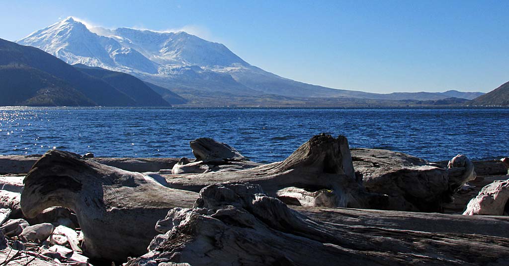
Pretty, tricky: The waters of Spirit Lake near Mount St. Helens have been in the spotlight for parts of five decades. Photo: Public domain

By Kendra Chamberlain. August 28, 2024. The United States Forest Service has begun considering options for what to do with a 40-year-old tunnel built at Spirit Lake in the aftermath of the 1980 Mount St. Helens eruption.

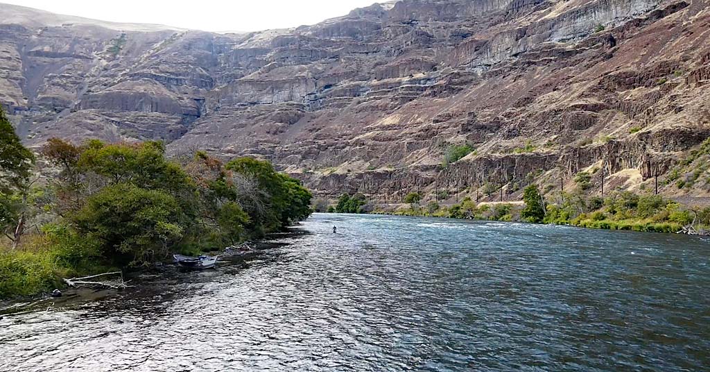
The tunnel—quite literally constructed on shaky ground—is the only thing keeping downstream communities safe from a potentially catastrophic flood from Spirit Lake, located just north of Mount St. Helens.

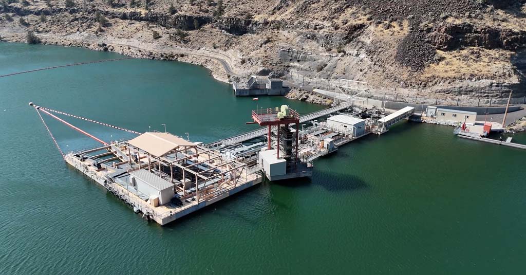
In 1985, the Army Corps of Engineers built a 1.6-mile-long tunnel through a nearby ridge to let the lake drain into the North Fork Toutle River.

The ridge itself is geologically active, filled with small faults and “shear zones” that have exerted pressures on the tunnel over the last four decades, requiring extensive repairs. In 2018, a report determined that the tunnel needed millions of dollars worth of repairs to avoid failure.

The Forest Service says it’s time to decide on a permanent solution for managing the lake’s water levels.

It’s a sticky situation.

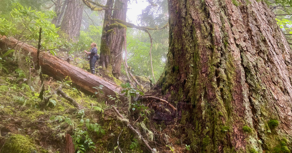
As Columbia Insight has reported, the tunnel is surrounded by some of the most important—and delicate—research sites in the world, offering scientists a rare opportunity to observe and study how life returns to an area devastated by a volcanic eruption.

Spirit Lake and Mount St. Helens graphic

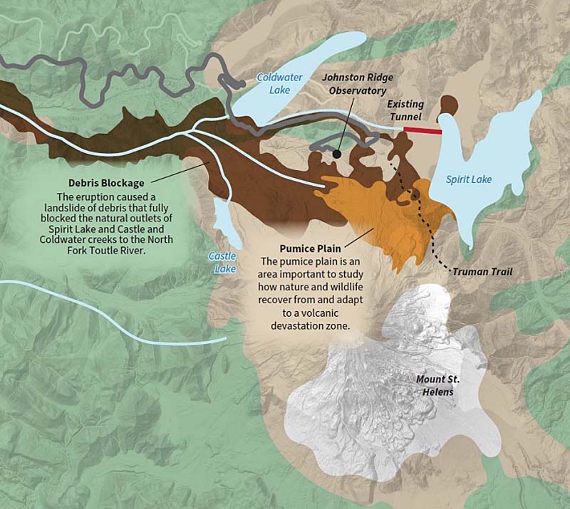
Graphic: USFS/Catalyst Environmental Solutions

The Forest Service has initiated what it calls “enhanced outreach” for the tunnel project, offering more opportunities for scientists, tribes, conservationists and recreationists to weigh in on how best to proceed. Stakeholders include the Spirit Lake/Toutle-Cowlitz River Collaborative, formed in 2021, a watershed-wide consortium focused on the long-term management of Spirit Lake, public safety and other issues facing the watershed.

This summer, the Forest Service released a first draft of options it’s considering for the tunnel. Proposals range from repairing the existing tunnel and adding a permanent pump station to carving out new open channels or drilling new tunnels.

The agency held a pair of virtual meetings in July outlining the options.

Whichever option is chosen, the Forest Service is likely in for a fight. When it proposed building a temporary road through multiple research plots in the Pumice Plain in 2020, researchers and conservationists roared back, hitting the agency with a multi-plaintiff lawsuit.

So how are enviros feeling about the new tunnel options?

It’s too early to say, according to Ashley Short, policy manager at Cascade Forest Conservancy, one of the plaintiffs in the Pumice Plain lawsuit.

“We’re still listening and learning at this point and won’t be able to speak to any real specifics on any alternative until we’ve seen more details,” Short told Columbia Insight.

“I can say we are committed to being a conservation voice and showing up in the planning process,” she said.

The formal scoping documents and environmental assessment are expected to be released in September.

In the meantime, the Forest Service is collecting responses to a questionnaire about the project until August 31.

UPDATE: Idaho’s aggressive quagga mussel response seems to have worked

The mollusks have invaded water basins around the US, but not yet gained a foothold in the Columbia River Basin

Quagga mussels

Bye for now: Quagga mussels are under control in the Snake River, for the time being. Photo: Wikimedia Commons

Update, Sept. 25, 2024: On Sept. 24, 2024, the Idaho State Department of Agriculture announced that a small number of quagga mussels were detected in a treated portion of the Snake River. “One of our greatest success stories as a state has been the coordinated, rapid response to quagga mussels last fall, but we knew we would be on watch for a period of five years,” said Idaho Gov. Brad Little in a statement following the announcement. “I have great confidence in the team at the Idaho State Department of Agriculture and their many, many partners to continue to tackle this problem with minimal disruption to the public.” —Editor

By Kendra Chamberlain. August 21, 2024. It’s been nearly a year since the dreaded quagga mussel was first detected in Idaho’s Snake River near Shoshone Falls.

The discovery swung the Idaho State Department of Agriculture (ISDA) into a frenzy to eradicate the tiny creatures from its waters.

The state spent some $3 million last year to dump a copper-based treatment into the river in three sections, killing virtually everything in its path—aquatic life, plants and fish alike.

But the treatment plan—considered one of the most aggressive ever undertaken in the United States—seems to have worked.

So far, no new quagga mussels have been detected, as reported by the Idaho Statesman.

The tiny quagga mussels are a danger to the Columbia River Basin. The mollusks are aggressively invasive, coating every surface they come in contact with and wreaking environmental and economic havoc.

The mussels have invaded important water basins around the United States, but so far haven’t gained a foothold in the Columbia River Basin.

Quagga mussels outcompete native freshwater mussels for food, and even attach to native mussel shells, killing them.

In September 2023, ISDA detected a plume of mussel larvae, called “veligers,” as part of routine monitoring of state waterways.

After more investigation, a diver working for the department was able to locate a single adult mussel, smaller than a fingernail, located about 16 feet underwater.
Female quagga mussels can release up to 500,000 eggs per year, which float freely and can easily spread throughout waterways.

ISDA previously told Columbia Insight the department doesn’t know how the species reached the Snake River, or how long the species was present in the river before detection.

The Idaho Statesman reports the department will continue intensive monitoring for the mussel for possibly five years before Snake River can be considered free of the invaders.

Of course, the mussels may be inadvertently introduced at any time, which is why ISDA is pleading with the public to stay vigilant about cleaning watercraft and stopping at mandated watercraft inspection stations.

By |2026-01-13T15:28:26-08:0008/21/2024|Rivers|0 Comments

Crayfish are playing a surprising role in the fight for clean water

Citizen scientists are also major contributors to a project that utilizes the freshwater crustaceans in a novel way

Signal crayfish Pacifastacus leniusculus

Rare quality: The signal crayfish is native to the Pacific Northwest. Most varieties of crayfish found in the region are not. Photo: Astacoides/Wikimedia Commons

By Kendra Chamberlain. August 15, 2024. Environmental workers come in all varieties but, fairly or not, they’re often tagged with a set of stereotypes: determined, resourceful, prickly, crunchy.

No matter their widespread validity, these qualities certainly apply to the latest group of enviro warriors—crayfish.

For the past four years, a team of researchers from the University of Idaho has been capturing crayfish from water bodies across the Columbia River Basin to examine levels of mercury found in the crustaceans’ tails.

The Crayfish Mercury Project is a pilot for using crayfish as a “biosensor” to track pollutants in watersheds across the Columbia River Basin.

While the research is focused on mercury, crayfish could also be used to track other persistent organic pollutants (POPs), such as PCBs or DDT that are present and moving through the Basin.

The project also offers a proof of concept for leveraging community-based science to conduct research.

The team has tapped into networks of community members to help generate data points. So far, more than 500 volunteers in Montana, Idaho, Washington and Oregon have helped the team collect some 1,200 crayfish to sample.

Crayfish as biosensors

Measuring levels of pollutants in water bodies is harder than you might think.

“If you were to go out to most of the areas within the Columbia River Basin and just pull up a liter bottle full of water, the chance of measuring detectable mercury or PCBs or DDT metabolites is actually fairly low. Not zero but fairly low,” says Dr. Alan Kolok, lead researcher at the Crayfish Mercury Project and retired professor at University of Idaho.

That’s where the crayfish come in.

Crayfish accumulate non-metabolizable compounds such as mercury, DDT, PCB and PBDE (polybrominated diphenyl ethers, a class of manmade, fire-retardant chemicals) at a linear rate, which means they’re incredibly useful for monitoring those chemicals, according to Kolok.

Graphic

Data gathered by the Crayfish Mercury Project could be layered with other mercury monitoring data to create a geospatial map of mercury in the Columbia River Basin. Graphic: Alan Kolok/University of Idaho

So far, the team has sampled crayfish from Clark River in Montana, the Boise River and its tributaries in Idaho, the Spokane River and its tributaries in Washington and the John Day River in Oregon.

“Full disclosure. We have not seen anywhere where the levels are so high that they are actually high enough to manifest public health concerns,” says Kolok.

It’s worth noting the state of Oregon recommends limiting crayfish consumption to two meals per month in the Lower Willamette due to higher levels of PCBs.

One of the goals of the project is to collect enough data points to establish a Basin-wide map of mercury concentrations, standardized across the multiple species of crayfish present in the region.

This data, coupled with watershed geography and datasets of mercury monitoring in other aquatic species, can be leveraged as a sort of geospatial evaluation of mercury in the Basin.

Such a map would help address data gaps around mercury levels in the region.

It would also help researchers understand how mercury moves through the environment.

Mercury in the Basin

Mercury is a widely distributed pollutant across the entire Columbia River Basin.

It travels primarily through the air—the EPA calls this “atmospheric deposition”—and was released for decades across the West through fossil fuel combustion, mining and other industrial processes.

“It’s incredibly hard to pinpoint the sources of mercury,” says Tate Libunao, a graduate student working on the project. “However, there are some identified point sources, such as older, reclaimed mines with exposed ore. There are a number of Superfund sites, both within Idaho as well as in northeastern Washington, that have had historical inputs of mercury.”

Chart: Mercury in crayfish in Columbia River Basin

Average total mercury concentration (µg/kg, wet weight) found in the adductor muscles of 350 crayfish across 15 watersheds. Green=Idaho, Blue=Montana, Red=Washington, Orange=Oregon. Graph: Crayfish Mercury Project

Some of the mercury present in the Basin is from geogenic sources—meaning the mercury is released through naturally occurring sources such as rock formations and volcanic eruptions.

In the last decade, wildfire has become a large source of re-released mercury in the West, according to a report from the U.S. Geological Survey.

“Mercury is kind of an oddball in the elemental world, which makes it really interesting, and also makes it really, really toxic, both to the environment and to humans,” says Kolok.

For one thing, mercury is fat soluble, rather than water soluble, like most other metals.

Mercury partitions into the fats of the soil or sediment in a body of water, or in the tissues of organisms that live in water.

This is important because it means mercury—unlike other metals—is biomagnified as it moves through the food chain.

Today, there are fish consumption advisories for mercury in every state within the Columbia River Basin. Resident fish such as bass and walleye are of particular concern because they eat other resident fish and so have higher levels of mercury in their fatty tissue.

Citizen science gaining momentum

Data gaps in mercury levels are in part due to the sheer magnitude of sampling required.

Measuring mercury in every waterway within the Columbia River Basin would be a massive undertaking. There are too many streams, creeks and tributaries for a small team to tackle.

Crayfish search

Watching the detectors: Volunteers from Spokane Riverkeeper collect crayfish on the Upper Spokane River. Photo: Crayfish Mercury Project

Kolok and Libunao have found a solution: citizen science.

Citizen- or community-based science relies on volunteers across a wide geographic area to conduct research on behalf of a research team.

Kolok points to the Christmas Bird Count, a 120-year-old tradition of bird-watching across the Western Hemisphere. Bird counts are gathered from individuals in 20 countries. Some findings have proven useful in tracking climate change impacts.

The Crayfish Mercury Project has partnered with organizations including Montana Fish and Game, Columbia River Inter-Tribal Fish Commission, Boise River Enhancement Network, Salish School of Spokane and Spokane Riverkeeper. These organizations have supplied hundreds of volunteers to collect crayfish for the project.

Kolok believes citizen science is “a burgeoning field in environmental monitoring.”

He’s authored two papers exploring how citizen scientists might help expand different types of monitoring of environmental contamination.

It’s also empowering to community members interested in learning more about the health of fish and waterways.

“We’ve actually inquired back to our participants, what do you value the most about this project?” says Libunao. “Time and time again, they talk about how they thoroughly enjoy a scientific authority to come out to educate the non-science community and bring awareness of whether the crayfish are safe to eat and what’s the health status of our waters in which we invest so much time and energy into safeguarding?

“In my experience, it’s been an incredibly rewarding one, because I get to effectively serve the community that I’m a part of. It’s been so gratifying in that context.”

By |2026-01-13T15:30:20-08:0008/15/2024|Rivers, Water|3 Comments

Federal committee pushes for major changes to forest management in Pac NW

Suggested revisions to the 30-year-old Northwest Forest Plan include a call for more cutting in northern spotted owl habitat

Old growth in H.J. Andrews Forest during bird census study, photo by Matt Betts

Up for discussion? Old growth in Oregon. Photo: Matt Betts

By Kendra Chamberlain. July 31, 2024. (Revised Aug. 13, 2024.) A federal committee of logging stakeholders, tribal representatives, conservationists and experts have released a suite of recommendations to the Northwest Forest Plan, a sweeping U.S. Forest Service management policy covering 8 million hectares of federal forest lands.

Adopted in 1994, the Northwest Forest Plan (NWFP) sets the overall management direction and guidance for 17 national forests across 24 million acres of federally managed lands in western Oregon and Washington and northwestern California.

The new recommendations range from increasing tribal participation in managing lands to managing forests for carbon sequestration and climate change—goals that weren’t top of mind to forest managers in the 1990s.

According to committee member Jerry Franklin, professor emeritus of environmental and forest sciences at the University of Washington’s College of the Environment, the committee “thought separately about two types of forests.”

Those two types of forest are “dry” forests on the east side of the Cascades Range, typified by species such as ponderosa pine and western larch, and “moist” forests on the west side, typified by Douglas fir and western hemlock.

Due in part to increasing concerns about wildfire, “those two types of forests have to have very different types of forest management plans,” said Franklin.

The east side forests, for example, require more active management.

“On the dry side you need a major program to restore forests to a condition that fire can be tolerated,” he said. “The committee recommended correcting the failure of the [initial] Northwest Forest Plan to encourage the restoration of dry forests … to make restoration of these forests a priority before they all burn up.”

The recommendations call for opening up some protected mature and old-growth areas for logging for the first time in 30 years.

This has conservationists concerned.

“It’s pretty clear that the Forest Service has a specific goal to amend the Northwest Forest Plan to give itself more explicit discretion and authority to accelerate logging, including in mature and older stands. And these committee recommendations ultimately reflect that,” says John Persell, a staff attorney at Oregon Wild.

Franklin disagrees with this assessment, noting that “thinning” practices will primarily remove younger trees living within older stands.

“The goal is to restore these forests to be more resilient to fire. We’re going to do that with tree cutting, thinning and we’re going to do it with fire,” he said. “If the Forest Service does it the right way, most mature and all old trees will remain in restored stands.”

According to Franklin, in “dry” forests trees reach maturity at about 150 years, while old trees are at least 200 years old. In “moist” area, forests mature at about 100 years and become old at 200 years.

30 years of a plan

The Northwest Forest Plan was born out of an attempt to save the northern spotted owl.

It pivoted forest management priorities in the Pacific Northwest from essentially treating woodlands as timber factories to understanding them as reserves for threatened and endangered species, including salmon and the marbled murrelet.

According to some estimates, the NWFP resulted in a 90% reduction in timber harvest virtually overnight.

Northwest Forest Plan map

Map: USFS

But measuring impacts of the plan 30 years later isn’t easy, according to retired Oregon State University professor Norm Johnson.

Johnson was one of the “Gang of Four” group of experts that hammered out the original plan under President Bill Clinton.

On the one hand, old-growth forests on the western side of the Cascades Range were saved from logging, says Johnson.

But northern spotted owl populations have continued to decline.

The marbled murrelet population has remained about the same size, says Johnson. Salmon habitat has improved under the plan, he says, but salmon populations haven’t rebounded for reasons beyond the USFS’s control.

And, he adds, the plan wasn’t a success in protecting the older forests in the dry areas east of the Cascades—those forests are too vulnerable to wildfire.

Assessing the recommendations

The federal committee’s recommendations tweak protections for both mature and old-growth tree stands in both the wet and dry sides of the Cascades Range.

While the original plan protected tree stands that were 80 years or older, the current recommendations bump that age up to 120 years, opening up about 15% more mature forest for logging.

The recommendations also allow salvage logging in old-growth forests after they’ve been disturbed by fire, something the original plan didn’t allow, and which critics say inhibits natural forest recovery following a fire.

Perhaps most starkly, the recommendations abandon the idea of protecting old-growth stands altogether in the dry forests of the eastern and southern portions of the management area.

Instead, the recommendations aim to protect the oldest trees in those stands by thinning out younger trees.

“Those stands are uncharacteristically dense. Fire suppression has really changed those stands—they’re in what you can almost call an unnatural condition,” says Johnson.

But there’s a big caveat to opening up those dry forest areas to more logging.

“Unfortunately, those overly dense stands are good owl habitat,” says Johnson. “So there we are. What a conundrum. There’s a lot to be worked out there.”

Oregon Wild’s Persell doesn’t believe there’s a good reason to open up mature or old-growth forest stands to increased logging.

“The science supporting the retention and recruitment of more old-growth forests to make up for the deficit of what we’ve lost has only solidified in the 30 years since the Northwest Forest Plan was first adopted. We’ve got ongoing biodiversity and climate crises that these mature, old-growth stands offer a natural solution to,” says Persell. “The northern spotted owl needs as much suitable habitat, intact and available, as possible.

“I look at these recommendations and I don’t see them as supporting spotted owl populations because we’re going to end up with less spotted owl habitat, not more.”

Johnson seems more optimistic about the recommendations.

“Let me say this, and I’ve got my hand on top of their report,” says Johnson. “The fact that a fairly broad group could come together and agree on a number of changes that should be made is a major accomplishment. It’s a big deal to do this.”

Another accomplishment touted by committee members is a recommendation that hundreds of thousands of acres of moist mature and old forest be removed from availability for timber harvest.

“That will be a huge win if the Forest Service accepts the recommendation,” said Franklin.

Critics, however, say that while the forests in question were technically not protected under the 1994 plan, they’re neither being logged nor are under any threat of being logged, and therefore represent a minimal compromise.

It remains to be seen how the USFS will incorporate the extensive list of recommendations into the plan.

The agency will release its final amendment to the NWFP this fall.

By |2026-02-09T10:51:35-08:0007/31/2024|Forestry, Trees|2 Comments

Columbia River Treaty modernization doesn’t change much for salmon

The United States and Canada have announced a tentative agreement that updates the 60-year-old treaty. Critics say it’s “business as usual”

Duncan Dam Columbia River aerial view

Collect and control: Completed in 1967, the Duncan Dam in the Purcell Mountains is one of three dams in British Columbia built as part of the Columbia River Treaty. Photo: Wikicommons

By Kendra Chamberlain. July 17, 2024. The United States and Canada have spent the past six years reworking a half-century-old deal between the two countries that outlines how the Columbia River is managed for both flood control and hydropower generation.

After 19 grueling rounds of negotiations, the two parties have announced that an agreement on the Columbia River Treaty has finally been struck.

The “agreement in principle,” released July 11, offers a rough outline of provisions of the treaty that will be updated. The final version will hold for 20 years before it can be revised.

“After 60 years, the Treaty needs updating to reflect our changing climate and the changing needs of the communities that depend on this vital waterway,” President Joe Biden said in a statement. “In the coming weeks, the United States and Canada will continue our work together to draft a Treaty amendment that reflects these key elements and to begin the process in both our countries to get this done.”

The two countries have agreed to tweak what’s called the Canada entitlement, a provision of the current treaty that sees a portion of hydropower generated in the United States sent to Canada in exchange for keeping some water stored in reservoirs on the Canadian side of the river to help manage flood risks across the border.

While the treaty doesn’t technically have an expiration date, its flood management provisions expire in September.

The update will see a 50% reduction in power the United States sends to Canada by 2033. The United States will have access to “reservoir storage space” behind Canadian treaty dams for flood management, but will have to fork over roughly $37 million over the next 20 years, according to the Government of British Columbia.

The Columbia River Treaty was originally signed in January 1961 by U.S. President Dwight Eisenhower and Canadian Prime Minister John Diefenbaker.

Noticeable omission

Tribal and environmental groups have been hopeful the negotiations would offer an opportunity to inject into the treaty more safeguards for the Columbia River and its overall health.

The treaty was negotiated without any tribal input and does not reflect tribal interests, nor the needs of the river or its fish, according to the Columbia River Inter-Tribal Fish Commission (CRITFC).

For the last decade, the commission has been pushing for an ecosystem-based function management approach within the treaty that would prioritize things like increased spring and summer flows, restoring fish passages and reconnecting floodplains.

Columbia River Basin and Columbia River Treaty map

Columbia River Basin and Columbia River Treaty map. Source: Save Our wild Salmon

More recently, the Columbia River Treaty Non-Governmental Organization Caucus, a body of 10 organizations, joined CRITFC in calling for ecosystem-level function to be included as one of the primary purposes of the agreement.

Doing so could ensure the river’s overall health has equal footing in the agreement alongside hydropower generation and flood management.

“That was noticeably omitted,” Joseph Bogaard, executive director of Save Our Wild Salmon and chair of the caucus, told Columbia Insight.

Bogaard wrote an op-ed for Columbia Insight last year explaining the caucus’ hopes for treaty modernization.

The group expressed disappointment that the new agreement doesn’t include provisions to ensure the health of the river and fish.

“The view from our community’s perspective is that the agreement in principle reflects a continuation of business as usual as it relates to economic interests in the Basin and salmon—notably endangered salmon who are struggling for survival today,” said Bogaard.

The update will establish a new tribal and Indigenous-led body to offer recommendations on how to better support Indigenous cultural values.

The update also commits to sustaining “healthy” salmon populations by maintaining minimum flows during dry years to ensure salmon can complete their annual migrations.

But Bogaard said the update doesn’t do enough to protect the river or its fish.

“The power and flood interests get priority, and salmon seem like an afterthought,” he said. “And, of course, many of these [salmon] populations have already been lost, and those that remain, for the most part, are at risk of extinction.”

The final agreement will need to be approved by the U.S. Senate and the Province of British Columbia before being enacted.

By |2026-01-13T15:38:56-08:0007/17/2024|Rivers|1 Comment

REVIEW: New doc blames PGE operations for water quality decline on Deschutes

The Last 100 Miles debuts in Portland on July 9. Additional screenings to be held in Hood River, The Dalles, Maupin

Lower Deschutes River

Tragic beauty: Something’s up with the water quality on the Lower Deschutes River. A new film explains. Photo: The Last 100 Miles/Peterson Hawley Productions

By Kendra Chamberlain. July 8, 2024. The latest film from award-winning documentary duo Michael Peterson and Steven Hawley follows the Deschutes River Alliance’s efforts to remedy ongoing water-quality issues on the lower Deschutes River in central Oregon.

The Last 100 Miles: The Fight for the Lower Deschutes River follows a group of anglers who have documented water-quality violations in the lower Deschutes for the last decade.

The group claims Portland General Electric’s operation of Pelton Round Butte Hydroelectric Project is threatening angling livelihoods as the water downstream of the dams violates state standards.

Peterson, who wrote and directed the film, has been involved with the Deschutes River Alliance for years. Hawley—the second half of Peterson Hawley Productions, and a DRA board member—introduced him to the organization.

DRA is a fiscal sponsor of the film.

Peterson said the goal of the documentary is to raise awareness about the issue.

“About a year and a half ago, I thought, ‘we could really reach a lot of people and make a huge difference with a full-length feature film. You could reach people that you never could any other way,’” Peterson told Columbia Insight. “That’s what I do. I make films and try and help inspire positive change in the world, and that’s what I’m hoping the film can do.”

The Last 100 Miles is captivating, even heartbreaking at times.

“What the Deschutes River used to be 15 years ago is not what it is now,” said Peterson. “It’s still an amazing river, but it’s just not near as vibrant and full of life as it used to be.”

Deschutes deteriorating

The Pendleton Round Butte project includes three dams built in the 1950s and 1960s.

In 2009, a 273-foot-tall Selective Water Withdrawal Tower was installed to offer fish passage for steelhead and salmon for the first time since the dams were built.

After the tower was installed, water quality on the lower Deschutes began degrading at an alarming rate, according to the DRA.

Tower critics—including retired state government employees from the Department of Environmental Quality (DEQ) and the Oregon Department of Fish and Wildlife (ODFW)—say they have identified the culprit, as well as what they claim is an easy solution to the problem.

PGE selective water withdrawal tower

Towering presence: PGE’s selective water withdrawal tower on the lower Deschutes River was installed to offer passage for steelhead and salmon. In that sense, it’s working. Photo: The Last 100 Miles/Peterson Hawley Productions

The film includes interviews with Rick Hafele, a retired aquatic biologist with DEQ, Larry Marxer, former chief water quality expert at DEQ, and Steven Pribyl, a retired ODFW fish biologist.

The men sit on the board of DRA, which was formed in 2014 to address the issue of the tower.

The group formed its own water quality-monitoring program, run by DRA staff scientist Hannah Camel along with Hafele, Pribyl and Marxer.

A network of sensors deployed at different points in the river track temperature, pH levels and dissolved oxygen levels every 30 minutes from April to November.

The group produces annual reports documenting the river’s water quality.

Evidence they’ve collected is compelling. Their monitoring has found that nearly every day during the monitoring period, at least one water-quality standard is being violated.

PGE’s own water quality monitoring confirms these violations. A study commissioned by PGE and published in 2016 recorded pH levels that were out of compliance to state standards, but these were chalked up to a calibration error.

That’s just the beginning of the story.

DRA-affiliated anglers passionately address the economic impacts of reduced fishing on the lower Deschutes, though it’s obvious these people’s interest in the river extend beyond their livelihoods. They’re viscerally connected to the river.

Opposing perspective missing

Noticeably absent from the documentary are the dam’s owners and operators.

Peterson said both PGE and the Confederated Tribes of Warms Springs, which holds 49% ownership of the project, declined to be interviewed for the film.

The Confederated Tribes of Warms Springs have been involved with the dam project since the 1950s, but acquired an ownership stake in 2001.

The ownership split has given the Tribe more say over the project’s management, and its environmental impacts on the river.

The Tribe was instrumental in reintroducing salmon and steelhead to the lower Deschutes over a decade ago.

The DRA has been working just as long on getting PGE to tweak how it releases water to help improve water quality on the lower Deschutes.

Sarah Cloud, executive director of the DRA, said ultimately it’s up to DEQ to enforce the state water standards.

“What we want is for the Oregon Department of Environmental Quality to enforce the Clean Water Act on the lower Deschutes River,” Cloud told Columbia Insight. “It’s a very simple ask, and it’s something they can do.

“We have asked PGE directly to try this for three years and see what happens to the river. And they have yet to do it. DEQ needs to step up, do their jobs and make them run the project so it’s in compliance.”

The Last 100 Miles: The Fight for the Lower Deschutes River will debut at Cinema 21 in Portland on July 9 at 7:15 p.m. Additional screenings will be held in Hood River, The Dalles and Maupin, Ore., in August and September.

Read Columbia Insight‘s own investigation into PGE’s Strategic Water Withdrawal Tower here.

By |2026-01-26T11:56:35-08:0007/08/2024|Rivers|1 Comment

© Copyright 2013-2025 Columbia Insight. All Rights Reserved.

As a 501(c)3 nonprofit organization, all donations to Columbia Insight are tax deductible to the full extent of the law. Our nonprofit federal tax-exempt number is 82-4504894.