Stay Updated Subscribe today for the latest research + reporting about environmental news. Subscribe Now

Stay Updated Subscribe today for the latest research + reporting about environmental news.

Subscribe Now

Kendra Chamberlin

Kendra Chamberlin

Kendra Chamberlain

About Kendra Chamberlain

Columbia Insight contributing editor Kendra Chamberlain is a freelance journalist based in Eugene, Oregon, covering environment, energy and climate change. Her work has appeared in DeSmog Blog, High Country News, InvestigateWest and Ensia.

The law that makes Oregon unique is under threat

A coalition of farmers, environmentalists and others are pushing for protection of the state’s land use regulations

Jefferson County Oregon aerial

Protected: Jefferson County includes Mount Jefferson, Confederated Tribe of Warm Springs Indian Reservation, Metolius River, Black Butte, Suttle Lake, Lake Billy Chinook and Priday Agate Beds. Photo: Holden Films/Central Oregon LandWatch

By Kendra Chamberlain. February 10, 2026. With the suburban boom that followed World War II, Oregon farmland and other open spaces with mountain and ocean views, particularly in the Willamette Valley, began being bought up by developers and affluent families looking for investment and vacation properties.

Led by Gov. Tom McCall, conservationists mobilized a defense of the land. McCall famously spoke about the “shameless threat to our environment and to the whole quality of life—unfettered despoiling of the land” in a 1973 address to the state legislature.

Signed into law by McCall in 1973, Senate Bill 100 revised land-use policy in the state by creating the Land Conservation and Development Commission and putting limits on the types of development allowed on rural land. The bill’s primary goals were to protect farms and forests from the commercial blight that arose in states with less restrictive land use regulations, and curb leapfrog subdivisions and second homes scattered in forests and farmlands.

Now more than 50 years old, Senate Bill 100 has kept Oregon looking like Oregon, not California or Arizona, or even Texas or Ohio.

Opponents have long challenged Oregon’s unique land use law, which has held a tense line between rural landscapes and urban development.

Now, opposition has become so formidable that farmers and conservationists across the state are sounding an alarm and calling for the protection the state’s visionary land use planning laws.

This month, 53 organizations signed a letter addressed to state lawmakers and Gov. Tina Kotek as the state legislature begins its 2026 session. Signatories include conservation groups like Bird Alliance of Oregon and WaterWatch of Oregon, and agricultural groups such as Oregon Agricultural Trust and American Farmland Trust.

“Why spend years building up a farm if a developer can take over the land around yours and put up a subdivision or retail store or strip mall?” said Susan Hess, founder and publisher emeritus of Columbia Insight, which is not a signatory to the letter.

“The last crop you’ll ever plant is a subdivision,” said longtime cherry orchardist and Columbia Insight board member Bob Bailey.

Crook County Oregon landscape from the air

Crook County: Central Oregon’s rural lands are home to iconic vistas, high desert ecosystems and a bustling agricultural economy. Can it stay that way? Photo: Ryder Redfield/Central Oregon LandWatch

Rory Isbell, staff attorney at Central Oregon LandWatch, says the state’s land use law has also protected Oregon’s natural resources.

“We at LandWatch are big believers of the land use system and all the benefits it provides for the state,” Isbell told Columbia Insight.

LandWatch, along with 1000 Friends of Oregon, a group McCall helped establish, spearheaded the letter.

Isbell said lawmakers in the state capital have recently introduced a spate of bills that seek to undermine the state’s system in favor of development.

“It seems like every year for the past several years, we’ve seen an accelerating number of proposals coming out of Salem and legislative sessions that would really weaken the land use system,” said Isbell.

The Oregon legislature will consider a handful of bills this year that would expand urban growth boundaries in some areas and open farmland to other uses.

The letter highlights a “deep concern about escalating threats to [land use planning] integrity emerging from Salem.”

“Few public policy frameworks have served our state so well, for so long, and with such broad benefits,” the letter reads. “While other Western states have been marred by unchecked or unplanned development, Oregon’s program provides a balance that has led to livable cities and towns, constrained rural sprawl, and limited climate pollution—all while preserving the farms, forests, and open spaces that sustain our economies, ecosystems, and communities.”

By |2026-02-10T09:15:44-08:0002/10/2026|Land Use|1 Comment

Major Gorge energy development gets fed go-ahead

Yakama Nation leaders continue to oppose pumped hydropower storage project in Klickitat County

Pumped hydro project location rendering, Goldendale, Washington

Powering up: This rendering depicts the proposed Goldendale Energy Storage Project, south of Goldendale, Wash., near the John Day Dam (lower left) and a defunct aluminum smelter (lower center). Illustration: Rye Development

By Kendra Chamberlain. January 28, 2026. The hotly contested Goldendale Energy Storage Project, located near Goldendale, Wash., has been awarded a key 40-year construction and operations license from the Federal Energy Regulatory Commission (FERC). The decision comes after a five-year application process.

Developers still have regulatory hurdles to pass before the controversial pumped-hydropower storage project is a done deal. These include submission of construction plans and safety and dam-engineering documents, and obtaining state, federal and local permits related to wetlands, storm water and land disturbance. Approval must also be secured from the U.S. Army Corps of Engineers for work related to federal waterways.

But FERC approval is a major step forward.

Florida-based Rye Development, the firm behind the pumped hydropower storage project, expressed excitement about moving closer to the finish line.

“This is a landmark moment for the Pacific Northwest,” Erik Steimle, Rye Development director of development, said in a statement.

Rye Development is partnering with Copenhagen Infrastructure Partners to construct the facility.

The FERC decision has outraged opponents of the project.

Leaders of the Yakama Nation, who have consistently voiced opposition to the location of the project, are angry that their objections to development of a culturally important plot of land has seemingly fallen on deaf ears.

“Federal agencies are rewarding bad actors who have spent years finding loopholes to target a new wave of industrial development on top of indigenous sites that have religious and legendary significance to the Yakama People and many others who don’t have political connections or deep pockets” said Yakama Tribal Council Chairman Gerald Lewis in a statement.

“Elected Yakama leadership have met with tribal leaders in Oregon who face similar challenges—regulators in D.C. that do not hold private developers accountable to the laws that are meant to protect the environment, our foods or important historical sites, and instead issue incomplete licenses with only an afterthought of losses and destruction to Yakama resources,” said Lewis.

Energy Demands vs. Tribal Heritage

Closed-loop, pumped-hydro systems, such as the one planned for Goldendale, rely on pumping water uphill from a lower reservoir to an upper reservoir via a subterranean pipe when the price of electricity is low, and moving the same water back down the pipe to spin a turbine when the price of energy is high.

If built, the Goldendale facility will span the site of a defunct Columbia Gorge aluminum smelter and the Tuolmne Wind Project.

One storage pond will be located at the top of a ridge that overlooks the Columbia River.

The other storage pond will be downhill, adjacent to the old smelter.

Water will move back and forth between the ponds to store energy and, when needed, feed that energy back to the grid.

Goldendale Energy Project Map

Goldendale Energy Storage Project location. Map: Wash. DOE

The project will include remediation of the site of the old aluminum smelter, an estimated $15 million cleanup taken on by Rye Development and overseen by the Washington Department of Ecology.

Rye Development says the facility will store electricity for up to 12 hours and generate 1,200 megawatts of on-demand electricity.

According to the Seattle Times and other sources, rapid data center expansion is a major driver of increased electricity demand in Washington.

Rye says the facility “is expected to create more than 3,000 family-wage jobs during its four- to five-year construction period, as well as dozens of permanent jobs.”

Proponents call the project a win-win, and a necessary step toward helping the region achieve its zero-carbon emissions goals.

“This is a project that’s been looked at by the Goldendale community since the 1990s as part of their overall economic development plan for renewable electricity, primarily wind, then solar and pump storage, all part of the energy overlay zone,” Steimle told Columbia Insight.

But some green energy advocates aren’t willing to look past the Yakama Nation’s opposition.

“It can’t be considered green energy if it’s impacting and obliterating cultural resources,” Simone Anter, senior staff attorney at Columbia Riverkeeper, told Columbia Insight. “Cultural and religious resources are part of the environmental review. You see them in NEPA [National Environmental Policy Act] reviews and SEPA [State Environmental Policy Act] reviews. And so the destruction of them can’t just be sidelined as not environmental issues.”

Proposed pumped-hydro project near Goldendale, Washington, project location. Image from Washington Department of Ecology

How the proposed pumped-hydro project near Goldendale, Wash., will work. Image: Wash. DOE

Columbia Riverkeeper is standing with the Yakama Nation, but also challenging parts of the state’s Clean Water Act certification for the project.

Rye Development says it will work with Yakama leadership.

“Now that we have the license, it’s super important for us to continue to work with the affected Tribes on the final historic properties management plan for the project that does ensure protection of cultural resources, but also access to the site as we move through construction and into operation,” said Steimle.

If the company builds the facility, an important piece of Yakama heritage will be lost.

“They know it’s wrong,” Lewis said in his statement. “If a small Christian shrine sat on this site, the decision-makers would understand what ‘sacred’ means. During his last days in office, Governor Inslee encouraged FERC to consider damage costs of $25 million but developers rejected all specific commitments and hope to keep building the energy grid on still more sacrifices to the Yakama way of life.”

By |2026-01-28T13:08:03-08:0001/28/2026|Energy, Renewable Energy|0 Comments

Why WDFW is bringing eDNA project to Washington rivers

A novel study will shed light on aquatic life in the state’s major freshwater drainages

eDNA in aquatic test

What’s happening in there? eDNA analysis can determine species present at the time a water sample is collected based on DNA shed into the environment. Image: FISHBIO

By Kendra Chamberlain. January 19, 2026. The state of Washington has embarked on a wide-ranging study to catalogue all native, freshwater aquatic species found in every river and major drainage in the state.

The Aquatic Biodiversity Study is the first of its kind in the Pacific Northwest, and possibly the nation, according to the Washington Department of Fish and Wildlife.

Researchers with WDFW will use environmental DNA technology to detect and identify tiny bits of genetic material floating in sources of freshwater.

Nearly every living thing sheds genetic material into its environment, leaving microscopic “footprints” behind.

With advances in genetic sequencing, the use of environmental DNA, or “eDNA,” to catalogue and monitor species within a specific environment has become an important area of genetics research.

Study of eDNA has widespread applications across fields, from food safety to forensic research, according to WDFW’s native, freshwater fish and shellfish specialist, Marie Winkowski, who is involved the study. It can also be used to help monitor for invasive species.

In aquatic settings, eDNA is carried by current.

WDFW researchers are visiting the state’s larger sources of freshwater, placing a special filter into the water and collecting as much eDNA as they can as water runs by.

“We are using environmental DNA, specifically, metabarcoding, which allows us to sample for multiple species at once,” Winkowski told Columbia Insight in an email. “This means it is more cost effective than other sampling methods that would be required to track all those species, and we can also cover a larger area.”

Once samples are collected, isolated and amplified—meaning DNA sections are replicated to create a larger specimen to work with—researchers will try to match the DNA segments with existing sequences in a global reference database.

There are two advantages to this approach: first, the technology allows for collecting a lot of information from a single sample of water, which is more cost-effective than other surveying methods.

Second, the technique can detect the presence of species without disturbing them, or even seeing them.

And while the survey will focus on freshwater fish and shellfish, the technology might also be able to detect the presence of birds, beavers and other animals that interact with the water.

Study limitations

There’s one caveat. Researchers will only be able to match eDNA fragments with species whose genetics are already in the database.

“If a species is not in the database, we may only be able to identify it to a broader group (like genus or family), or not at all,” wrote Winkowski. ”More studied fish species like salmon have significantly more genetic sequence information available than lesser studied species like sculpins.”

WDFW is using the National Institute of Health’s GenBank database, a collection of all publicly available DNA sequences from around the world.

According to Winkowski, it’s considered the world’s most up to date and comprehensive DNA sequence repository.

WDFW researcher conducts eDNA study in a Washington river

Water shed: WDFW’s Aquatic Biodiversity Study co-lead Vince Butitta conducts eDNA sampling on the Dungeness River in 2025. Photo: WDFW

“This study will help increase the amount of genetic information available of more species, in more river systems across the state,” said Winkowski.

The survey is funded through a larger pot of money allocated by the Washington State Legislature to protect and restore biodiversity.

“This funding revitalized WDFW’s capacities across programs to protect and recover at-risk species and their habitats, develop efforts to evaluate and manage other Species of Greatest Conservation Need (SGCN), and more,” according to Winkowski. “Projects like this study will enable us to understand and track ongoing changes in aquatic biodiversity across the state.”

WDFW has already surveyed the Dungeness, Elwha, Yakima, Naches, Wenatchee, Willapa and Skokomish river systems in Washington. Researchers hope to have all state waterways surveyed over a seven-year period.

By |2026-01-21T16:02:56-08:0001/20/2026|Biodiversity|0 Comments

Trump kiboshed salmon recovery deal. Can this plan fill the gap?

Northwest Power and Conservation Council’s latest fish program allocates $300 million per year on salmon recovery

John Day Dam on Columbia River

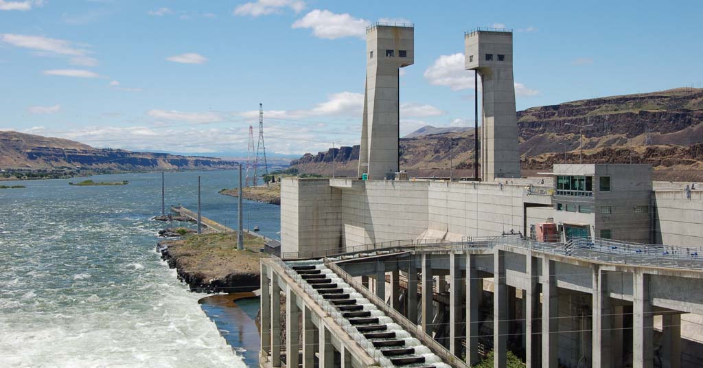
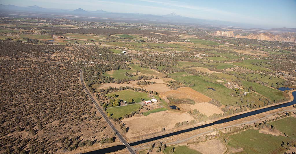
Spillage: The amount of water that spills over dams, such as the John Day Dam on the Columbia River, is a crucial piece of salmon recovery. Photo: USACE

By Kendra Chamberlain. January 13, 2026. The Northwest Power and Conservation Council has released the latest draft plan for its 40-year-old Columbia River Basin Fish and Wildlife Program. The plan steers the next five years of hydrosystem operations for dams on the Columbia and Snake rivers to support salmon, steelhead and other species.

The council says its proposed actions will result in cooler water temperatures, elevated spill levels in spring and summer, reductions in ramping and daily flow fluctuations and reduced predation.

Funded by the Bonneville Power Administration, the plan allocates $300 million annually toward the cause, including funding habitat restoration projects throughout the Columbia River Basin.

The nearly 200-page document underscores the scale and complexity of salmon recovery.

“There are many factors that affect salmon recovery. Our focus here is on mitigating for hydrosystem impacts, and we have an ‘all of the above’ set of tools that we use to apply to that,” Kris Homel, program performance biologist at the NPCC’s fish and wildlife division, told Columbia Insight.

The NPCC has set a goal of reaching five million salmon returning to the Basin each year. Current estimates peg the 10-year rolling average at about half that number.

The NPCC’s Fish and Wildlife Program is one of the larger management plans in the region.

Since the Trump administration decided to abandon the historic Columbia River Basin Restoration Plan with Tribes agreed to in 2023, some conservationists are looking to the NPCC’s Fish and Wildlife Program, and the companion power plan the Council will develop next, to fill the gaps.

“This is absolutely the best path right now to mitigate further harm to fish from the hydropower operations and make actual progress toward important recovery goals,” Tanya Riordan, policy and advocacy director at the conservation nonprofit Save our Salmon, told Columbia Insight.

Regulating spill

One of the stickier issues at play is spill levels at dams during spring and summer migration periods for salmon.

Spill levels have been altered a number of times over a relatively short period of time, according to Patty O’Toole, NPCC’s fish and wildlife division director, making it difficult to draw reliable conclusions about their impacts.

A key goal of the draft plan is to hold spring and summer spill levels at dams at a consistent level long enough to study the impacts of that level.

Kris Homel is a program performance biologist with the Northwest Power and Conservation Council. Headshot

Kris Homel. Photo: NPCC

“Spill levels, spring spill particularly, have really changed every couple of years, and there hasn’t been enough time at any one level to learn that much,” O’Toole said. “That’s resulted in a lot of debate over the effectiveness of this spill level or that spill level.

“A salmon life cycle is not just a couple of years. We’re talking five, seven, eight years for some species, just to turn around one single life cycle. So if you really want to know if things are helping it takes longer than a couple years to learn from that.”

The draft plan prioritizes spring spill to the 125% gas cap 24 hours a day from April to the middle of June. “Gas cap spill” means spill to the maximum level that meets, but does not exceed, the “total dissolved gas” criteria allowed under applicable state water quality standards.

Higher spill levels will be prioritized from mid-June through Aug. 1 at the lower Snake River dams, and through Aug. 15 at lower Columbia River dams.

But Save Our Salmon’s Riordan pointed out that tribal fish managers have called for elevated spill levels to be held through the entire month of August, to support remaining wild stock of some salmon species.

“Juvenile salmon migration throughout the warmer August period yields a significant, oversized portion of the wild spawners returning to the Colombia and Snake rivers,” said Riordan. “So it’s a really crucial timeframe to include that elevated level of spill for the juvenile out-migration.”

The Council is accepting public comment on the plan through March 2, and will be holding public hearings across Washington, Oregon, Idaho and Montana.

By |2026-01-14T16:51:52-08:0001/13/2026|Dams, Salmon|0 Comments

What are beavers up to in the Malheur National Forest? We’re getting answers

A first-of-its-kind survey will improve management of beavers and riparian ecosystems in Oregon’s Blue Mountains

Beaver survey Oregon 2025

Beaver believers: The Community-Engaged Beaver Research and Monitoring Project documented habitat use across 57 streams spanning an area larger than Rhode Island. Photo: Think Wild

By Kendra Chamberlain. December 18, 2025. While politicians in Washington, D.C., staged the longest federal government shutdown in history, a horde of volunteers combed through the riparian areas of the Malheur National Forest in eastern Oregon’s Blue Mountains, scouring the landscape for signs of the illustrious beaver.

The volunteers were part of the Community-Engaged Beaver Research and Monitoring Project, a collaboration of the conservation nonprofit Think Wild, the U.S. Forest Service and the Oregon Department of Forestry.

Over six weeks this fall, volunteers and state and federal staff trudged through more than 1,500 square miles of national forest land to document any and every sign of beaver activity, from teeth marks on bark to full-on beaver lodges.

The group put in more than 900 field hours.

Dr. Maureen Thompson, who serves as program manager for Think Wild’s Beaver Works Oregon, said the survey, which used a beaver monitoring protocol developed by Oregon State University researchers, is the first of its kind for beaver monitoring.

Tree that a beaver gnawed on

Mega bites: Survey data will be used in the adjacent Ochoco National Forest, where beaver trapping has been forbidden since 1986. Photo: Think Wild 

“We are the first community-science entity that is using this protocol and collaborating to expand the potential to other forests,” Thompson told Columbia Insight. “That’s so important, especially this year because we were the only ones who did it—because there was a government shutdown during the whole survey period.”

The project is an example of the blossoming relationship between the public and conservation science on public lands. Such projects help fill data gaps that would otherwise persist in an era of tight budgets at state and federal levels.

“It’s often the only way to gather data at the scale needed to inform meaningful conservation,” said Thompson.

Beavers are a keystone species that provide essential hydrologic engineering to ecosystems across the United States.

In Oregon, beavers were considered a nuisance animal until 2023, when the state legislature voted to reclassify them as native wildlife worthy of coexistence with humans on public and private lands.

The surveys begin to paint a more detailed picture of how and where beavers are using habitat, and will help officials identify and prioritize areas for restoration and conservation.

“By understanding where beavers are active and where they could return, we can better plan for watershed restoration, habitat connectivity and long-term ecosystem health,” according to a Beaver Works Oregon press release.

“This is just the beginning of having any kind of baseline understanding of beaver habitat use [and] the extent of their populations across their potential habitat,” said Thompson. “I just love that we were able to set up this project in a way that the data is actually directly going through a pipeline of the land managers.”

Think Wild and its partners plan to conduct more surveys across the Malheur, Ochoco and other national forests in eastern Oregon in order to refine habitat models and support evidence-based policy and management decisions.

By |2025-12-19T15:00:12-08:0012/18/2025|Wildlife|1 Comment

This new innovation could make solar farms more wildlife friendly

In southern Oregon, the massive Diamond Solar Project will be part of a trending design and construction style

Luning Solar Energy Project in Nevada

Heating up: Chicago-based Invenergy helped build the Luning Solar Energy Project in Mineral County, Nev. Its latest project will be located in Oregon not far from Crater Lake. Photo: Invenergy

By Kendra Chamberlain. November 26, 2025. You’re an elk. You’re on your annual migration from the mountains to lower-elevation feeding grounds, the same route traveled by countless generations of your ancestors.

An obstacle blocks your path. You’ve encountered nothing like it before. A high, metal fence. Behind the fence, massive, sharp angled panels reflect sunlight with intensity foreign to your concept of the world.

What now?

Solar energy is great. But it comes with costs. One of these is impact on wildlife.

Habitat connectivity has emerged as an environmental concern related to renewable energy facilities like large solar farms.

Utility-scale projects degrade habitat and typically include six- to eight-foot-high fencing, which severs migration corridors and bars wildlife access to habitat and resources.

“Solar facilities impact fauna through habitat loss and fragmentation, altered microclimate and creation of novel habitat,” according to a 2025 report published in the journal ScienceDirect. “The rapid transformation of landscapes necessitates urgent research into biodiversity impacts of solar facilities worldwide.”

Some developers are getting the message.

Tianqiao Chen founder of Shanda Group

Tianqiao Chen. Photo: Shanda Group

At a proposed solar installation in southern Oregon, the renewable energy company Invenergy has plans to build a wildlife corridor and a nearly 2,000-acre conservation area to help offset the ecological impacts of industrial-scale construction in a largely undeveloped wilderness.

Chicago-based Invenergy is the global renewable energy company behind the Diamond Solar Project, a proposed 200-megawatt facility located near the junction of U.S. Route 97 and Oregon Route 138, nicknamed the “Highway of Waterfalls.” The location is just east of Diamond Lake in the Umpqua National Forest and northeast of Crater Lake National Park.

The project passed a milestone in October when the Klamath County Planning Commission approved permits to install 406,000 solar panels and on-site battery storage on a 1,560-acre plot of forested land.

The land is owned by the private investment firm Shanda Group. Founded by Chinese billionaire Tianqiao Chen and other family members, Shanda Group is the second largest foreign owner of land in the United States.

Chen owns nearly 200,000 acres of forestland in Oregon’s Klamath and Deschutes counties.

Wildlife and solar mitigation

The Diamond Lake project site is home to wildlife including deer and elk. It includes access to important water resources, according to the Oregon Department of Fish and Wildlife.

“We were concerned about an impediment to migration, as well as blocking off a water source,” ODFW’s Jeremy Thompson told Columbia Insight. Thompson served as the department’s energy coordinator while the Diamond Solar proposal was created. “There are some water sources through that corridor that showed use by ungulates, both deer and elk in that area.”

ODFW offers energy siting guidance to help inform designers of large developments on ways they can minimize or mitigate impacts to local habitat and wildlife.

Diamond Solar Project location southern Oregon

Hot spot: The red rectangle represents the approximate location of the Diamond Star Project solar installation near the intersection of state and federal highways. The large blue circle in the lower left is Carter Lake. Photo: Google Earth

In the case of the Diamond Solar proposal, Thompson said ODFW staff asked Invenergy to include a wildlife corridor that runs through the facility to offer a way for ungulates to move through the land.

The company and ODFW settled on a 600-foot-wide wildlife corridor.

Thompson said the inclusion of wildlife passages in solar build-outs is becoming common, though it’s still a relatively new concept.

“We’ve worked with multiple companies to try to institute passage through solar farms, especially as we talk about some of the larger solar farms that are being proposed in north-central Oregon,” said Thompson. “We just haven’t seen one that’s been constructed yet.”

ODFW hopes to conduct research using collared deer and game cameras to determine if the corridor is successful.

“The science isn’t sound yet on how wide that corridor needs to be for animals to feel comfortable using it,” said Thompson.

Renewable energy projects across the country have begun attempting to accommodate wildlife in their designs, in hopes of reducing environmental harm.

Design tweaks include fencing with holes large enough to allow small animals to slip through, and passages or corridors for larger animals.

Early evidence suggests these features can be successful.

The Nature Conservancy, for example, tracked a variety of small animals slipping through wildlife-friendly fencing at a solar facility in North Carolina.

The Diamond Solar Project also includes a 1,900-acre conservation area, which is meant to replace habitat lost to the solar facility. That land is also owned by Shanda Group.

Construction of the Diamond Solar Project is expected to take two years. Invenergy plans to have the facility finished by 2029.

By |2025-12-18T17:22:48-08:0011/25/2025|Energy, Wildlife|2 Comments

© Copyright 2013-2025 Columbia Insight. All Rights Reserved.

As a 501(c)3 nonprofit organization, all donations to Columbia Insight are tax deductible to the full extent of the law. Our nonprofit federal tax-exempt number is 82-4504894.