Stay Updated Subscribe today for the latest research + reporting about environmental news. Subscribe Now

Stay Updated Subscribe today for the latest research + reporting about environmental news.

Subscribe Now

Guest Author

Guest Author

About Guest Author

This author has not yet filled in any details.
So far Guest Author has created 149 blog entries.

Racial injustice pervades our wilderness. A change of heart is needed

For people of color in the Columbia River Basin, the simple act of taking a hike or casting a fishing line into the water can be weighted with danger

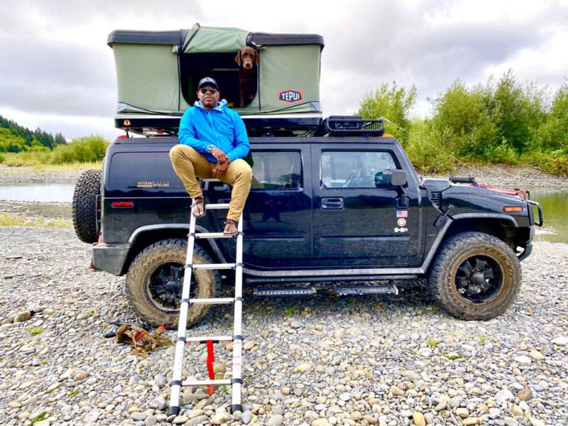
At ease: The author finds a moment of peace in the outdoors. It isn’t always this simple. Photo by Chad Brown

By Chad Brown. August 10, 2020. A few years ago on Veterans Day I was fishing where the Deschutes runs into the Columbia River. I was fly-fishing with a buddy, another person of color. It was a perfect day; a day to unwind and chase trout.

I pulled up in my truck behind a vehicle, the only one parked off the road. We donned our gear and started to approach the river. We passed two white anglers and said “Hello.”

They did not respond. So, we carried on with our day. When we were done, we returned to my truck, which was now the only one parked off the road, and saw that while we were fishing my tires had been slashed and my brake lines yanked out.

On social media, I have been publicly accused of “taking” fly-fishing from white people. Once I went fly-fishing with a very good friend of mine on the Clackamas River. He and his wife had made a significant donation to Soul River Inc., the nonprofit organization I founded that brings together urban youth of color with military veterans as life coaches. We took a picture together and I posted it on Facebook. That’s when I got attacked with pure hate on social media. (See Facebook post below.) In a way, it caught me off guard but did not really surprise me. This comes with being black in America.

I was once given a warning shot to get out of the water when I was fly-fishing on the Sandy River. I’ve received threatening phone calls and told I’d be drowned the next time I tried to fish.

Spirit of inclusion

There is a mentality among some white folk that denies racism in the outdoors exits. This mentality suggests that, “If I don’t experience it, it must not exist.” They also think, “That sort of thing happens in other places, not here in the Pacific Northwest.”

This mentality discounts and denies my experiences along with the experiences of many other people of color.

Social injustice: Even positive contributions can be met with racist replies. Courtesy of Chad Brown

Nature is free for people to enjoy, explore and roam in; it’s free to find solace and peace in nature. But nature is not free for me and many POC the way it is for white people.

I wish I could feel completely at ease when I’m in the outdoors. I wish I could simply enjoy nature and find healing instead of worrying about my safety—especially when I’m outdoors alone.

I still feel I have to earn my right to enjoy the outdoors and struggle to find access that doesn’t leave me feeling uncomfortable in wild spaces.

We are dealing with a boiling pot of water that has passed its boiling point. It’s been boiling for hundreds of years and has never found a cooling point. Racism in America has always been part of the lives of POC and central to our struggle for survival. Its existence and narrative has repeated itself over and over.

I strongly believe that community is what is lacking and what this community needs is love. Loving one another is what we have done very little of over hundreds of years and the act of love has never really been put in the highest of place in our society.

If we learned to show up for one another with love, in the spirit of inclusion for everyone, we would have a different society today.

The climate we have today in the United States of America is offering us all a moment to pause and listen to the unheard voices of America … if we choose to listen. These are voices of indigenous women missing and murdered on their own land; indigenous tribes fighting for their water rights (and losing); Latinos facing the challenges of maintaining their identity and making a living often through low-paying jobs; African Americans asking for equality and justice while seeing black men and women getting killed by merciless cops all over this country.

I am a black man living in Oregon, and the reality is that because my skin color makes me a constant target, at any moment I could easily end up like George Floyd.

Imagine being a visible target every time you step outside. You could be judged, spat on and called “nigger.” You could walk into a store or office and be falsely accused of a crime. You’re subject to traffic stops simply for being in the “wrong” neighborhood, and then harassed by the cops.

Systemic racism did not start when George Floyd was murdered. It started hundreds of years ago when this country was formed.

Just as people of color were not included in the decision-making process then, they are not included today. Indigenous communities and all people of color need to be heard and listened to when it comes to outdoor recreation, policy-making and nature conservancy.

A stronger outdoor community

Today is our opportunity to create alliances and new friends and to learn from one another to build better and safer communities—both in the urban and outdoor worlds. This is our opportunity to dismantle racism and lean into creating communities with strength that will support our youth for tomorrow.

This is our opportunity to invite POC into the decision-making process. This is an opportunity to start listening and to step in to help change the narrative of many years, to dismantle hate, ignorance and bigotry and allow equal opportunity to create a safe space for POC and all. This is an opportunity to show up with love as a warrior not as a friend.

The love I am referring to is the love ethos of a warrior—the strength of a bear and the fight of a lion. It’s the embodiment of the human spirit, a willingness to sacrifice one’s life or time for another human being. This love is what it will take to bust down the force of hate, ignorance, bigotry and racism! This love is what makes warriors and what makes community. Love is King.

White folks have the choice to not participate and remain silent. White privilege provides an option to not fight for what is right.

But white people also have the choice to lean into their privilege and use it to build a bridge to stronger communities, to make all humans a race of one.

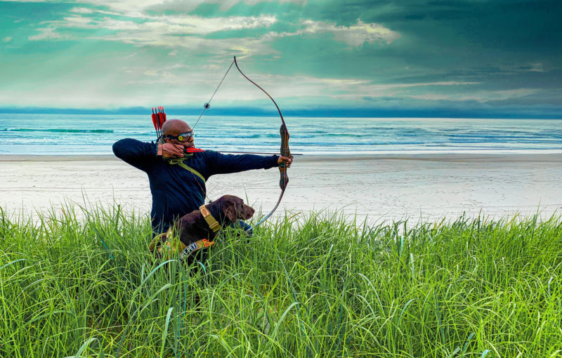
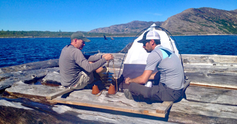
Lofty aim: Navy veteran Brown began acquiring outdoor skills growing up in Texas. Through the nonprofit Soul River he’s passing his knowledge to a new generation of outdoor enthusiasts. Photo by Chad Brown

Our nation is crippled. Our local communities are disoriented and losing focus. Despite the noise outside, voices of racial and gender diversity are still not truly being heard. We are facing darkness together and the one light we have is our love, which will lead us on a freedom path of justice and equality for everyone—and most of all provide safety in the urban world and safety in the outdoor world.

It’s easy to point the finger and charge forward with hate. Where is our love for one another?

Loving one another requires a deep strength and maturity of the mind. Loving one another requires a sacrifice of self to rise for others who can’t speak for themselves, who can’t fend for themselves.

To love is to put yourself second or third to your brother’s or sister’s safety, fairness and well being. This does not mean you put yourself out; this means you are willing to walk with your brothers and sisters the distance it takes to change the narrative. Love is King.

When I served in the U.S. Navy, I served with men and women who were there for each other for the good and the bad regardless of skin color and other differences.

We need equality. We need to be heard. We need a leader who hears the voices of pain. We need true allies and true action to make change.

BLACK LIVES MATTER.

Chad Brown grew up hunting in rural Texas and served in the U.S Navy doing tours in Desert Storm/Shield in Kuwait and Operation Restore Hope in Somalia. Today he’s an accomplished documentary, stylized portrait and adventure photographer, creative director, conservationist and founder/president of Portland-based nonprofit Soul River Inc. Soul River merges urban youth of color with military veterans as life coaches in the great outdoors.

Publisher’s note: After discussion with the author, and following his preference, we have decided to make an exception in this story to Columbia Insight’s policy against the use of racial slurs or racially insensitive language. As Chad noted: “It takes two seconds to read and if that two seconds makes a reader feel uncomfortable then imagine how uncomfortable it is being black in America and the fear that accompanies being outdoors.”

By |2021-04-07T14:28:32-07:0009/10/2020|Natural Resources|17 Comments

New road at Mount St. Helens? Scientists see another disaster

A planned access road to Spirit Lake has ignited a fight between the U.S. Forest Service and academics over one of the most important research sites in the world

Mount St. Helens and Spirit Lake from the summit of Mount Margaret, about eight miles to the north. The gray area at the base of the mountain is the Pumice Plain. Photo by Eric Wagner

By Eric Wagner. June 18, 2020. The Truman Trail starts at the end of the Windy Ridge parking lot on the east side of the Mount St. Helens National Volcanic Monument.

Named for Harry Truman, a cantankerous lodge owner killed during the 1980 eruption, the trail follows a winding gravel service road for its first couple of miles. Then it descends to meet an expanse of land called the Pumice Plain.

From the Pumice Plain it rides the landscape’s contours, dropping in and out of gullies, crossing the occasional stream. Mount St. Helens presides to the south with its gaping crater. North of the trail lies the deep, cool blue of Spirit Lake.

To strike out over the Pumice Plain on the Truman Trail is to walk across one of the most closely studied landscapes in the world.

Scientists have worked here since the volcano erupted 40 years ago. In summer, they can be seen checking mammal traps or surveying plants.

“This is one of the world’s great natural laboratories,” says Charlie Crisafulli, a U.S. Forest Service (USFS) ecologist who has worked at Mount St. Helens since 1980. “The record of research and discovery that has come out of here is extraordinary.”

But the closeness of that attention now faces an uncertain future thanks to Spirit Lake; or, more precisely, thanks to a small hole at the base of a ridge on the lake’s western shore.

MORE ON CI: The Cascades’ Green River Valley: Last place for a mine

That hole is the mouth of the Spirit Lake tunnel, built after the eruption to allow the lake to drain to a nearby river. After nearly four decades in service, however, the tunnel needs to be either upgraded or replaced.

At issue is how the USFS wants to do that: by building a 3.4-mile-long road through the heart of the Pumice Plain. Officials say the pair of projects would take two or more years to complete and cost between $5 and $15 million.

Scientists oppose such a road.

Whether the Forest Service heeds their objections could have enormous consequences not only for their studies, but also for the unique experiment that is the Pumice Plain, and Mount St. Helens.

Why it’s so valuable

The tangle of the lake, the tunnel and the anxieties they provoke go back 40 years to when Mount St. Helens erupted on the morning of May 18, 1980.

Although the eruption has since entered regional lore as a singular event—the Eruption of Mount St. Helens—it was actually several processes in quick succession. First, a powerful earthquake caused the mountain’s summit to collapse in the largest landslide in recorded history. Seconds after, clouds of ash and steam and shattered stone exploded out from where the summit had been, racing over the land at more than 600 mph and flattening the forest.

These processes would remake the landscape. Part of the landslide, or debris avalanche, plunged into Spirit Lake with such force that a huge wave may have sloshed up the hillsides, gathering up tens of thousands of fallen trees and dragging them back to the lake.

Even more debris rumbled 14 miles down the North Fork Toutle River valley. Water then leached from that debris, sending tremendous mudflows down the Toutle and Cowlitz rivers.

The mudflows destroyed hundreds of bridges, homes and buildings before they reached the Columbia River more than 70 miles away.

In 2016, when the Spirit Lake tunnel was closed for repairs, the lake rose about 30 feet. Logs from the lake’s log mat floated upland. When the tunnel was reopened and the lake drained, the logs were left marooned. Photo by Eric Wagner 

Meanwhile, back at Mount St. Helens, waves of blistering pumice spilled over the crater walls, and a plume of ash began to rise more than 15 miles into the sky.

The eruption left 57 people dead and caused $1 billion in damages. Pumice covered a six-square-mile area in front of the mountain—the Pumice Plain—to a depth of 120 feet, while Spirit Lake became a black cesspool of logs, pumice and ash.

After the eruption, the lake bottom was almost 200 feet higher than it had been. Its surface area had nearly doubled to about 2,200 acres. And its sole outlet to the North Fork Toutle River was gone, buried under as much as 600 feet of debris.

After emergency responders, some of the first people to visit the blast area were scientists. Geologists were keen to unravel the eruption’s mechanisms.

But just as eager to see the devastation was a team of biologists for whom the eruption was in essence a massive, unplanned experiment. In the decades after the blast, they’d look at how everything from bacteria to plants to large mammals returned.

Plots set up in the Pumice Plain in the early 1980s are still in use today, having served as the foundation for hundreds of scientific papers.

MORE ON CI: Wolverines break through in South Cascades … finally!

One group’s findings helped shape regional forest management by uncovering the role “biological legacies”—organisms that survived the blast—played in the development of the post-eruption community.

“Mount St. Helens has taught us so much about how plants and animals respond to large disturbances,” says Crisafulli. “It has let us ask questions that no one can ask anywhere else in the world. That’s what makes this such a valuable landscape.”

It was in part at the urging of scientists that President Ronald Reagan created the monument in 1982, setting aside more than 100,000 acres as a place for “geologic forces and ecological succession to continue substantially unimpeded.”

Spirit Lake dilemma

While Crisafulli and his colleagues were hard at work, though, Spirit Lake was not sitting idly by. Having no outlet, and with rain and snowmelt pouring into its basin every year, the lake began to rise.

Government officials soon realized they had a potential catastrophe on their hands: if the basin were to fill, Spirit Lake could breach the debris blockage and violently empty, unleashing huge mudflows on downstream communities still rebuilding from the 1980 eruption.

To forestall this, in 1985 the U.S. Army Corps of Engineers completed a 1.6-mile-long tunnel through a nearby ridge to let the lake drain into the North Fork Toutle River.

But while the lake’s surface was steady, the ridge through which the tunnel had been drilled was not. It was instead a matrix of small faults and shear zones that buckled and squeezed the tunnel.

Dwarf lupine, the subject of invaluable study, was one of the first plants to come back in the Pumice Plain. Photo by Brewbooks

Engineers have had to close the tunnel several times over the years to make repairs. During a recent closure that lasted several months, Spirit Lake rose more than 30 feet.

Federal managers were spooked. What if the tunnel were damaged in an earthquake?

“It was definitely a wakeup call,” says Chris Strebig, a project director with the Forest Service.

Officials faced a situation that Rebecca Hoffman, the monument’s manager, characterizes as “urgent, but not an emergency.”

Was the lake an immediate danger to the public? No. Might it become one in the future? Maybe, but only under the right circumstances.

“This is the struggle we’re in the middle of,” says Hoffman. “I don’t want to get to the point where we wait for an emergency.”

MORE ON CI: The return of Clearwater Coho

In 2016, the Forest Service asked a committee from the National Academies of Science, Engineering, and Medicine (NASEM) to help determine the best way to manage Spirit Lake.

A NASEM team studied the problem for a year and issued a report in late 2017, which highlighted both the need for Spirit Lake to have a second outlet, and also how outdated much of the information about the lake system was.

But as the Forest Service decided on a course of action, the authors cautioned, it would have to be both deliberate and deliberative.

“The process needs to be informed by good science,” Gregory Baecher, a University of Maryland engineer and chair of the NASEM committee, told the Seattle Times in 2017. “But ultimately it is a question of objectives and values.”

Trucks vs. helicopters

That question of objectives and values is now at the fore of the dispute about the Forest Service’s plan.

Following the release of the NASEM report, the Service initiated an effort to find a second outlet for Spirit Lake.

Given the challenging terrain, the options are limited. Perhaps engineers could dig another tunnel under a different ridge. Or a channel through the debris blockage.

But the exact geological nature of the blockage is one of the aforementioned knowledge gaps. No one knows precisely what it is made of, how stable it is.

Monument managers decided that, to find out, they needed to drill into it.

The challenge is how to get large rigs out to the drilling site.

In late 2018, the Forest Service proposed building a temporary road across the Pumice Plain to transport the rigs. The proposed road would have followed an old roadbed the Corps used when it was building the tunnel in the early 1980s.

Researchers objected. Most of the old roadbed has long since eroded away. In its place now is the Truman Trail.

Even a temporary a road would significantly change the fragile landscape, they argued. And the planned route passed right through several long-term study plots.

Their initial reaction was so negative that the Forest Service withdrew the proposal in spring 2019.

[perfectpullquote align=”full” bordertop=”false” cite=”” link=”” color=”” class=”” size=””]Regeneration at Mount St. Helens lets researchers ask questions that can’t be asked anywhere else in the world.[/perfectpullquote]

But just a few months later, in December, the Service released a new proposal. This time, the drilling project was fused with another, unrelated project to replace a gate at the head of the Spirit Lake tunnel. According to the Corps of Engineers, the gate is no longer up to standard.

To complete these two projects, the Forest Service proposed either to build the road, or shuttle equipment and personnel in by helicopter.

Researchers preferred the helicopter approach.

But after receiving public comments, the vast majority of which opposed the road, the Forest Service announced in early April it had opted for the road. Additionally, the Service determined the project would have no significant environmental impact on the surrounding area.

The research community of Mount St. Helens is supremely dismayed with that decision. Forest Service officials say they’re trying to lessen the dismay.

“We’ve been working with the research community throughout the project,” Hoffman says. “We’re working with specific researchers, and will continue to work with research community to limit the amount of impact that occurs.”

Done deal?

Biologists feel they aren’t being listened to. Some who attended early planning meetings left fearing a decision had already been made.

“I just came away with a sense that they’re bound and determined to build a road,” says Carri LeRoy, a biologist at the Evergreen State University who studies stream formation in the Pumice Plain.

Now LeRoy, who recently received a grant from the National Science Foundation, fears for the future of her work; if the Forest Service builds the road it will pass right through her sites, and her project might be over as it begins.

“I’m worried they’re just paying lip service to researchers’ concerns,” she says.

Jim Gawel (left) and Ken Burkart work on an experimental log mat they assembled themselves. Gawel is pulling up ceramic tiles covered with biofilm; the tent behind them is called a BugDorm, and is used to capture insects. Photo by Eric Wagner

On top of that, biologists feel they’re being scapegoated.

Local media coverage has tended to frame the issue as one of road-versus-research. In public documents and meetings about the project in downstream communities, Forest Service officials have tended to stray more to the emergency side of the continuum than the urgent. They’ve shown images of the mudflows from the 1980 eruption, even though the likelihood of that history repeating itself is remote.

“This exercise is sold to the public as a must exercise for safety,” Arne Mortensen, a commissioner for Cowlitz County, wrote to me in an email. “Absent a near-term and long-term cost analysis to show otherwise, using the road approach looks better.”

Furthermore, researchers say, the environmental assessment and its determination of no significant impact are woefully inadequate, downplaying potential effects while ignoring others. They argue that a full environmental impact statement is needed to compel a fuller accounting of what a road might do to a landscape as singular as the Pumice Plain.

Either way, a rocky road

Undergirding all of these objections is the feeling that the Forest Service is giving short shrift to the uniqueness of the blast area at Mount St. Helens.

“Saying ‘public safety’ is an easy way to get what you want,” says Jim Gawel, a professor at the University of Washington who has studied Spirit Lake since 2005. “It plays into the stereotype of researchers just playing around and not caring about the real world, and that isn’t true.”

No one disputes that Spirit Lake should be managed with the safety of downstream communities in mind, Gawel says, “but part of the issue is that the Forest Service is used to managing for forestry, not research. They haven’t been trained to think about an environment like this. You get the feeling they have a management template and they’ve just transposed it here, in this place that is singular.”

After all, as Crisafulli points out, Mount St. Helens has become famous for the innovative and creative thought it inspired since the 1980 eruption. Where others saw a lifeless wasteland, biologists saw an opportunity to watch all the ways life responds to seeming total devastation.

The Forest Service was a major supporter of those efforts then; no agency has spent more on research at Mount St. Helens.

Forty years later, Crisafulli argues, it would be nice if the USFS once more embraced that tradition of creativity and foresight. To do so would be a most fitting legacy.

Eric Wagner is the author of After the Blast: The Ecological Recovery of Mount St. Helens, published in April 2020.

By |2024-08-28T10:51:56-07:0006/18/2020|Natural Resources, Public Lands|9 Comments

Wolverines break through … finally!

Inside the inspiring effort that confirmed the first reproductive wolverine den in Washington’s southern Cascade Range in modern times

Cascades Carnivore Project video of “Pepper” and kits confirmed new wolverines in the South Cascades. Their work continues. Video courtesy of Cascades Carnivore Project

By Jocelyn Akins. June 11, 2020. The William O. Douglas Wilderness is a remote and wild area just outside of Mount Rainier National Park’s eastern boundary. Because most visitors to the region are drawn to the iconic mountain and its easier access, relatively few hikers venture out into this U.S. Forest Service Wilderness.

Even so, in the late spring of 2018, I wasn’t overly confident that our team of researchers would have much luck making visual contact with a female wolverine field cameras had captured images of weeks earlier. And I had no idea that what they’d find on that late spring day would lead to one of the most significant wolverine discoveries in three-quarters of a century.

Cascades Carnivore Project—which I’d founded a decade earlier—finally had irrefutable evidence that wolverines from the North Cascades had crossed Interstate 90 and were reproducing. They were beginning to recolonize the South Cascades and establish a bona fide population.

The thrill was immense.

I had founded Cascades Carnivore Project to study wolverines further south, on Mount Adams. It had taken 15 painstaking months to yield a single photograph of a wolverine. And now a decade had passed before I could confirm they were reproducing, and not spiraling into oblivion.

To gain such a research reward after so much blood, sweat and tears was extremely satisfying. I may have screamed with sheer joy; there were many hugs amongst our ragtag crew of shoestring wildlife researchers.

Bears and wolverines

My dream had always been to become a carnivore biologist. I grew up on the North Shore of Vancouver, British Columbia, where I regularly encountered black bears. I spent my childhood hiking through the subalpine meadows and jagged peaks of nearby Mount Baker, which I could see from my bedroom window.

In 2005, I landed my first paying job estimating grizzly bear numbers in the Alberta foothills of the Canadian Rockies with a local NGO called the Foothills Model Forest. I was also lucky enough to work in Grand Teton and Yellowstone National Parks during the summers of 2005 and 2007 studying grizzly bear ecology for the USGS Interagency Grizzly Bear Study Team.

In the winter of 2007, I returned to Yellowstone as a volunteer for the Absaroka-Beartooth Wolverine Study, a research project supported by the National Park Service and U.S. Forest Service. My field partner and I were charged with checking 10 wolverine live-traps every day at dawn and dusk. Between us and four other two-person crews, we spent endless hours running traps throughout the winter.

When we finally captured our first wolverine, I was amazed that the large male growling inside the trap weighed only 38 pounds. That’s just about one-tenth the weight of the average Yellowstone grizzly. I banged the outside of the trap with my hatchet to encourage him to stop chewing through the six-inch lodgepole pine rounds that made up the trap.

The wolverine has an outsized reputation. Incredible feats have been attributed to this midsized carnivore. My hairdresser recently told me she loves wolverines because they can kill a bear. Not true.

They also have this renown for scaring large predators like grizzlies away from carcasses. But I think this must be such a rare event. The risk of being injured by a large carnivore is rarely worthwhile in the struggle for survival.

[robo-gallery id=”12985″]

Emblematic, elusive, endangered

The spring after wolverine trapping ended in Yellowstone, I returned to Hood River, Oregon, where I’d recently established a home. I was surprised to learn that two years earlier, in 2005, a lone wolverine had been discovered on the Yakama Reservation on nearby Mount Adams across the Columbia River in Washington’s Cascade Range.

Yakama Nation biologists had recorded a photograph taken at a single remote camera monitoring station. No other evidence was found.

The detection was extremely intriguing to me. Mount Adams lay outside the contemporary distribution of wolverines at the time. I wanted to know whether this individual was a single disperser in a lonely pursuit of a mate, or one of many from a remnant population that had gone undetected by scientists. 

The occasional wolverine is known to roam far and wide. Famously, a wolverine named M56, collared for a research study in the Teton Range of Wyoming, wandered south into Colorado, becoming the first wolverine in the state in almost 100 years; and then unluckily died in 2016 by the bullet of a ranch hand’s pistol in North Dakota.

North Dakota! Midwestern wheat fields and cattle ranches. What was a wolverine doing far from the typically rugged habitats wolverines are associated with in the contiguous United States?

In 2008, another lone male, later nicknamed Buddy, was detected near Lake Tahoe by a Pacific marten researcher, making it the first known wolverine in California since 1922. The nearest known wolverine population to Lake Tahoe is in Idaho’s Sawtooth Mountain Range, about 400 miles away.

I figured it wouldn’t be totally far-fetched for the Mount Adams wolverine to have wandered over from the Sawtooths. 

Where the wolverine roam

Wolverines have a circumpolar distribution in the northern hemisphere, occurring in Scandinavia, Russia, Mongolia, China and North America. Historically they occurred in North America as far south as the Sierra Nevada of California; though, there was a gap in their distribution in southern Oregon and northern California.

Wolverine numbers dwindled throughout the 20th century in large part due to predator poisoning aimed at gray wolves and bears, large-scale timber extraction, road building and to a smaller extent from fur trapping. By about the 1930s they were extirpated from the Pacific states.

In the 1960s, there were a smattering of reports of wolverines that had either returned or persisted as a very few individuals in their historic range in Washington. Then came a slow increase of verifiable observations during the 1990s.

Wolverines seemed to be making a modest, yet astounding, comeback.

[perfectpullquote align=”full” bordertop=”false” cite=”” link=”” color=”” class=”” size=””]Wolverines are best studied in winter, when they’re most attracted to bait and snow makes tracking easier.[/perfectpullquote]

By 2005, a small population of wolverines from Canada had re-established in the North Cascades Ecosystem. Researchers live-trapped and satellite-collared 14 individuals in northern Washington to learn about this newly re-established population.

They found that some of the Washington wolverines had territories of almost 2,000 square-kilometers (about 770 square miles) or more, seven times larger than grizzly bear home ranges, which are estimated at 280 square kilometers (about 110 square miles). Typically one male can cover the same area as two or three females, and will mate with each of them.

Two things were certain—there were very few wolverines and they roamed huge areas of wild and rugged mountains in the Cascade Range.

Birth of Cascades Carnivore Project

To begin addressing the research questions I had—Where did the Mount Adams wolverine come from and were there other individuals in the area?—I approached the Washington Department Fish and Wildlife. I wanted to learn more about the Department’s efforts to monitor rare mesocarnivores (carnivores that inhabit the middle of the food web, and are not typically top predators).

At the time, they weren’t doing much for carnivores in Washington’s Cascades south of Interstate 90. The department has a limited budget and it was occupied with protecting the state’s most at-risk species, such as salmon and spotted owls.

Wolverines are notoriously difficult to study. They roam large areas and inhabit remote, roadless mountain ranges.

On top of that, they’re best studied during winter, when they’re most attracted to the bait we set out and when snow makes tracking easier. But I’d hiked and mountaineered all my life and felt that this was exactly the sort of effort I wanted to take on.

Thus began in 2008 the Cascades Carnivore Project, later officially registered as a nonprofit research organization and supported by the Washington Department of Fish and Wildlife, the United States Forest Service and the National Park Service. 

I had no idea how to raise funds for such an endeavor. But there was incredible support from the local community and things got rolling.

I assembled a crew of friends and other Hood River locals. Working on days off from my wildlife consultant job on Oregon wind farms, we began setting camera stations deep in the Gifford Pinchot National Forest.

Researchers celebrate when their grueling efforts pay off like this. Photo courtesy of Cascades Carnivore Project

In the early days, we backcountry skied long days into the mountains. Eventually, I borrowed a 1996 Yamaha snowmobile, a gutless, old beast that floundered in our Cascade concrete snow.

But it allowed us to access the heart of wolverine habitat. We could now travel to the north side of Mount Adams and snowshoe or ski up to timberline to deploy our camera stations.

It took 15 months to obtain the first photograph of a wolverine—15 long months setting camera traps as far into the mountainous wilderness as we could get.

I was over the moon. I probably yelled loud enough for the wolverine to hear.

Cascades Carnivore Project has been monitoring the natural re-colonization of wolverines in Washington’s southern Cascades ever since.

That first detection was quickly followed by a second one nearby. And then 11 more between 2009 and 2012 around Mount Adams and north to the Goat Rocks Wilderness.

Then things stagnated. I started focusing on another rare but slightly easier to study species, the Cascade red fox. The wolverine project was put on hold. 

Breakthrough

Six years, a Ph.D. in conservation genetics and two children later, I returned my focus to wolverines. With our field crew, I trekked north in search of more wolverines around Mount Rainier and the surrounding wilderness.

At this time, I’d established a fruitful collaboration with the Okanogan-Wenatchee National Forest, and had been working with two talented young field technicians, Scott Shively and Kayla Dreher. Together, we’d deployed 16 wolverine-specific monitoring stations throughout Washington’s southern Cascades designed specifically to identify individual wolverines from photographs.

In March 2018, Scott asked to set a camera station deep in the heart of the William O. Douglas Wilderness, farther than any other stations we had set, which already took long days to access.

The goal was far-fetched in my mind. There wasn’t even enough daylight to get to such a remote place in winter. The trip also involved crossing a river that was too big and dangerous in winter conditions.

But Scott was so excited. Who was I to stand in the way of such determination? This was exactly the sort of energy that had gotten the project off the ground in the first place.

On a snowy March morning, Scott and Kayla ventured out well before dawn. It wasn’t until midnight that they returned with the bait hung and camera deployed, having crossed the Bumping River twice, once in the dark.

Male and female wolverines

On the left, a male wolverine nicknamed Van. On the right is Pepper. Her enlarged teats indicate lactation and nearby kits. Photo courtesy of Cascades Carnivore Project

A month later they returned, this time with tents, sleeping bags and food for an overnight trip.

I was not on this trip, as I stayed closer to home to be near my husband and three- and five-year-olds, and run the Mount Adams stations. But I learned of the results when they returned.

Scott and Kayla had found wolverine tracks all around the camera station and along a ridge where the station was located. The female, who we nicknamed “Pepper,” was recorded at the camera station.

When we examined the photos on my laptop, we noticed that, incredibly, she showed enlarged teats, meaning she was lactating and likely had kits in a den nearby. This was the first female wolverine documented in Washington’s South Cascades in over 75 years or more, and she was reproducing.

I knew this was an incredible find but there was so much more to learn.

More luck followed when a rare, late spring snowstorm provided ideal tracking conditions over the next clear days.

Confirmation day

The crew agreed to return to the camera station and see if they could find and follow her tracks and determine where her den may be located.

A week later, once the storm had abated and we’d allowed a few days for wildlife to lay down tracks in the snow, Scott and Kayla returned to the station and found more visits by Pepper.

They followed her tracks over a ridge into a nearby glacial cirque. They sat down and glassed the whole drainage with binoculars and found many tracks coming in and out of a copse of trees.

As the team descended into a wide drainage at the base of the cirque to investigate, Pepper appeared loping across a frozen lake. She skirted in and out of trees on the lake edge, watching them before continuing away from the tracks through the trees.

The crew raced back up to the ridge where there was spotty cell service and called me. I was jogging up the town stairs with my three-year-old son on my back to get some exercise. I immediately called world-renowned wolverine biologist Audrey Magoun to see if the crew should continue on to the tracks going in and out of the copse of trees.

She let me know that at this time of year, in early May, wolverine mothers typically move their kits from a natal den to rendezvous sites where they can move about and better find food. So we felt it would be all right to approach the den as it may not have been their long-term home.

Scott and Kayla continued to the trees and discovered a snow hole. They set a camera on Kayla’s ski pole and left the site to avoid disturbing Pepper any more.

[perfectpullquote align=”full” bordertop=”false” cite=”” link=”” color=”” class=”” size=””]A decade ago, when a wolverine was found in the South Cascades, it was hard to imagine others joining this lone critter.[/perfectpullquote]

I returned to the snow-hole site with Scott and Kayla a fortnight later. In the soft spring snow the ski pole with the camera held as a sentinel for nine days and then slumped over. But before that happened, it captured video of the female with her two wolverine kits, likely born in mid-February and now 10 weeks old.

We confirmed this was the first reproductive wolverine den documented in Washington’s southern Cascade Range, and just the third den in the state, in over 75 years.

I was bowled over. A decade after running stations across the South Cascades and photographing only a single male wolverine over many years, not only had we detected a female—meaning wolverine reproduction was possible—but we’d located her natal den. These are extremely difficult to find even in a larger population.

During the last night of this trip, Scott and I were awoken at 1 a.m. to a sniffing sound close to my tent. I froze in my sleeping bag and listened to an animal drawing two deep inhales. The next morning, I discovered fresh wolverine tracks in the snow four feet from my tent where I’d draped my stinky socks over a cedar sapling to dry overnight.

Genetic analysis of hair and scat samples revealed that Pepper and a male wolverine detected at stations around the den both had the genetic signature of the North Cascades wolverine population. This strongly suggests the South Cascades are being re-colonized from the north. 

Somehow, these remarkable creatures had made it across I-90, one of the biggest obstacles to wildlife migration in the Cascades. This in itself was rare and inspiring news.

The future of Cascades wolverines

Cascades Carnivore Project is now working with a larger genetic dataset to figure out how many wolverines have come down to Washington from Canada, how likely individuals are to consistently cross I-90 into southern Washington and the prospects for their long-term persistence in Washington and elsewhere in the continental United States.

Connectivity is a huge deal for small populations because they often naturally have low genetic diversity. The wolverine lost much genetic diversity when it was wiped out from Washington. Individuals migrating in from elsewhere and mating help create the genetic stock necessary to adapt to a changing landscape.

Conservation Northwest and the Sierra Club Checkerboard Project, two environmental NGOs, created the I-90 Wildlife Bridges Coalition to build new wildlife bridges and underpasses for animals to cross safely over and under I-90.

Wolverine researchers in Washington are excited by the return of this unique carnivore and its expansion throughout the state. But they have concerns that threats from climate change and increased recreation in the mountains may threaten their survival.  

Late last month, a wolverine, incredibly, made its way to the Washington coast, a feat unheard of in the Pacific states. Sure, wolverines are known to beachcomb in Canada and Alaska, but never has one been verified outside of the mountains in Washington.

My immediate thought was to wonder, which zoo lost its wolverine? But we checked with each zoo in the area. All critters were safe and sound.

Cascades Carnivore Project founder Jocelyn Akins now also looks for other elusive creatures including Cascade red fox. Photo by Michael Hanson

I believe that like M56 (the Colorado wolverine) and Buddy the California wolverine, this one was dispersing and searching for a new home and a mate.

The population of wolverines in the Alpine Lakes Wilderness in the Central Cascades, and those further north, where this one likely came from, is largely unstudied. It’s impossible to know without further research how the prey populations, for example, are faring in the Cascade Range.

In early March, just before the park closed for COVID-19, we visited one of our wolverine stations in Mount Rainier National Park and discovered a new female wolverine.

Whether she is a reproducing mother is uncertain. But her arrival brings hope for the future of wolverines in the southern Cascades.

When the park closed we were unable to snow track her or locate a den. But she continued to visit our station, so we knew she’d likely established a territory in the park.

Cascades Carnivore Project continues its long-term study of wolverines and other mesocarnivores, such as the Cascade red fox, Canada lynx and the fisher in the Cascade Range. We are focused on understanding how climate change affects these rare carnivores and their alpine ecosystems.

A decade ago, when we detected the first wolverine in Washington’s South Cascades in modern times, it was hard to imagine others would join this lone critter. Despite successes detecting virtually every other carnivore in the Cascade Range, for many years our efforts to locate additional wolverines turned up nothing.

Pepper and this new female provide hope for the possibility of wolverines returning for the long-term.

While COVID-19 pandemic rages, controversial environmental policies and projects advance

EPA Administrator Andrew Wheeler speaks at the USDA Headquarters on Feb. 27, 2019. Photo courtesy of USDA

By Ben Mitchell. April 23, 2020. The novel coronavirus COVID-19 pandemic has been dominating headlines in the United States for the past several weeks, and for good reason. The virus has closed borders, shut down a huge portion of the economy, spurred stay-at-home executive orders, upended our daily lives in myriad ways, stoked political unrest, and, most importantly, as of this writing, has sickened roughly 760,000 people in the United States and killed more than 40,000.

Worldwide, that tally rises to 2.3 million people infected and more than 165,000 dead, although these figures will already be outdated by the time you read this. COVID-19 is now the No. 1 cause of death in the U.S. — killing more people at a higher daily rate than heart disease or cancer. And while the pandemic is something deserving of attention and concern, it’s not the only thing our government is occupied with at the moment.

At a time when many government offices are now closed to the general public, some of these agencies are still operating and continuing to make key decisions that affect commerce, public health and the environment.

On March 26, the Environmental Protection Agency (EPA) issued a memo to “All Governmental and Private Sector Partners” that it would be relaxing enforcement of environmental rules and would not be seeking penalties for noncompliance with routine pollution monitoring and reporting requirements from businesses and other entities — if the EPA determines noncompliance was due to the COVID-19 pandemic. Although the EPA states in its release that these measures are only temporary, no end-date for this grace period is given.

The policy caught the attention of a number of news outlets, including The Hill, The New York Times and the Associated Press. It even raised eyebrows across the pond at The Guardian, who called it, “an extraordinary move that has stunned former EPA officials,” referring to Cynthia Giles, President Barack Obama’s former head of EPA enforcement, who characterized the memo as “a nationwide moratorium on enforcing the nation’s environmental laws and… an abdication of EPA’s responsibility to protect the public.”

Governor Jay Inslee and Governor Kate Brown speak out against fossil fuels climate change. They also created orders requiring stay at home and business closures. Photo by Trudi Inslee

In a follow-up press release, the EPA took issue with some of the reporting, accusing journalists of “repeating reckless propaganda,” with the EPA clarifying that the policy was “not a license to pollute.” However, the The Guardian reported that the policy change came on the heels of a lobbying push by the American Petroleum Institute, who sent a letter to the EPA a few days prior to the change asking for the suspension of the rules.

And it’s not the only curtailment of environmental rules President Donald Trump’s administration has pursued during the pandemic. A few days after the EPA policy challenge, the administration announced it would be rolling back Obama-era emissions standards for vehicles — a move that Trump officials say will create jobs and cheaper cars, but that critics warn will add a billion more metric tons of carbon dioxide to the atmosphere. And last week, the EPA said it would be changing the calculating method used to assess the costs and benefits of power plants controlling the release of toxic metals — again, rolling back standards established during the Obama presidency.

It’s hard to quantify how the EPA’s policy change on reporting and enforcement will directly affect the Columbia River Basin. But Lauren Goldberg, legal and program director for Columbia Riverkeeper, is concerned that it will.

“EPA’s changes in enforcement could lead to more toxic pollution in the air we breathe and the Columbia River. EPA plays a vital role in enforcing environmental laws in the Pacific Northwest. The agency’s handling of enforcement during the pandemic is deeply disturbing,” she wrote in an email to the Columbia Insight, adding that the environmental advocacy nonprofit’s attorneys and community organizers are in the process of “responding to a flurry of federal actions to gut environmental and public health protections.”

And while the EPA is putting its regulatory oversight on the back burner, the Federal Energy Regulatory Commission (FERC) is still approving projects, including a sizable one in the Pacific Northwest. On March 19, FERC, lacking a full five-member commission, voted 2-1 to approve the Jordan Cove liquefied natural gas export terminal and Pacific Connector Gas Pipeline in Coos Bay, Oregon. Pembina Pipeline Corporation, the Canadian company looking to build the project, says it will create thousands of union construction jobs and contribute more than $100 million annually in state and local taxes.

The project enjoys the support of some business and labor groups, but has hit roadblocks at the state level, having been denied a clean water permit from the Oregon Department of Environmental Quality, as well as receiving an objection from the Oregon Department of Land Conservation and Development on the grounds it was inconsistent with the Coastal Zone Management Act, according to an article in the Northwest Labor Press. On top of that, both Oregon Governor Kate Brown and Senator Ron Wyden heavily criticized FERC for what they characterized as a rushed vote by an incomplete panel. In a statement, Gov. Brown made note of the timing of the decision.

Jordan Cove protesters hold a rally at the State Capitol. Photo by Don Ewing, 350Eugene

“Given a national and state emergency, in which the federal government and its agencies are unable to fulfill their basic responsibility to keep citizens safe, it is stunning that the FERC moved forward on this decision,” she said.

According to a statement on FERC’s website, despite the pandemic, the commission is still “committed to continuing to carry out our important work and fulfilling our statutory obligations as seamlessly as possible during this time.”

By |2020-05-14T11:20:29-07:0004/23/2020|Climate Change|0 Comments

EVs in Eastern Oregon?

Photo by Gord McKenna

Rural areas present a unique set of challenges in the push to electrify our transportation systems.

By Jim Drake. March 26, 2020. Like a momentary spark, electric vehicles took center stage at the Feb. 19 Democratic Primary National Debate in Las Vegas.

Responding to a question addressing climate change, former Vice President Joe Biden alluded to the crucial role that electric vehicles (EVs) play in reducing carbon emissions, and said the installation of new charging stations would be a top priority of his administration.

[perfectpullquote align=”full” bordertop=”false” cite=”” link=”” color=”” class=”” size=””]“I would make sure that we had 500,000 new charging stations in every new highway we built in the United States of America or repaired.”[/perfectpullquote]

As electric car manufacturers continue to increase the range of their vehicles, today’s battery technology is getting EV drivers farther and farther from home on a single charge. But the amount of EV infrastructure available to the public will need to grow and change accordingly in order to give drivers the confidence they need to get from one end of the Beaver State to the other.

Oregon’s portion of the West Coast Electric Highway (WCEH) nearly a decade old and in need of its own infrastructure upgrades is a network of 44 EV charging stations that covers much of the western half of the state. With a consistent branding and marketing strategy, the WCEH supported and encouraged the state’s early adopters of electric cars: residents of Portland, the Willamette Valley, the coast, and more recently, the Columbia Gorge.

But for EV drivers heading east of The Dalles and onward towards the Idaho border, the lengthy and sparsely populated stretches between cities, towns and rural communities can seem daunting.

Fortunately, despite the numerous challenges faced by rural communities, the complex process of bringing EV infrastructure to Central and Eastern Oregon is beginning to make inroads with help from state agencies, public and private utility companies, and the efforts of EV drivers themselves.

Electric vehicles in Oregon

According to a recent report from the Oregon Department of Transportation, Oregon has 19,066 registered all-electric vehicles on the road (not including plug-in hybrids). Although that figure represents less than one percent of the state’s registered passenger vehicles, the report reveals that EVs are currently registered in every county in Oregon. And those vehicles are already making a difference in terms of the state’s overall greenhouse gas emissions.

The EPA estimates that every electric vehicle on the road keeps 4.6 metric tons of CO2 out of the atmosphere. (These reductions are even greater when renewable energy sources are used to charge the batteries.)

According to the EPA, a typical gasoline-powered passenger vehicle emits roughly 440 grams of CO per mile, and these emissions increase significantly when sitting in traffic. Photo courtesy of Wikimedia Commons

And since lowering the state’s overall greenhouse gas emissions in the transportation sector is a top priority and climate change goal for the Oregon’s Governor’s office, various offices and state agencies are working to promote EV use and increase the number of electric vehicles statewide.

“Clean air is important for everybody, lowering greenhouse gas emissions is important for everybody, and every part of the state should have the opportunity to benefit from the advantages that electric vehicles bring,” says Mary Brazell, a policy advisor for the Oregon Department of Transportation (ODOT).

Brazell says that an important part of promoting and understanding the needs of electric vehicles is the Zero Emission Vehicle Interagency Working Group (ZEVIWG). Led by ODOT, this group is working to fulfill the requirements of Gov. Brown’s Executive Order 17-21, which was issued in order to accelerate the adoption of electric vehicles in Oregon.

“It’s definitely something that the state agencies take very seriously,” Brazell says.

One of the primary ways that ODOT is expanding electric vehicle infrastructure in the state is by proposing highway locations for EV charging stations that would be built by an entity called Electrify America. (This entity was created as part of the legal settlement that came out of Volkswagen’s diesel emissions scandal in 2015.)

With each cycle of investment from Electrify America, ODOT continues to submit information on the potential placement of charging stations.

“Completing Interstate 84, in terms of going beyond where the Electric West Coast Highway is, and trying to have some additional charging east of The Dalles, was a priority. We were successful in getting Electrify America to put charging stations near the Idaho border in Huntington, and into LaGrande and Hermiston…and also in Hood River,” Brazell says.

Electrify America installed a public charging station at the Walmart in Hood River in 2019. There are now four public charging stations located around town. Photo by Jurgen Hess

ODOT is also pursuing funding opportunities through a Federal Highway Administration program known as the Alternative Fuel Corridor Designation.

One goal of the corridor designation is to have roads become “EV Ready,” which means there should be charging stations — including DC Fast Charging, which charges a battery to 80% capacity within 20 minutes — about every 50 miles.

“I-5, Highway 101, and I-84 from Portland to The Dalles are currently designated as EV Ready. The areas that we’re going after right now are Hwy 97 and Hwy 26,” Brazell adds.

Incentives and opportunities

Brazell says that some investor-owned utilities — as well as consumer utility cooperatives and public utility districts — are offering incentives for electric vehicles and charging infrastructure that may be of interest to rural communities.

“Pacific Power was recently heard before the Public Utilities Commission on their proposed transportation electrification plan, which included grant opportunities and pilot projects involving infrastructure development,” Brazell says.

She points out that Pacific Power’s plan included four DC Fast Chargers that were installed in Madras, and says they are testing a similar charging facility in Bend.

An interactive map shows that charging stations now exist in the towns of Arlington, Ione, Heppner, Condon and Fossil, but Brazell says a big challenge facing rural communities is the relatively low numbers of electric vehicles in rural counties.

“It’s a conundrum to try and encourage expansion into areas of the state where there may be fewer electric vehicles today…and fewer opportunities to make money on the use of DC Fast Charging. Even though 80% of electric vehicle charging takes place at home, at night, one of the biggest barriers to electric vehicle adoptions is people’s concern that they can refuel if they’re on a long trip,” Brazell says.

There is a public charging station located at the Harney County Chamber of Commerce, but there are currently only three electric vehicles registered in the county. Photo courtesy of PlugShare

Jessica Reichers, a Technology and Policy Manager for the Department of Energy, agrees.

“The cost of installing that infrastructure will fall to whatever entity chooses to install it. And if you are looking at a business model where you install the charger, and people pay you a certain amount of money to help fund the cost of that charger, there’s so few people with electric vehicles in Eastern Oregon that you’re probably not going to be able to make a business case for that,” Reichers says.

Nevertheless, Reichers says there are incentives for residents that want to put charging infrastructure in their homes or workplaces.

“You can get up to a $1,000 dollar tax credit to help put charging in your own home, and businesses can get up to 30% of the cost of the charger, up to $30,000, through tax credits to fund charging infrastructure.”

Reichers said that many state utilities have applied for Clean Fuel Credits under the Department of Environmental Quality’s Clean Fuels Program, and that this money could also be used for the installation of charging infrastructure.

Updating the West Coast Electric Highway

The first charging station on the West Coast Electric Highway opened in 2011. But in the years since, car manufacturers have made changes to the types of plugs and batteries used in their vehicles, and Reichers says the Highway needs to be updated accordingly.

She says the DOE is working to solve these issues, and plans to make any future charging installations compatible with all of the existing equipment in the state.

A traveler on the West Coast Electric Highway charges her vehicle at a public charging station in Springfield, Ore. Photo courtesy of ODOT

“ODOT is getting ready to put out a Request For Proposals right now for a contractor to come in and update the West Coast Electric Highway network to include CCS and CHAdeMO charging capability, and run that network going forward,” Reichers adds.

Reichers says the DOE will also be working with Electrify America during the next round of funding cycles to look at potential expansions to the West Coast Electric Highway.

“We’re anticipating discussions in spring of 2021, so we’ll be looking where we can get infrastructure to parts of the state that have not been included in the past,” Reichers says.

Taking charge in Pendleton

In 2013, Jordan McDonald bought his first electric vehicle. Since then, McDonald has been using his first generation Nissan Leaf for an 88 mile round-trip commute from Pendleton to Boardman in rural Umatilla County.

“A lot of people in Eastern Oregon have 15, 20, or 40 mile commutes, especially if you live out of town. It’s a no brainer for me to drive as much as I can on electric. It takes my maintenance costs down to almost zero. It cuts fuel costs in half,” McDonald says.

The one-way trip is nearly at the maximum distance he can travel on a full battery charge, so he does what more and more commuting employees are doing, even in urbanized areas: he plugs in his car at work to relieve the stress of trying to get home on a 30% battery charge.

But after seeing an increase in the amount of EV’s on the road in his area, McDonald is now leading the effort to get a public charging station installed in downtown Pendleton.

“I’ve spotted six or seven Leafs, and four different colored Teslas running around town, all with Oregon plates,” McDonald says.

Those Tesla vehicles have a good reason to be on the road. The private car manufacturer installed eight of their unique charging stations at the nearby Wildhorse Casino, about 10 miles from Pendleton’s downtown. But McDonald wanted something the rest of the EV community could use, and he learned about the grant program offered by Pacific Power that covers 100% of the cost of a DC Fast Charge system.

A Tesla Supercharger station was installed in the Wildhorse Casino parking lot in 2015. At the time, it was the only Supercharger station located along I-84 between Portland and Boise. Photo courtesy of PlugShare

“Originally, I was going to write it for my own property. I decided we would have a higher chance of success if I wrote the grant for the city of Pendleton because they prioritize nonprofits and government entities,” McDonald says.

He predicts that the new public charging station, to be located at the Heritage Station Museum, will be ready around October of this year.

“ChargePoint, an electric vehicle charging station manufacturer, will provide the equipment, maintenance and warranty. A local electrician will do the main install work and our public works department will do the main site prep work,” McDonald explains.

The budding market for electric pickup trucks and SUVs

McDonald says he believes that electric vehicles are going to be a game changer, especially when auto manufacturers start making pickup trucks and SUVs, which are necessities in the agricultural hubs of Eastern Oregon.

“People in agribusiness and construction, they pretty much have to have something with towing capability or at least some substantial cargo capacity,” McDonald says. “Almost everyone in Eastern Oregon drives further on a daily basis than your average urban counterpart, but I don’t think that people are insensitive to the cost of fuel, especially for larger vehicles.

“I think that when they become available…I think it’s really gonna take off. People really just have to be educated about the reduced maintenance and reduced fuel costs.”

The Oregon Electric Vehicle Collaborative — a group that is working to ensure EV access to low income communities, communities of color and rural communities — has been discussing what kinds of electric vehicles would be best suited for the agricultural-based economy of Eastern Oregon. Group facilitator Kristen Wright believes there could be some prototype equipment that could be especially useful to the rural community.

“If we’re looking at reducing emissions, if that’s really the ultimate goal, then we need to think about things like forklifts in distribution warehouses. Or similar construction equipment, that, if electrified, could create better working environments,” Wright says.

And according to Mary Brazell, who recently attended the Portland Auto show, auto manufacturers are bringing more and more options to the marketplace. She says that everyone is waiting for the trucks.

“It’s really something to see the power of competition in the marketplace. Ford has a F150 electric that’s due out at the end of 2021. That’s an important part of the market that hasn’t been served yet; and there’s more companies putting out larger SUVs and crossovers, with hybrids and pure plug-in battery electrics,” Brazell says.

Other groups like Forth Mobility, a non-profit group out of Portland involved in promoting electric vehicles, have been working with the Oregon Electric Vehicle Collaborative. And Thor Hinckley, Sr. Program Manager at Forth, says that larger, more farm-friendly electric vehicles are on the way, with companies like Tesla and Rivian getting into the act.

Rivian’s R1T debuted at the Los Angeles Auto Show in 2018, and the electric pickup trucks are expected to go on sale later this year. Photo courtesy of Wikimedia Commons

“I think everyone watching the media has been aware that Tesla has their own pickup truck coming out, and people are putting deposits on it,” Hinckley says.

“Rivian is another American manufacturer that’s focused on the electrification of SUVs and pickup trucks. They will have products on the market late next year, and those products will go 250-400 miles in range.”

Citing the new Charging Ahead Rebate, Hinckley says that qualified buyers can save $2,500 off of new or used vehicles by jumping into the electric vehicle realm.

“There’s no such thing as a cheap new vehicle, but with a price equivalence of $1 per gallon for electricity, I think the savings can add up quickly for many rural residents.”

*This is the second in a series of stories about the role of transportation in combatting climate change.

Bike Commuting in the PDX

Photo by Jurgen Hess

By Melissa Allen. Feb. 20, 2020. Portland is weird. In many ways the cultural offspring of Sacramento and Seattle, we take pride in the stranger, hipper features of our city. (Home to mustaches, man buns, microbreweries and donuts, it seems only natural that the biggest city in Oregon would be dedicated to maintaining the smallest park in the world.)

Many Portlanders are also proud of the city’s vibrant biking culture. Known as the number one city for bike commuting in the United States, our affinity for biking surpasses most other cities in the country.

But why do we bike? Is it the topography? The 365 miles of bike lanes, and the overall accessibility of different neighborhoods to bicycles? Or is it due to the sheer determination of residents, many of whom choose to minimize their impact on the environment regardless of the weather?

Tshombé Brown works at the University of Portland, and he recently started bike commuting again after obtaining a new set of wheels. He says that contributing less carbon to the environment is a big part of why he chooses to bike, but there’s also the convenience factor. Living close to work, he only has a ten to fifteen minute commute, which is pretty light by Portland standards. And for Brown, biking has a number of advantages over driving or taking the Max.

“I found that the Max isn’t particularly fast in town,” he says, “so, a lot of the time, you can get to your location faster on a bike than the Max.”

There are some challenges that he faces, however. For one, the trolley tracks pose a (tire-grabbing) threat that is sometimes unavoidable. There is also the issue of cost. Brown says that every bike he has owned has been a free hand-me-down, but he realizes that inexpensive bikes are hard to find in the city. And he points out that the necessary gear and clothing for year-round riding can also add up.

Biking in the rain down Cesar Chavez Blvd. Photo by Todd Mecklem

Biking for Brown also poses the issue of adequate safety measures. He has a fantastic and well-maintained afro, but like many brown and black people, finding an appropriate, affordable helmet that fits is an issue. For people of color who do not have naturally straight hair, there is a good amount of time that goes into making sure an air of professionalism is emitted every day. Wearing a helmet that is too small not only displaces that professionalism…it also poses a safety risk.

Pat Bognar is a professional photographer who hasn’t driven her own car in years. She tells a story about riding on the South Park Blocks one rainy day when one of her tires got caught in the tracks and she was catapulted over her handlebars. (Brown says he’s had similar experiences.)

But she considers her bike to be a vital tool in her photography kit, and the occasional crash hasn’t kept her from using it to get around town and into places inaccessible by a car.

Bognar says that living abroad taught her to sever her reliance on cars, and that after moving back to the United States from Paris, which she calls “the most walkable city in the world”, Bognar saw Portland from a new perspective.

“If I needed to get from one end of the city to the other, I would hop on the subway! And I’d be there, so [Paris] taught me to not rely on cars. To use alternative methods. And the bike is the best method in Portland,” Bognar says.

Part of her fascination with the bicycle stems from her environmental conscience. “Why create more carbon footprints than necessary?” she asks.

Another benefit is the freedom that biking allows her, and she frequently hops on and off to capture photos with her beloved Mamia 7.

But there are downsides to biking, she says, and one of the challenges she faces is a lack of accessibility in certain parts of town

“We have bike lanes now in important places, but not necessarily where I go,” she explains. “I ride [to the University of Portland] every day from about 21st and Burnside so I gotta go across the Burnside bridge and up that crazy hill, and it takes about an hour.”

When asked if Portland is an ideal biking city, Ben Helgren, the owner of Block Bikes PDX, responded: “Not exactly. If you go around the city, there are multiple layers of signs that sometimes direct you to a bike route that doesn’t exist anymore. Sometimes there are signs that tell you how to get somewhere…then the signs stop as you get going.”

With the rise of smart phones and their GPS systems, the use of physical signs may not be a problem for a lot of people. But does it indicate that the city is no longer participating in furthering the bike culture in Portland?

According to Helgren, “[biking] didn’t start because of road planning, it started because people started riding bikes here because the temperature is mild.” The city has tried many different things to accommodate bikers, but Helgren says they have not seemed to follow through with any one thing to success, leading to constant confusion with bikers and drivers as well.

Another concern for the biking community is Portland’s homeless population. Stacey Daley, who works at River City Bikes, points out that the city’s strategies for dealing with homeless residents could improve — particularly in regards to bike routes and homeless camps, which sometimes interfere with bike right-of-ways, block lanes and sidewalks, and sometimes cause confrontations with bikers

As Delaney explains: “Many places are no longer safe to ride because the city doesn’t know how to deal with the homeless situations: the camps.”

There are clearly improvements to be made to Portland’s biking infrastructure, and the only way that is guaranteed to happen is if the population of bike commuters rises. And while Helgren feels that population has declined in recent years, Daley thinks the amount of commuters has increased drastically. She even jokes that some days are like “traffic on the bike highway.”

Merging on N. Vancouver Ave. Photo by Jonathan Maus

With such an increase of cyclists in certain areas of Portland, many believe the city should be taking further measures to ensure the safety of some of their most vulnerable commuters. The amount of bike lanes should increase, they say, and should be better dispersed throughout the Portland metro area. The consistency of signage and efforts could also improve.

Perhaps one approach to improving Portland’s bike-ability would be to emulate what’s being done in European cities, where bike commuting is even more commonplace — particularly Amsterdam, where all streets are bike streets, and there are separated bike tracks instead of lanes. Their roads are designed for cars and buses to travel slowly because they include speed bumps, narrow streets, and raised intersections. And looking at the Netherlands as a whole, there are over 22,000 miles of bike paths.

Getting back to the Rose City though, statistics show that as of 2017, 6.3 percent of commuters in Portland choose to travel by bike, compared to the 0.5 percent of commuters who travel by bike in other cities.

So why do we bike in Portland? For a lot of us, it is due to convenience and our own environmental awareness. We know we are responsible for the health of the environment, and if that makes us weird, so be it.

Through the rain, slick leaves and trolley tracks, biking is done with determination in the PDX.

By |2020-04-23T10:20:51-07:0002/20/2020|Uncategorized|0 Comments

© Copyright 2013-2025 Columbia Insight. All Rights Reserved.

As a 501(c)3 nonprofit organization, all donations to Columbia Insight are tax deductible to the full extent of the law. Our nonprofit federal tax-exempt number is 82-4504894.