Stay Updated Subscribe today for the latest research + reporting about environmental news. Subscribe Now

Stay Updated Subscribe today for the latest research + reporting about environmental news.

Subscribe Now

Guest Author

Guest Author

About Guest Author

This author has not yet filled in any details.
So far Guest Author has created 149 blog entries.

Environmental justice at Hanford: Reconnecting Indigenous people to their land

Inmi Wawnak-shash iwa ichin Ticham-yaw ku ichin Wana-yaw: “This Land and River is my Body.” A Yakama Nation member explains why cleaning up Hanford is about more than just public safety

Hanford Journey 2019

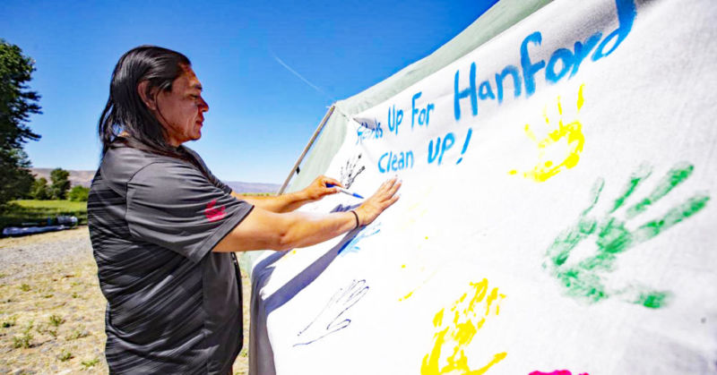
Purpose and place: A 2019 Native American ceremony on the Columbia River called for Hands Up for Hanford Cleanup! Photo by Evan Abell/Yakima Herald-Republic

This story is part of Columbia Insight‘s Indigenous Issues series examining environmental stories that directly impact tribal lands and communities.

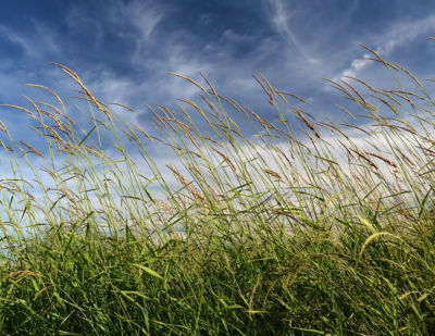
By Michael A. Buck. October 29, 2020. I am native to Central Washington’s distinguished sage, shrub-steppe and heavy basalt community landscape. The powerful Columbia River within the beautiful “Evergreen” state of Washington is home to the federally recognized Confederated Tribes and Bands of the Yakama Nation, known as River-People or “Wanapum.”

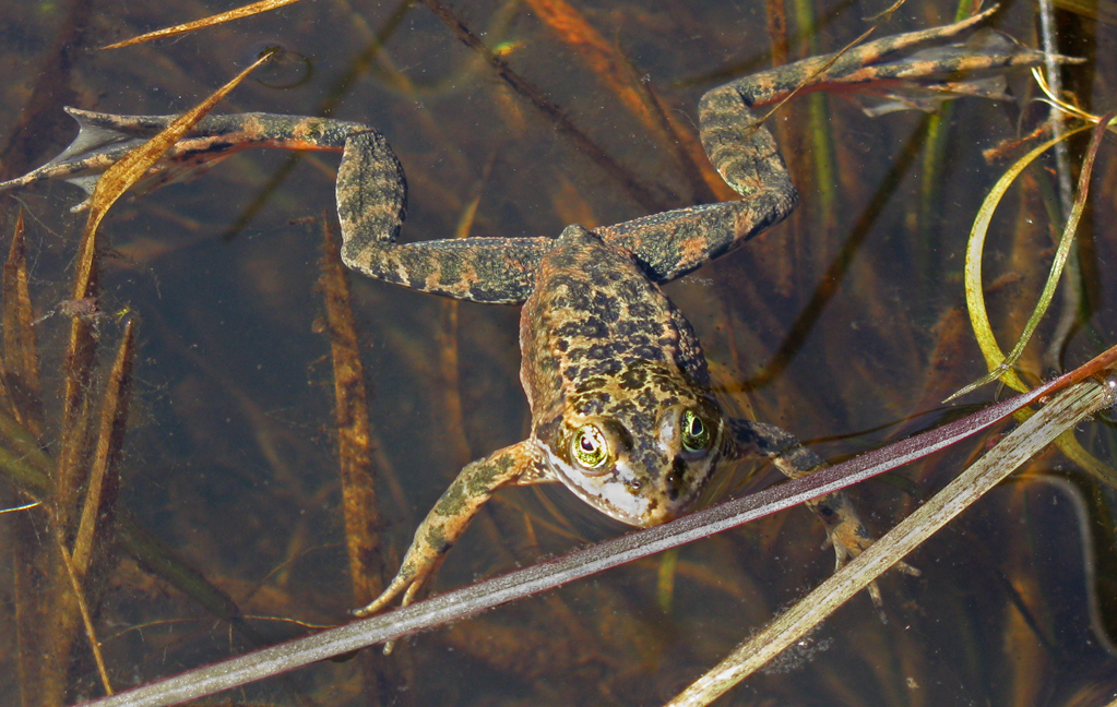
Traditional Yakama members continue to devote heartfelt song and ceremony on behalf of a once thriving, diverse and rich Salmon Culture, ubiquitous in the heart of the Pacific Northwest.

As an undergraduate who studied Environmental Sciences at Heritage University, I am examining a potential contribution to Environmental Health Science, questioning significant Northwest environmental historical truths and uncertainties that may or may not have taken place at traditional Columbia River tribal fisheries.

Present-day indigenous environmental scholars like myself are now reserving a right to methodically listen, document and protect our own history. Traditional Ecological Knowledge (TEK) bridges us to our ancestry, subsequently creating tribal-specific metrics of health within a very limited and contemporary traditional food system of our respective regions.

Treaty of 1855 still governs

The Hanford Nuclear Reservation (Hanford) in Washington is one of the largest sites in the country for the treatment, storage and disposal of radioactive and non-radioactive hazardous waste. It currently stores over 53 million gallons of mixed radioactive and non-radioactive hazardous waste.

During World War II, the United States government constructed Hanford to manufacture plutonium for military purposes. Over the decades, the United States Department of Energy has disposed of approximately 450 billion gallons of contaminated water and liquid mixed waste on the site.

As a result, at least one million gallons of high-level mixed radioactive and non-radioactive hazardous waste have leaked into the environment; 170 miles of groundwater beneath Hanford are contaminated. In addition, tens of millions of gallons of waste remain stored at Hanford in tanks that were constructed in the 1940s and meant to last only 20 years. These tanks are now in danger of failing, with potentially catastrophic consequences.

Hanford Journey 2019 photo by Kiliii Yuyan

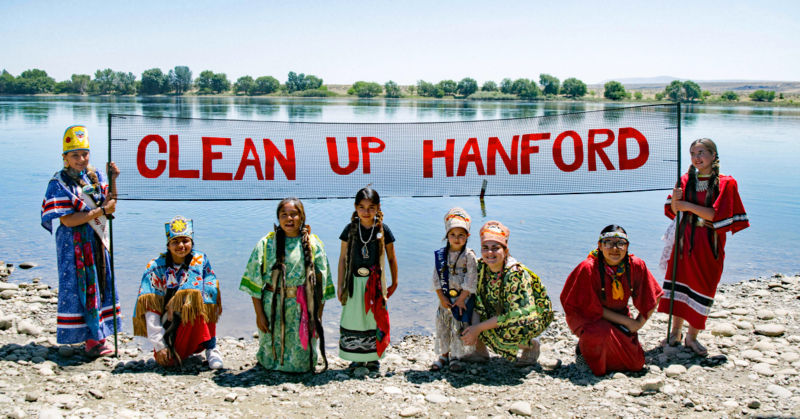
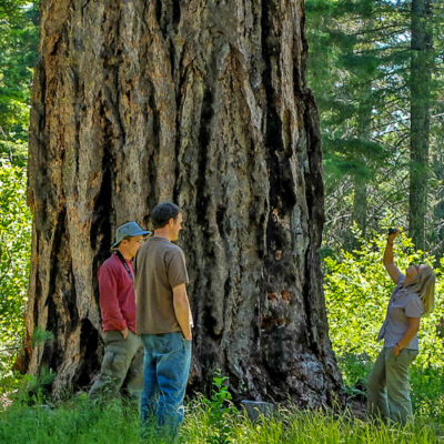
Hanford Journey: Yakama youth and Elders are elevated by shared experiences on the Columbia River. Photo Kiliii Yuyan

It is very important to uphold the Treaty of 1855 between the United States and Yakama Nation on behalf of the shared region at Hanford. The Treaty of 1855 has implications on Hanford; Yakama land at Hanford was ceded to the United States in the Treaty, with provisions that rights would remain forever. The Treaty involved a grant of land and rights to the United States by Yakama Nation, not the reverse.

The historical, unjust distribution of benefits and burdens between tribal communities and surrounding United States government agencies in our state, in effect, “justifies” the majority of present-day toxic waste and pollution in the Columbia River.

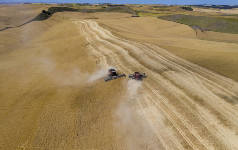
Energy production in Washington has come at the expense of the natural flow of the Columbia and has been a pattern that Indigenous people have witnessed and encountered repeatedly throughout PNW history.

Critical negative social impacts remain self-evident within tribal communities along the Columbia River. These include a dangerous uncertainty of human health effects and questionable water quality at traditional fishing and gathering areas in the region near Hanford.

Restoring a relationship to the land

A dignified environmental history exists and can begin to counter physiological and mental health disparities as a result of identity loss due specifically to relocation and forced acculturation experienced by tribal communities. A colorful history that begins with Columbia River Indigenous tribal Elders and youth ignites self-determination and identity renewal with a vengeance!

Regional environmental histories of the Yakama, Warm Springs, Umatilla, Nez Perce and Wanapum of Priest Rapids are re-emerging as a spirited manifestation of present-day environmental justice practices that command awareness and respect.

According to distinguished environmental justice scholar Joseph R. Desjardins, environmental justice and environmental racism is demonstrated as “an unequal distribution of burdens and benefits amongst people of color … all too often, society places the burdens on people in the least advantaged positions—the poor and people of color for example.”

[perfectpullquote align=”full” bordertop=”false” cite=”” link=”” color=”” class=”” size=””] “It is not the land that is broken, but man’s relationship to the land that is broken.” —Robin Wall Kimmerer[/perfectpullquote]

A human dimension of restoration founded on relationship building exists today in the collaborative and synergistic “Hanford Journey.” This 2019 event hosted by Yakama Nation’s Environmental Restoration Waste Management Program and Columbia Riverkeeper guided transportation by land and water from Vernita Bridge to the Hanford Reach. The event facilitated a reconciliation of societal disconnection with the Reach and Hanford shorelands.

Current Umatilla scholars and anthropologists from this region question the absence of experiencing historically significant places.

“When we do not visit the places our ancestors knew and we do not tend to the rituals of honoring those places in prayer, do we deprive ourselves of the insight and wisdom the land provides? If knowledge of the land is a reflection of knowledge of ourselves, do we become separated from our history when we are separated from our land, the place of our history?” wrote the Cayuse-Umatilla tribal Elder Kakinas (Thomas Morning Owl) in Eugene S. Hunn’s Sahaptian Place Names Atlas “Caw Pawa Laakni (They Are Not Forgotten) in 2015.

The youth and Elders of the Yakama Nation especially will be elevated as mutual beneficiaries of monumental experiences shared on the Columbia. The future health of current youth of the Yakama Nation can count on the experience and dedication of such scholars with whom they can relate.

Revamp outdated policies

We honor and invest time and resources in special delivery of greater awareness to specific goals and objectives that are adjacent to upholding water-quality standards and a higher standard of collaborative integrity that honors multiple generations, human and non-human alike, that rest in the heart of the Columbia.
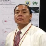
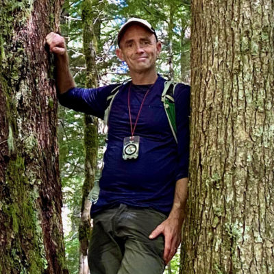
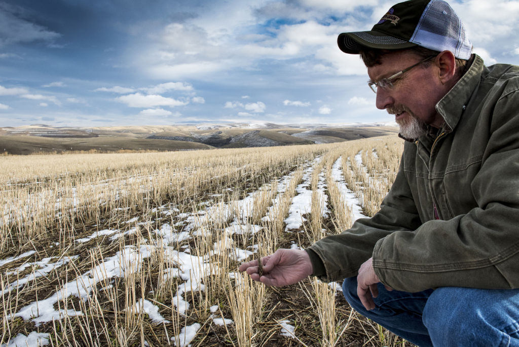
Michael A. Buck

I invite the dialogue of Columbia River Basin administrators, land-use planners, map-makers, surveyors, monitors, scholars, writers, artists, professors, lawyers, environmentalists, community-based organizers and dedicated scientists to share in a common goal of rebuilding and restoring human relationships with each other and with the river.

As the author and professor Robin Wall Kimmerer once stated: “It is not the land that is broken, but man’s relationship to the land that is broken.” 

In a time when the history of “heroes” of this nation is being seriously questioned and even obliterated we can see that the land that my people visited at Hanford always remembered us.

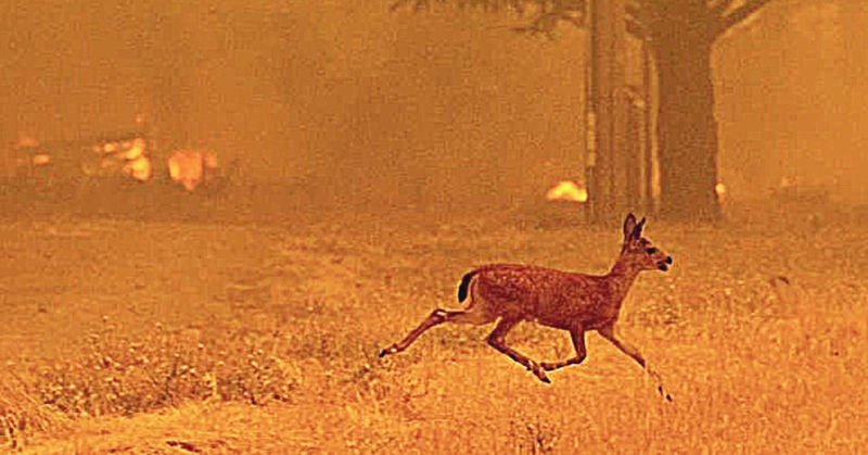
We are a manifestation of this land. We are the Columbia, we are the shrub steppe, we are the deer, we are the huckleberries, we are the roots. That connection will not be broken by an outdated logic of the uninformed.

Michael “Kakinas” Buck is a Yakama Nation member who grew up on the Yakama Nation Reservation.  He studies food systems of Indigenous cultures and investigates cases of significant historical environmental injustices.

READ MORE INDIGENOUS ISSUES STORIES.

The Collins Foundation logo

The Collins Foundation is a supporter of Columbia Insight’s Indigenous Issues series.

The secret power of old growth

More than ever, as the Forest Service seeks to undo logging restrictions, we need to embrace the crucial way old-growth forests keep the planet healthy

Carbon king: Thick, furrowed bark makes this 500-year-old Douglas fir more fire-resistant than younger trees. It also stores more carbon than smaller relatives. Photo by Jurgen Hess

By Marina Richie. October 22, 2020. Everyone loves old-growth forests. Hiking in them. Instagramming them. Sharing them with younger generations.

As Wild Heritage chief scientist Dr. Dominick DellaSala puts it: “Large trees are irreplaceable bio-cultural legacies.”

But big trees and ancient forests offer far more than emotional calm and aesthetic beauty. As the planet faces innumerable connected climate crises—from melting ice caps to species extinction—scientists are continuing to discover myriad ways old-growth trees benefit the global ecology.

Yet people also love logging them. 

In August, the U.S. Forest Service announced a proposal to eliminate logging protections for big trees across more than 9 million acres in six national forests in eastern Oregon. Led by DellaSala, more than 100 scientists from around the Columbia River Basin and the world responded by signing a letter condemning the proposal.

MORE: Forest Service wants to limit protections on large trees

“The Forest Service is pulling the rug out from under large tree protections at a time when the recovery of the ecosystem is far from complete and logging large trees will raise fire and climate risks when scientists are calling for more large-tree protections,” stated the letter.

What is ‘old growth’ exactly?

To appreciate the influence old and large trees have on the environment, it’s necessary to understand what “old growth” actually means.

For starters, “old growth” isn’t a scientific term. Nor is there a consensus definition.

The term “old growth” originated with the logging industry in the temperate forests of the Pacific Coast as a way of prioritizing large trees with the highest dollar value. And as a way to rid the forest of what were assumed to be deteriorating trees taking up space where new crops of trees could be planted. It was a term created simply to ascribe economic value.

Although the USFS typically defines an old-growth tree as at least 150 years old, to most scientists and foresters “old growth” is a misnomer.

“A tree is old not because of reaching a certain age, but because of its physical characteristics,” says Jim Lutz, associate professor of wildland resources at Utah State University.

Variety show: This old-growth forest demonstrates species diversity with different-sized Douglas fir, hemlock and grand fir with a vine maple, salal, Oregon grape and California hazel shrub layer. Downed logs, branches and needles provide a deep duff layer on top of soil. Photo by Jurgen Hess

Rather than calling the trees “old growth,” a 2020 British Columbia Provincial government task force offered a mosaic definition: “Old forests meld light and dark; their structural complexity can include large old living trees, large standing dead snags, long downed logs, a multi-layered canopy, hori­zontal patchiness with canopy gaps that allow understory growth, and hummocky micro-topography.”

While “old growth” remains a common term, most forest scientists prefer terms such as “intact,” “old” or “ancient” forests, reflecting processes that shape these unique ecosystems over centuries.

Carbon storage containers

At least in terms of the modern climate crisis, perhaps the greatest benefit of old-growth forests is their ability to retain carbon. From industrial agriculture to jet travel, human activity is releasing carbon dioxide into the atmosphere with dire climatic consequences.

Big and old trees are carbon-storing champions. The bigger the tree, the more leaves (or needles) it has to harness the sun’s energy, and the more surface area for stockpiling carbon.

Even in death, large standing snags and downed logs retain carbon, cycle nutrients and nurture saplings. Intact forests stow more than half their carbon as organic soil, or within standing and fallen trees that will become part of the rich humus.

Old growth in H.J. Andrews Forest during bird census study, photo by Matt Betts

Big reveal: In Oregon’s H.J. Andrews Experimental Forest researchers are learning more about how old growth helps global ecology. Photo by Matt Betts

“The large trees are important and even cutting a few of them down has a real effect on carbon,” says Lutz, the lead author of a 2018 study, “Global Importance of Large Trees.” One of Lutz’s study plots was within the Wind River Experimental Forest in the Gifford Pinchot National Forest in Washington.

Its key finding? The largest 1% of trees in mature and older forests comprises 50% of the biomass, storing half a forest’s carbon. A living tree is half water; the part that’s not water is half carbon. A tree’s ability to stockpile carbon increases rapidly with diameter. A tree with a two-foot diameter stores about 1.7 tons of carbon; a five-foot-diameter tree stores 19.2 tons.

“If you take out the top 1% of the trees you have taken out half the carbon above ground,” says Lutz.

Suzanne Simard, a professor of forest ecology at the University of British Columbia, studies the deepest layers of old-growth forests. Through roots and fungi called mycelium, she documents how mother trees share carbon, water and nutrients with other organisms, and show a preference for nurturing their kin. When injured or dying, they send messages to the next generation as defense signals that give seedlings more ability to resist future stress.

Simard has proven a two-way exchange of carbon between paper birch and Douglas fir trees. A birch sends carbon to a Douglas fir in summer when the fir is shaded; the fir returns carbon to a birch when it loses its leaves, because the evergreen fir is still growing.

“Forests aren’t just a bunch of trees competing with each other, they’re super cooperators,” Simard says.

Why logging hurts so much

The Pacific Northwest is home to some of the biggest, tallest, oldest and heaviest forests in the world. The oldest can safeguard carbon for more than 1,000 years.

Sensitive crooner: Hermit warblers avoid hot spots. They’re not big on clear cuts, either. Photo from Wikimedia commons

“We have less than three decades to turn around our emissions, and our biggest carbon reservoirs are the ocean and forests,” says Beverly Law, professor emeritus at the Forest Ecosystems and Society at Oregon State University. “The low-hanging fruit is to let forests grow.”

Law is co-author of a five-year study published in 2019 that shows preserving western forests with high and medium carbon-storing abilities would be the equivalent of halting eight years of burning fossil fuels in the region.

In contrast, a 2016 study documented that the number-one source of carbon emissions from western forests is timber harvest at 66%, with fire at 15%. Logging slash disrupts intact soils that release carbon, as does transport, processing and manufacturing. These emissions counter any stored-carbon benefit in wood products that also end the once-living trees’ potential.

The highest carbon-storing forests of the Pacific Coast and Cascades—with pockets extending east into the northern Rocky Mountains—comprise 10.3% of forested domain in the western United States.

Law’s findings point to the importance of natural climate solutions to cap global temperature increases and avoid the worst of the climate crisis, from rising seas to extreme heat and floods.

Provider of critical habitat

Old forests feature great vertical height, dead wood holding moisture and epic biomass. That’s heaven for wildlife, from insects and apex predators, to jumping slugs and spotted owls.

“The high biomass is like a big swimming pool,” says Matt Betts, a professor at Oregon State University’s Forest Ecosystems and Society who specializes in forest birds and microclimates.

Matt Betts, a professor at Oregon State University

Pretty cool: In the Andrews Forest, OSU scientist Matt Betts demonstrates the way birds—and humans—seek out pockets of cool air in ancient forests. Photo by Ava Betts

Big deep pools stay colder longer than shallow, small ones, he adds. That makes older forests more habitable to a wide array of species.

In the H.J. Andrews Experimental Forest in western Oregon, Betts and postdoctoral scholar Sarah Frey study songbirds with sensitive heat thresholds that thrive only in complex older forests that act as natural air conditioners.

Hermit warblers are quintessential residents. They breed in the Pacific Northwest then winter in western Mexico and Guatemala. Betts’ team tracks warblers in the Andrews Forest, documenting the way they flit and perch within different vertical tree layers as temperatures vary throughout the day.

Betts recently received National Science Foundation funding to explore the significance of “microrefugia,” pockets of cool air linked to hummocks, drainages and the forest’s vertical layers.

Cooler spots within a forest may be critical to wildlife surviving a warmer future. At stake could be the survival of iconic species such as Pacific fishers and American (pine) martens.

Temperature regulation

David Mildrexler is a systems ecologist for Eastern Oregon Legacy Lands. He’s a mapping expert who uses remote sensing to look at the land surface temperatures of forests around the world.

In 2018 he published research that showed the planet’s profile of high temperatures is fairly stable from year to year. Next to ice-covered areas, forests are the most important factor for keeping it cool.

Showing its age: Black scars indicate this 600-700-year-old Douglas fir has survived numerous fires over the course of its lifetime. Photo by Jurgen Hess

“We can see how forests are cooling the land surfaces in a major way,” says Mildrexler.

Large trees function as giant water towers that cool the planet through evaporation of water from leaves. With their deep roots, big trees tap groundwater sources not available to shallow-rooted plants, enabling trees to maintain their cooling role even during dry conditions.

“Older and intact forests are better at cooling the Earth’s surface,” says Mildrexler. “Where we deforest areas or significantly log them, the land surface temperatures spike rapidly.”

Networks of large and interconnected trees form the backbone of resilient forests, he says. Within these networks, large trees store the most carbon and are more fire-resistant than younger trees. Fire resistance in old growth is primarily the result of thick bark, which protects the cambium layer from higher temperatures.

All forests are flammable, especially in the extreme heat and drought conditions that have fueled recent wildfires across the West. Preventing even worse wildfires, Mildrexler says, depends in part on reducing emissions and storing carbon as fast as possible.

“When we protect the carbon-storing big trees and forests we’re doing what’s right for the climate,” he says. “We’re also doing what’s right for water retention, for biodiversity and ultimately for our culture—for all who love to hunt, fish and enjoy the outdoors.”

Marina Richie is a freelance writer based in Bend, Oregon. She wrote science articles for University of Montana’s Vision and Research View from 2009-2018, including covering a major lichen discovery.

By |2023-04-10T13:55:45-07:0010/22/2020|Climate Change, Forestry|10 Comments

Sage grouse, pygmy rabbits among wildlife hardest hit by fires

Animals are coping with 2020’s unprecedented fires much as humans are—fleeing the flames then returning to their stricken homes

Gone in seconds: Like this deer fleeing California’s 2018 Ranch Fire, most wildlife escapes the initial blaze of a wildfire. It’s the aftermath of scorched habitat that poses the more grave threat. Courtesy of Science X/Phys.org

By Jordan Rane. October 15, 2020. Millions of scorched acres. Ruddied skies. Noxious air. Decimated towns. Destroyed homes. Evacuations. Lives lost and still more missing. This year’s wildfire season has been yet another record breaker, triggering a litany of grim observations.

“We do not have a context for this amount of fire on the landscape,” an Oregon Department of Forestry fire chief remarked in September.

Amidst a blaze of ominous forecasts that can barely keep up with the evolving crisis, the immediate concern is protecting people and property. Land and resources come next.

But what about the millions, even billions, of largely out-of-view residents? Countless creatures are still seeking cover in the vast, charred woodwork: bear, elk, deer, cougar, coyote. Raptors, owls, sparrows, all types of birds. Beaver, bull trout and Malone jumping slugs. Lizards, porcupines, salamanders, skunks, butterflies, insects of every kind …

How is the wildlife spread across multiple ground zeroes of burning Columbia River Basin wildlands handling all the year’s conflagrations?

MORE: Firsthand account: He evacuated. Hours later the cabin burned

There’s no way to accurately count wildlife casualties due to fire. Birds fly away. Other creatures burrow. Some flee only to later return to their charred habitats.

“Animals die in these fires, especially in the incredibly intense, fast-moving ones we’re seeing across broad fronts, and it’s generally very hard to determine those estimates—but it’s typically not as catastrophic as people might think,” says Jason Fidorra, a Washington Department of Fish and Wildlife district wildlife biologist. “The majority of wildlife populations will likely escape and survive the initial event.”

The greater concern for wildlife, says Fidorra, is the aftermath of fires.

Grassland species suffer

“The real wildlife impacts of these fires are going to be felt this winter, a time that’s typically hardest on a lot of resident species,” says the Eastern Washington-based Fidorra, who oversees a fragile, fire-altered shrub-steppe ecosystem, parts of which now resemble a blackened moonscape.

Spread throughout the mid-Columbia River Basin and beyond, North America’s largest natural grassland is home to numerous threatened species.

Among them are critical casualties from recent fires, including the tiny, endangered pygmy rabbit, which has had at least one of its captive breeding populations in Central Washington destroyed.

According to the New York Times, September fires in the sagebrush steppe country of Central Washington “killed about half of the state’s endangered population of pygmy rabbits, leaving only about 50 of the palm-sized rabbits in the wild there.”


Running out of habitat: The Columbia Basin pygmy rabbit is a genetically distinct sub-population of pygmy rabbit (Brachylagus idahoensis), the smallest rabbit in North America. After this year’s fires, fewer than 100 remain in the wild in Washington. Courtesy of Oregon Zoo, Michael Durham

Fires have also devastated Washington’s sage grouse habitat. According to estimates in the Seattle Times, Douglas County’s Pearl Hill Fire alone has wiped out 30-70% of the population of the ground-dwelling birds there.

“Sage grouse is one of the keystone species of the shrub-steppe of Eastern Washington,” says Fidorra. “Because of this recent fire complex up in Douglas County, the new recommendation from our state agency is to uplist it to endangered.

“Sage grouse require sagebrush to survive, they consume it. And like a lot of our species here, we’ll be seeing several longer-term impacts from wildfire and altered habitat—which in the case of shrub-steppe, unlike forests, can take up to 50 years to regenerate.”

Predators take advantage

In forested ecosystems, periodic natural wildfires can spur a more efficient cycle of habitat renewal hastened by nature’s most violent reset button. Creatures great and small have been dealing with and adapting to fires since the invention of lightning.

“Large mammals will often graze calmly while fires burn only a few hundred yards away,” according to Oregon Explorer. “As a result of their acclimation to these conditions, direct fire-caused mortality among animals is generally low.”

According to the Oregon Department of Fish and Wildlife, there are no documented cases of forest fires in the Pacific Northwest that have wiped out an entire species or animal population. The main threat of wildfire on wildlife is habitat change and what the agency euphemistically calls “a reorganization of animal communities.”

In the throes of a massive forest fire, how do animals begin to reorganize? Mainly how you’d guess.

Birds fly away. Rodents and amphibians often burrow underground or in rocks to evade flames. Ungulates, bears, cats and other mammals either seek new territory or find safe harbor in rivers, lakes and other fire-resistant refuges.

Sage steward: WDFW biologist Jason Fidorra with burrowing owl. Photo by Dana Cadwell

It’s the old, the young, the sick and the more confined smaller-sized species that are most at risk from fast-moving flames, smoke and heat that can climb above 1,200-degrees Fahrenheit at ground level.

Some predators take advantage of the situation. Raptors, bears and raccoons have been known to hover on the fire line to pick off meals from the exodus of prey making an exposed exit through suddenly reduced coverage. Woodpeckers are quick to feast on a buffet of bark beetles in blackened trees.

“In those short-term situations, there’s always winners and losers,” sums up a recent National Geographic study on the complexities of animal behavior in a forest fire. 

Returning to stricken homes

Though depicted in plenty of animated films, one dramatic scene you likely won’t see is masses of panicked fauna communally fleeing the flames in unison. 

“It’s not the stampede people might imagine, but you’ll definitely see them moving out of those areas individually, instinctively, and largely effectively depending on the fire’s intensity and speed,” says Katie Santini, a U.S. Forest Service biological science technician based in the Columbia River Gorge National Scenic Area. “With wildfire, it’s important for us to think about how wildlife doesn’t see or experience boundaries the way we do.

“A lot of times during these burns you’ll get a mosaic with pockets—such as riparian areas—that often don’t burn as heavily. That’s where you’ll often find wildlife seeking refuge until the main threat has passed.”

MORE: How non-native plants fuel wildfires, destroy eco-systems

Within a fire-stricken area, animals also tend to know when it’s safe to return to the places they’ve vacated.

“When we’ve done prescribed burns it’s always revealing to see how animals have responded even just within a day when we return to check the fire line,” says Santini.

“We’ll find grazing deer and wild turkey technically in the burn area. Animals do get displaced, but that displacement may not last as long as one might expect.”

Life cycles disrupted

Fleeing from larger, more uncontrolled wildfires, displaced animals forced into new territory can face myriad challenges.

“Sudden movement of this kind is a dangerous activity for virtually any species,” says Fidorra. “They’re traveling through unknown territory with predators, roads and all sorts of other risks. Then animals arrive in a foreign habitat that’s already occupied and there’s a severe home-court advantage for the resident populations, which are often territorial.

“Newcomers might not be killed, but they may be unable to breed, reproduce or simply find suitable space.”

Moonscape: September’s Pearl Hill Fire in Washington rendered much wild habitat uninhabitable. Photo by WDFW

Wildfire-induced wildlife movement can also lead to other risks. Pockets of over-concentration can become a hotbed for disease transmission. Browsing deer on neighboring commercial croplands can stoke human-animal conflict—already strained across evolving Columbia River Basin landscapes.

“Our wildlife are being hit by a lot of things these days—new roads and developments infringing on old habitats, tremendous increases in human recreation on public land adding additional stress,” says Santini. “Throwing this level of wildfire into the mix just makes it that much harder for them to be resilient when a big event like this happens. In a sense, it wears them down.”

Can nature and its inhabitants maintain any semblance of a natural cycle in the wake of unprecedented wildfire?

“I wish I had the answer to that,” says Fidorra. “You just have to remain hopeful that the importance that people place on these ecosystems remains high enough that we’re able to work together to resolve these issues over the long term for all of these impacted species.

“Thankfully, fire is a hot topic—no matter what side of politics you’re on,” he adds. “Which helps.”

Jordan Rane is an award-winning travel writer whose work has appeared in CNN.com, OutsideMen’s Journal and the Los Angeles Times.

By |2020-11-05T04:07:14-08:0010/15/2020|Recreation, Wildfire, Wildlife|2 Comments

Hidden threat: How non-native plants fuel wildfires, degrade ecosystems

Invasive grasses have also wreaked havoc on the threatened Oregon spotted frog. Efforts are underway to save its habitat

Burning ambition: Arriving in the late 1800s, by the 1930s cheatgrass had become the dominant grass in vast areas of the Pacific Northwest and “worst” western range weed. Being a potent fire fuel is just one of its problems. Photo courtesy of NRCS

By Sue Kusch. October 1, 2020. Many of us drive through the open rangelands of the Columbia River Basin on our way to somewhere else. The honey-colored dried grasses that blanket the midsummer landscape appear innocuous as they sway in the wind.

What we don’t see is the potential of the vast swaths of dried grass to explode into a fast-moving and volatile grass wildfire that blackens the land, eliminates native plant vegetation and destroys rural economies.

One of the biggest invasive species problems in the United States, cheatgrass has taken root in every state and dominates over 50 million acres of western grassland and sagebrush steppe habitat.

In the last 20 years, an increased number of wildfires on cheatgrass-infested lands is proving to be the most damaging of its many negative consequences.

Cheatgrass blooms early in the wet spring and dries out by June, forming a thick thatch similar to our green suburban lawns. This dried thatch becomes both tinder and a sustained fuel base for wildfire, extending the natural fire season by months.

“Basically cheatgrass is comparable to tissue paper covering the landscape—an easily ignited fuel that carries fire quickly and spreads it rapidly,” says Mike Pellent, retired Bureau of Land Management (BLM) rangeland ecologist.

[perfectpullquote align=”full” bordertop=”false” cite=”” link=”” color=”” class=”” size=””]Cheatgrass’s ability to dominate land has essentially created millions of acres of wasteland.[/perfectpullquote]

Once a grassland fire has occurred, cheatgrass moves onto the disturbed soil, utilizing nitrogen in the soil, creating a vicious cycle.

“Wildfires promote more cheatgrass, which in turn further increases the impacts and probability of wildfires,” says Pellent.

While forest fires receive media attention and are given far more resources than rangelands, the reality is that since the year 2000 more acres of grasslands have burned than forests.

Fast-moving wildfire destroys the rural infrastructure used to maintain the ranching economy: fencing, water troughs, cultivated hayfields and cattle are repeatedly destroyed by wildfires that now occur every three to five years.

How the invaders invaded

Native to Europe and East Asia, cheatgrass (Bromus tectorum), like many non-native plants, sailed across the Atlantic from Europe mixed in with straw and grain sent to support North American settlers’ introduction of cattle in the mid-to-late 1800s. Railroads enabled the grass seed to continue west where it thrived on grassland denuded by the introduced livestock.

Adapting to the cold, wet winters and hot, dry summers of the Great Basin and Columbia River Basin, cheatgrass found an inviting landscape throughout western rangelands. It’s particularly aggressive in the sagebrush steppe ecosystem where it has earned the designation of a noxious weed, dominating the land to the exclusion of all other plants.

Reed canary grass: Doesn’t play well with others. Photo by Rosewoman

Beyond wildfires, the environmental and economic impacts of cheatgrass invasion are significant and long-lasting. Eliminating native vegetation like sagebrush and Idaho fescue alters the evolved relationships between plants and animals, affecting 350 species that depend on the sagebrush habitat for food, protective cover and nesting.

Cheatgrass’s ability to dominate land has essentially created millions of acres of wasteland. The loss of native flora and fauna and the threat of wildfire greatly diminishes the ability of people to use the land not only for grazing but for recreational activities such as hunting, birding and hiking.

Efforts to contain it cost government at all levels millions of dollars a year.

Threatening Oregon spotted frogs

In the wetter landscapes of the Pacific Northwest, another non-native grass is altering wetland ecosystems, using its aggressive rhizomes to quickly create monocultures around the edges of ponds, lakes and streams.

Reed canary grass (Pharlaris arundinacea) is a perennial grass that was initially introduced as highly productive forage on pastureland.

Eventually, the grass escaped pastures, thriving in nutrient-rich riparian environments scattered throughout the Pacific Northwest.

Unlike the short-stemmed cheatgrass, reed canary grass grows six-foot stems that tower over the edges of wetlands while simultaneously developing a thick mat of roots that encourages the accumulation of sediments, inhibiting the growth of native vegetation. Its annual production and release of wind-blown seeds contribute significantly to the spread of this grass.

“Reed canary grass can dominate seasonally wet meadows, which creates large areas of dense, coarse vegetation that limit feeding options for the Sandhill cranes and other ground nesting birds that prefer to feed in short vegetation,” says Keyna Bugner, natural areas manager for the Washington Department of Natural Resources, Southeast Region. “In addition, the tall grasses make it difficult for the birds to travel through, and also provide cover from predators that could harm the Sandhill cranes and their young during the vulnerable time before the young are able to fly.”

One of the contributing factors in the decline of the federally listed threatened Oregon spotted frog, reed canary grass alters the native habitat necessary to the frog’s reproduction. The red-bellied frogs lay egg masses among short grasses in the open and un-shaded low water levels of ponds.

Displaced: The Oregon spotted frog has been lost from at least 78% of its former habitat. Photo courtesy USGS

For several years, a joint effort by federal and state agencies has been underway to restore habitat for the Oregon spotted frog at the Trout Lake Natural Area Preserve in the Columbia River Gorge.

The removal of reed canary grass is key to the success of the project. Bugner employs a variety of removal methods: hand pulling, herbicides, mowing and solarization, which involves placing heavy, black weed cloths on the invasive grass to kill it. When the cloths are removed several years later, the bare ground is planted with native plants endemic to the area.

Re-establishing native plant species is critical to the success of restoration projects.

“Using locally sourced plants and seed from your project area will greatly increase the success of re-establishing native vegetation,” says Bugner.

Fighting invasive plants

One of the challenges in managing invasive plant species is fragmented ownership of land. State and federal agencies have partnered with private landowners, creating plans to jointly manage invasive species.

The Sage Grouse Initiative is one example of the many partnerships created to coordinate efforts for the eradication of invasive species and the restoration of native habitat.

This can appear to be an overwhelming problem, best left to professionals. But Greg Peters of the Sage Grouse Initiative, and DNR’s Bugner, offer the following recommendations to individuals and property owners who can help deal with the problem:

• Monitor and eradicate invasive plants regularly

• Plant and maintain native plants to prevent invasive plants from taking hold

• Limit disturbance of native ecosystems

• Avoid bringing fire to grasslands—campfires, cigarettes, fireworks, ATV travel—during the driest time of the year

• Become informed and volunteer with local organizations working on restoration projects

Invasive non-native plant species are wreaking havoc on many of our native ecosystems. After an invasive species has been introduced, it becomes a time-consuming and expensive problem to manage. Prevention is the best way to manage invasive species.

A former college educator and adviser in Vancouver, Washington, Sue Kusch cultivates edible, medicinal and native plants. She currently serves as president of the Suksdorfia Chapter of the Washington Native Plant Society.

By |2020-10-16T13:10:10-07:0010/01/2020|Conservation, Plants, Wildfire|0 Comments

Shepherd’s Grain wants a no-till future. Here’s why

The first step in becoming a topsoil expert is as simple as vetting the flour you consume. A Washington company makes that easy

Well grounded: On his farm overlooking the Deschutes River Canyon in Oregon, David Brewer inspects harvested wheat stubble. Brewer and his wheat are part of the Shepherd’s Grain network of no-till farmers. Photo: Jurgen Hess

By Dana Joseph. September 17, 2020. The last thing you probably need with your morning coffee is another existential threat to ponder, this one about the very food you eat and the very ground beneath your feet. Good thing, then, that Kyle Schultheis has your back—and your bagel.

With his dad, Schultheis farms 2,200 acres in the rolling hills of the Palouse in Eastern Washington, about 15 miles south of Pullman in a small town called Colton. They grow winter wheat (soft white and hard red), spring wheat (dark northern, soft white, hard white), food barley, oats, canola, lentils, garbanzo beans, Kentucky bluegrass and hay (beardless barley, grass, alfalfa). He’s the sixth generation to farm here.

“My great-great-great grandfather homesteaded here in 1874—we currently farm some of the original homesteaded ground,” Schultheis says, after a day harvesting the last field of spring wheat.

He’ll haul the wheat to a terminal on the Snake River, where it will be loaded onto barges and shipped to Portland to be exported. Schultheis will spend the majority of the coming days driving a semi-truck back and forth from the field to the river terminal.

MORE: A believable solution for climate change? This no-till film may have it

“A round-trip is two and a half to three hours, so I will make four trips throughout the day,” he says.

He’s making a point of taking the time because as devoted as he is to farming, he’s also devoted to getting out the word about Shepherd’s Grain, a sustainability-focused flour company based in Reardan, Washington.

“A major reason for me wanting to farm was our involvement in Shepherd’s Grain,” says Schultheis.

Meeting the company’s buyers and discovering their appreciation for farming families and the quality of the grain they’re growing helped motivate the former teacher to return to the fields after years in the classroom.

[perfectpullquote align=”full” bordertop=”false” cite=”” link=”” color=”” class=”” size=””]“Soil erosion and degradation is the most neglected environmental crises in the 21st century.” — David Montgomery, University of Washington[/perfectpullquote]

“As a kid growing up on a farm, I didn’t understand where the crops we grew went once they were harvested and we dumped them at the local elevator or river terminal,” Schultheis says. “Shepherd’s Grain connected the food chain for us and generated value for the quality grain we were growing and identity-preserving in our grain bins.”

For Schultheis, “identity-preserving” is what makes Shepherd’s Grain special.

“We own 11 of our own grain bins, and throughout harvest I manage them and coordinate which trucks will be taken to our home grain bins and which will go to the local elevators to ultimately be exported as a commodity,” he says.

When it’s loading out of his bins, Schultheis knows exactly where the wheat goes.

“Just last month, my aunt in Portland purchased a 50-pound bag of Shepherd’s Grain low-gluten flour and when she entered the bag code on the website, it showed the wheat used to make the flour was grown on our family’s farm,” says Schultheis.

But there’s more to Shepherd’s Grain than just a bit of flashy technology.

Connecting growers and consumers

Shepherd’s Grain produces and markets a variety of wheat flours—low-gluten, high-gluten, pastry, cake, whole wheat, as well as a food-grade whole flax seed—grown using the no-till method employed by farmers the company actually gets to know.

Karl Kupers and Fred Fleming, the original “shepherds” of Shepherd’s Grain, were Eastern Washington growers who wanted a relationship with the people they sold food to.

“They were tired of the commodity wheat-production system,” says Jeremy Bunch, director of logistics and R&D at Shepherd’s Grain. “They babied their crops along all year, pouring sweat, tears, money, effort and prayers into making sure their crop made it to harvest. Then the crops were quickly harvested and taken to a commercial grain elevator, where the crop was dumped in a pit and kissed goodbye—all with no connection to where that wheat would go and who would eat it.”

Palouse pride: Enter a code on a bag of Shepherd’s Grain flour and you might find the wheat used to produce it comes from a farm like this one in Eastern Washington. Photo: Shepherd’s Grain

Determined to change that system and reconnect growers and consumers in a regional grain economy—and do so based on sustainable no-till production—Kupers and Fleming started Shepherd’s Grain. This was the early 2000s—the Pacific Northwest was already well known for its foodie culture and environmentalism.

“It was ripe to receive the story of farmers focusing on food quality and environmentally friendly farming practices,” says Bunch.

The name of the company reflects its philosophy. In contrast to systematically farming a monoculture, no-till farming with diversified crop rotations requires a high level of care and management. The idea of a shepherd, paying close attention to each animal, was a fitting analogy for farmers who are paying much more attention to their land.

And to their topsoil.

No-till revolution

Earth’s surface is covered with just a foot or two of topsoil. And we’re losing it at an alarming rate.

Topsoil is more than dirt. Healthy soil teems with life and provides the nutrient layer for vegetation and food from agriculture. The amount and quality of topsoil are directly related to crop yield.

“Soil erosion and degradation is probably the most neglected of the important environmental crises humanity faces in the 21st century,” says David Montgomery, a professor of geomorphology at the University of Washington. He wrote about the effect of soil erosion in 2017’s Growing a Revolution: Bringing Our Soil Back to Life. “Plowing degrades soil organic matter and leaves the soil bare and vulnerable to erosion by wind or rain. Since the dawn of agriculture, humanity has degraded between a quarter and a third of the world’s potential farmland. … We’re on track to degrade another third over the course of the present century.”

But, Montgomery says, we don’t have to repeat the story of ancient civilizations that squandered their soil. “Regenerative farming practices based on no-till farming with cover crops and complex rotations can rebuild soil fertility as a consequence of intensive agriculture.”

No-till is a type of farming that doesn’t disturb the soil. After a field has been harvested, straw, or stubble, is left behind. Tillage incorporates that stubble into the soil, creating a smooth seedbed for the next year’s crop. No-till utilizes special equipment that plants the next year’s crop directly into the previous crop’s stubble. The stubble and roots help prevent soil erosion.

Farmers often switch from tilling fields on an annual basis to continuous no-till once they recognize the un-sustainability of losing their topsoil.

“The number of tons of topsoil lost on the Columbia Plateau from erosion due to tillage is astronomical,” Bunch says. “Food-production security depends on soil staying where it’s supposed to so that it can be farmed indefinitely. … Topsoil and agricultural chemicals should not be running off into the Columbia River.”

This isn’t news to Schultheis.

“The decision to begin using no-till was one that my grandpa and dad began experimenting with back in the 1970s,” he says. “The benefits are that we have nearly eliminated soil erosion on our farm, we are able to save all moisture we receive for the crop, there is better water infiltration and we have been able to increase our soil organic matter.”

Pesticides and herbicides

No-till isn’t perfect—or without challenges.

“There is still a lot unknown as to how all the communities of organisms within the soil interact and how they are affected by our farming practices,” says Schultheis.

Shepherd’s Grain growers try to copy the natural ecosystem they farm within. This looks different from farm to farm, and it isn’t always easy to decipher.

“Natural ecosystems contain a great deal of biodiversity below and above ground, and there is a great deal of complexity in how all of those organisms interact with each other,” Bunch says. “No-till farmers try to understand these dynamics, and then take upon themselves the challenging task of trying to mimic those natural systems in food-production systems.”

Growing pains: No-till farming isn’t always this pretty. Absent tilling, weeds present a problem. Photo: Shepherd’s Grain

Then there’s pesticide and herbicide use, which no-till farmers rely on while trying to mitigate their harmful effects.

Many people ask why Shepherd’s Grain growers aren’t organic. The answer is that sustainability is a higher priority.

“Organic agriculture at scale largely depends on tillage in order to control weeds and other pests,” Bunch says. “Our farmers have committed to saving the soil, and then are working on ways to decrease the use of chemicals. Organic no-till is a wonderful production system. It’s just that we haven’t fully figured out how to do it yet on a number of fronts.”’

As for weeds, Schultheis says the subject is “incredibly complicated.” A fertile growing area that receives ample rainfall is a perfect breeding ground for them.

“Some farmers will say that no-till generates the possibility for more weeds and weed resistance because of our reliance on rotations and herbicide chemistries,” Schultheis says. “However, farmers who utilize tillage still have weeds and use pretty close to the same amount and type of herbicides that no-till farmers do.

“No-till is still a relatively new technology and we are still learning about how to use rotations mixed in with different herbicides to best keep our fields clean each year to help break up the weed cycles.”

“All of our farmers have obtained Food Alliance certification, which is a third-party certification that verifies our growers are farming in environmentally sustainable ways,” Bunch says. “Food Alliance has a list of prohibited pesticides that are particularly damaging to the environment, so our growers are not allowed to use them.”

Bunch adds that because Shepherd’s Grain growers practice no-till, the pesticides they do use stay on the fields rather than eroding off into waterways as they often do in conventional tillage production.

Where to find no-till products

As Shepherd’s Grain and its growers continue to work through those issues, more and more bakers are using the products of their no-till practices.

With locations in the Seattle and Portland metro areas, Grand Central Bakery is a longtime Shepherd’s Grain customer.

“They are an example of a relatively larger bakery that has solid commitments to procuring ingredients that support sustainable farming,” Bunch says. “Sea Wolf is another bakery in Seattle that exemplifies artisan baking at its best. … We are proud of the magic they create with our flours.”

No-till table: St. Honoré Boulangerie uses Shepherd’s Grain flour in many of its baked goods. The popular bakery has four Portland locations. Photo: Jurgen Hess

The grain, the flour, the bread in the oven, the bagel on your plate—in the end, it all comes back to the land and our connection to it. For his part, Schultheis feels good about his family’s stewardship. And his role as a soil shepherd.

“As farmers, we are unbelievably proud of what we do,” he says. “Every decision we make is based on producing the highest quality food for the consumer, while trying to leave the soil in better condition than it was so that my children will have the opportunity to be the seventh generation (of farmers) if they so choose.”

For more information about Shepherd’s Grain, including where to buy its 5-pound bag of all-purpose or whole wheat flour, visit shepherdsgrain.com.

By |2024-07-09T11:32:07-07:0009/17/2020|Agriculture, News|0 Comments

Firsthand account: He evacuated. Hours later the cabin burned

A Portland man recounts his terrifying and surreal evacuation from the Holiday Farm Fire in Oregon’s Willamette National Forest

Holiday Farm Fire in Willamette National Forest, September 2020

As of September 14, 745 personnel are fighting the Holiday Farm Fire, which has burned more than 165,000 acres along Oregon Route 126. Photo by Oregon Department of Forestry

By Dave Santen. September 14, 2020. I’d gone up on Sunday, September 6, for a three-night stay alone in a cabin overlooking Oregon’s McKenzie River, east of Vida and near Blue River. Before I left, I let my wife know where I was headed. I downloaded a map to my phone, took a compass and first aid supplies, plenty of water—stuff you probably ought to have in case of emergency.

On Monday, I hiked Olallie Mountain by myself. At the top, along with remnants of a Forest Service fire lookout that stood from 1932 until it burned in 2019, views of Three Sisters to the east were obscured by smoke from fires to the northeast near Mt. Jefferson. My cell phone pinged me with an alert of high winds forecast for later that afternoon.

Back at the cabin that afternoon, I watched across the river as trees whipped in the wind, and smoke rolled through. Conditions worsened and eventually I went indoors.

I had internet access and didn’t see any fires nearby, so I settled in for the evening. Around 8 p.m., the power went out, and I lost light and internet access.

MORE: Fire threatens Trapper Creek Wilderness

A woman named Jessica, who takes care of the property, came over from her house across the road with lights and batteries for the cabin’s artificial candles. The only fires reported were miles away, she said. I was more worried about the wind and the possibility of a large tree limb crashing through the roof.

I sat and read by artificial candlelight, listening to branches bounce off the sloped roof. At some point I could hear emergency vehicles moving through, heading east on Oregon Route 126.

The air worsened outside and the winds picked up. I considered gathering up my belongings, but I settled for leaving a pair of shoes by the bed instead, and turned in.

Caravan of evacuees

Just after midnight I woke; the windows above glowed with an orange light wrong for that time of night. I stared dumbly for a moment until a notice burst from my phone: Emergency Alert: A Level 3 GO NOW Evacuation notice from Nimrod East to the Mck Ranger Station

As I pulled on clothes and shoes I heard a banging on the front door and a woman shouting: “Fires! We have to evacuate now! Go now!”

I answered, grabbed an armful of belongings and my keys and rushed out the front door to my car. Cars and trucks swarmed west, while emergency vehicles blew past. Firefighters were near, helping notify people—I think I remember seeing them. Atop the hillside across the road, fires swarmed through the trees as winds blew in our direction—the sky itself looked to burn.

Evacuation text related to Holiday Farm Fire in Willamette National Forest, September 2020

The midnight text that alerted residents and visitors it was time to move. Courtesy of Dave Santen

Throwing items in the car, I ran back inside, found my duffel bag and a laptop and realized that I wasn’t going to die packing. I ran back out, stuffed everything in the backset, slammed the cabin door shut, got in my car and peeled out into the caravan of evacuees.

We made our way through, past checkpoints, and gradually cars pulled off to the side of the road to assess. Another emergency notice came through on my phone—I couldn’t see it but I was glad to know I had it.

I drove awhile until I got to Springfield, past barns and people loading livestock, and gatherings of residents clustered at muster points. I finally pulled over after driving aimlessly through a smoky and silent Springfield, realized that my shirt was on backward and that I’d left my glasses.

I drove north to Woodburn before I finally could see stars and sky through the smoky haze.

Back home in Portland I slept a few hours. The day was clear and quiet. I searched for news of the Holiday Farm Fire and watched it bloom to more than 150,000 acres. (For updated information on the Holiday Farm Fire go to the multi-agency Incident Information System website.)

I saw photos of communities burnt to the ground, and evacuees forced further west. I watched the desperation of residents waiting for firefighters to arrive. A spokesperson with one of the agencies said that fewer than 200 were deployed in a fire that would typically require more than 1,000 to manage.

Rumors of looters, rumors of antifa, rumors of buildings still standing or still burning, rumors of roads still open or closed, all moving as fast as the fire itself. Volunteers delivering equipment to firefighters shoot video on their camera phones that gets posted online—grim narrations as they pass one structure after another: “Gone. Gone. Gone. That one looks all right. Gone. …”

I ride alongside virtually, via social media, up and down those roads, comparing it to street views on Google Maps, trying to correlate the snapshots of lush forest and river with the ash and char of the landscape now.

I found Jessica, the cabin’s caretaker, on Facebook, confirmed that she’d been the one who knocked on my door and thanked her. She and her family were OK. But the cabins she manages were gone, including the one I’d been staying in. They’d burned shortly after my evacuation.

I don’t have any business telling this story—I was an overnighter in an area where people lost homes and businesses and potentially lives. I didn’t lose anything. Not really. Stuff I’d planned to go back for: a guitar that I finally bought myself after years of excuses not to. Old fishing lures and equipment that had been my dad’s and his dad’s. Clothes. Papers. Projects I’d set aside for someday. Everything I thought I might want to finally do on a few days’ vacation, away from work and family and obligations and politics and pandemics.

Today the smoke in Portland and across the Northwest chokes us. Air quality monitors that gently nudge you to open the windows when AQI nears high double-digits now flare with hopelessly high counts: 300, 400, 600?

In that smoke, loss. Homes. Businesses. Retirements. Habitats. Lives imagined and lives forfeited. With every breath, that loss.

Dave Santen lives in Portland.

Share your fire and smoke experiences by leaving a comment below.

By |2023-02-06T12:05:42-08:0009/14/2020|Features, Wildfire|4 Comments

© Copyright 2013-2025 Columbia Insight. All Rights Reserved.

As a 501(c)3 nonprofit organization, all donations to Columbia Insight are tax deductible to the full extent of the law. Our nonprofit federal tax-exempt number is 82-4504894.