Stay Updated Subscribe today for the latest research + reporting about environmental news. Subscribe Now

Stay Updated Subscribe today for the latest research + reporting about environmental news.

Subscribe Now

Guest Author

Guest Author

About Guest Author

This author has not yet filled in any details.
So far Guest Author has created 149 blog entries.

Remembering Dan Bell and Tim Counihan

The environmental community is mourning the loss of two champions of Columbia River Gorge conservation

Tim Counihan and Dan Bell

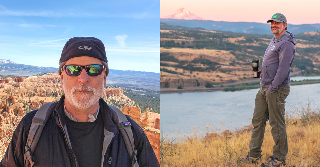
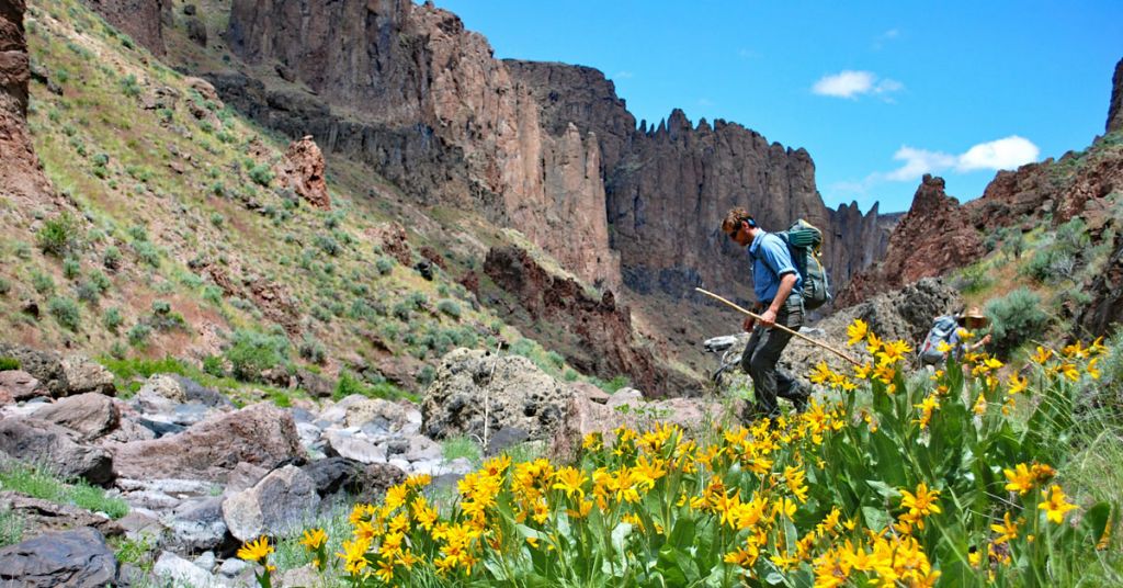
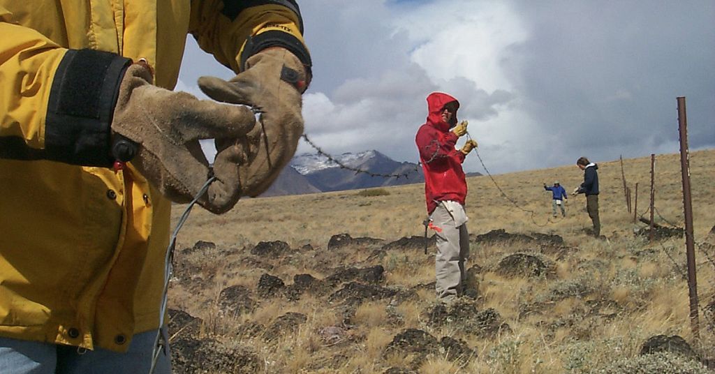
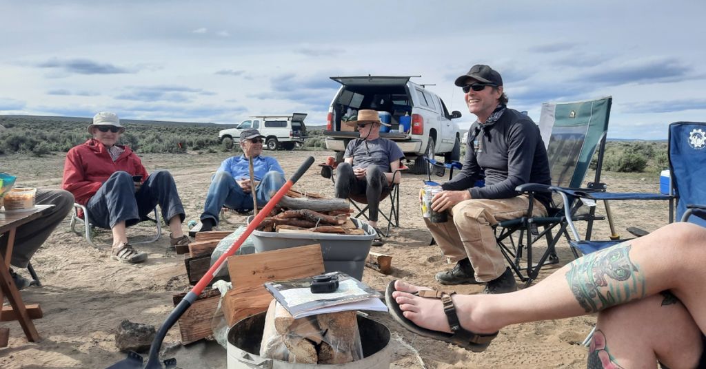
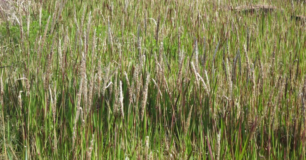
Tim Counihan in Utah and Dan Bell at Heartleaf Bluffs in Washington. Photos: Jen Bayer (Counihan), Friends of the Columbia Gorge (Bell)

By Ava Rudensey and Malia Perry. June 21, 2024. The first time Tim Counihan looked at a drop of pond water under a microscope, on a middle school field trip, he was hooked.

“It was teeming with life,” he later remembered.

An abiding fascination with the hidden stories inside water remained with him throughout his life.

Ultimately it led Counihan, who died on April 28 at the age of 65, from his early days in the Chicago area to the Columbia River Gorge.

He began his life in the Pacific Northwest studying the impact of hydropower on salmon and steelhead populations for the United States Geological Survey.

He remained with the USGS for more than 30 years, devoting himself to multiple studies and projects.

A firm believer in civic responsibility, he also served as a city councillor for Hood River, Ore., in 2016 and again from 2019 to 2024.

As a lead research fishery biologist he recently investigated invasive species, such as the quagga and zebra mussels threatening the Columbia River.

His keen eye for details, especially the overlooked and unglamorous ones, distinguished Counihan among his peers. He once told avian biologist Miko Ruhlen that one of the things he loved most about his job was that it allowed him to “look at things that people haven’t looked at before in ways that people haven’t looked at them.”

His ability to understand root causes of issues was important to the last project he participated in.

At the Yakama Nation Fisheries Program he worked with a team developing a system to monitor invisible toxins entering the Columbia River.

As Laura Klasner Shira, an environmental engineer and colleague at YNFP, put it, Counihan worked to answer the most vital questions about Columbia River restoration efforts: “What is the state of the river? Is it getting better? Are we making a difference?”

Counihan’s wife, Jen, also a fishery biologist, told Columbia Insight how happy he’d been to “work with the Yakama Nation on this subject that is important to their cultural heritage and also to the rest of us who eat fish from our river in our backyard.”

Counihan’s work made a difference.

Dan Bell

In 2020, Dan Bell, land trust director for the Friends of the Columbia Gorge, seized a rare opportunity when he spearheaded the acquisition of a four-acre plot of land in the Catherine Creek Recreation Area, located eight miles east of Hood River, across the bridge in Washington.

The parcel was one of the last privately owned properties situated within 4,000 acres of protected public lands.

“In over twenty years of working with land trusts, it has happened to me only a handful of times: getting the opportunity to protect a piece of property that is both critically important and potentially transformative,” Bell wrote at the time. “More often than not, these properties have been targets of conservation for decades, then suddenly they become an opportunity when they go on the open market. You only get one chance, or the property may go to another buyer and never be conserved.”

Bell pounced, then navigated the Friends through a tricky negotiation and drawn-out purchase process.

Then, almost as soon as the sale was finalized, he moved to secure a second land package of more than a hundred acres slightly further east along the Columbia River.

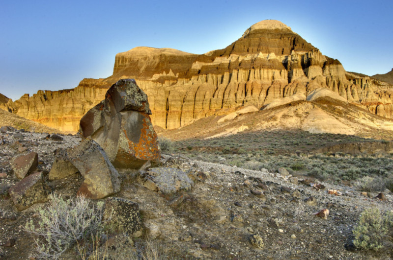
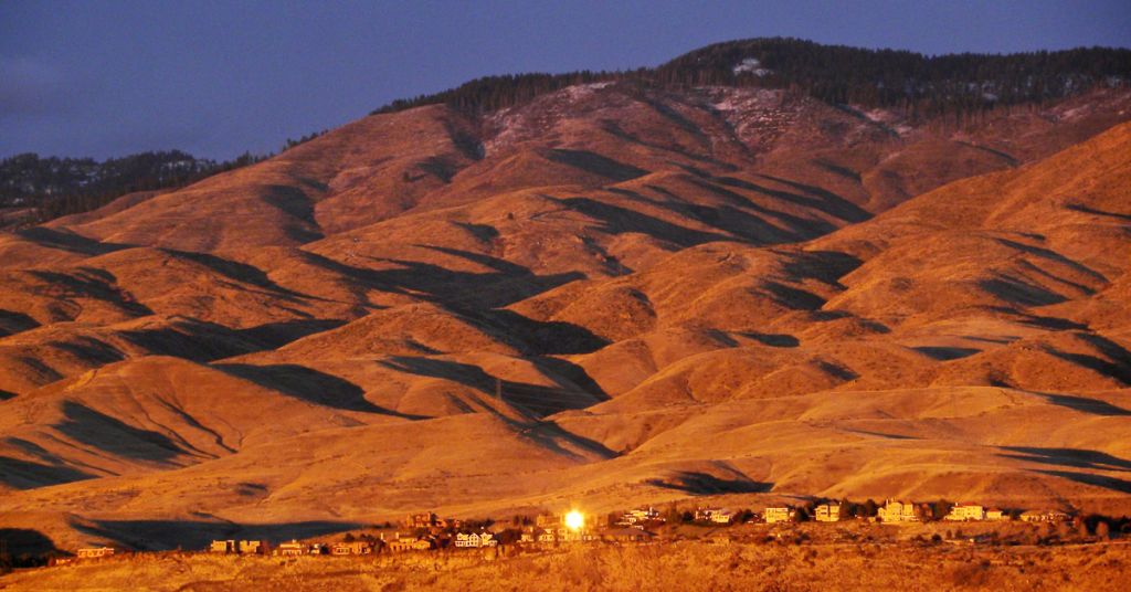
Known as the Heartleaf Bluffs, that land is now the second-largest preserve owned by the Friends of the Columbia Gorge.

A unique spirit and ability to get things done were hallmarks of Bell, who passed away on June 8 following a heart attack. He was 52.

“He was highly respected for the professionalism he brought to his work—identifying lands in the Gorge in need of special protection and bringing together all the different agencies, people and financing needed to acquire them for the public or for the Friends of the Columbia Gorge Land Trust, ” said Buck Parker, a former Friends of the Columbia Gorge board member and chair (and a current Columbia Insight board member).

As land trust director for the Friends, Bell oversaw the acquisition, management and disposition of lands for the past six years.

He also spent seven years as the Oregon Nature Conservancy’s Willamette Basin conservation director.

“What set Dan apart from so many people was his unwavering, unflinching humanity,” wrote Friends of the Columbia Gorge Executive Director Kevin Gorman in a post on the organization’s Facebook page. “At his core, he was a very, very good person. He always worked toward the common good and sought pathways bound in caring for one another. His intelligence was wrapped in wisdom wrapped in empathy.”

Columbia Insight reporter/intern Malia Perry is a native Oregonian and student at Brandeis University.

Hailing from Edmonds, Washington, Columbia Insight reporter/intern Ava Rudensey is a student at Brandeis University.

By |2026-02-09T11:00:55-08:0006/21/2024|Conservation|1 Comment

The world found the Owyhees. Advocates say it’s time to protect land

The secret is out. Now, a diverse coalition of interests is pushing to designate the Owyhee Canyonlands as a national monument

West Little Owyhee Ricer Canyon

The solitude and lack of apparent human influence is fading around places like the West Little Owyhee River. Photo: Tim Neville

By Sally Krutzig/Idaho Statesman. May 30, 2024. Just southwest of Boise lies one of the last vast swaths of solitude in the United States.

The Owyhee Canyonlands, with stunning red gulches, winding rivers and a moon-like landscape where a volcano with a caldera once 600 times larger than Mount St. Helens erupted, stands as the largest unprotected wilderness area in the American West.

Locals might have once seen the Owyhees as the area’s best-kept secret: national park-quality wilderness without the tourists.

Advocates say those days are gone.

The secret is out, they say, and the repercussions of not enacting federal protections could be irreversible—to the point that even those most skeptical of government regulation agree that the Owyhees are facing unprecedented change.

The number of people visiting the Owyhees has grown along with Idaho’s Treasure Valley’s population. The Lower Owyhee Canyon and Lake Owyhee have seen an average of 250,000 visitors per year for the past seven years, according to the nonprofit group Friends of the Owyhee.

A viral social media video of Leslie Gulch garnered more than 21 million views and attracted international travelers.

Advocates say that influx—along with a complicated mix of unregulated recreation, invasive species, wildfires and mining claims—could irrevocably damage the pristine beauty of the 7 million-acre wilderness.

The edge of the Owyhees is located about 60 miles southwest of Boise and extends past the Nevada-Oregon state line. Just 5% of that public land, most of which falls under the Bureau of Land Management, is permanently protected.

Stakeholders want that to change.

Pretty peril: Owyhee country. Photo: Greg Burke, ONDA

Last month, Protect the Owyhee Canyonlands, a coalition of at least 14 groups, including the National Wildlife Federation, invited the Idaho Statesman to tour the Owyhees for an inside look at the deserts, plants, farmland and wildlife, and offer a glimpse at what conservation groups are hoping to modify when it comes to protection for the land.

Advocates have been fighting to protect the land for nearly a decade. In 2015, groups petitioned former President Barack Obama to designate the Owyhees as a national monument.

Efforts seemed promising until January 2016, when the armed occupation of the nearby Malheur National Wildlife Refuge, led by far-right activist Ammon Bundy, made any type of environmental protection of the area too contentious of an issue for politicians, according to Ryan Houston, executive director at the Oregon Natural Desert Association.

Bundy’s fight against federal public land regulations garnered support and sympathy from some factions.

In 2019, a coalition of local ranchers and business leaders joined with environmental groups to seek protections that both sides agreed were needed. They worked with Democratic Sen. Ron Wyden of Oregon to draft legislation, leading to last year’s Malheur Community Empowerment for the Owyhee Act.

The bill would create a wilderness designation with a “monitoring network” of local ranchers, environmental organizations and tribal representatives to oversee the protection of one million acres of the Owyhees.

The bill’s lack of movement, however, is worrying conservationists.

It hasn’t progressed since passing the Senate Energy and Natural Resources Committee in December.

[perfectpullquote align=”full” bordertop=”false” cite=”” link=”” color=”” class=”” size=””]The Owyhees are home to 26 plants that can’t be found anywhere else in the world.[/perfectpullquote]

Aaron Kindle, National Wildlife Federation director of sporting advocacy, said environmental pushes can make legislators nervous, especially during a big election year.

Now, Protect the Owyhee Canyonlands, an alliance of at least 14 different groups, has made the next push—asking President Joe Biden to designate the Owyhee Canyonlands as a national monument.

“Conservation, for those of us who’ve been in it for a long time, is an interesting game,” Kindle said. “I think right now, folks know things aren’t exactly functional in Congress at times. You’ve got to be creative and think of different ways to get these things done.”

Ranchers in Malheur County, Oregon, home to much of the Owyhees, remain skeptical of too many restrictions and are wary of monument status.

Elias Eiguren, a fourth-generation Malheur County rancher, is treasurer of the Owyhee Basin Stewardship Coalition, the group that worked with conservationists on Wyden’s bill. The group first came together as a voice against the Owyhees becoming a national monument nearly a decade ago.

While advocates say they are seeking a plan that would keep ranchers’ rights intact, Eiguren said it’s hard to trust that will happen when his family’s livelihood depends on their roughly 500 cattle having access to BLM grazing land.

“There’s been a lot of history between us and some of the environmental groups that we’re working with, and over the past two or three decades, it hasn’t been very good,” Eiguren told the Idaho Statesman by phone. “They’ve gone down the route of lawsuits and taking us to court.”

Yet even those in the Owyhee Basin Stewardship acknowledge that the Owyhees land is changing at an alarming rate, and protections are needed.

Eiguren said that as he’s gotten older, he’s seen more tourists, more wildfire, more invasive weeds and less wildlife.

“There was nobody out there when I was a kid,” Eiguren said. “We never saw anybody. It was just a handful of cattle ranchers. Now, especially in the summer months, you’ll see vehicles three, four times a week. Convoys coming through, groups of people that are going on tours. So it’s changed quite a bit.”

The idea of the Owyhees becoming a national monument isn’t implausible.

In 2022, Biden launched the billion-dollar America the Beautiful Initiative through an executive order that, among other things, looks to support “locally led conservation efforts across the country with a goal to conserve and restore 30% of U.S. lands and waters by 2030,” according to the White House.

Over the past year the president has created five national monuments and expanded two others.

John Podesta, President Biden’s senior adviser on climate change, said in April that Biden has preserved more land than Obama or former President Bill Clinton, with “more to come, including better use and better protection of public lands,” The New York Times reported.

Should Biden fail to get re-elected, conservation advocates are wary that Republican Donald Trump will be less receptive to protecting the Owyhees—or any land.

Trump famously reduced the 1.3 million-acre Bears Ears National Monument in Utah by 85% in 2017, less than a year after Obama established it, and the Grand Staircase–Escalante in Utah by 47%.

Biden restored the complete monuments in 2021.

“No matter who’s president or who’s in Congress, the value is still here,” Kindle said. “We will continue to champion conservation of this landscape, regardless of who is in office.”

Native wildlife under threat in Owyhees

Skyler Vold, Oregon Department of Fish and Wildlife’s greater sage-grouse expert, wakes up before the sun each spring morning to watch the sage-grouse dance. He finds a lek—an annual sage-grouse mating spot—and trains his scope on the shimmying male birds, famous for their unique mating ritual that involves inflating balloon-like airsacs on their chest and thrusting them out to impress the hens.

On April 23, Vold took the Statesman to an Owyhees lek before dawn.

There, Vold counted 22 birds—a record for that lek and an exciting sight for someone who knows the bird’s numbers have declined by 80% since 1965.

The Owyhees area is one of six greater sage-grouse strongholds left in the world.

If the sage-grouse aren’t doing well, everyone should be worried, according to Vold. The birds are an “indicator species,” serving as something of a canary in a coal mine. If the sage-grouse are suffering, other high-desert species in the area probably are suffering, Vold said.

In addition, more than 1,200 species of plants call the Owyhees home, including 26 plants that can’t be found anywhere else in the world.

“It’s our job to protect these habitats for these native species,” Vold said. “We have kind of messed up this ecosystem, and it’s our job to do our best to manage it to where it was historically.”

sage grouse Oregon photo by BLM

The West’s vanishing sagebrush ecosystems are home to unique plant and wildlife species, including sage-grouse. Photo: BLM

The sage seas of the Owyhees are facing two significant threats: fire and grass. The Western United States has experienced an unprecedented number of wildfires in recent years, and some have ripped across the Owyhees, leaving splotches of burned land behind.

Normally, the sage would slowly regrow, as it has for centuries. But cheatgrass, an invasive species native to Eurasia and the Mediterranean, has made that nearly impossible. After a fire, cheatgrass sprouts quickly, hoarding the small amount of water available in the desert soil and preventing slower-growing native plants from getting the hydration needed to sprout.

Cheatgrass has taken over large chunks of the Owyhees, and wildlife advocates say federal protection is needed to stop the weed from forever changing the landscape.

More concerning to ranchers than cheatgrass, which cows will happily munch on, is another plant-choking invasive grass species known as medusahead, according to Eiguren.

Animals won’t eat the mature plant, and one study found that that grazing capacities were reduced by up to 80% when medusahead was present, according to the U.S. Department of Agriculture.

Either form of protection, whether it be legislative or executive, would create a vegetation management plan focused on managing the spread of invasive species and provide more resources than possible under BLM management, according to the National Wildlife Federation.

Tribal leaders seek regulation for mining, recreation

Longtime Idahoans might remember a time before the state’s population blew up and brought so many new residents within spitting distance of the Owyhees.

The cultural memories of local Native American tribes go back even further.

“That’s our old territory out there,” Buster Gibson, director of Nevada’s Fish and Game Department for the Shoshone-Paiute Tribe, told the Statesman in an interview. “A lot of our battlegrounds, our burial sites, our prayer sites, that’s all tied to there. It’s not just specific to where our reservation is.”

Gibson and Reginald Sope, councilman for the Shoshone-Paiute of the Duck Valley Indian Reservation—which straddles the Idaho-Nevada state line south of Boise and Mountain Home—said one of the biggest reasons they support a national monument is to prevent new mining claims.

People first became interested in mining the area in 1863, when rich deposits of gold were discovered in the Owyhees.

Under its current unprotected status, the Owyhees remain open to new mining claims.

That door would be closed under either Wyden’s legislation or as a national monument. Protected areas would be subject to a mineral withdrawal that would prevent new claims from being made, while existing claims would be grandfathered in, according to Protect the Owyhee Canyonlands.

Australia-based Jindalee Resources, which holds the more than 6,000-acre McDermitt Caldera mining claim in McDermitt, Nevada, about 10 miles from the end of the West Little Owyhee River in Oregon, said last year that its surveys indicate the land holds the largest lithium deposit in the United States.

Gibson and Sope said they worry about the damage mining could do to both the land and tribe’s health.

“It might look like a lot of mining claims out there right now,” Gibson said. “But in 20 years … it could triple by then.”

The Owyhee Basin Stewardship Coalition has a more nuanced perspective. Eiguren pointed out that Malheur is the poorest county in Oregon and mining could help the local economy, though he does have concerns.

“We need a little boost to what our local economy is,” Eiguren said. “At the same time, the base of our economy is agriculture, and that (revolves) around our water resources and our land resources. The last thing we would want to do is contaminate that in a long-term or irreparable fashion.”

Owyhee Lake kayak

Who wouldn’t? Owyhee Lake. Photo: Chuck Thompson

Gibson and Sope also would like to see more regulation of recreators in the area. At the moment, people are free to drive recreational vehicles wherever they want in the Owyhees.


Gibson said it’s disturbing to see hikers post photos of tribal artifacts they brought home from the Owyhees, or people driving dirt bikes in sacred places, calling it a “desecration.”

“We wouldn’t go look for some artifacts in the cemeteries,” Gibson said. “It would feel pretty sick to do something like that, but it’s allowed to be done on our homelands. We don’t really have a say. We don’t have resources.”

Gibson hopes that more protections and resources will preserve the land for future generations of tribe members, so they can be taken out into the Owyhees. “When they show you a family member’s grave or something that is significant to you, that lasts within you as a child,” Gibson said.

“When you come back to the world out here, you think back on it like that’s the only clean place you can ever think of.”

Originally published by the Idaho Statesman, this story is re-published with permission.

Reporter Sally Krutzig covers local government, growth and breaking news for the Idaho Statesman. She previously covered the Idaho State Legislature for the Post Register.

By |2026-01-26T14:15:57-08:0005/30/2024|Conservation, Public Lands|0 Comments

Pac NW brands at forefront of nationwide charge to phase out ‘forever chemicals’

Some products with PFAS—a common treatment for water and stain resistant outdoor apparel—will soon be illegal to sell in many states

Hikers in Oregon in the rain

Carriers: Many of us bring “forever chemicals” into the wilderness, whether we know it or not. Companies like KEEN aim to end that.  Photo: KEEN

From aluminum waste to pesticides to microplastics, Columbia Insight has always emphasized reporting on toxins in the Columbia River Basin. This includes recent news about the State of Washington’s legal fight with the U.S. Army over the disposal of so-called “forever chemicals,” or PFAS, and the broader national awareness of problems associated with these chemicals with multiple industrial applications. So, it caught our eye when we saw the article below, originally published by Environmental Health News and reprinted here with permission, that chronicled the leading role taken by Pacific Northwest businesses and other organizations to eradicate PFAS from much of the clothing and shoes we unknowingly take with us into the outdoors. —Editor

By Tatum McConnell, Environmental Health News. May 18, 2023. The outdoor footwear company KEEN, headquartered in Portland, made a discovery about their shoes in 2014: they were rife with stain- and water-resistant chemicals known to harm human health called PFAS, also known as “forever chemicals.”

Laces, buckles, interior textiles and more were receiving a PFAS treatment before becoming part of a sandal or hiking boot.

“PFAS were being applied to styles that were meant to go in the water, and a water shoe doesn’t need to be waterproof,” Lauren Hood, KEEN sustainability manager, told Environmental Health News (EHN).

The company started by asking suppliers to stop using unnecessary PFAS, which removed about 65% of this type of chemicals in their products. It took four years for KEEN to phase out PFAS in all products, through finding and testing chemical water-proofing alternatives.

Now apparel companies will need to follow KEEN’s example to comply with upcoming bans on PFAS in consumer products, including outdoor clothing, passed in at least three U.S. states.

With varying timelines, the bans apply to all types of PFAS chemicals (researchers have documented more than 9,000), and cover industries specified in each state’s bill, such as food packaging or textiles.

PFAS is short for per-and polyfluoroalkyl substances, a family containing thousands of chemicals with at least one strong carbon-fluorine bond. The bonds allow PFAS to repel water from clothing, but it also makes the chemicals extremely persistent in humans and the environment.

Research has linked PFAS to health harms including reproductive issues, cancers and developmental delays in children, according to the Environmental Protection Agency.

California and New York are first up—both states banned PFAS in food packaging starting in 2023, and have a 2025 deadline for removing PFAS from apparel. Maine has targeted 2030 to ban PFAS from nearly all products sold in the state.

The bans in California and New York will have a wide impact, Avinash Kar, senior director of the National Resources Defense Council’s Health and Food, People and Communities Program, told EHN.

“Larger states can drive the overarching marketplace,” he said. Companies are likely to make uniform changes for their product line, so that the same items can be sold in states with or without PFAS bans, Kar added.

REI store in Denver

Big decision: REI store in Denver. The outdoor gear company announced in February it won’t carry products included in the California PFAS ban starting in the fall of 2024. Photo: jpellgen/Flickr

Some companies are ahead of the regulatory curve and have already phased out all PFAS from their products.

Others have voluntary policies to phase out PFAS ahead of the 2025 deadline, including REI, headquartered near Seattle, which announced in February it won’t carry products included in the California PFAS ban starting in the fall of 2024. This standard applies to hundreds of outdoor brands that sell items through the co-op.

The REI move followed an October 2022 consumer fraud class action lawsuit filed in Washington against REI over alleged PFAS content in some waterproof clothing sold by the company.

“The REI PFAS consumer fraud lawsuit is but the latest in a growing line of PFAS lawsuits that allege that certain consumer goods contain PFAS, that the products or company’s values were marketed as healthy or environmentally friendly, and that consumers would not have purchased the products if they knew that the products contained PFAS,” wrote the The National Law Forum when the suit was filed.

Since 2005, more than 6,400 PFAS-related lawsuits have been filed in U.S. courts, with companies potentially facing billions of dollars in damages.

“With Thinx settling a class-action lawsuit citing the presence of PFAS in their underwear and 3M’s long-awaited announcement to discontinue the use of PFAS by 2025, consumer awareness and media attention on this class of chemicals is reaching an all-time high,” wrote Sway (dedicated to healthy home furnishings) in January 2023.

PFAS are often applied to products like raincoats and other water-resistant items used outdoors, so the upcoming bans will have a big impact on the outdoor apparel industry.

To comply with the law, companies need to hunt down and remove the chemicals from their products. This means having conversations with suppliers and testing materials, then redesigning items if PFAS are present.

These changes will likely ripple out to places beyond current PFAS-ban adopters, as companies remove PFAS across their supply-chain.

Experts say this will cut down on people’s exposure to PFAS beyond the states enacting the bans, from factory workers and communities surrounding production sites, to consumers across the globe.

State by state bans

Enacted and proposed PFAS bans across U.S. states target different industries and include varying enforcement methods, but most cover a broad range of consumer products.

In March, New York amended its law to better align with California’s regulation timeline and broadened the ban to include outdoor apparel and other industries.

The synced timeline “makes planning much easier for companies,” James Pollack, an attorney who specializes in consumer product regulation at Marten Law, which has offices in Boise, Portland and Seattle, as well as Boston and Washington, D.C., and calls itself one of the largest environmental and energy law firms in the West.

Enviro attorney James Pollack

Toxic avenger: James Pollack. Photo: Marten Law

One-at-a-time bans create a patchwork of regulation that can be difficult for companies to comply with, Pollack said. For the outdoor apparel industry, “the design phases for this [gear] are often years in advance,” he pointed out.

In addition to California, New York and Maine, there are enacted PFAS bans in Vermont, Maryland and Colorado, though apparel is not included in these states. PFAS bans for some products have been proposed in Minnesota and Rhode Island, and Vermont and New York are considering bills to expand theirs.

Washington state’s legislature directed its department of ecology to create a PFAS ban for aftermarket fabric treatments, carpets and indoor furniture as early as 2025, and has set a later date for banning PFAS in apparel. The European Union is also considering a measure to ban all uses of PFAS.

“I’ve been doing this work for a long time. It is powerful how bipartisan PFAS is,” Sarah Doll, national director of Oregon-based Safer States, told EHN.

This month Vermont’s senate unanimously approved the bill that expands the range of consumer products included in its PFAS ban, which will now move to the state’s house. PFAS bans have seen bipartisan support in other states as well.

PFAS exposure isn’t seen as an urban or rural issue, said Doll. PFAS can be found in products nearly all Americans come into contact with from food packaging to furniture, so many want to see them phased out.

At the U.S. federal level, however, there’s been less action on PFAS in consumer products. A bipartisan bill introduced to the U.S. House and Senate in 2021 to ban PFAS in food packaging never reached a vote in either body.

Getting PFAS out

Outdoor apparel brands and companies in other industries are now tasked with tracking down PFAS added to products and taking it out of their supply chain.

“In many cases, brands have no idea what’s in the products that they sell,” said Mike Schade, director of Mind the Store at Seattle-based Toxic-Free Future.

Figuring out what chemicals are present can involve working through layers of suppliers to learn what is added to components of a product. Companies can also test their products to look for fluorine, a component of PFAS, or specific PFAS chemicals out of the thousands in the family.

For some products, like KEEN’s water shoes, PFAS simply isn’t needed and companies can work with their suppliers to remove it from production.

For others, like wet weather gear, brands have to find and test alternative chemicals to find new options that perform well outdoors.

“As companies move away from PFAS, we think it’s important … to evaluate the safety of alternatives to ensure they’re not moving from one bad actor chemical to another. We don’t want to repeat mistakes of the past,” Schade said.

Those mistakes include a transition from long-chain PFAS to short-chain PFAS, which contain fewer carbon atoms. Many companies transitioned their apparel to short-chain PFAS, including Patagonia, in 2016. But researchers say these chemicals still pose risks to the environment and health.

Hikers on a trail in rain gear

Wearing it out: PFAS have been found in garments such as rain jackets, hiking pants and sports bras made by brands including Lululemon and Athleta, according to CBS News 

In addition to use for water and stain repellency, PFAS can end up in textiles and products unintentionally. Machine lubricants and other materials used in manufacturing can contain PFAS and contaminate the items produced in factories.

In these instances, textile producers and brands may not be aware that PFAS are present. Removing those sources of the toxic chemicals could require testing and finding alternative materials to use during manufacturing.

KEEN has removed all intentionally added PFAS chemicals from their products, explained Hood. But, “the work is sort of never done,” she said, “nothing is really PFAS-free. It’s in the ice in the Arctic and it’s in our bodies. It’s just everywhere now.”

PFAS-free ripple effect

KEEN’s work to remove PFAS from products has created a bigger supply-chain impact, said Hood. Some manufacturers KEEN worked with to phase out the chemicals now sell PFAS-free components to other companies as well.

Brands that have phased out PFAS are able to share resources and information, such as a guide KEEN published that includes alternative water-proofing recommendations.

Tracking down intentional uses of PFAS and removing them from products is a good start at reducing the presence of this harmful class of chemicals, said Schade. But preventing unintentional PFAS contamination will be a challenge that could take industries longer to solve.

Ultimately, “unless we cut off the manufacturing of PFAS, they’re going to continue to show up as a contaminant,” Schade said.

Originally published by Environmental Health News. Reprinted with permission. Sections on PFAS lawsuits added by Columbia Insight.

By |2023-05-18T08:08:55-07:0005/18/2023|Conservation|1 Comment

Removing the tangled legacy of barbed wire

Thousands of miles of barbed wire blight rangeland and pose a danger to wildlife. Someone’s doing something about it

Barbed wire

Game effort: Volunteers retire or retrofit dangerous barbed wire in southeastern Oregon. Photo: Oregon Natural Desert Association

By Damian Fagan, October 6, 2022. It’s ugly, dangerous and destructive. In its time, it was heralded as one of history’s great inventions.

In the 1870s, barbed wire fencing was advertised as “The Greatest Discovery of the Age.” Joseph Glidden patented his product and billed it as “lighter than air, stronger than whiskey and cheaper than dirt.”

As much as any development—the steam engine and telegraph included—barbed wire changed the North American frontier.

By 1880, Glidden’s factory in DeKalb, Illinois, had produced more than 263,000 miles of double-strand wire, enough to circle the planet 10 times over.

“It takes no room, exhausts no soil, shades no vegetation, is proof against high winds, makes no snowdrifts and is both durable and cheap,” one ranching advocate explained.

But the same fencing that penned in domestic livestock decimated ancient migratory routes for wildlife and created a deadly hazard for birds and game.

Today, an estimated 620,000 miles of fencing—enough to stretch around the earth nearly 25 times—crisscrosses the West.

But organized efforts are underway to remove unsightly, deadly and obsolete barbed wire.

One of the best case studies of these rehabilitation efforts comes from the high desert sagebrush steppe east of Oregon’s Cascades Range.

Beatys Butte project

In the mid-1990s, the U.S. Fish and Wildlife Service phased out grazing within the 278,100-acre Hart Mountain National Antelope Refuge in southeastern Oregon. After the cattle departed, the Oregon Desert Natural Association (ONDA) stepped in to assist with removing over 300 miles of interior fencing.

“ONDA has been removing or working with barbed wire fencing since we started engaging volunteers for most of our 35 years,” says Gena Goodman-Campbell, ONDA stewardship director.

Dead sage grouse

Wire kills: Sage grouse in eastern Oregon after fatal encounter with barbed wire. Photo: Pete Zimowsky

Those early efforts have since expanded across Oregon’s high desert.

In September, ONDA organized the Beatys Butte Fenceline Retrofit Project, a four-day camping expedition with six volunteers to improve pronghorn passage by retrofitting barbed wire fence to wildlife-friendly standards. ONDA led a similar trip in May with 13 volunteers.

“Retrofitting a barbed wire fence to be more friendly for wildlife consists of replacing one or more of the barbed wires with smooth wire so that wildlife can pass more easily over or under the fence,” says Goodman-Campbell. “In this case, volunteers replaced the bottom barbed wire with smooth wire and ensured the new bottom wire was about 16 inches above the ground so that pronghorn would be able to pass under the fence without getting tangled up in the wire.”

The two trips in 2022 retrofitted about four miles of barbed wire fence, helping to reconnect migration routes for pronghorn. 

As part of the “land between” Hart and Sheldon National Wildlife Refuges in the Bureau of Land Management’s Lakeview District in south-central Oregon, the Beatys Butte allotment encompasses 575,495 acres, 506,985 acres of which are public land. According to ONDA, the area is used as winter and migratory habitat for pronghorn antelope, and habitat for sage grouse, pygmy rabbits, western big-eared bats, ferruginous hawks, burrowing owls, desert and short-horned lizards and other mammals and birds.

“Beatys Butte is an integral part of the landscape between Hart Mountain and the Sheldon National Wildlife Refuges and is a critical migration corridor for pronghorn between the two refuges,” says Goodman-Campbell.

“Fences clearly can disrupt migration corridors for wildlife, especially larger ungulate wildlife, with how the fences are designed,” says Shannon Ludwig, Sheldon-Hart Mountain National Wildlife Refuge Complex refuge manager. “Deer like to jump over fences, and pronghorn and bighorn sheep like to go under the fences.”

Working with the BLM, ONDA equipped volunteers with a smartphone app and maps to document over 100 miles of Beatys Butte fence in need of retrofitting.

ONDA hopes to continue the ongoing project next year. One of its next steps is to work with BLM to analyze data gathered by volunteers alongside pronghorn migration data to prioritize which sections of fence should be retrofitted next. 

“The Bureau of Land Management is very happy to have ONDA’s help in inventorying the condition of our fences as well as accomplishing on-the-ground work,” says Kate Yates, Lakeview District BLM wildlife biologist. “At this time, it’s just ONDA, but there is always room for other groups to help out.”

Clearing Hart Mountain

One of ONDA’s major success stories has been the Hart Mountain Project. Started in the mid-1990s and completed in 2012, the effort pulled more than 300 miles of obsolete barbed wire from the Hart Mountain National Antelope Refuge.

“It’s pretty gratifying work to pull up to a spot in the morning and see a barbed wire fence, then get back into your car at the end of the day, tired, hot and hungry, and look back at where the fence was and it’s now like virgin land,” says John Katzenstein, an ONDA volunteer who participated in the final Hart Mountain fence pull in 2012. “It’s really rewarding, not just for us ONDA folks, but for hunters, hikers, fisherman, bikers and the wildlife.”

Hart Mountain barbed wire

Clear improvement: A newly fence-free section of Hart Mountain. Photo: Damian Fagan

ONDA has also removed over 125 tons of fencing from the cattle-free section of the Steens Mountain Wilderness, much of it in rugged country.

“Some areas could be accessed by vehicles, but ONDA has also removed wire via helicopters or horse packers,” says Craig Terry, an ONDA volunteer from Hood River who has been participating in fence-removal projects since 2008.

Depending upon the condition, wire and posts are recycled or reused.

Virtual fencing

One of the more promising contemporary replacements for barbed wire is virtual fencing.

Though more sophisticated, virtual fencing is similar to invisible fences used to keep dogs in a yard.

Free-ranging cows wear a GPS collar that tracks their movements. The collars emit a shock and/or auditory cue (such as a series of beeps) when an animal approaches a computer-controlled “fence.”

ONDA Beatys Butte

Work party: ONDA turns barbed-wire projects, such as this May 2022 Beatys Butte fencing retrofit, into social events. Photo: ONDA

No physical fencing is required. Instead, portable towers installed on rangeland use radio frequency signals from GPS satellites to provide coverage for creating the boundaries.

A rancher or livestock producer can create virtual boundaries from a cellphone or laptop to control and manage animal movements.

“I don’t think I’ve ever seen a technology or product that has come up in my discipline that has been so exciting,” says David Bohnert, Director of the Eastern Oregon Agricultural Research Center. “It’s not an iron gate and you’ve got to train the cattle and set the system up to be successful. But right now, with some of the stuff we’re learning, I think it has a lot of potential.”

Virtual fencing may represent a paradigm shift in livestock operations, but there are still tens of thousands of miles of obsolete barbed wire fences posing a threat to wildlife across the Columbia River Basin and Pacific Northwest.

Volunteers will be busy for some time seeking out and removing them.

Damian Fagan is a freelance writer from Bend, Oregon.

By |2023-02-06T14:55:38-08:0010/06/2022|Conservation, Public Lands|5 Comments

50 years and counting: Why environmental preservation is embedded in Oregon culture

Adopted in 1973, the state’s unique land-use system was a reaction to postwar development, but it’s never stopped facing challenges

Tom McCall

State champion: Oregon Gov. Tom McCall envisioned a balance between development and scenic spaces. Photo illustration: Nicole Wilkinson

By Carl Abbott, September 22, 2022. When Oregon Gov. Tom McCall famously warned the Oregon legislature in January 1973 about the “shameless threat to our environment and to the whole quality of life—unfettered despoiling of the land,” he spoke for many of his constituents.

He lambasted “sagebrush subdivisions, coastal condomania and the ravenous rampage of suburbia” as the doing of “grasping wastrels of the land.”

Half a century later, McCall’s speech keynotes the origin story of Oregon’s unique land use planning system.

But memorable phrases tell only part of the history of this landmark of Oregon policy.

In 1973, the governor was addressing a state that was already primed for action.

In the years following World War II, suburban growth began consuming Willamette Valley farmland. Increasingly affluent families were snapping up vacation properties with mountain and ocean views.

Oregonians in the latter half of the 1960s responded with conferences, reports and finger-wagging at the bad example of California.

In 1969, the legislature acted with Senate Bill 10. The legislation established land-use regulation as a state concern, requiring local governments to develop land-use plans in line with 10 statewide goals.

The intention was good, but the measure lacked teeth for monitoring and enforcement.

McCall promised to fix the problems when he ran for reelection in 1972.

Creating the Oregon land-use planning system

Adopted in 1973, Senate Bill 100 filled the gaps left by Senate Bill 10.

Crucially, it created a Land Conservation and Development Commission (LCDC) with the mandate to write revised land-use goals; and a Department of Land Conservation and Development to ensure compliance.

Counties and municipalities would study the goals and write plans that the new state agency would review, acknowledge as satisfactory or send back for more work.

SB 100 was conceived by and for the Willamette Valley.

A chief mover was Hector Macpherson, a Linn County dairy farmer concerned about protecting agriculture from urban sprawl. Oregonians need only to drive I-5 to realize that the rich valley between the Cascades and the Coast Range is a small garden within the vastness of the North American West.

The bill passed both houses of the legislature by comfortable margins. Forty-nine out of 60 legislators from Willamette Valley districts voted in favor, but only nine of their 30 colleagues from coastal and eastern counties agreed.

The disparity highlighted conflicting opinions about land use in the state that prevail to this day.

Making it work

Senate Bill 100 worked, but not simply because new legislation had been passed.

New laws need to be implemented through regulations and rules, judicial opinions, government agencies and citizen buy-in.

There are at least half a dozen reasons why the Oregon land-use planning system survived its early years and has become embedded in the way Oregonians do business.

Senate Bill 100 history

A 1972 report produced by landscape architects Lawrence Helprin and Associates helped crystallize opinion that without stronger land-use regulations the Willamette Valley would turn into Southern California.

Bipartisan support: Hector MacPherson and Tom McCall were Republicans, but the legislation got strong support from urban Democrats such as Ted Hallock of Portland and Nancy Fadeley of Eugene. A decade later, Republican Stafford Hansell, a farmer from Hermiston, led a review committee that started out skeptical and ended up supportive.

Thoughtful language: The wording and content of the 14 statewide goals incorporated community input that DLCD director Arnold Cogan gathered through dozens of workshops and hearings in all corners of the state. Language also counts: DLCD doesn’t approve or reject local plans, it “acknowledges” them, sometimes after several rounds of review.

Oversight: McCall helped to establish 1000 Friends of Oregon, a watchdog organization of energetic young lawyers who litigated key cases that made it clear that localities can’t skirt the requirements of the goals. In the ensuing decades 1000 Friends has continued to keep alert to questionable land-use decisions.

Urban Growth Boundaries: The single biggest early test of the policy was drawing the Urban Growth Boundary (UGB) for the Portland region. The Portland UGB is the most prominent single manifestation of the SB 100 system, the aspect that people outside the state are most likely to know about. The work of establishing the UGB went remarkably smoothly for a decision with great consequences for the value of land inside and outside the boundary.

Appeals process: The legislature fine-tuned the system by creating a Land Use Board of Appeals to relieve local courts and bring special expertise to zoning and land use disputes. It also tried to blunt potential opposition by developing alternative procedures for deciding the location of controversial public facilities such as prisons.

Balance: “Development” is built into the system along with “land conservation.” The Oregon system is a framework for orderly and efficient growth that minimizes impacts on productive farm and forestland. Urban Growth Boundaries around metropolitan areas and municipalities are supposed to include a 20-year supply of developable residential and industrial land and to be expanded as needed—think of a UGB as a skin that encloses a city but expands as it grows. There’s plenty of disagreement over the right balance of conservation and development, but it is an intended tension.

Ballot box challenges

In the 1970s and early 1980s, the statewide approach to planning survived four ballot measures.

Voters had rejected an early challenge to SB 10 in 1970.

The strengthened system created by SB 100 won 57% approval in 1976 and 61% approval in 1978. Support was strongest in Portland, Salem and Eugene, but also grew along the northern coast and in south-central counties experiencing rapid recreational development.

During the depression of 1981-82, however, complaints grew that planning requirements inhibited economic development. Voters in 1982 got to decide whether to abolish the LCDC and return all land-use planning authority to localities, with state goals purely as guidelines (in effect a return to SB 10).

Oregon land use

Enduring balance: Oregon’s land-use policies have withstood numerous challenges. Photo illustration: Nicole Wilkinson

The returns showed the same regional divisions as before, with strongest opposition from ranching and lumbering counties. But the effort to abolish the LDDC failed.

The political scene was quiet until the emergence of a strong property rights movement at the start of the new century. In November 2000, 53% of Oregon voters approved Measure 7, an amendment to the state constitution that required government compensation for any and all loss of potential property value because of state or local land-use regulations (making it the nation’s most stringent property rights measure).

Non-metropolitan areas voted heavily for the measure, but it also picked up substantial support in Portland suburbs.

Measure 7 never went into effect because the Oregon Supreme Court disallowed it on the technical grounds that it simultaneously amended more than one clause of the constitution.

Property rights activists countered the court’s decision with Measure 37, this time as simple legislation. It passed overwhelmingly in November 2004.

Measure 37 required local governments, on request of a property owner, to waive regulations imposed since the most recent transfer of ownership or pay compensation for lost value.

Many property owners submitted modest claims to create one or two building lots, but some saw the opportunity for massive development.

Union County found itself with the possibility of a massive development in the middle of the Grande Ronde Valley. Measure 37 claims covered a whopping 2,300 acres of Hood River County, mostly on land zoned for exclusive farm use.

As Oregonians increasingly realized the full implication of Measure 37, the legislature placed Measure 49 on the November 2007 ballot to roll back the most extreme effects.

This time voters liked the compromise that vested some individual property rights while blocking massive subdivisions on farm and forestland.

The future of land use in Oregon

As we approach the 50th anniversary of SB100, the state land-use system is still visionary … and well-embedded in the apparatus of state and local government.

When the legislature passed SB 100, the primary goal was to protect farms and forests. Compact urban development was secondary, valued as a tool for maintaining the natural resource economy.

Over the decades the urban provisions have been increasingly important in themselves. Urban growth boundaries don’t stop land development, but they ensure that it’s more measured and thoughtful than in many states, curbing leapfrog subdivisions and second homes scattered in forests and farmlands.

[perfectpullquote align=”full” bordertop=”false” cite=”” link=”” color=”” class=”” size=””]Conflicting opinions about land use in the state prevail to this day.[/perfectpullquote]

Looking forward, the Oregon planning system will be more valuable than ever as one of the state’s strongest tools for responding to our climate emergency.

Because it was developed during the energy crisis of the 1970s, efficient transportation has been an important goal from the beginning. Compact suburban and urban development are essential for supporting public transit and promoting communities where people can walk and bike in preference to using automobiles for short and mid-length journeys.

UGBs encourage infill, and changing patterns of retailing and office work make this even more likely in the 2020s. E-commerce is stranding overbuilt malls and leaving derelict big box stores with empty parking lots.

The popularity of working from home portends vacant office parks.

Such underutilized and sometimes abandoned real estate will offer sites for housing, schools and public facilities that also support energy efficient development.

Residents of the Columbia River Basin are painfully aware that warming climate turns forests and grasslands to tinder and makes it essential to limit the penetration of development into wildlands.

Oregon’s urban growth boundaries and restrictions on development in farm and forestlands are powerful tools to mitigate residential home sprawl.

They’re not sufficient when fires reach the magnitude of 2020 in Oregon, but they can mitigate some of the most egregious problems of the urban-wildland interface that’s become an intractable problem in other western states.

Carl Abbott is emeritus professor of urban studies and planning at Portland State University. He’s the author of many articles and books, including How Cities Won the West: Four Centuries of Urban Change in Western North America.

By |2025-12-03T14:50:35-08:0009/22/2022|Land Use, Opinion|3 Comments

One of ‘the world’s worst weeds’ is spreading in Boise foothills

Cogongrass is the latest of a fast-growing number of invasive plants threatening Idaho’s fire-prone rangelands

Invasive plants

Unwelcome newcomer: Cogongrass seeding in Boise. The invasive plant is extremely difficult and expensive to eradicate. Photo: Adam Schroeder/Ada County Weed, Pest and Mosquito Abatement

Sarah Trent, August 30, 2022, High Country News. In early May, invasive plant specialists in Idaho received a surprising and ominous report: Retired botanist Barbara Ertter had spotted a small but spreading patch of what the U.S. Department of Agriculture calls one of “the world’s worst invasive weeds” growing in Boise.

She sent the details to a second local botanist, Ann DeBolt, who confirmed: Cogongrass, a perennial grass native to parts of East Africa and Asia, was growing along the roadside in a foothills subdivision.

Its presence there was “extremely alarming,” DeBolt wrote to state experts.

It was the first known report of the species in Idaho. DeBolt knew the grass well from her work in Florida, where it lines roadsides and has invaded mining sites, pastures and natural areas, displacing native species and boosting the speed and severity of wildfires.

Idaho is already struggling to manage invasive grasses, which increase the risk of wildfire in the Great Basin’s warming, drought-stricken rangelands. The sudden appearance of cogongrass in Boise also exemplifies how a warming climate allows species to thrive in places where their presence was once thought unlikely.

Cogongrass is a well-known problem in the Southeast, where it has infested more than 1.25 million acres, according to the USDA.

Though the patch in Boise covers only about a tenth of an acre right now, this plant’s roots can spread 6 to 8 feet per year. Fire-adapted and extremely flammable, it spreads even faster after a blaze.

Grazing animals won’t eat the grass, and it’s very difficult and expensive to eradicate. It spreads underground through rhizomes, and over land by foot traffic, vehicles and wind that pick up both root fragments and seeds from the plant’s fluffy white seed heads.

It’s not clear how cogongrass got to this particular Boise neighborhood, said Adam Schroeder, director of the weed and pest abatement program for Ada County, where Boise is located. He thinks it’s possible that it hitched a ride with someone who moved to Boise, one of the fastest-growing cities in the nation, or that a cogongrass variant had been planted nearby on purpose: a subspecies, sold under the names Red Baron or Japanese bloodgrass, is typically sterile but can revert to the original, fertile type and spread.

The plant is just one of a growing list of newcomers. Lately, Schroeder said, as a result of human migration and a warming climate, his office has to respond to reports of a new weed species just about every year.

“When you think about what that looks like over the next 10 to 15 years, that’s a lot more work,” he said.

Boise foothills at sunset

Incoming: Homes in the foothills surrounding Boise, one of the fastest-growing cities in the nation. It’s likely a cogongrass seed was transported by someone that moved to the area, or a subvariant of the grass was used in a home landscaping project. Photo: Gary O. Grimm/CC

For at least 150 years, non-native grasses—including cheatgrass, medusahead, and ventenata—introduced by human migration, trade and agriculture have dramatically altered the Boise and Great Basin landscapes.

“That tends to be a one-way transition,” said Rob Bennett, a natural resource manager at the Bureau of Land Management’s Boise District.

These annual grasses rapidly seed and reseed disturbed landscapes, preventing native perennial grasses and sage from taking root. They also fuel a worsening cycle of larger, hotter wildland fires that tear faster and more frequently across the rangelands, burning through sagebrush habitat and ranches and opening up yet more areas for invasive grasses to spread further.

After a fire, their seeds can germinate in just a few weeks, easily outcompeting native plants, unless land managers quickly apply pre-emptive, selective herbicides and work hard over time to both slow their spread and replant native perennials and sage.

Cogongrass could add to this already challenging situation. It tolerates a wide range of conditions, including drought, and thrives along roadsides where the risk of wildfire ignition is high.

[perfectpullquote align=”full” bordertop=”false” cite=”” link=”” color=”” class=”” size=””]“Every instance of this plant needs to be eradicated before it becomes something that is well out of our control.”[/perfectpullquote]

Once established, cogongrass is very difficult to control. The only treatments known to work are glyphosate and imazapyr, broad-spectrum herbicides that kill most everything else, too.

“If you have to wipe out the entire area, that makes things much more difficult to rehabilitate,” said Caleb Ashby, who leads post-fire emergency stabilization and rehab efforts for the BLM’s Boise District. “There are things worse than cheatgrass and medusa out there.”

Schroeder has already started treating Boise’s small patch of cogongrass. To be effective, he said he’ll need to apply herbicide across the site every six weeks or so for the next two to four years.

“I’m a pretty optimistic guy, so I’m 100% confident that we’re going to knock this thing out everywhere we find it,” he said.

But he’s less certain that it hasn’t already spread elsewhere, or that weed managers will be able to find all of it—steep local terrain and the potential for home landscape plantings to revert to fertile grass makes it difficult to survey.

“There are things worse than cheatgrass and medusa out there.”

Another unknown is climate change. The plant’s behavior in tropical regions like the Gulf Coast is well understood, but it might behave differently in places like Idaho, where rising temperatures could be aiding its spread.

Experts had long assumed that colder temperatures would prevent it from getting a foothold in northern regions, but that hasn’t stopped the patch in Boise, which Schroeder believes could be about five years old.

In the weeks after DeBolt’s initial report, the Idaho Department of Agriculture temporarily added cogongrass and its subspecies, Japanese bloodgrass, to the state noxious weed list. For at least 15 months, all sales of the plants will be forbidden, while agencies work with landowners and enforce eradication efforts statewide.

Schroeder advises Boise residents to notify his office if Japanese bloodgrass or Red Baron grass has been planted in their yards so the department and its partner agencies can map the locations and help develop plans for removal. One such planting has already been identified by a homeowner who purchased the plant at a local nursery.

Before DeBolt’s email warning about the grass’s presence in the foothills, “I might have driven right past this infestation,” Schroeder said. He hopes the attention raised by listing it as a noxious weed in Idaho will result in quick and effective action.

“Every instance of this plant needs to be eradicated,” he said, “before it becomes something that is well out of our control.”

The Institute for Journalism & Natural Resources supported reporting for this story. Columbia Insight is publishing this story with permission fromHigh Country News.

Sarah Trent is an editorial intern for High Country News based in southwest Washington.

By |2023-01-28T16:22:02-08:0008/30/2022|Agriculture, Natural Resources, Plants|0 Comments

© Copyright 2013-2025 Columbia Insight. All Rights Reserved.

As a 501(c)3 nonprofit organization, all donations to Columbia Insight are tax deductible to the full extent of the law. Our nonprofit federal tax-exempt number is 82-4504894.