Stay Updated Subscribe today for the latest research + reporting about environmental news. Subscribe Now

Stay Updated Subscribe today for the latest research + reporting about environmental news.

Subscribe Now

Dac Collins

Dac Collins

Dac Collins

About Dac Collins

This author has not yet filled in any details.
So far Dac Collins has created 71 blog entries.

Climate case stalls out, lurches forward…unsteadily

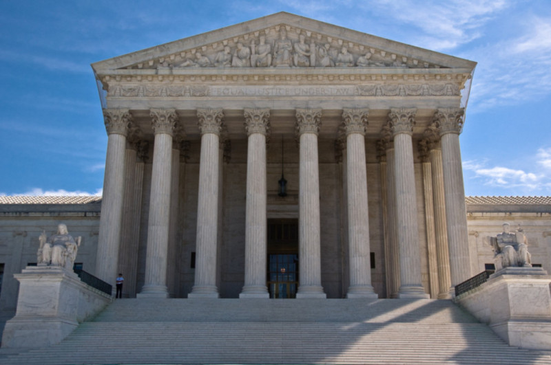
Nov. 8, 2018. The Supreme Court has denied yet another request by the federal government to dismiss Juliana v. United States, bringing the landmark climate case one step closer to a trial.

The trial was scheduled to begin on Oct. 29 in Eugene, OR, but a last-minute motion filed by the Trump administration on Oct. 18 sought to derail these plans. And it seemed to have worked, as Chief Justice Roberts granted the government a stay the following day and put a hold on the scheduling of the trial. But, for the federal government, that relief was only temporary. A court order released two weeks later, on Nov. 2, vacates Justice Robert’s Oct. 19 order and denies the government’s request for a dismissal, although it does maintain that “adequate relief may be available in the United States Court of Appeals for the Ninth Circuit.”

The lawsuit that pits 21 young Americans against the federal government was originally filed in 2015 in the Oregon U.S. District Court. It is founded on the notion that the government violated public trusts rights by promoting policies that harm the environment and fail to address climate change. Initially filed against then-President Barack Obama, a 2016 amendment names President Donald Trump as the lead defendant. Represented by Our Children’s Trust, along with Earth Guardians and Dr. James Hansen, the 21 plaintiffs are between 13 and 22 years of age, and they come from all over the country. 11 of them live in Oregon.

Since then, the case dubbed by some as “the trial of the century” has seen its fair share of hemming and hawing. The U.S. Dept. of Justice first requested a flat-out dismissal during pre-trial hearings in March of 2016, arguing that the courts were not the proper venue to settle such an issue, and that the constitution mentions neither pollution nor the government’s responsibility to regulate it. This request was denied in November of that year in a monumental decision written by Oregon District Court Judge Ann Aiken. In the decision, Aiken writes that a healthy climate is a fundamental constitutional right, and she acknowledges that “air, running water, the sea, and consequently the seashore” are public trust assets that the trustee—in this case the federal government—has a duty to protect.

Aiken’s groundbreaking decision paved the way for a District Court trial date to be set for Feb. 5, 2018, but the issue was taken up by the U.S. Court of Appeals for the Ninth Circuit in November of 2017 at the request of the Trump administration. As a result, the trial was rescheduled for Oct. 29, 2018.

Since then, the administration has made repeated attempts to either delay the trial or have it dismissed. Two of these motions were denied by Judge Aiken in October of this year, just two weeks before the trial was slated to begin. And by denying the government’s most recent request on Nov. 2, the Supreme Court has offered up a resounding “no” to the federal government’s pleading.

A new trial date has not yet been set, however, and the Trump administration has already filed a new set of appeals with both the U.S. District Court and the Ninth Circuit. So, for now, the fate of Juliana v. United States seems to be up in the air. And while the federal government continues to encourage resource extraction, support fossil fuel production and evasively tune out the voices of America’s youth, that air will continue to get dirtier and dirtier. The evidence is piling up, kids.

By |2019-02-27T14:34:56-08:0011/08/2018|Climate Change, News, Old Articles|1 Comment

A Tribute to Wild and Scenic Rivers: The Deschutes, Part 2

“The charm of fishing is that it is the pursuit of what is elusive but attainable, a perpetual series of occasions for hope.” – John Buchan

By Dac Collins. Nov. 1, 2018. Hope is a motivational force. It is the definitive mindset of the fisherman. Without it, the motion of casting and swinging a fly across a piece of water is no different than kicking up sand in the desert. And on a broad, alluring river like the Deschutes, where science and reason dictate that trying to actually hook a steelhead is an exercise in futility, hope is the only thing that will actually keep you fishing.

Photo by Emily DeCarlo. The author swings a fly on the Lower Deschutes.

And this early in the morning, with the canyon still cloaked in semi-darkness and over 20 miles of fishable water below me, staying hopeful is easy. Even though I’m already halfway down a run that should hold fish, and the last 30 to 40 swings have brought nothing but cold hands, I’m able to look at that midstream boulder below me and picture a fish on either side of it.

So I take a few steps down and send the fly across the run. It lands with a light splash on the water’s surface and a surge of nervous confidence runs up the line, down the rod and into the bones of my hand. I mend once and can feel my offering getting deeper for a few seconds. Then the line tightens as the fly starts its broadside dance across the current. By watching the tip of my line—the fly itself hidden from view—I can tell that it is about to pass within a foot of the boulder. With this realization my guts tighten and my vision narrows. The world as I see it condenses to a square foot of water. The expectation builds as my line straightens out beneath me and I imagine the take. Wait for it. Then…nothing. The small black fly just hangs there, and for a fleeting moment in my mind’s eye it transforms from a dancing, seductive creature to a lifeless hunk of feathers and fur. So I cast it out again, aiming for the far side of the boulder this time and erasing that brief moment of hopelessness from my memory.

Thirty minutes later I get to the bottom of the run. I reel up and walk back to the boat, where the passengers eye me with discontent. I can tell they are both cold, and that they’re wondering why we’re on the water this early in the morning. I can’t blame them. Even the swallows are still cooped up in their adobe huts, waiting for the sun to hit the water before venturing out for breakfast.

Back in motion, I push forward on the oars, heading toward the left bank where the sun’s warmth is starting to spill over canyon walls and onto the river’s surface. Holding us in this exquisite spot, my hands thawing out on the oar grips, I offer up a plan: “There’s an island just around the corner…should be in the sun right now. What do you say we stop there for a little while?”

“About time,” she says. “Pretty sure my toes are frozen.”

Looking around, Emily and I recognize exactly where we are. We floated this same stretch of river a year ago to the day, but something feels different. The river itself looks familiar, its horseshoe bends and Volvo-sized boulders in precisely the same spots as the year before and the years before that, but the canyon that contains it all seems changed. Blackened.

Blackened because 2018 was the worst fire year in recent memory for the Lower Deschutes. Between June and September of this year, three significant wildfires rolled through the Wild and Scenic river canyon.

Photo by Emily DeCarlo. While some healthy trees remain standing in the lower 20 miles of river, most of the vegetation along the riparian corridor and on the surrounding hillsides was thoroughly torched over the summer.


Jeff Kitchens, who works as Field Manager for the BLM’s Prineville District, describes this year’s fire season as unprecedented.

“Judging from the comments I received,” Kitchens says, “people who have been actively recreating and living around that river for the last half-century haven’t seen a year like this before, where we had that much of the river corridor burned in a single year.”

“I mean we have a very frequent fire return interval because of the grasses,” Kitchens continues, “so we do on average see one large fire in the river corridor annually. But we had very large portions of our river corridor burned consecutively, one after the other, so that by the end of this calendar year we saw large portions of all four segments of the Lower Deschutes burn, whether on one or both sides of the river.”

First there was the Boxcar fire, which was reported on June 21 after a lightning storm passed through the area. It started less than a mile upstream from Maupin and, after merging with the South Junction fire (another lightning-caused fire), it spread into the river canyon and over thousands of acres of grass and farm land above the canyon. No lives or serious structures were lost, however, and the fire was declared 85% contained by June 28.

Just three weeks later, on July 17, another fire started on private land southeast of The Dalles. Known as the Substation fire, it was human-caused, although the official cause is still under investigation.

Fueled by wicked summer winds, Substation grew out of control in a hurry. Within the course of a few days, it had run through more than 18 miles of sagebrush, grasslands and wheat fields, jumping the river from Wasco to Sherman county (two of the largest wheat producing counties in the Northwest). On July 18, just a day after it began, Oregon Governor Kate Brown declared the fire a national emergency and troops were called in from the National Guard. By that point it was already considered the number one priority fire in the nation.

Photo by Lincoln Graves, courtesy of KATU. Taken on July 22, an aerial photograph of the Lower Deschutes Canyon and its confluence with the Columbia shows the scope and severity of the Substation fire.

It was on that same day that 64-year old John Ruby died fighting the fire. Finding himself unable to choose between sitting idly by or following evacuation orders while the blaze approached his neighbor’s wheat field, Ruby attempted to cut a fire line with his tractor. He was found lying next to his scorched tractor around 2pm that afternoon.

By July 21 the winds had slackened, allowing crews to make progress containing the fire by pushing it into the river canyon and away from the communities above. And by the evening of the following day, the Substation fire was 92% contained.

But for residents of Wasco and Sherman counties, the end of fire season was still not in sight. On July 26th, while crews were still working to fully contain the Substation fire, a piece of farming equipment ignited near Dufur, starting the Long Hollow fire immediately to the south of the Substation fire. Although it only burned an area half the size of the Substation fire, it took out all of the buildings at the historic Harris Canyon Ranch, including the iconic Harris Canyon water tower, which has been a familiar landmark along the lower river since 1912.

Other structures that were destroyed during the Substation and Long Hollow fires include a couple of composting outhouses and the last surviving boxcar on the east bank.

Many of the public recreation sites that access the river along segments 3 and 4 were closed for days at a time while the Substation and Long Hollow fires passed through. And since July and August are peak months for recreating on the Lower Deschutes, rafting outfitters and other small businesses based in river communities like Maupin felt the effects of these closures.

“It was tense and a little scary for a couple weeks there,” says Kate Wallace, who, along with her husband Andy Kreipe, owns Deschutes River Adventures in Maupin.

According to Wallace, it was still a good summer for their raft rental and guiding operation, especially since the Boxcar fire that affected the popular day stretch above town was contained before rafting season really kicked off. But she says they did see a significant dip in people using the lower segments of river (3 and 4) later in the summer.

Photo courtesy of BLM. A map of the Lower Deschutes shows the river divided into four segments. While all four burned this summer, segments 3 and 4 were impacted most severely.  

“The attention that the fires got in the media maybe scared people more than it should have,” Wallace says, explaining that she and her husband were responding to phone calls about the fires long after they had been put out. Even after the smoke cleared, she says, many people were afraid to go down into segments 3 and 4 and “it was just sad to see nobody using that stretch, and to see permits still available on weekends, which is usually not the case down there.”

“[But] to be very honest,” Kitchens says, “I am glad that we closed those access points in conjunction with law enforcement when we did. I think that those that had the foresight to shut down access when Substation occurred saved lives. You look at the intensity of the fire that rolled through there, and not allowing people down in there was the right choice.”

Kitchens also points out that of the more than 350,000 acres that burned in Sherman and Wasco counties this summer, a significant chunk of that was private land.

“For all the benefits that these fires may have to the ecosystem,” Kitchens says, “we cannot forget the thousands of acres of private land and crops that were lost. You think about the number of days that fire threatened communities over and over again, whether it was Maupin or Grass Valley or Dufur…it really took a toll on those communities, and it’s important to remember that.”


Floating through this surreal landscape, we can’t help but imagine what it must have looked like in late July. In places it appears the flames roared all the way down to the river’s edge, torching the willows and alders that line the bank. Emily’s camera snapping all the while, we picture century-old junipers in flames, their trunks splitting open to expose veins of crackling, boiling sap. Deer must have fled into the steeper side canyons, we reckon, while the sheep sought protection on sheer, rocky cliff sides and resident birds flew north to the Columbia. The fish alone were safe from the devastation, finding sanctuary in the cool depths of the river.

Photos by Emily DeCarlo. Taken from slightly different angles, these photos show the same hillside as it looked on Sept. 2, 2017 (left) and Sept. 2, 2018 (right). 

The lack of people on the river adds an element of desolation to our surroundings. Labor Day weekend should be peak season, but aside from a handful of diehard steelheaders and a few rafts, there’s hardly anyone down here. To put things in perspective, we barely managed to secure boaters passes for these dates last year, snatching up the last two available out of the 214 that the BLM gives out each day from May 15-Oct. 15. This year, there were still nearly 200 passes available as of Aug. 31.

Staying close to the bank, we drift by some of the more popular campsites. One looks more like a neglected fireplace than a spot to set up camp for the night. Coal-black skeletons of torched hardwoods remain in place, their canopies the color of an eternal fall and their lifeless roots covered with a thick coating of ash. Every now and again a gust of wind kicks up a grey cloud of dusty cinders.

Then something catches Emily’s eye. “Look over there!” she shouts, pulling the camera away from her face. I follow her pointer finger to an opening in the charred trees and its obvious enough what she’s looking at. New growth. The more we look the more we see, bold and vibrant against the burnt backdrop. Some shoots are already over a foot tall, reminding us how wholly alive this canyon still is and giving us a preview of what all of this will look like come Spring.

Photo by Emily DeCarlo. New growth sprouts up through the ashes.

Revitalized and delighted by the sight of green grass, we push down around the bend to anchor up at the island I had mentioned. Protected from the unruly blaze by a wide channel on either side, there are still plenty of healthy trees to hang a hammock from. And after eating a quick lunch of hot and spicy noodles, that’s exactly what we do.

Long overdue for a nap, Emily hops into the hammock to get some rest while I grab my rod from the back of the boat. The dog follows me, knowing exactly where I am headed and why I stopped here in the first place: there’s a good-looking run on the other side that just might hold a steelhead.

A Tribute to Wild and Scenic Rivers: The Deschutes, Part 1

“No man ever steps into the same river twice, for it’s not the same river and he’s not the same man.” – Heraclitus

Photo by Emily DeCarlo

By Dac Collins. Oct. 11, 2018. We launched on the brighter side of dawn. A lift of the bow and a firm push sent the dusty aluminum boat sliding off the trailer with a racket that offended a pair of mergansers on the far bank. The winch squealed against the weight as it slowed the slick bottom’s progress over the roller, then THWAP! The echo of the stern hitting the water bounded from one canyon wall to the next, chasing the ducks in their harried flight downstream.

(Try as we may to meet the morning’s grace with a peaceful and quiet demeanor, we humans have a way of making our presence known.)

I pulled the boat into shin-deep water before dropping the anchor and walking idly toward the gear pile. Looking down as I walked, I avoided the roundest rocks and focused on the sloshing sound my calves made in the shallow water. Its surface reflected more light with each passing second. In a few hours it would be a mirror.

Looking up, the size of the pile struck me. How long were we going to be out? Two days? I threw a dry bag over my shoulder, grabbed the cooler with both hands and, back bent, carried the load to the boat.

I recognized the sound of squeaky rubber boots on the pavement before she made her voice heard. “Where’s Willow’s food? We brought it, right?” With that, the dog trotting alongside her stopped suddenly. She looked at me, ears raised, clearly understanding the gravity of the question.

“It’s under the seat with the tarps and propane bottles,” I said, pulling the boat closer so the two of them could hop in.

“Oh!” She smiled. The dog dropped her ears, breathing easier now. Above them, the eastern skies blushed faintly. The stars had all but winked themselves out.

“The truck is locked and keys are in the spot,” she said as she dropped a leg over the side of the boat. Her other foot pushed off the bank and she turned around to take a seat as the dog jumped in behind her. “Just look at the sky! Let’s go!”

“Okay,” I said. “All systems go. If we don’t have it we won’t need it.”

In my head, I rattled through a disjointed list of “essentials”: socks, water jug, tent stakes, wine cups, chocolate, flies, first aid-kit. Then I hopped onto the rower’s seat, gave the oars a push and found myself pleasantly aware of our place in the world. Adrift.


A week before we launched at Mack’s Canyon and left the dead-end gravel road behind, I drove down to Maupin determined to learn more about the Lower Deschutes River.

Like all rivers, the Deschutes gives up her secrets infrequently and in small doses. So in order to claim with any confidence that you “know” any given river—and especially a big, brawling river like the Deschutes—you must devote a significant portion of your life to greeting it in all its lights, moods and seasons. After years of this learned devotion, patterns emerge. A language begins to develop. And although you know deep down that the only constant feature of a river is the notion that it is constantly changing, you just might start to understand why some of those changes occur.  

So, seeking knowledge, I went to see two people who knew the lower Deschutes.


 I met up with John Hazel and his wife Amy at their fly shop, the Deschutes Angler. Along with a grocery store, a bar, a mechanic and a couple of raft outfitters, the shop is one of the few enterprises along Maupin’s Main Street and, depending on the season and time of day, it can be one of the busiest.

“Well, when I was young it’d be 275 days a year,” John told me from behind his desk, referring to his time spent on the Lower Deschutes when he started his guiding career in the late ’70’s. “Now that I’m old it’s, you know, 60.”

In that span of forty years, the grey-bearded steelhead guide has witnessed plenty of change on the 100 miles of river below Lake Billy Chinook. As fly fishing’s popularity grew over the decades, the Lower Deschutes attained fabled status. Fish tales featuring dense clouds of salmonflies and bright summer steelhead began to circulate, and anglers started pouring in from every corner of the country. They still do.

To protect the resource, managing agencies like Oregon Department of Fish and Wildlife (ODFW), Bureau of Land Management (BLM) and Oregon Parks Department began regulating the river. They outlawed bait and banned fishing from boats. They increased the production of hatchery steelhead and chinook at the Oak Springs Hatchery. They created an online permit system. They built composting toilets at some of the popular campsites and forbid the killing of wild steelhead.

Meanwhile, Hazel’s understanding of and relationship with his home water only deepened. Then, about ten years ago, when the Pelton Round Butte Hydroelectric Project reached its fiftieth year in operation, he began to notice a drastic change. More of a transformation, really.

The Wild and Scenic Lower Deschutes flows north out of the Pelton Round Butte Hydroelectric Complex, which forms Lake Billy Chinook. From here, the river flows freely for 100 miles before joining the Columbia. Photo courtesy of PGE

In 2008, Portland General Electric (PGE) was required to reapply for a contract with the Federal Energy Regulatory Commission (FERC) in order to continue operating its dam that, upon being built, blocked access to nearly 200 miles of sockeye, steelhead and chinook habitat. As part of that re-application process, PGE was required to mitigate these losses. So the utility came up with a plan to reintroduce these species above the dam and restore their runs to sustainable numbers. They started collecting fish from the river and transporting them above the dam with trucks. The problem remained, however, of getting the next generation of salmonids below the Pelton Round Butte Hydroelectric Complex and on their way to the Pacific.

Enter the Selective Withdrawal Tower

The idea behind the selective withdrawal tower was that if PGE could engineer a tower above the dam that would allow warmer water to spill from the top of Lake Billy Chinook instead of the bottom—as dams usually do—they could create enough current in the reservoir to pull juvenile salmonids in the right direction. Those fish could then be loaded up and trucked below the dam, where they could begin their migration to the Pacific Ocean in earnest.

So PGE’s staff of engineers and scientists collaborated with a diverse group of stakeholders— including the Confederated Tribes of Warm Springs, ODFW, the Native Fish Society and American Rivers—and formed a strategy to restore wild salmon and steelhead to the upper Deschutes Basin, and to re-establish a natural flow regime in the lower river. They touted scientific models showing that wild runs could be reintroduced to tributary streams like the Metolius and Crooked Rivers, and in 2010, they finished building the intake tower that is still in operation today.

100 miles upstream of the river’s confluence with the Columbia, a bird’s eye view of the Pelton re-regulating dam shows the selective withdrawal tower and collection facility (at bottom right), where juvenile salmon and steelhead are loaded up in trucks to be transported below the dam. Photo courtesy of Northwest Power and Conservation Council   

But it was “not even close to what they initially thought,” John says, referring to how the reality of fish passage (for both adults and juveniles) through the Pelton Round Butte Complex compared to PGE’s models.

PGE spokesman Steve Corson admits that the project hasn’t been an overnight success, but he also maintains that the project is “by definition a long-term effort.”

“These runs were cut off a half-century ago,” Corson explains. “And realistically, we’re only a couple generations of fish into the process of bringing them back. We fully appreciate the fact that we’re a long way from having the kind of sustainable, harvestable runs that are our goal, and we fully expect it to take many years to get there.”

Emphasizing their commitment to “a collaborative approach to managing fisheries and water quality on the river,” Corson explains that the utility and the Confederated Tribes of Warm Springs, who co-own the hydroelectric project, are constantly seeking ways to improve fish passage at the project using adaptive management strategies. By hosting a monthly round table discussion with the Pelton Round Butte Fish Committee, PGE and the Tribes receive feedback from a variety of voices about how the project should proceed. One example of this adaptive management strategy relates to when the withdrawal tower is in operation.

“Power generation needs at the hydroelectric project have historically required passing more water through the turbines in day-time hours, but since flow through the selective water withdrawal systems is what attracts juvenile fish for downstream migration—and fish like to move at night—we found that the system wasn’t attracting fish as efficiently as we’d expected. So a couple of cycles ago we ran a pilot project to test night generation,” Corson says. “We found that it helped, so this year we began prioritizing night time flow during peak migration periods.”

Whether or not these pilot projects and other adaptive management strategies seem to be working depends on what data you look at, and on which year that data was taken. Since anadromous fish face a growing number of adverse pressures, from worsening ocean conditions and shrinking mountain snowpack to the hydroelectric gauntlet known as the Columbia River, runs can vary drastically from year to year. Likewise, the complex life cycle of salmonids makes it difficult to ascertain which of these pressures is most detrimental to the fish.   

Corson points to “strong indicators that we’re headed in the right direction, such as the record-setting 463 returning adult sockeye we passed upstream in 2016 and the roughly 450,000 smolts we passed downstream in 2017.” 

These promising returns were recorded long after the water quality of the Lower Deschutes began to change, however. By 2011, within a year of the tower’s installation, the effects of the lower river being fed by warmer water from Lake Billy Chinook’s surface instead of the cold, highly oxygenated water from the bottom of the reservoir were noticed almost immediately.      

“All of the sudden, fishermen were scratching their heads, going, ‘What the heck happened? Where are all the caddis?’” Amy says. “You used to have a lantern full of caddis at your camp, and then there’s practically none. It was significant and it was noticeable.” 

“Those were the first signs,” John adds. “The insects were completely different; the hatch timing was completely off. Then we noticed that the bird populations were changing.”

Biologists believe that these black spots are an indication of ecological changes in the lower river. Photo by Nick Wheeler, courtesy of DRA   

And if those clues were disconcerting, the black spots that started appearing on the fish during the summer of 2012 were devastating. The result of parasitic flatworms burrowing into the skin of the trout, the prevalence of the disease became an unsightly reminder of how quickly things had changed.

“I was literally in a state of depression,” Amy says, “rowing past all these places where I could pull up and I knew there would be a fish there…and they [weren’t] there anymore.”

So the Hazels organized a coalition of concerned long-time Lower Deschutes anglers—some of them scientists and lawyers—to form the Deschutes River Alliance in 2013. Their goal was to create a science-based non-profit organization focused on the health and well-being of the Lower Deschutes. The DRA took PGE to court, suing the utility company for numerous violations of the Clean Water Act. They conducted their own in-depth study looking at how nutrient loads, flow regimes and water temperatures have changed since the selective withdrawal tower’s inception. They created the only thermal imaging of the entire Lower Deschutes and claimed they had proof of what they had already figured (and feared): that these negative changes in the lower river were directly correlated to the selective withdrawal tower.

“Years later, the story unfolds in court,” John says. “and Judge Michael Simon ruled for PGE. Because he’s really excited about getting wild steelhead and salmon above the [dam]. That’s his goal. And I think it’s the goal of most of the people that hold steelhead and salmon close to their heart here in the Pacific Northwest. I mean who wouldn’t support the reintroduction of sockeye, chinook and steelhead above the project? We’re all in. That’s fantastic. But the real problem here is what it has done to the water quality in the lower 100 miles. The whole ecosystem has seen a very sizable negative impact on the water quality since 2009-2010 when they started the withdrawal…So if there wasn’t any impact downstream, I guess this would be a non-issue.”

The issue remains, however, and the debate over the Lower Deschutes and its fish has only grown more contentious since Judge Simon’s recent decision. The DRA will continue to fight for the cleanest, coldest water possible in the 100 miles of river below Lake Billy Chinook, while the utility company, for its part, will continue to invest its time and energy into getting salmonids above the reservoir.

On the surface it seems like a bitter fight between two opposing forces, but the underlying irony is that both sides are in it for the fish.


Still blocked from the sun by vertical canyon walls, the three of us drifted downstream and out of sight of the boat ramp. Up in the bow, one passenger pulled down her hood before jamming her balled fists deep into her jacket pockets. The other sniffed inquisitively at the chilly September air. None of us paid any attention to the strung-up fly rod sticking out the back of the boat, but I knew it was there. For I came to the river that morning searching for steelhead, and I was full of hope. 

Photo by Emily DeCarlo


The Last Place for a Mine

USFS green-lights exploratory mining in the upper Green River valley

By Dac Collins. July 19, 2018.  Among the freshwater gems that drain the western slopes of the Cascades, southwest Washington’s Green River is the coveted emerald. The remote upper section of river, located within the Gifford Pinchot National Forest, is a state-designated gene bank for endangered wild steelhead, while its lower reaches provide clean drinking water for residents of the Cowlitz Valley.


Green River Valley. Photo: Trip Jennings/Balance Media

But a coalition of environmental organizations say the Green is also one of the Pacific Northwest’s most endangered watersheds due to the U.S. Forest Service’s recent decision to allow a Canadian prospecting company to conduct exploratory hard-rock mining near its headwaters.

The headwaters of the Green lie just to the northeast and outside of Mt. St. Helens National Volcanic Monument in a steep, remote and incredibly lush valley. And because of its location within the northern fringes of the 1980 ‘blast zone’, the river snakes westward through a geologically unique and relatively newborn ecosystem. Still the focus of numerous research projects, the nearly 230 square-mile area known as the blast zone encompasses regenerating blown-down forests, remnants of old-growth stands and windswept pumice plains peppered with wildflowers. It features drainages that were scoured by violent mudslides, supports herds of elk and other wildlife, and represents some of the best true wilderness recreation opportunities in Washington’s South Cascades. The entire region is a fascinating study in the resiliency of the natural world.

The Green is also considered a stronghold for anadromous fish. A major tributary of the Cowlitz River, which consistently ranks as one of Washington’s top producing steelhead streams, the pristine upper reaches of the Green River make up some of the best spawning habitat in the entire Lower Columbia River Basin. In 2014, the state designated the river a “Wild Steelhead Gene Bank” for both summer- and winter-run fish, which ensures that all hatchery fish are excluded from this extremely sensitive and unique riparian sanctuary.

So it comes as no surprise that thousands of Northwesterners—including a handful of federal politicians and over 20 conservation groups—see the prospect of industrial hard-rock mining around the Green’s headwaters as an immediate and intolerable threat.

Background
While the history of mining in the upper Green River watershed dates back to a brief but unproductive gold rush at the turn of the 20th century, recent efforts to extract gold, copper and molybdenum from the area represent their own convoluted chapter in the region’s history.

In 1969, the Duval Corporation purchased mining rights to the Green River valley (also known as the Mount Margaret) deposits and proceeded to drill 150 core samples over the course of the following decade. Mining prospects were drastically altered by the 1980 eruption. The creation of the 110,000-acre national volcanic monument required a number of land swaps. And the Duval Corp. sold its claims. The Green River watershed was not included as part of the national monument. But the U.S. Forest Service purchased the land surrounding it in 1986 with money from the Land and Water Conservation Fund—a fund created with the intent of preserving public lands with high conservation and recreation values for future generations to enjoy.

To further complicate things, the Forest Service was given ownership of the land itself, while the mineral rights were given to the Bureau of Land Management. This means that anyone wanting to mine in the area had to receive express permission from both federal agencies.

There was only one attempt made to mine in the area during the next 18 years, and that permit application was turned down by the Bureau of Land Management in 1993. The next attempt came in 2004, when Idaho-based General Moly Inc. acquired a 50 percent stake in the Mount Margaret deposits and applied for a mining lease. This attempt also failed after the Cascade Forest Conservancy, a local conservation group rallied the support of over 30,000 nearby residents from Kelso, Longview and Castle Rock during the public comment period of the agency’s environmental assessment.

After a contentious four years, the BLM denied the permit.

Industrial mining interests kept an eye on the Mount Margaret mineral deposits, however, and in 2010, two years after it was denied a permit by the BLM, General Moly Inc. sold its mining rights to Ascot Resources, Ltd.

The Canadian prospecting company submitted a drilling plan within months, one that was quickly approved by the USFS. The Canadian company had begun extracting core samples by August of 2011, but an injunction filed by the Cascade Forest Conservancy halted the exploratory drilling.

Ascot submitted another permit application in late 2011, one that was likewise approved by both the USFS and the BLM, and then subsequently halted when the Cascade Forest Conservancy convinced federal courts to invalidate the permit in 2014. But the Canadian company began writing another application in early 2015.

Here we can fast-forward to earlier this year, when the Cowlitz Valley Ranger District announced in February that it found no significant impacts during its environmental assessment of Ascot’s drilling plan. It gave consent to the BLM to issue prospecting permits.

What’s at stake?
If the BLM follows suit and grants drilling permits to Ascot, exploratory mining activities will take place on roughly 900 acres of public lands in the upper Green River valley. The Canadian company will be allowed to drill 63 holes from 21 drill pads in order to locate deposits of copper, gold and molybdenum; some located less than 200 feet from Green River tributaries and approximately 400 feet from the river itself.

Vice President of Ascot Resources Kristina Howe maintains that exploratory drilling can be (and has been) done in a safe and environmentally conscious manner. “Ascot and its predecessors have conducted exploratory drilling in the area for many years without incident as we seek to map the mineral resource. Environmental protection is a top priority for us.”

Opponents, however, view the location of a mine as potentially catastrophic and unsustainable, since it is possible that Ascot would extract the minerals by constructing an open-pit mine. Opponents argue that the industrial-scale mine would not only destroy most of Goat Mountain, but it would severely jeopardize the drinking water of the thousands of people living in the Cowlitz valley downstream.

The tailing ponds that are synonymous with open-pit mines and act as giant waste deposits for sludge containing heavy metals (such as copper, lead, cyanide, cadmium, mercury and arsenic) are also notorious for failing and leaking into nearby streams. And the likelihood of these tailing ponds failing, they argue, is increased exponentially by the fact that the Green River lies in one of the most seismically active areas in the Northwest within sight of an active volcano that experts agree will erupt again at some point in the future. When (and not if) that happens, the earthen dams holding back the toxic sludge would be almost guaranteed to fail.      

Because of the disastrous environmental consequences that a mine like this one portends, the Cascade Forest Conservancy (CFC) says it will continue to fight Ascot through litigation and with the help of a coalition of over 20 partners including American Rivers, Backcountry Horsemen of Washington, Washington Wild, Washington Trails Association, the Wild Steelhead Coalition and the Clark-Skamania Flyfishers. These organizations represent the vast significant number of individuals who recreate on public lands and have a stake in their conservation and protection.

“Tens of thousands of people have expressed opposition to this proposal due to its impacts on recreation, clean water, and native fish, in and around one of our most treasured National Monuments,” wrote CFC’s executive director Matt Little in a February press release. “Allowing mining activities in a pristine river valley alongside an active volcano is simply ludicrous. We will do all we can to stop it.”

David Moryc, Director of Wild and Scenic Rivers for American Rivers, echoed Little’s sentiments, saying that “as a wild steelhead sanctuary, and as a source of clean drinking water for downstream communities, the Green River, a [potential] Wild and Scenic River is the last place for a mine. The Forest Service should not be green-lighting mining on our public lands that were purchased explicitly for conservation and recreation purposes.”

Photo: Steve Balance Media

The U.S. Forest Service, on the other hand, contends that it is allowing prospecting and not mining, which the agency views as an important distinction. In a thorough, 34-page “Decision Notice & Finding of No Significant Impact” that was written back in January, Cowlitz Valley District Ranger Gar Abbas further explains that distinction.

“My consent decision to the BLM facilitates only prospecting (exploration) activities within the prospecting permit areas. It is not a mineral leasing or development (mining) proposal,” Abbas writes.

“It has become clear there is a great deal of concern that this decision somehow makes the potential for future approval of a new mine in this area easier or more likely. This consent decision is not for a mineral lease or mining; it is specific to issuance of prospecting permits that would convey rights to the holder to conduct exploration operations subject to terms and conditions of the prospecting permits…any subsequent application for a lease of the Federal mineral estates would be subject to a separate National Environmental Policy Act (NEPA) analysis and public comment process, to be evaluated on its own merits, and would require a separate decision in which the Secretary of Agriculture, through the Forest Service, would deny or consent to leasing.”

Ascot’s Howe agrees with District Ranger Abbas when he says that it is a little too early to be worrying about the potential impacts of an open-pit mine that might not even be worth digging. After all, she says, the prospecting company has not yet determined if there is sufficient gold, copper and molybdenum in the area to make the project economically viable.

Neither Howe’s nor the District Ranger’s explanations are enough to ease the minds of concerned parties, however, who are quick to point out the risks of prospecting activities in such a location. They claim that any amount of exploratory drilling would damage the scenic integrity of the land because the noise and the presence of roads and machinery would take away from the solitude and the backcountry experience that such a remote location provides. They also point out that the drilling activities would mostly occur during the summer and fall, which coincides with peak recreation times for humans in the area as well as with breeding times for species such as elk and blacktail deer.

And from an underwater perspective, Steve Jones of the Clark-Skamania Flyfishers is quick to point out the inherent danger of copper and other metals leaching into the Green River. “Copper is a particular threat to steelhead and salmon,” he says. “Test drilling alone is likely to increase concentrations of dissolved copper entering the Green, and even brief spikes in the copper content of surface water interferes with the ability of steelhead and salmon to find habitat and spawn successfully.”

What’s next?
Ten years after the CFC first thwarted Ascot’s attempts at exploratory mining in the area, the group finds itself in a similar position arguing on the same basic principles.

“When the Forest Service purchased this land—and there’s a letter that states this—it was intended to preserve the Green River as it flows into the monument, and to preserve the scenic beauty of the Green River Valley,” says CFC’s policy and campaign manager Nicole Budine.

“The Land and Water Conservation Fund is a huge piece of this,” she says, “because typically [the fund] is used to protect areas from mining. Now we have this situation where exploratory drilling for copper, gold and molybdenum is proposed on a piece of land that was purchased with the LWCF fund.”

The Forest Conservancy and other opposition groups worry that permitting any type of mining on LWCF lands will create a precedent, one that could allow other LWCF lands across the country to be opened up to resource extraction.

Howe, for her part, says that the scope of the company’s exploration activity will be “very limited,” and that it will be closely monitored and regulated by the same federal agencies that “carefully considered the potential geologic impacts and determined any impacts would be ‘minor to insignificant.'”

“If there is a significant resource,” Howe says, “then we would need to develop a plan and go through another round of rigorous environmental permitting review. But until we know what resource exists, any talk of what comes next is premature.”             

Now that the Forest Service has given its consent, CFC and its partners must wait for BLM to make its decision. At this point, she says, there is not much the public can do to influence the BLM, “but there is still an option for legislation to be passed which would remove this area from mining and protect it in the long term.”

The option Budine refers to is called a “mineral withdrawal”, and it would essentially take this area out of consideration for mining. “It’s not asking for it to be wilderness, it’s not asking for a high level of protection…it’s just asking for the baseline level of protection that the Forest Service essentially intended for it when they purchased it.”

To Spill or Not to Spill?

Increased spill continues to stir up controversy along Columbia and Snake Rivers

By Dac Collins. May 17, 2018. To spill or not to spill? This Shakespearean question lies at the core of a controversial dispute regarding the increased amount of water currently being spilled over the eight federal dams located on the Lower Snake and Columbia Rivers.

Last April, U.S. District Court Judge Michael Simon ruled that federal dam managers must send more water through the spillways of the dams instead of the turbines this spring. This “increased spill” is meant to aid juvenile salmon in their downstream journey to the Pacific, and it is a ruling that conservation groups, tribal members and fishermen have sought for decades now. Advocates say the increased spill will allow endangered salmon and steelhead smolts to pass more safely over the dams instead of through the turbine blades, and that it will significantly shorten their travel time to the ocean.

In accordance with Judge Simon’s ruling, managers at the Dalles Dam are sending significantly more water over the spillways this spring. (Photo taken on May 12.) Photo by Eric Prado licensed by CC BY-NC 2.0.

Although this is the fourth time that the U.S. District Court has ordered increased spill over the federal dams since 2005, it represents the biggest planned spill to date for the U.S. Army Corps of Engineers. Which is why federal dam managers—along with power companies, irrigators, barge operators and some politicians—are so enthusiastically opposed to Judge Simon’s ruling.

Those same groups appealed the ruling earlier this year, but it was upheld by the Ninth Circuit U.S. Court of Appeals on April 2, and the increased spilling began the following day at Lower Granite, Little Goose, Lower Monumental and Ice Harbor dams on the Lower Snake River. The increased spill over the Columbia River dams (McNary, John Day, The Dalles and Bonneville) began a week later, on April 10.

In the weeks since, opponents to the federal mandate have done everything in their power to reverse the decision and return dam operations to the status quo. 

That’s because, for power companies like Bonneville Power Administration (BPA), the spill is viewed as a tremendous waste of money. Although it is too soon to know the exact figures, BPA estimates that the increased spill could cost them up to $40 million in potential revenue—an amount they say will be passed on to ratepayers as a “spill surcharge.”

The barging industry sees the increased spill as a hazard to navigation (and to their bottomline). Likewise, farmers see the water currently being spilled over the federal dams as lost irrigation potential. Both groups say that the energy lost outweighs the benefit to salmon and steelhead, and they argue that there is no proof that spilling more water over the dams will help improve fish runs in the future. Some claim that the federal mandate will actually have the opposite effect, maintaining that it increases the amount of gases in the water that can harm juvenile fish.

And while political pressure has so far proved inadequate in reversing Judge Simon?s ruling, lawmakers are still trying.

Three weeks ago, Rep. Dan Newhouse (R-Wash.) helped pass legislation through the House that would reaffirm Congressional authority over the Columbia and Snake River dams, and would stop the increased spilling. The bill (H.R. 3144) passed by a vote of 225 to 189, garnering support from Rep. Greg Walden (R-Ore.), who said of the federally mandated increased spill: “River operations that have been guided by years of research by federal agencies, tribes and other cooperators have now been threatened by court order, and Northwest families and our communities will likely pay the price in higher power rates.”

And in early May, Rep. Newhouse came out to visit McNary dam, where energy production has dropped from 1,000 to 275 megawatts, in order to publicly share his views on the increased spill.

“I see wasted water,” Newhouse told the Tri-City Herald. “There are some things we are already experiencin—the lost power generation, lost dollars, lost economic benefit.”


These juvenile coho and chinook, spawned and raised at the Winthrop National Fish Hatchery in Washington, must pass through the four lower Columbia River dams on their 600-mile trip to the ocean. Photo courtesy of the USFWS licensed by CC BY-NC 2.0.

The bill will go to the U.S. Senate next, where its passage remains unsure. At least a few senators are eager to oppose it, including Patty Murray (D-Wash.), who released this statement on April 25, the same day the bill passed the House: “There is an ongoing legal process intended to account for all uses of our critical river system and a court-mandated comprehensive review that everyone can participate in, so I oppose this legislation that would cut off and politicize what should be a robust and transparent process.”

Oregon Governor Kate Brown echoed Murray’s concerns in a letter that she drafted earlier this year, writing that “H.R. 3144 would disrupt the regional efforts to engage in a full, accurate and transparent analysis of salmon and dam management,” and that “Washington Governor Inslee has expressed similar opposition to H.R. 3144.”

As for private stakeholders in the region, the Northwest Sportfishing Industry Association and 139 other related businesses have already signed a letter opposing the bill. The letter states that “the additional spill recently ordered by the court is strongly supported by regional salmon biologists” and points to the above-average returns of chinook in 2015 to prove that spilling more water over the dams can help boost fish returns.   

The increased spill will continue through the middle of June. Until then, or at least until the U.S. Senate makes a decision regarding H.R. 3144, Newhouse and other opponents to the federal mandate can do little besides criticize and complain.

By |2020-11-11T09:42:36-08:0005/17/2018|Old Articles, Snake River Dams|1 Comment

WDFW Plans to Euthanize Diseased Elk in Trout Lake Valley

The Washington Department of Fish and Wildlife (WDFW) is preparing to remove up to 20 elk from the Trout Lake Valley in order to prevent the eastward spread of a crippling hoof disease. This news comes right after the department’s announcement at the end of April that state wildlife managers have found the first evidence of diseased elk on the east side of the Cascade Range.

Up until a month ago, the department viewed treponeme-associated hoof disease (TAHD) as a problem solely affecting herds on the western side of the state—the disease has spread to 11 counties in western Washington over the past decade. But lab results from a deformed hoof that was taken off a dead elk near Trout Lake in early April confirm that the infectious disease has officially made its way east of the Cascades.

This startling realization has led the department to take immediate action. It plans to work with USDA Wildlife Services in order to euthanize any elk in the area that show signs of TAHD. The goal is to prevent the disease from spreading any further into eastern Washington.

According to WDFW hoof disease coordinator Kyle Garrison, “This is the first time the department has tried to stop the advance of the disease by removing affected elk. There’s no guarantee of success, but we believe a rapid response might contain this outbreak given the isolation of Trout Lake and the low prevalence of elk showing symptoms of the disease.”

Garrison says that, after discussions with the public earlier this month, the department has received widespread support for the removal plan. 

Since there is no vaccine to treat or prevent TAHD, state wildlife managers have struggled to contain the communicable disease. To date, outbreaks have been confirmed in Cowlitz, Grays Harbor, King, Lewis, Mason, Pacific, Skagit, Skamania, Thurston, Wahkiakum, Whatcom (and now Klickitat) Counties.

The disease has worked its way across the Columbia as well. Since 2015, the Oregon Department of Fish and Wildlife has confirmed the presence of TAHD in elk populations on both sides of the state.

While WDFW continues to work toward containing the crippling hoof disease, there are a few things the department says everyday citizens can do to help their efforts. Anybody hiking or driving off-road in a known affected area can help minimize the risk of spreading the disease by washing their boots and tires afterward. And if anyone observes an elk with hoof deformities, they should report their observations as soon as possible by visiting this link. Also, WDFW requires hunters to remove the hooves of any elk taken in an affected area and leave them onsite. For the 2017-18 hunting season, this refers to the following Game Management Units: 407, 418, 437, 454, 501-564, 633, 636 and 642-699.

© Copyright 2013-2025 Columbia Insight. All Rights Reserved.

As a 501(c)3 nonprofit organization, all donations to Columbia Insight are tax deductible to the full extent of the law. Our nonprofit federal tax-exempt number is 82-4504894.