Stay Updated Subscribe today for the latest research + reporting about environmental news. Subscribe Now

Stay Updated Subscribe today for the latest research + reporting about environmental news.

Subscribe Now

Chuck Thompson

Chuck Thompson

Chuck Thompson

About Chuck Thompson

Chuck Thompson is editor of Columbia Insight.

BLM blasted for ignoring its own permitting system

A conservation group says more than half of federal grazing permit renewals were OK’d without legally required environmental analysis

Cattle grazing

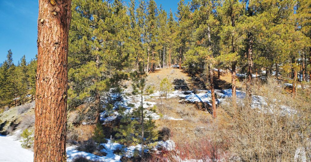
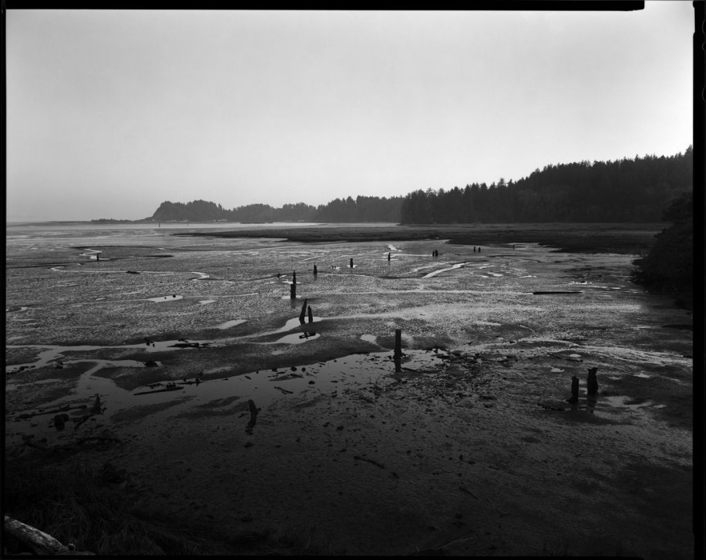
The health of open grazing territory, like this rangeland on the east side of Steens Mountain in Oregon, is under scrutiny. Photo: Greg Shine/BLM

By Jordan Rane, March 31, 2022. The Bureau of Land Management administers nearly 250 million acres, or about a tenth of America’s total land mass. Its efforts to oversee land use for industry, recreation and conservation interests inevitably make it a target for criticism.

The latest beef against the BLM concerns its stewardship—or lack thereof—of 160 million acres of public land in the West allotted for livestock grazing.

As reported by E&E News in late March, a conservation group claims the government agency is “failing to conduct an environmental analysis before renewing many livestock and sheep grazing permits across millions of acres of public lands in the West.”

“There’s clear evidence that the lands under the Bureau of Land Management’s protection are unhealthy due to grazing,” Josh Osher, public policy director of Western Watersheds Project (WWP), told E&E News. “Essentially the BLM has been failing to manage public lands—and has largely failed to comply with the law.”

MORE: Invasive plant species are decimating Oregon’s rangeland

Under the National Environmental Policy Act (NEPA), the BLM is required to conduct a thorough environmental analysis of all public land allocated for livestock grazing before renewing any permit for that purpose.

According to WWP, well over half of the agency’s 10-year grazing permit renewals were granted without any NEPA-based review or land health evaluation.

A giant backlog of renewal cases is at the root of the problem, says the environmental advocacy group, and so is a culture of apathy.

“The bureau’s land managers are just willfully disregarding the law and simply not doing what’s necessary,” Osher told reporters via Zoom.

Cattlemen support BLM position

A 2014 amendment to the Federal Land Policy and Management Act enables the BLM to auto-renew 10-year grazing permits pending completion of reviews to avoid delay.

Conservation groups say the agency has used this time-buying allowance as a loophole to simply shelve reviews indefinitely—while unchecked over-grazing degrades federal lands, wilderness areas and critical habitats of threatened species, such as the greater sage grouse.

Ranchers rangeland

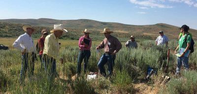
Ranchers take part in a rangeland photo monitoring workshop. Photo: University of Idaho

Other groups disagree with this assessment.

True, backlogs “continue to plague many agencies,” Kaitlynn Glover, executive director of natural resources for the National Cattlemen’s Beef Association and executive director of the Public Lands Council told E&E in an emailed response. “But to say that range conditions aren’t being monitored is blatantly false. Ranchers and grazing permittees engage in regular range monitoring that informs their grazing decisions, and because their ecological data is accurate and timely, they are able to make responsible management decisions in real time.”

That view has been challenged by a recent analysis of BLM data by government watchdog group Public Employees for Environmental Responsibility (PEER).

The group found that 54 million acres of the bureau’s public rangeland don’t meet minimum health standards.

Livestock ranching groups have disputed PEER’s findings as a “wholly unscientific” study based on a “cherry-picked hit map.”

Conservation groups, in turn, point to another federal records study: in 2013, 28% of grazing permits were renewed by the BLM without NEPA reviews. Less than a decade later, that percentage has nearly doubled.

“The bureau has sharply reduced the number of new NEPA analysis for grazing allotments, and is still woefully behind on land health evaluations, as well,” Osher said. “It’s unacceptable and needs to be dealt with as soon as possible.”

As for NEPA analysis and ways grazing-permit renewals in the Columbia River Basin have been handled in recent years, it’s difficult to say.

“Hello and thank you for the opportunity to respond, we have nothing to add at this time,” replied a BLM spokesperson via email to a request for comment from Columbia Insight.

Columbia Insight contributing editor Jordan Rane is an award-winning journalist whose work has appeared in CNN.com, Outside, Men’s Journal and the Los Angeles Times.

Idaho is going all-in on cloud seeding. Here’s why

As drought conditions worsen, the state’s legislature is betting that an old technology will be able to turn some new tricks

Cloud seeding

Wishing on a cloud: Pilots from North Dakota-based Weather Modification, Inc. prepare a cloud-seeding aircraft with seeding flares. Photo: Derek Blestrud/Idaho Power

By Jordan Rane, March 31, 2022. “If you don’t like the weather in Idaho, just wait a minute and it’ll change.” Cue droll rim shot.

That’s the opening line of a four-minute promotional video called Harvesting the Storm produced in 2012 for electric utility Idaho Power.

With images of clouds sailing over sun-splashed mountains and a dated synthesizer score, the video starts off like a 1980s high school science-class film.

Rather than shutting eyes, however, the narrator’s next line opens them: “Only Mother Nature can change the weather—but we can modify it a bit through cloud seeding.”

Stimulating precipitation (snowflakes) by introducing a foreign substance (silver iodide) into clouds to (as Idaho Power’s video benignly puts it) “give Mother Nature a little boost” may sound like the latest advance in humankind’s eternal quest to control its environment. In fact, it’s been going on since the Truman administration.

MORE: So long, skiing? Study says Cascades could have no snowpack in 50 years

More than 50 countries currently have active cloud-seeding programs, according to the World Meteorological Association, coaxing a range of weather modifications from suppressing fog, frost, hail and heat to stimulating rain and snow.

In Idaho and other western states, such as Utah, Colorado and Wyoming, operational winter cloud-seeding programs aimed at amping snowfall (and spring melt) have been active for decades.

But recent state legislation supporting its use means you’ve probably been hearing more about cloud seeding lately than ever before.

With much of the West and practically all of Idaho facing severe drought, cloud seeding is “undergoing a small renaissance,” according to the Washington Post.

Legislative action

Idaho Power operates 26 cloud-seeding generators and serves more than half a million customers in southern Idaho and eastern Oregon. The utility says its cloud-seeding program produces a million acre-feet of water annually, or enough energy to supply nearly 60,000 homes.

Its argument has been convincing in many quarters.

Passed by the Idaho State Legislature and signed into law in 2021, House Bill 266 promotes more cloud-seeding opportunities as a “unique and innovative opportunity to augment and sustain the water resources of the state.”

“Cloud seeding is in the public interest,” states the bill.

Drought, Utah Division of Wildlife Resources

Back on earth: Utah Gov. Spencer Cox said 2021 “could be the worst drought year on record.” Over 90% of the state experienced extreme or exceptional drought. Photo: Utah Division of Wildlife Resources

Although it doesn’t attach funding to cloud-seeding programs, the law does call for the expansion of programs, saying, “State funds may be used or expended on cloud seeding programs.”

The law is the broadest recent example of gathering support for increasing cloud-seeding efforts in the drought-stricken Columbia River Basin.

While it attracts questions about its efficacy (see below, “Does cloud seeding work?”), Idaho’s cloud-seeding “renaissance” appears to be bolstered by new numbers. In a good year, says the Idaho Water Resource Board, cloud-seeded basins have seen water increases as high as 15%.

Programs in other Western states suggest a regional trend. These include a joint effort to install ground-based, cloud-seeding generators in Wyoming-Colorado’s vast North Platte River Basin, where dual cloud-seeding programs have been undertaken over the last two winters by aircraft.

“I definitely think it’s one of those things that we can’t ignore, as far as drought mitigation,” Wyoming’s cloud-seeding program manager Julie Gondzar recently told the Idaho Statesman, while saying that cloud seeding, at its best, increases snowpack over time “slowly and incrementally.”

‘Teaching clouds’ to make snow

Cloud seeding’s origins date to 1946 when scientists discovered that injecting tiny particles of silver iodide into clouds could create additional precipitation.

Clouds that contain large quantities of “super-cooled” water that exist in a liquid state slightly below the freezing point are cold enough to produce snow.

If they don’t, explains Idaho Power’s senior atmospheric scientist Derek Blestrud, it’s because they’re lacking the nuclei to crystallize.

“For a snowflake to happen, crystals have to form around something,” says Blestrud (in the aforementioned video). “Otherwise most winter storms are inefficient, with water vapor transitioning downwind and not producing snowfall on the ground. So we add silver iodide to teach the cloud how to form snow.”

In seeded clouds, the inorganic chemical compound provides nuclei—tiny cores—on which water can condense to form water droplets or ice crystals.

The result: snowfall in as few as 20 minutes after silver iodide is released into the clouds.

How clouds are seeded

How does the silver iodide get into clouds? There are two primary methods.

Idaho Power propels its snow-making agent into the sky in winter and spring from ground-based towers erected in the mountains. 

Idaho Power

Stormbringer: Brandal Glenn of Idaho Power explains how a two-person crew can set up a remote, free-standing cloud-seeding tower in two to three hours. Screen grab: Harvesting the Storm/Idaho Power

The utility also releases flares from small aircraft. These flares send plumes of silver iodide above cloud cover, coaxing additional snowfall over the mountains.

In spring, the boosted snowmelt can irrigate fields and replenish reservoirs behind hydroelectric dams, eventually generating additional megawatt hours of hydropower.

The Idaho Water Resource Board provides funding for state water projects, including Idaho Power’s cloud-seeding programs in the Boise, Wood and Upper Snake River basins.

It’s considering more cloud-seeding projects for the southeastern part of the state.

Is cloud seeding safe?

Safety is one of the first things people ask about cloud seeding.

Scientists and other experts tend to brush aside the concern.

Cloud seeding machine

Pump It Up: Cloud-seeding machine. Photo: DRI Science

“It’s a common misconception that silver iodide is harmful,” says Sarah Tessendorf, a cloud physicist at the National Center for Atmospheric Research in a recent Washington Post article. “Silver iodide occurs naturally and cloud seeding injects amounts smaller than we can detect. … Snow and water sampling shows that silver from cloud seeding is well below other sources like natural mineral dusts and very far below EPA regulations.”

According to Encyclopedia.com, in cloud-seeding operations “only small amounts of silver iodide are released into the atmosphere. That which does fall to earth does not dissolve in water and so is unlikely to enter a community water supply. Tests have shown that the concentration of silver iodide in rainwater is far below the 50 micrograms per liter that has been deemed safe by the U.S. Public Health Service.” 

However, not all scientists agree cloud seeding is harmless.

A 2016 study published by the National Library of Medicine found “cloud seeding may moderately affect biota living in both terrestrial and aquatic ecosystems if cloud seeding is repeatedly applied in a specific area and large amounts of seeding materials accumulate in the environment.”

“The silver ion is among the most toxic of heavy metal ions, particularly to microorganisms and to fish,” according to research first published in 1970 in the journal Water Resources Research. “The ease with which (it) forms insoluble compounds, however, reduces its importance as an environmental contaminant.” 

The National Library of Medicine rates silver iodide as an environmental hazard, calling it “very toxic to aquatic life.”

Does cloud seeding work?

This is where cloud seeding becomes more controversial.

Cloud seeding was developed in the 1940s by an American chemist named Vincent Schaefer while working at the General Electric Research Laboratory in Schenectady, New York.

In his first experiments, Schaefer dropped crushed dry ice from an airplane into cloud formations. He reported success, with rain or snowstorms resulting from this seeding.

Cloud seeding

Work in progress: Silver iodide particles are distributed on clouds through aircraft or from ground-based generators to produce artificial rain. Illustration: Wikimedia Commons

Throughout the rest of the 20th century scientists attempted to validate and improve upon Schaefer’s work, with mixed results. In the late 1970s, the United States invested more than $20 million a year in weather-modification research, but by 2003 it was spending less than $500,000 annually.

In 2003, the National Academy of Sciences issued a report stating that no reliable scientific evidence existed to suggest cloud seeding produced more rain or snow than would naturally occur.

“There is ample evidence that ‘seeding’ a cloud with a chemical agent—such as silver iodide, which could form ice crystals that may fall as rain—can modify the cloud’s development and precipitation,” wrote The National Academies of Sciences in 2003. “However, scientists are still unable to confirm that these induced changes result in verifiable, repeatable changes in rainfall, hail fall and snowfall on the ground.” 

As drought in the West becomes increasingly dire, however, community and state leaders are becoming more desperate for solutions.

Proponents of cloud seeding say the problem isn’t necessarily that cloud seeding doesn’t work. Simply that it’s difficult to prove that it does.

One of the toughest things to divine is how much precipitation a cloud might have dropped naturally prior to being seeded. There’s simply no way to know that.

Tempered optimism

“We’re using new models to evaluate the impact of cloud seeding, and we have observed direct evidence of the pattern of snow produced by cloud seeding—but we still have more questions,” says Tessendorf of the National Center for Atmospheric Research, adding that most statistical programs comparing the amount of precipitation from randomly seeded clouds to unseeded ones have failed to meet statistical significance. “The signal from cloud seeding is often very small and within the range of natural variability.”

“We can add snowpack to equip our reservoirs for a drought and build supply for when we need it,” says Idaho Power’s Blestrud with the same measured optimism, “but we cannot use cloud seeding to fix a drought.”

Get new Columbia Insight stories every week—free here.

The language in Idaho House Bill 266 echoes that mix of optimism and equivocation.

“Data accumulated and analysis undertaken demonstrates that cloud seeding has resulted in an annual increase in water supplies in the basins in which it has been performed,” states the bill. Then comes the caveat: “Additional research and analysis is necessary to determine the precise nature and extent of those increases.”

Don’t like the results of cloud seeding? Wait a few minutes its advocates seem to be saying. Something is bound to change.

Columbia Insight contributing editor Jordan Rane is an award-winning journalist whose work has appeared in CNN.com, Outside, Men’s Journal and the Los Angeles Times.

Appreciate this story? Environmental journalism can’t survive without you. Support Columbia Insight here

By |2022-11-15T18:40:12-08:0003/31/2022|Climate Change, Energy|0 Comments

Lack of snowpack causing anxiety east of Cascades

With water content of snow as much as 26% below average, some farmers warn ‘this could be worse than last year’

Low snowpack

Winter is coming? Bare spots started to show up toward the end of a record-dry February in the Blue Mountains near Baker City, Oregon. Photo: Jayson Jacoby/Baker City Herald

By Jayson Jacoby (Baker City Herald), March 15, 2022. In a county plagued by drought, the phrase “driest February on record” sounds about as pleasant as a fork screeching across a chalkboard.

“Below average snowpack” isn’t exactly melodic, either.

That February was particularly parched might seem implausible considering the soggy piles of slush soaking Baker City, Ore.

But those rapidly melting bergs are largely the products of snow that fell in late December and early January.

Since then—and particularly during February—a persistent high-pressure pattern has shunted away most of the Pacific storms that typically bring precipitation to Northeastern Oregon during winter.

“A bubble, or dome, or whatever you want to call it,” is how Mark Ward, a frustrated Baker Valley farmer, described it.

“All the storms go around us,” Ward said in a phone interview on March 2.

MORE: Less snow is the new norm. That’s trouble for farmers

He was, by coincidence, speaking from Portland, there to attend a meeting of the Oregon Potato Commission, which he chairs.

Ward said rain was sluicing down as he spoke.

“We just can’t seem to get it across the mountains,” he said.

Driest February since 1943

Few of the storms that have pushed inland this winter have maintained much momentum, or brought much moisture, to the bulk of Oregon that lies east of the Cascade Mountains

Icicles

Rocky going: Cold temps persisted throughout February in much of Northeastern Oregon, but snowfall was scarce. Photo: Jayson Jacoby/Baker City Herald

The Baker City Airport’s rain gauge measured a paltry 0.01 of an inch of moisture for February.

And that meager amount—anything less wouldn’t even have qualified as measurable precipitation—came down on the final day of the month.

February is not notable for its deluges, to be sure.

The shortest month is also the third driest at the airport, with an average of 0.62 of an inch.

Only July (0.51) and September (0.57) are more desiccated. August is close behind, with an average of 0.63 of an inch.

But even for a month distinguished by a scarcity of moisture rather than a surfeit, this February stands alone.

The 0.01 total is the least measured at the airport since 1943, when record keeping began there.

The previous record was .10 of an inch, a dubious distinction shared by 1997 and 2006.

2002 was only slightly more moist, with 0.12 of an inch.

‘Concern level high’

The absence of any significant storms also is reflected in the mountain snowpack around Northeastern Oregon—a vital source of water for farms and ranches, fish habitat, recreation and some municipal water supplies.

Although the snowpack increased at most measuring sites, the rises were modest even by February’s standards.

As a result, the snowpack actually lost ground, in terms of percentage of average, during the month—dipping from 6% below average at the start of February to 15% below average at month’s end.

That’s a troubling trend for Ward and other farmers who depend on the snowpack to nourish their crops come summer. Ward’s family grows peppermint, wheat and alfalfa as well as potatoes.

“The concern level is high,” Ward said. “This could be worse than last year. And last year was the worst I’ve ever seen.”

MORE: So long, skiing? Study says Cascades could have no snowpack in 50 years

The snowpack certainly is well beyond where it was one year ago.

At the start of March 2021, the snowpack in Northeastern Oregon was about 29% above average.

But that bountiful snowpack didn’t translate into brimful reservoirs, mainly because the ground was so dry that much of the melting snow soaked into the soil.

If there’s a bright spot in the current situation, Ward said, it’s that widespread rain in the fall of 2021 partially replenished the desiccated soil before the ground froze and the snow fell.

“We’re ahead of where we were last year as far as ground moisture,” he said.

That could lead to more of the snowpack, paltry though it is at this point, trickling into streams and reservoirs compared with 2021.

Snowpack poor across region

The loss was more significant in some areas.

At Bourne, for instance, in the headwaters of the Powder River north of Sumpter, the water content of the snow—a more relevant metric than snow depth, since the moisture content of snow can vary greatly—actually shrank during February, from 9.8 inches (exactly average) to 9.2 inches, which is 26% below average.

Bourne is a bellwether measuring site for estimating the amount of water that will flow into Phillips Reservoir this spring and summer.

That vital source of irrigation water for about 30,000 acres in Baker Valley was depleted during the 2021 drought, more than in any year since it first filled in 1968.

MORE: How a federal program contributed to southern Oregon’s groundwater crisis

As of March 1, the reservoir was holding 2,500 acre-feet of water—just 3% of its capacity. (One acre-foot of water would cover one acre of flat ground to a depth of one foot.)

Elsewhere in the Elkhorn Mountains, the snowpack dropped during February from 5% below average at Anthony Lakes to 11% below average, and from 3% below average at Little Antone to 16% below average.

The decline was much less at Eilertson Meadow, one of the few places where the water content remains above average—12% above, almost identical to the 13% above at the start of February.

In the Wallowas, the water content at Schneider Meadow, which was just 7% below average on Feb. 1, is now 24% below average after growing by slightly less than one inch during the month.

Columbia Insight is publishing this story as part of the AP StoryShare program, which allows newsrooms and publishing partners to republish each other’s stories and photos.

Supporting environmental journalism is critical. Click here to help. 

By |2022-11-15T18:43:24-08:0003/15/2022|Agriculture, Water|0 Comments

‘Slap in the face’: Critics say Biden’s Hanford policies mimic Trump’s

Tribes, others react with anger to a recent federal downgrading of legally mandated cleanup rules on nuclear waste

Hanford closed reactor

Not going away: Around Hanford Site, nine closed nuclear reactors sit on the Columbia River shoreline. Photo: Jurgenhessphotography.com

By Jordan Rane. March 9, 2022. Can the analogy of sweeping dust under the rug—the radioactive kind—be used to describe a proposed cleanup strategy by the federal government at the decommissioned Hanford nuclear site?

Opponents of the Biden administration’s recently released “Assessment of the Department of Energy’s Interpretation of the Definition of High-Level Radioactive Waste” would likely say yes.

That’s a mouthful. Here’s what it means.

Under federal law, high-level radioactive waste must be vitrified—that is, solidified into a stabilized glass product and stored in a deep national repository (that has yet to be established somewhere).

It’s a process that’s extremely time-consuming and expensive.

MORE: Hanford Site cleanup effort hits milestone

The DOE’s latest “Assessment” on how to best dispose of 56 million gallons of liquid waste sitting in 177 underground storage tanks at Hanford would wipe out the automatic “high-level” designation.

Instead, in accordance with a 2019 DOE decision made under the Trump administration, the designation of “high-level” waste will be reinterpreted in way that would exclude waste created by the production of nuclear weapons that took place for decades at the Hanford Site in southwest Washington.

“We continue to maintain the position that the Department of Energy does not have the authority to reinterpret the meaning of high-level waste, much less to reclassify waste on its own,” Mike Faulk, press secretary for Wash. Gov. Jay Inslee, told Bloomberg Law last week.

“It’s a slap in the face,” added Tom Zeilman, counsel for the Yakama Nation, in the same report. “We expected the Biden administration to take a different tack.”

Long-term neglect

If you can get past the title and 21 pages of legalese, the DOE document essentially affirms a Trump administration reinterpretation (or selective downgrading) of what constitutes “high-level radioactive waste.”

In the case of downgraded waste, the agency would, in lieu of the mandated vitrification, opt for sealing it in place or transporting it to another disposal site.

Hanford low activity waste melters

Heat treatment: 30-ton melters at Hanford Site heat low-activity waste into liquid at 2,100 degrees. The waste then flows from melters into canisters. Photo: DOE

“If we just maintain the status quo, and we insist on the plan as it currently exists, we just don’t think we’ll be on the path to success,” said David Reeploeg, executive director of Hanford Communities, an intergovernmental cooperative of the two counties and four cities that are home to nearly 100 percent of Hanford’s work force.

The DOE currently spends $2.7 billion annually for cleanup operations at Hanford, which employs about 8,000 workers.

Hanford Communities largely supports the DOE’s reinterpretation.

“We are very optimistic about this [strategy’s] potential,” Reeploeg told Bloomberg Law.

Legal clashes over Hanford waste classification have been going on for decades.

While the DOE has pledged to work toward a resolution with state and Tribal officials, its current plan could lead to a surge in litigation.

MORE: Environmental justice at Hanford: Reconnecting Indigenous people to their land

“We do not feel that the government at this point is really looking at the long-term consequences of giving the DOE this unlimited discretion,” said Zeilman, counsel for the Yakama Nation, which has historic ties to the vast Hanford area along with other Tribes of the Columbia River Plateau. “They are looking to dispose of waste in place for potentially millions of years.”

War, damage

Plutonium production began at Hanford in 1943. Initially, the plutonium was used to build the atomic bomb dropped by the United States on Nagasaki, Japan, on Aug. 9, 1945, effectively bringing an end to World War II.

After World War II, Hanford shifted to a Cold War footing, eventually occupying 586 square miles. At its peak, nine reactors were creating most of the plutonium used in the U.S. military’s nuclear arsenal.

The last of Hanford’s reactors ceased operation in 1987, leaving behind an unprecedented legacy of environmental pollution that’s earned the grim reputation as the most polluted place in the Western Hemisphere and the United States’ biggest environmental disaster area.

Columbia Insight contributing editor Jordan Rane is an award-winning journalist whose work has appeared in CNN.com, Outside, Men’s Journal and the Los Angeles Times.

Supporting environmental journalism is critical. Click here

By |2022-11-15T18:45:32-08:0003/09/2022|Energy, Waste Management|0 Comments

An old technology produces a new view of Columbia River

Photographer Robbie McClaran spent eight years documenting industrial impacts along the course of the river. Now his work goes on display

The Great River of the West exhibition, 2022

Looking south to Beverly Gap, along a section of the historic Sunset Highway/U.S. Highway 10, near Vantage, Washington. Photo: Robbie McClaran (Original dimensions of this photo have been modified. All other images in this article are reproduced per original dimensions.) 

By Chuck Thompson. February 17, 2022. You don’t take selfies with the kind of camera Robbie McClaran uses. For starters, the thing weighs about 12 pounds.

Well, McClaran doesn’t always use a 1954 Deardorff 8×10 field camera. But the Portland-based photographer remained devoted to it—as well as a 1920s Eastman 2D—over the eight years it took to produce his new photo exhibit.

“The Great River of the West” is a photographic survey of the Columbia River from its source in the Canadian Rockies to its confluence with the Pacific.

“I hoped to produce an exhibit that would not just be a collection of pictures that’d be up on the wall and then go away,” says McClaran, whose work has appeared in The New York Times Magazine, Smithsonian, Vanity Fair, Rolling Stone and Fortune. “The idea all along was to put together a body of work that would exist in the public sphere.”

A commercial and editorial photographer, McClaran’s documentary and fine art work is held in several private and public collections, including the University of Oregon, Portland Art Museum, New Orleans Museum of Art and the Ogden Museum of Southern Art.

The Great River of the West exhibition, 2022

View from the number 13 tee at Riverside Golf Course, Fairmont Hot Springs, British Columbia, approximately 1.5 miles downstream from Columbia Lake. Photo: Robbie McClaran

A collection of more than 60 photos, “The Great River of the West” is currently on display through March 3 at the Buckley Center Gallery at the University of Portland. From there it will travel to the LightBox Photographic Gallery in Astoria, Oregon (April 9-May 2); the Moscow Contemporary, in Moscow, Idaho (June 3-Sept. 10); and the Walters Cultural Arts Center in Hillsboro, Oregon (Oct. 4-Nov. 18).

It’s not just a collection of pretty pictures. The subjects and captions present a unique view of the river’s history, inspiring contemplation and discussion that stretch far beyond the photographer’s lens.

Columbia Insight recently met with McClaran via Zoom to pose questions we had after taking in the show.

Columbia Insight: How is this project different from others that have traced the entire length of the Columbia River?

Robbie McClaran: I had seen projects that celebrated the natural beauty of the river, which is obvious and all around. But they very conspicuously cropped out the human impacts that were around the river.

I wanted each photograph to have some evidence of human impact. But I didn’t want it to be disaster porn. I didn’t want it to be, “Oh look at this horrible pollution thing.” In some of the pictures it looks like this beautiful landscape. Then you look a little closer and it’s, “Oh there’s a railroad track running through there.” Others it’s more obvious.

CI: Did this project change your view of the river?

RM: Oh, yeah. The story of Grand Coulee Dam, for example. It was extolled as this WPA project that began to save the economy and won WWII and all that’s great. But nobody really talks about the fact that it was built without fish ladders and that native salmon are now extinct up above Grand Coulee, which is still a vast stretch of river.

I only discovered just two years ago the Colville Tribe is working on a project to reintroduce salmon above Grand Coulee and doing it by trucking them around the dam. They’ve already seen some successes. That kind of thing is really exciting but also tragic and heartbreaking.

The Great River of the West exhibition, 2022

Looking North from Twin Sisters, Wallula Gap, Washington. Photo: Robbie McClaran

CI: There’s an emphasis on Indigenous history in the accompanying text. You make a point of naming the ancestral Tribal lands in many of the photos.

RM: That was not my initial process, to be honest. It was a process of discovery. Initially, I wanted to go see what’s the source of the Columbia River. Through that and doing research and reading historical accounts … I read the David Thompson journals and several other books. I read the Click Relander book about Native Tribes called Drummers and Dreamers.

The thing I wanted to be very careful about, I’m not a scholar of Native American history. I didn’t feel it was my place to come in and try to tell a Native story. But I did feel it was worthy of acknowledging the fact that history didn’t begin with Lewis and Clark.

CI: You associate the word Columbia with Christopher Columbus, rape, murder and slavery. Are you suggesting a reexamination of the name of the river, say, the way Mt. McKinley was officially renamed Denali in 2015?

RM: I haven’t heard any movement around that. I guess I wanted to open with that to perhaps open to the door to that thought. I think there are a lot of people who never really consider where the names of places come from.

I wanted to be a little provocative because I’d like people to think about these kinds of things. I’m more of a person that likes to propose questions rather that present my answers and solutions.

The Great River of the West exhibition, 2022

Low Tide, Ilwaco, Washington. Ancestral Land of the Lower Chinook People. Photo: Robbie McClaran

CI: The images have an antiquated look. Why?

RM: I wanted to use this antique, large-format film camera. It shoots an 8-inch-by-10-inch negative. It has an old lens that is questionably sharp and vignettes out toward the edges. It’s one of those things I just like the look of the pictures. I wanted the pictures to have this historic look and feel, but I wanted them also to look very contemporary and photograph modern constructions and things along the river.

CI: What kind of camera did you use?

RM: I actually used two different cameras for this project. For many years, and the first several years of this project, I used an Eastman 2D. I bought it at a swap meet in Portland in the mid-1990s. That camera was made in the 1920s. It had very limited movements and slowly developed other problems, light leaks, etc.

So in 2018, I “upgraded” to a Deardorff V8. The Deardorff was made in 1954. I took it to a guy in Battle Ground (Wash.) who restores these specific cameras and had it refurbished. It’s a very sweet machine. It is a far more reliable and fully functional camera than the Eastman, but I really loved the idea of using a 100-year-old camera. Still, a 65-year-old isn’t bad.

CI: Is the camera challenging to use?

RM: The camera itself is very big. It’s a big, bulky, heavy thing and requires a heavy-duty backpack to carry the camera and the film holders. A big tripod. So my kit’s about 40 pounds thrown onto my back.

Working in this format it’s not like a digital camera where you take a picture and look on the back of your camera and go, “Okay, it looks good.” With this there’s so many things that can go wrong.

Also, the film itself is really expensive. It’s about five bucks a sheet of film before I even process it. I don’t shoot a lot. Oftentimes I’ll take one, or if I’m really feeling ambitious I’ll take two.

The Great River of the West exhibition, 2022

Mica Dam, Columbia River, British Columbia. Mica Dam is the first, or uppermost, dam of 14 on the main stem of the Columbia. Completed in 1973, it stands 801 feet above the bedrock. Ancestral homeland of the Secwepemc, Ktunaxa, Syilx tmix, and Sinixt People. Photo: Robbie McClaran

CI: Is the area around Mica Dam in British Columbia as dramatic as it looks in your photograph?

RM: First of all, it’s a long way from anywhere. To get there you have to go to Revelstoke (BC). And then drive, geez, about 100 miles through the middle of nowhere. It’s extremely remote and then it’s just out there in the middle of nowhere and it backs up this massive Kinbasket Lake.

To take the photo there, obviously the dam itself is fenced off, but you can get pretty close to it. I was perched up, not really on a cliff ledge, but I didn’t want to go out too much further!

CT: The photo of the historical marker and road signs near the Lewis and Clark campsite is really plain, yet I keep going back to it. Why do I like that photo?

RM: Here’s the thing, I ask myself that oftentimes. Sometimes I don’t know. There’s something ironic about it. It’s such a common scene, but it also has that photographic quality of light and tonality that for those of us who love black and white traditional photography it has these tonalities we love seeing. But it’s almost like a so-what picture. I agree. I like that picture a lot. And I’m not exactly sure why.

The Great River of the West exhibition, 2022

Historical marker, Lewis and Clark Campsite, near Altoona, Washington. Photo: Robbie McClaran

CI: What do you hope people take away from the exhibit?

RM: There’s no singular goal. My interest is multi-layered. It goes back to simply exploring parts of the river I’d never been to, particularly the Canadian sections of the river where there are vast stretches that are virtually inaccessible unless you’re willing to go down dirt logging roads and stuff. There’s the Native history I wish we knew more about. There’s the industrialization of the river.

CI: Fair to say this exhibit has a strong personal connection for you?

RM: Going back 25 years ago, we were living in Hood River and so I was playing on the river. I was a windsurfer. I always thought it was a great recreational thing but I never thought of it as much more than that. We think of the Columbia Gorge because it’s our backyard playground. I realized, myself, there were vast stretches of the river I didn’t know anything about.

Chuck Thompson is editor of Columbia Insight.

“The Great River of the West” was supported by grants from the Oregon Arts Commission, the Ford Family Foundation and the Regional Arts and Culture Council (RACC).

By |2025-12-03T14:54:35-08:0002/17/2022|Opinion|1 Comment

Long-awaited update: Court cancels mining permits near Mount St. Helens

Forest Service, BLM violated law by authorizing exploratory drilling in Washington’s Green River Valley. Conservationists want a permanent solution

Mount St. Helens and Green River Valley Below

Drill kill: Sprawling beneath Mount St. Helens, the Green River Valley will stay pristine. For now. Photo: Cascade Forest Conservancy

By Jordan Rane, February 15, 2022. Back in 2018, Columbia Insight reported on government approval of a proposed mining project near the headwaters of the Green River, located just outside the boundary of Mount St. Helens National Volcanic Monument.

A geologically unique area, the popular Cascades haven features some of the only nearby old growth forest to have escaped the 1980 Mount St. Helens volcanic blast.

It’s also a stronghold for anadromous fish.

MORE: Green River Valley: The last place for a mine

As we noted at the time, over 20 conservation groups “see the prospect of industrial hard-rock mining around the Green’s headwaters as an immediate and intolerable threat.”

As of last week that threat has been thwarted. For the time being, anyway.

On Feb. 7, a U.S. District Court in Portland formally canceled (“vacated” in legal terms) mining authorizations granted in the region by the U.S. Forest Service and Bureau of Land Management.

The court deemed those permits had been issued in violation of federal environmental law.

Four years to judgment

Last week’s judgment ruled the agencies failed to provide an environmental impact statement for public comment before issuing preliminary mining permits to Canadian prospecting company Ascot Resources.

Permission was instead expedited via a Finding of No Significant Impact (“FONSI”), allowing for exploratory drilling for gold, copper and molybdenum (a trace mineral commonly used in steel alloys) without first consulting the public or properly accounting for recreational and groundwater quality impacts.

“This is a major victory for this beautiful landscape and the many communities that would be negatively impacted by a mine,” said Molly Whitney, executive director of the Cascade Forest Conservancy, in a press release following the court’s decision.

Prposed mining location

Infographic: CFC and Balance Media

The CFC initially filed its complaint in 2019 after the permits had been approved in 2018.

“A proposed mine here would be an environmental and social disaster,” claimed a CFC online petition. “It would be a threat to world-class recreation opportunities and the southwest Washington economies that depend on them. It would negatively impact threatened salmon and steelhead, harm local wildlife populations and risk contaminating the drinking water of downstream communities.”

The Cowlitz Indian Tribe and the Confederated Tribes and Bands of the Yakama Nation also voiced opposition to mining in a landscape registered as a Traditional Cultural Property of both groups.

MORE: Mount St. Helens road fight enters new phase … slowly

The CFC hopes the court victory will bolster efforts to prevent all mining and prospecting activities in the Green River Valley in perpetuity.

“Companies have repeatedly applied for and obtained prospecting permits from agencies, despite our record of winning court challenges,” said Whitney. “There’s no reason to assume that Ascot Resources or another developer won’t succeed in obtaining permits again in the future.”

Columbia Insight contributing editor Jordan Rane is an award-winning journalist whose work has appeared in CNN.com, Outside, Men’s Journal and the Los Angeles Times.

Stop missing out on stories like this. Get Columbia Insight articles sent directly to you.

© Copyright 2013-2025 Columbia Insight. All Rights Reserved.

As a 501(c)3 nonprofit organization, all donations to Columbia Insight are tax deductible to the full extent of the law. Our nonprofit federal tax-exempt number is 82-4504894.