Stay Updated Subscribe today for the latest research + reporting about environmental news. Subscribe Now

Stay Updated Subscribe today for the latest research + reporting about environmental news.

Subscribe Now

Chuck Thompson

Chuck Thompson

Chuck Thompson

About Chuck Thompson

Chuck Thompson is editor of Columbia Insight.

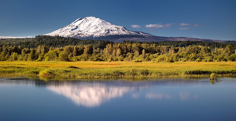
Climate change will exacerbate flooding in Columbia River Basin, OSU study finds

Managing the dramatic flood increases predicted for many areas called “clearly beyond our management capabilities”

Willamette River flood

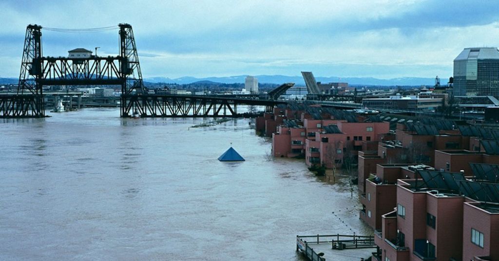
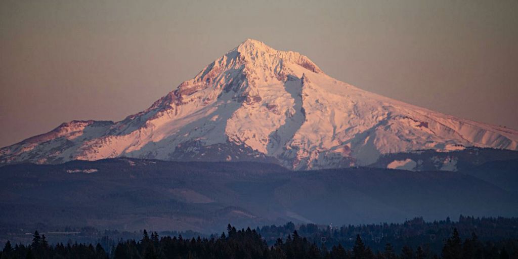
Rising concerns: Record-breaking rain, warm temperatures and deep snowpack during the winter of 1995-1996 led to severe flooding in many parts of northern Oregon, including along the Columbia and Willamette Rivers in the Portland metro area. By February 10, 1996, thousands had to be evacuated from their homes and the Columbia River reached 33.8 feet. Photo by Steve Morgan/Creative Commons

By Kale Williams, The Oregonian/OregonLive. February 18, 2021. Flooding in the Columbia River Basin is expected to increase dramatically in scale over the next half decade as the climate warms, according to new research from Oregon State University.

The severity of floods large and small—on the Columbia, Willamette and Snake rivers, along with hundreds of smaller tributaries—will increase and, in some places, the flooding season will grow longer.

That’s according to a new study from researchers at the university, published last month in the journal Hydrology and Earth System Science.

“The flood you’re used to seeing out your window once every 10 years will likely be larger than it has been in the past,” the study’s lead author, Laura Queen, a research assistant at OSU’s Oregon Climate Change Research Institute, said in a statement.

Queen ran simulations using streamflow data collected from nearly 400 sites throughout the Columbia River Basin and western Washington. The simulations included data from 1950 to 1999 and expected streamflow from 2050 to 2099.

“This was the best and most complete set of data,” said co-author Philip Mote, a professor in the College of Earth, Ocean and Atmospheric Sciences and dean of the Graduate School at OSU. “It shows that the magnitude of one-, 10- and 100-year floods is likely to go up nearly everywhere in the region. These are profound shifts.”

The Willamette River saw the biggest bumps in flood severity in simulations, with 50 to 60% increases in 100-year flood scenarios. Parts of the Snake River could see a 40% increase in 10-year floods and a 60% increase in 100-year floods.

The season for flooding on the Snake, now primarily confined to the spring, could start as early as December or January.

Higher stream flows earlier in season

The Columbia River Basin and much of the Northwest have seen frequent flooding historically. The Vanport flood in 1948 essentially wiped out one of Portland’s largest African-American communities at the time. 

Philip Mote, a professor in the College of Earth, Ocean and Atmospheric Sciences and dean of the Graduate School at OSU

Deep thoughts: Flood study co-author Philip Mote at a 2018 Columbia River Gorge Commission meeting on climate change. Photo by Jurgen Hess

Floods on the Chehalis River in Washington have forced the closure of Interstate 5 twice in the past 15 years. High water on the Willamette River in 1996 and 2019 caused millions in damages.

The simulations did not factor in flood mitigation efforts, like the extensive system of dams throughout the basin, but Mote said the changes are large enough that they would likely overwhelm any efforts to curb them.

“We don’t know how much of this increased flood risk can be managed through mitigation measures until we study the issue further,” he said. “But managing a 30% to 40% increase, as is predicted for many areas, is clearly beyond our management capabilities.”

One of the primary drivers for the expected shift is the warming climate. As temperatures climb, precipitation is more likely to fall as rain rather than snow.

MORE: Less snow is the  new norm. That’s trouble for farmers

With smaller snowpacks, rivers and streams will see higher flows earlier in the season. The snowpack in the upper part of the basin, in Canada, is not likely to see large changes in volume, but the snow there will melt faster, researchers found.

Mote said the obvious next step is to use the same simulations to model what will happen with the existing mitigation measures in place.

“This work provides information and impetus for the people who manage flood risk,” he said. “We’ll need to know how much of this can be mitigated by existing flood control.”

Columbia Insight is publishing this story as part of the AP StoryShare program, which allows newsrooms and publishing partners to republish each other’s stories and photos.

By |2021-02-17T17:17:16-08:0002/17/2021|Climate Change, Water|1 Comment

Major development could be coming to Mount Hood

U.S. Forest Service decision to swap land in Government Camp would transform commercial impact on Mount Hood. Community members on north side of the mountain are ‘aghast’ at deal

Mount Hood file photo The Oregonian

Peak promise: After years of wrangling a deal may be in place to undertake large-scale develop on Mount Hood. Photo by The Oregonian

By Ted Sickinger, The Oregonian/OregonLive, February 9, 2021. The long-running financial feud over a land swap that could transform development on the shoulders of Mount Hood hit a significant milestone this week as the U.S. Forest Service issued a final environmental analysis of the deal and a draft decision on proposed terms.

If this sounds familiar, it’s because some form of this grand bargain involving a swap of federal land in Government Camp for acreage owned by Mt. Hood Meadows at Cooper Spur has been in the works for two decades.

After years of dispute, Congress mandated that the Forest Service go ahead with a swap in 2009. But the deal has been repeatedly stymied by disputed appraisals, community and congressional concerns, new clarifying legislation, mediation, litigation and what many consider a slow walk by the Forest Service.

This is the first time, however, that the swap appears to be entering the home stretch with the Forest Service publishing a draft decision laying out the terms it sees as equitable. The decision is subject to a 60-day objection period, but in theory, it could be finalized by this summer.

Mount Hood National Forest Supervisor Richard Periman said in his decision posted Thursday that the terms satisfy congressional intent and provide significant public benefits. Mt. Hood Meadows officials called the decision “fair and accurate” and said “it is important that we recognize that this draft decision is in the public interest.”

“While there is still a ways to go, we are excited by the progress made to date and for the many potential opportunities completion of this historic land exchange will bring to the communities of Mt. Hood and to Oregon,” said Matthew Drake, chief executive of Mount Hood Meadows Oregon.

[perfectpullquote align=”full” bordertop=”false” cite=”” link=”” color=”” class=”” size=””]A community group says Forest Service appraisals “grossly undervalue” the land in Government Camp.[/perfectpullquote]

Community members on the north side of Mt. Hood, meanwhile, are aghast. After two decades trying to solve this puzzle, they say the deal doesn’t come close to satisfying the aim of Oregon’s congressional delegation or their own vision of a so-called “clean sweep” that would protect the area around Cooper Spur from development and direct all future building activity to Government Camp.

“It’s way worse than I thought it would be and it’s a terrible deal for the public,” said Heather Staten, executive director of Thrive Hood River, a conservation group in the Hood River Valley. “If this doesn’t solve the problem that Congress got involved to solve, which is to protect the north side, then all that has happened is that the government has facilitated a sweetheart deal for one corporation.”

In short, they intend to keep fighting.

Mike McCarthy is an orchardist whose great-grandfather homesteaded in the upper Hood River Valley in 1910. His family has been involved in efforts to stop further development at Cooper Spur and protect the watershed since Mt. Hood Meadows started contemplating a destination resort there in the 1970s. He says his mother was an early environmentalist in the area and he had hoped to see a deal done before her death in 2015.

“Now,” he said, “I’m hoping we’ll finish it before my death, whenever that is.”

The deal

The proposal calls for the Forest Service to transfer 67 acres of prime real estate for residential development in Government Camp to Mt. Hood Meadows. Company officials say that’s enough land for 144 building lots, though some estimates put it higher.

In exchange, Meadows would relinquish 605 acres of forestland on the north side of the mountain. That land, along with 2,700 acres of existing federal lands, would become a protected riparian area designated as the Crystal Springs Watershed Special Resources Management Unit. The Forest Service intends to add another 1,700 acres of land to the Mt. Hood Wilderness area between Cooper Spur and the Tilly Jane campground.

Yet opponents remain wary of one ownership proposal: The deal calls for Mt. Hood Meadows to retain ownership of Cooper Spur Mountain Resort, which comprises 159 acres of land, an inn, log cabins and other facilities. Meadows would transfer the Cooper Spur ski buildings and equipment to the Forest Service and relinquish its permit to operate it.

However, the Forest Service would seek a new operator of the ski area under a permit of up to 40 years. And that could be Meadows again, if it sought the permit.

According to appraisals approved by the Forest Service, the land in Government Camp is worth $3.76 million, while the land it would acquire at Cooper Spur is valued at $4.1 million. To equalize those values, Meadows would be paid $338,940.

Appraisals questioned

The entire deal hinges on the fair market appraisals, the key basis for determining whether the public is getting a good deal for the land, whether Meadows is being treated equitably, and ultimately how much land, if any, that Meadows would keep on the north side.

The community group and their lawyers say the Forest Service’s appraisals once again “grossly undervalue” the land in Government Camp. They say that undermines the public interest, and scuttles the original intention by leaving Meadows with about 159 acres of land on the north side, where it could pursue further development.

“The Forest Service and Mt. Hood Meadows chose to negotiate behind closed doors, rely on flawed appraisals and fundamentally alter the deal without the support of conservation groups, recreation clubs and local residents that supported them over two decades,” said Ralph Bloemers, the lawyer who has represented Thrive for two decades.

Government Camp by David Prasad/Creative Commons

Change-up area: 144 new buildings lots could be opened up in Government Camp. Photo by David Prasad/Creative Commons

As originally envisioned when proposed to the Forest Service in a 2005 agreement between Hood River County, the residents committee and Mount Hood Meadows, the swap involved 120 acres of federal land at Government Camp for all 770 acres of Mt. Hood Meadows’ land at Cooper Spur. But that “clean sweep” deal got hung up over controversy over the original appraisals.

Four years later, Oregon’s delegation pushed Congress toward a permanent fix in the 2009 Omnibus Public Lands Act, which mandated the trade happen within 16 months. But by 2014, the deal had gone nowhere, and Oregon lawmakers began to prod the Forest Service to make it happen after residents sued to force the swap.

The Forest Service hired an appraiser from Alabama to evaluate the properties. In summer 2017, the appraiser valued the Government Camp parcels at about $5 million and the Cooper Spur land at $9.5 million, using properties in Hood River, Sandy, Redmond and Medford to value the land in Government Camp.

Thrive and Bloemers’ Crag Law Center hired their own expert from Portland to review the federal appraisals. He found “significant errors” that undervalued the land in Government Camp and overvalued Mt. Hood Meadows property at Cooper Spur.

After mediation, the Forest Service ordered a new round of appraisals. The federal appraiser’s new report in December 2019 used properties in West Salem, Camas, Vancouver and Ridgefield to value the 107 acres of land in Government Camp at $5.7 million. After deducting unusable land due to required buffers, new roads, existing easements and other building constraints, the remaining 67 acres of Government Camp land was valued at about $85,000 an acre.

The Forest Service reviewed and approved those appraisals last year, prompting another round of reviews by Crag’s appraiser. They delivered that review to the Forest Service earlier this week.

Again, they claimed to find significant flaws. In particular, they say the federal appraiser failed to deduct unusable land from two of the comparable properties he examined to value the Government Camp property, and in essence, simply divided the sales price by the gross acreage.

They cited numerous issues, including that the federal appraiser:

  • Undervalued two of the comparable properties by between 75% and 100% on a per acre basis when he failed to note that up to half the land in question was not developable.
  • Used one comparable property in West Salem where housing prices are typically low, and certainly not comparable to the limited supply of developable land in the mountain resort.
  • Applied the faulty valuation on the comparable properties—a value per gross acre—to the net acres of usable land at Government Camp.
  • Failed to adjust for appreciation on the majority of sales that were negotiated one and a half to two years prior to closing.

Crag’s reviewer ultimately determined that the Government Camp property would be better valued at between $128,333 and $165,200 per buildable acre. Using a lower value of $125,000 an acre, that’s the equivalent of $8.3 million, 46 percent higher than the value in the federal appraisal.

The Forest Service’s draft decision on the land swap is now based on only 67 acres of land on the west side of Government Camp. The federal appraisal values that plot at $3.76 million, while applying Crag’s valuation would put it closer to $5.6 million.

Greg Leo, a spokesman for Mt. Hood Meadows, declined to delve into the specifics of the Crag’s review of the federal appraisals, but said the disagreement would be aired out during the Forest Service decision process, and the appraisals have to conform with very strict rules on government land trades.

There’s another way to look at the deal. Meadows says the 67 acres at Government Camp will accommodate about 144 building lots. Based on the Forest Service approved valuation of the land, that’s about $26,000 per lot. There will be extensive engineering, infrastructure and other costs associated with developing the land. But comparably sized lots in the area that have recently sold in Government Camp—albeit with road and utility access—have gone for up to 10 times that price.

What’s next?

The deal is now open for a 60-day objection period in which members of the public who participated in the planning process can voice their concerns to the Forest Service.

Mt. Hood Meadows by Eli Duke/Creative Commons

Never enough: If the deal goes through, powder days could become more crowded at Mt. Hood Meadows. Photo by Eli Duke/Creative Commons

Heather Ibsen, an agency spokeswoman, said it didn’t receive Crag’s review of the transaction until last week, so hadn’t completed a detailed review. But she said Crag and the citizen’s group, like other entities, will have the opportunity to participate in the process.

Neighbors’ overriding concern is that because of the “faulty” appraisals, Meadows could be left with 159 acres of land at Cooper Spur and potentially pursue future development. They point out that the company circulated a memo in 2017 contemplating a significant expansion of the Cooper Spur ski area as part of the process. That included expanded parking capacity, a new quad chairlift operating year round, new ski runs and additional lodge and food service capacity.

Meadows would be giving up its permit for the ski area as well as associated equipment as part of the deal outlined by the Forest Service. But nothing in the deal stops the company from submitting a proposal to operate it again when the Forest Service looks for new operators. If successful, the company could reinitiate its expansion efforts as well, said Staten, of Thrive.

“We had two goals: directing development to Government Camp, and providing us certainty about the future,” she said. “By retaining this land, it undermines the certainty for the future. There’s still a bunch of development potential.”

Back to court?

Ibsen says the so-called clean sweep was never mandated by Congress, and that the agency has never received a formal expansion proposal for the ski resort. She points out that some of the land for the expansion will be wilderness area after the land exchange is completed, and not open to recreational development.

Meadows, meanwhile, says 156 of the 159 acres of the land it would be left with after the exchange would be subject to highly restrictive forest zoning regulations. “There are no further development plans other than to continue the existing allowed uses for the subject properties,” said a statement from the company

That’s not reassuring for advocates, and if the deal goes through as contemplated, it may end up back in court. Staten said Thrive is “willing to avail itself of all options,” and she wonders whether Oregon’s Congressional delegation plans to live up to its previous commitments to protect the north side.

Hank Stern, a spokesman for Sen. Ron Wyden, said Wyden is aware of the issues being raised about the appraisals.

“He wants to ensure the Congressional intent of his 2009 Mt. Hood Lands Act is met to preserve the north side of the mountain and that fair appraisals are conducted,” Stern said.

Rep. Earl Blumenauer said he was encouraged that the process had reached a new milestone, but said a full public review of the underlying data and impacts were critical.

“From the beginning, the goal was to have a fair land exchange that protects the north side of the mountain,” he said in an emailed statement. “It is my expectation that all parties will work together to make that happen, and soon. Oregonians have waited long enough.”

Columbia Insight is publishing this story as part of the AP StoryShare program, which allows newsrooms and publishing partners to republish each other’s stories and photos.

By |2021-02-09T11:14:05-08:0002/09/2021|Natural Resources, Public Lands|0 Comments

Breach on! Idaho Rep. Simpson calls for removal of Snake River dams

The Republican’s weekend proposal for a massive infrastructure initiative to “end the salmon wars” is sending shock waves through the Columbia River Basin

Idaho U.S. Rep. Mike Simpson screen grab

Breacher man: On Saturday, Idaho Republican Mike Simpson released a video statement calling for the breaching of four dams on the Lower Snake River. 

This story is part of Columbia Insight‘s Snake River Stranglehold series examining the environmental impact of four dams on the lower Snake River.

By Chuck Thompson, February 8, 2021. If man bites dog is the mythical definition of a hot news story, Republican fights dam is surely its environmental equivalent. That’s why Idaho U.S. Rep. Mike Simpson’s (R) weekend announcement calling for the breaching of four controversial dams on the Lower Snake River is making top-of-the-fold headlines across the Columbia River Basin.

“Such a colossal proposal coming from a relatively unknown Republican is a shocker,” reported the The Seattle Times.

In a video announcement released Saturday, Simpson proposed a $33 billion infrastructure plan titled The Northwest in Transition that would breach the dams. As reported by The Lewiston Tribune, if turned into legislation and then law on Simpson’s timeline, the Lower Granite Dam would be breached in 2030 “and the river that was swallowed by slackwater 55 years earlier would reemerge.”

The other three dams—Little Goose, Lower Monumental, Ice Harbor—would be breached by 2031, returning the entire stretch of the river to its free-flowing state.

MORE: 140 miles: Snake River Stranglehold

“In the end we realize there is no viable plan that can allow us to keep the dams in place,” said Simpson is his video announcement. “We can create a Northwest solution that ends the salmon wars and puts the Northwest and our energy systems on a certain, secure and viable path for decades and restores Idaho’s salmon.”

Simpson stressed the involvement of tribal governments in his sweeping plan that would dedicate billions of dollars to replacing the economic benefits the dams provide to agriculture, energy and transportation concerns.

Dams on lower Columbia Snake River system

Immovable objects? Starting with Ice Harbor Dam and moving east (red dots indicate dams) four dams along the Lower Snake River have been the focus of controversy for decades. Courtesy of U.S. Army Corps of Engineers

“We must make these tribes equal partners in the solution and going forward they must be co-equal partners in salmon restoration,” he said.

“It is about so much more than salmon and dams, though it is about that too,” Todd True, senior staff attorney at Earthjustice’s Northwest regional office in Seattle, told Columbia Insight. “I think we all know we want clean, affordable energy, a strong and diverse economy, abundant salmon and to begin to correct the historic injustices Northwest Tribes that depend on salmon have suffered for so long. Congressman Simpson has created a moment where we have an opportunity to do all of that if we just have the courage and vision to join him in moving from a framework to legislation and action.”

All four Democratic senators from Washington and Oregon issued a joint statement of support for Simpson’s plan. In borderline-giddy press releases, more than 10 regional fishing and conservation groups praised Simpson.

“The recreational angling community has been pressing for salmon recovery in the Columbia River Basin for decades. Today, Idaho Rep. Simpson answered our calls with a blueprint for the largest river and salmon restoration effort in history that also creates jobs and strengthens the energy and agriculture sectors,” said Chris Hager, executive director of Association of Northwest Steelheaders.

But Republican House members from Washington and Idaho condemned the plan, instead proposing a resolution in favor of expanding hydropower provided by the dams.

MORE: No surrender: Coalition to sue feds over Snake River dams … again

“These dams are the beating heart of Eastern Washington,” said Rep. Cathy McMorris Rodgers, R-Spokane, in a press release. “Spending $33 billion to breach them—with no guarantee that doing so will restore salmon populations—is a drastic, fiscally irresponsible leap to take.”

“State law is now removing coal as a power source, which has utility leaders scrambling to find ways to quickly make up for that loss in power production. Removing the Snake River dams would make this effort even more challenging,” read a Sunday editorial in Washington’s Tri-City Herald. The editorial also called removing the dams “counter-productive to our efforts to battle climate change.”

Environmental groups have vigorously opposed the dams since even before the U.S. Army Corps of Engineers built them in the 1960s and ’70s. But legal efforts as well as campaigns to generate widespread public support for their cause have failed to budge the federal government from its own intransigent position to keep the dams in place.

All four of the federally operated dams are located in Washington.

Although for many, Simpson’s proposal seemed to come out of nowhere, close observers of the controversy surrounding the dams have been waiting for such an announcement from the Idaho politician for years. Although stopping short of calling for removal of the dams at the time, at a conference on salmon recovery in Boise in 2019 Simpson signaled his openness to considering the possibility.

On Saturday, Simpson said he and his staff conducted more than 300 meetings with stakeholders around the region before coming to the decision to call for breaching the dams.

MORE: Video: This 13-year-old environmentalist will amaze you

Chuck Thompson is editor of Columbia Insight. Columbia Insight‘s series focusing on the Lower Snake River dams is supported by a grant from the Society of Environmental Journalists.

 READ MORE SNAKE RIVER STRANGLEHOLD STORIES

What’s wrong with solar power? More than you know

In Klickitat County opposition to solar-energy development highlights a tricky environmental problem spreading across the country

Baldock Solar Station Photo by Oregon Department of Transportation

Mixed company: Nature and commerce find common ground at Baldock Solar Station off I-5 in Oregon. In residential areas, industrial-level solar installations are a tougher fit. Photo by Oregon Department of Transportation

By Chuck Thompson, January 28, 2021. As an exercise in rural governance, the January 14 meeting of Washington’s Klickitat County Board of Commissioners provided a near perfect distillation of why it’s practically impossible to inspire civic engagement in local politics. And why the fight against climate degradation often feels like such a discouraging and impossible endeavor.

The board’s specially convened “workshop” was undoubtedly conceived with good intentions—an hour-long one-off in which the county’s three commissioners and staff would discuss solar-energy development in the county. It’d give the public the opportunity to get up to speed on an issue that’s become increasingly important just beyond their front doors.

Rolling invitingly beneath the snowy slopes of Mt. Adams, large, uninhabited tracts of open land in Klickitat County—a pastoral idyll with a population of about 22,000 in southern Washington—have become a magnet for multinational energy companies looking to build massive solar-power installations.

When Lund Hill, the county’s first industrial-scale solar factory was approved in 2019, Washington’s Department of Natural Resources touted it as a first-of-its-kind use of state lands for solar power.

DNR Commissioner Hilary Franz emphasized that grazing permits on the 480 acres of state land used in the 1,800-acre Lund Hill project generated only $2 per acre in annual lease payments. Avangrid Renewables, the company leasing the Lund Hill land for its 500,000 photovoltaic-panel solar installation, would pay $300 an acre. Revenue from the use of the land goes to the Common School Trust, used for school construction across Washington state. Franz called the deal a “win-win-win.”

Avangrid is a subsidiary of Iberdrola, a utility company based in Spain valued at $62.5 billion. Its construction of the Lund Hill installation is expected to be complete by the end of 2021. Though not yet online, Lund Hill has kicked off a solar rush.

“All of a sudden we have got people poking around, leasing land and starting studies,” said Dana Peck, executive director of the Greater Goldendale Area Chamber of Commerce, in a 2019 interview with the Seattle Times. Goldendale is the Klickitat County seat and largest city.

“We are open for business,” confirmed Franz in the same article.

A workshop for whom?

Though Klickitat County’s January 14 solar workshop was open to the public, its Zoom audience microphones were muted. Neither public comment nor Q&A session was on the agenda. The meeting was intended as an informational forum during which the county’s commissioners would discuss issues connected to solar-power development.

As the workshop progressed, however, two things became clear. First, that the commission is united in its support of turning over huge swaths of land to out-of-state and overseas energy corporations and has no intention of taking seriously any opposition to plans for major development. Second, even if they did it wouldn’t matter. Massive solar installations are coming to Klickitat County whether anybody who lives there wants them or not.

About 20 minutes into the discussion Commissioner Dan Christopher said opponents of solar developments, “will be able to have a voice in the permit processing, but it doesn’t necessarily stop a project or a plan or our official policy. It just allows them to have a voice in that particular development and not our policy thinking.”

Washington Department of Natural Resources Commissioner Hilary Franz photo by Washington DNR

It’s always sunny in Olympia: Washington Department of Natural Resources Commissioner Hilary Franz. Photo by Washington DNR

If that came across as a pat on the head to opponents of commission policies, a comment Christopher delivered 10 minutes later about a proposed solar-power project known as the Knight Road substation landed a little lower.

“There’s nothing stopping this project, future projects, unless we have a complete change of policy, which the majority of the people would have to scream for,” Christopher said. “And it’s my understanding that even then if every single person in Klickitat County said no on solar, the solar company could still go through the state and you’d get it anyway.”

At this point a member of the presumably muted audience identified himself as Brian Walsh of Avangrid Renewables. Despite being told by two commissioners that the meeting was not open to public comment—and that letting him weigh in would be unfair to local residents not allowed to speak—Walsh nevertheless pressed forward, confirming to all gathered that they indeed had no final say in the matter.

“The answer to the question could you just go to Washington, the answer is true,” said Walsh, a Portland-based development director for Avangrid.

Avangrid and the commissioners’ shared supposition of state authority is based on power granted to Washington’s Energy Facility Site Evaluation Council (EFSEC), which says it “provides a ‘one-stop’ siting process for major energy facilities in the State of Washington.” A Generalized Siting Process flow chart produced by EFSEC shows the governor having final approval of lease applications. (Kenny Ocker, communications manager for DNR, which entered into the lease of lands with Avangrid for Lund Hill, responded to an interview request from Columbia Insight about solar projects in Klickitat County by directing the query back to the county and state Department of Ecology.)

Potential negative impacts of solar factories barely rated a mention at the workshop. Most of the session was dedicated to a fait accompli discussion of the process by which solar factories could pass though permitting process hoops.

All of this was carried out in the procedural, somnambulant monotone for which midweek, dead of winter, local council meetings are renowned. Each of the three commissioners expressed considered and rational views on the topic at hand.

MORE: 16 and counting: Inside Klickitat County’s war on cougars

In rural Washington it’s no surprise to find a county commission in favor of industrial development. As Dave McClure, the county’s natural resources director reported during the session, wind energy accounts for an estimated 100 to 120 jobs in the county with a pay range of $52,000-$115,000, well above the regional average.

No amount of professionalism or thoughtfulness, however, could shroud the workshop’s ultimate takeaway: however congenially accomplished the decisions being made by the board will have negative environmental consequences Klickitat and neighboring counties will be stuck with for generations.

This is how climate change and habitat destruction are abetted at local levels—with collegial smiles, economic logic and the best of intentions.

Opposition takes form

On a bright October morning in 2020, Klickitat County resident Greg Wagner noticed a strange car parked in the wheat field behind his house. On the side of the car he spotted the logo of Terracon, a Kansas-based engineering consulting firm with 150 offices serving all 50 states.

Not far from the car a woman was bent over, shoveling small piles of dirt into a Ziploc bag. Behind her, a backhoe was churning up larger pieces of earth.

Wagner, a retired journeyman electrician who’s lived in Klickitat County for seven years, walked outside and asked the woman what she was doing. The woman answered she was taking soil samples but, according to Wagner, declined to provide further information.

C.E.A.S.E. founder Greg Wagner says industrial solar is a national not local issue. Photo courtesy of C.E.A.S.E.

Broad view: C.E.A.S.E. founder Greg Wagner says industrial solar is a national not local issue. Photo courtesy of C.E.A.S.E.

“So I went over and asked the backhoe operator what was going on and he told me this area is going to be a solar farm,” recalls Wagner. “That’s when C.E.A.S.E. came into existence.”

C.E.A.S.E., which stands for Citizens Educated About Solar Energy, is a community organization focused on solar development Wagner founded three months ago. It’s since grown to about 200 members. Its mission statement reads: “It is not our intention to stop solar entirely. We simply want the ordinances updated and the public aware of the current dangers that utility solar farms are posing on counties across our nation.”

Wagner and other C.E.A.S.E. members have become regulars at Klickitat County commissioners meetings. Their goal is to get the local government to halt permitting of solar-power developments until impact and mitigation studies can be done, and outdated permitting guidelines can be reviewed.

Renewable energy development regulations and policies in Klickitat County generally date to 2004-05, when they were written to accommodate the influx of wind farms. With 602 wind turbines in the county, wind power is a core piece of its economic development strategy. C.E.A.S.E. wants the county to rewrite its regulations and policies in light of impacts specific to solar energy.

“All we want is a moratorium to give us time to study all the issues and convince them that to cover 5,000 acres here with solar panels is irresponsible,” says Wagner. “They (the Board of County Commissioners) don’t want a moratorium. They don’t want to scare off energy companies because they want the tax revenues. We feel like they’re listening but not responding.

“I told them C.E.A.S.E. is not your adversary, we’re here to work with the county for the good of all citizens. They just don’t want to work with us. Why is it the energy company got time to talk at the (January 14) workshop but citizens didn’t get equal time?”

Elaine Harvey is a Klickitat County resident, Yakama Nation Tribal Member and fish biologist who believes leasing land for commercial use could violate treaties that allow Yakama Nation members the use of public lands for hunting, fishing and other traditional activities. She joined C.E.A.S.E. in December 2020. Like Wagner, she’s dismayed by what she characterizes as the county government’s headlong and ill-informed pursuit of solar-energy development.

“They (the commissioners) don’t do their research,” says Harvey. “They want to invite these big companies in without thinking about the long-term consequences. These are 40-year leases.”

MORE: Rural solar project in Oregon faces local opposition, wildlife concerns

Harvey called the January 14 workshop “depressing.” Wagner called it “disheartening.” Both describe the commission’s actions as “secretive” and its knowledge of solar energy inadequate.

“County officials believe they are making big money—in reality no,” says Wagner. “(They are) just being used by big business. Our county has some of the most lenient ordinances. That is why these solar companies are wanting to build here. They can go to library.municode.com and view every state and county ordinances and then pick which county offers the least resistance.”

During the Zoom workshop the muted Harvey could only swallow her emotions when one of the commissioners said, “We went through this exercise with wind. I don’t know that solar is that dissimilar.”

“With wind and solar you’re talking about two different things,” says Harvey, who has a master’s degree in resource management and is a doctoral student enrolled in the University of Idaho’s Natural Resources PhD program. “They aren’t the same thing at all.”

An inconvenient truth about an inconvenient truth

The gathering controversy in Klickitat County raises a fascinating ethical dilemma for environmentalists. Most if not all have come to understand that more than a century of burning coal, gas and oil for energy has brought the planet to the brink of a full-blown climate catastrophe from which it may never recover. Solar energy has been celebrated as, if not a cure-all, a major part of the solution.

No energy source is perfect. If we want hot showers and cars there’ll always be an environmental price to pay, no matter how many layers of green paint we apply. But issues associated with industrial-level solar power are vastly more problematic than most people realize.

The complex laundry list starts with the panels themselves. Toxic chemicals used in solar panels include cadmium telluride, copper indium selenide, cadmium gallium (di)selenide, copper indium gallium (di)selenide, hexafluoroethane, lead, polyvinyl fluoride and silicon tetrachloride, a byproduct of producing crystalline silicon.

Then there are the lithium ion batteries common in solar installations.

Similar to fracking, lithium mining involves drilling a hole in the ground then using hundreds of thousands of gallons of water to pump a brine of minerals to the surface. From this brine lithium carbonate is extracted. Toxic wastewater is often pumped into rivers and other water sources.

“They did that in China and killed a lot of fish,” says Wagner.

Mt. Adams Klickitat County by Gary Dee/Wikimedia Commons

County pride: At 12,280 feet, Mt. Adams provides Klickitat and surrounding counties with clean water and stellar views. Some locals worry industrial-scale solar factories will infringe on both. Photo by Gary Dee/Wikimedia Commons

Disposal is a growing problem. Solar panels installed in the early 2000s are reaching the end of their life cycles. The most common industry practices are to burn or simply bury old panels in landfills.

“Potential leaching of these metals into the surrounding environment can pose a public health problem,” wrote Discover magazine in December 2020. “As society continues to adopt solar power, this problem may worsen in the coming decades, with almost 80 million tons of solar waste projected by 2050.”

When massive solar factories are installed, places like Klickitat County experience their own localized effects.

“Solar farms take good farmland out of production,” says Wagner. “There are issues with storm water, wildlife habitat and pollinators.”

“I live in an area that has so much diverse wildlife that’s not going to be able to use the area because they’re going to fence it all off,” says Harvey. “There will no longer be migratory corridors for certain species. We have wetlands here. If 2.5 million solar panels go in, what’s the impact to the birds?

“The chemicals they use to wash these solar panels can lead to contamination of the groundwater. It’ll eventually go to our hatcheries and the fish will all die. That can happen pretty fast. With climate change we don’t have as much snowpack as we used to, so a solar (installation) is going to impact the water availability for everybody, and they’ll need lots of water to wash those panels.”

MORE: Less snow is the new norm. That’s trouble for farmers

The problem isn’t limited to Klickitat County. In November 2020, residents in southern Oregon’s Langell Valley protested a proposed, 1,851-acre solar-power factory there.

“The view is going to be atrocious,” said one local homeowner, who lives near the site of the planned installation. “Instead of seeing cattle grazing on pasture, wetlands and deer, they’re going to see an eight-foot chain-link fence and solar panels.” 

Novel solution?

Log onto the “Solar Projects” page of the Klickitat County website and Lund Hill is the only development you’ll find listed. Call the Planning Department and you’ll be told no other projects are currently being considered in the county.

“We do have one solar project approved a year ago. That is Lund Hill,” says Mo-chi Lindbland, Klickitat County planning director, who spoke at the solar workshop. “That’s the only one that we’ve received an application for and issued a permit on. Until I have an actual application I don’t have much information I can provide to the public.”

Although Lindblad is aware of companies such as Invenergy, Cypress Creek Renewables and NextEra Energy—all large energy concerns C.E.A.S.E. emails say have been actively scouting the area—she politely deflects any talk of actual projects in the works.

“At least two of them did express interest and asked the county about the permitting process,” she says. “But we have those inquiries all the time. Unless I have a permit application I don’t have much input that I can share.”

Elaine Harvey photo by Elaine Harvey

Fluid situation: Fish biologist Elaine Harvey is worried about the impacts of contaminated runoff from solar factories. Photo courtesy of Elaine Harvey

There’s nothing inaccurate in any of that, but Lindblad’s assessment of solar energy development in Klickitat County presents a mere fraction of the picture. To locals like Wagner, it suggests a “total lack of transparency” and aggravating reluctance by county leadership to address issues that opponents of new solar installations find unacceptable.

“This is the solar-panel monopoly that Klickitat County is entering,” says Harvey. “We are enabling the big polluter companies who buy solar farms (for carbon tax credits) and are destroying the atmosphere, and told we gotta live with it. I just think we’re their little pawns.”

“It’s very doubtful a company from Spain worth $62 billion cares very much about Klickitat County,” says Wagner, referring to Lund Hill developer Iberdrola. “We’ve got a big problem in our county but it’s a problem that exists all across America. It’s not a ‘me’ issue here in our county it’s a ‘we’ issue everywhere. There has to be some common ground.”

Maybe that common ground is a place that’s already been consumed by energy production. Harvey has a suggestion.

“Why are we disturbing good habitable land and good agricultural land when you’ve got Hanford nearby?” she asks, referring to the decommissioned nuclear production complex about 90 miles northeast of Goldendale. “Nobody lives there. It’s uninhabitable. There are big, open pieces of land that are contaminated already, just put the solar power over there.”

It’s an interesting idea, but those counting tax revenues in Klickitat County would likely not receive Harvey’s suggestion favorably. Hanford is located in neighboring Benton County.

Even so, it’d be nice if somebody took the time to look into it. Maybe one of those big multinationals looking for a deal could be persuaded to come to Klickitat County’s aid, one way or the other.

Chuck Thompson is the editor of Columbia Insight.

By |2023-03-16T10:58:37-07:0001/28/2021|Renewable Energy|21 Comments

Warm Springs evaluates carbon sequester project in wake of wildfire

More than half the forest tribes set aside for protection as part of a Cap-and-Trade program have been destroyed by fire

BLM Firefighters at Warm Springs Reservation, Photo by Seth Macaldy/BLM Oregon

Imperiled trees, imperiled program: Bureau of Land Management firefighters have extensive experience on Warm Springs Reservation. Photo by Seth Macaldy/BLM Oregon

By Michael Kohn, The Bulletin. January 21, 2021. Five years ago the Confederated Tribes of Warm Springs set aside 24,000 acres of forestland for a project to sequester carbon and reduce greenhouse gases. Last summer more than half of that forest went up in smoke in the devastating Lionshead Fire.

Now tribes, which earned millions of dollars from the California Air Resources Board for the project, are hard at work assessing just how much was lost. Bobby Brunoe, general manager for the tribe’s Branch of Natural Resources, so far calculates that 15,000 acres of the project area were lost in the fire. Overall, the Lionshead Fire burned 204,000 acres, of which 96,000 acres are on the Warm Springs Indian Reservation.

Warm Springs, located 70 miles north of Bend, sells carbon credits earned through California’s Cap-and-Trade Program, by protecting its forests so they can continue to capture carbon. The program is a market-based form of regulation that sets an upper limit, or “cap,” on carbon emissions produced by companies in California.

The carbon offset projects can be located outside of California, a policy that opened the door to participation by Warm Springs. Around the country, there are 136 forest offset projects.

According to the agreement, Warm Springs will maintain and build carbon stands within its project area for 100 years. At Warm Springs, the area considered for protection was zoned as “conditional use,” a designation that allowed the tribes to log it if they so desired, although it had not been logged before.

Entering the Cap-and-Trade Program was a financial incentive to keep the forest intact and increase its carbon intake capacity. But wildfires like Lionshead throw a wrench in those intentions as the burned trees reverse carbon sequestration, sending carbon into the atmosphere.

Buffer pool protection

The California program is protected from wildfire events through its “buffer pool” of carbon credits, which are available to use in case forest carbon is lost through wildfire or other natural disasters. Each forest project contributes 10-20% of its total credits into the buffer account, which acts as a sort of insurance.

The project area on Warm Springs that burned, known as ARC260, is located on the east side of Mount Jefferson. The area will be evaluated for damage, said Brunoe, as not all areas of a forest burn the same—parts of a forest may have a light or heavy burn, or no burn at all.

In addition, a burned area is not necessarily out of the carbon project as a standing snag can still be counted as carbon.

The verified estimate of current carbon stocks must be completed by a third party within 23 months, according to the California Air Resources Board.

Much of the area where ARC260 is located is currently inaccessible due to deep snow, so research is expected to start in earnest in spring.

“The extent and severity of the fire impact to the Warm Springs carbon project remains unknown and will be under evaluation for the next year and a half, involving detailed forest inventories and modeling,” said Brunoe.

Once the evaluation of the forest damage is complete, a determination will be made on how much to reduce the buffer pool.

Scientists worried

Some scientists have expressed concern that the buffer pool is not sufficiently protected against fire risks over the 100-year period, and hold up Warm Springs as an example.

“The fact that the Warm Springs project has burned twice in a decade is a perfect example of the problem,” said Danny Cullenward, lecturer at Stanford Law School and policy director of CarbonPlan, a nonprofit that independently analyzes carbon removal opportunities based on science and data. “There is no way the protocol’s buffer pool holds up if that pattern is common in the program.”

Lasting impact: Sparked by lightning on August 16, 2020, smoke from the Lionshead Fire spread across the Warm Springs Indian Reservation well into September when this photo was taken along U.S. Route 26. Photo by Jurgen Hess

The wildfire in 2020 wasn’t the first time the project area burned. When the project was in the set-up stage, a wildfire burned around 2,000 acres of forest within the project boundaries, said Don Sampson, who helped arrange the agreement when he was chief executive of Warm Springs Ventures, the tribe’s economic arm. Sampson worked for ventures from 2013 to 2016.

When the project was in its early stages, said Sampson, a series of independent analyses took place to verify the amount and value of carbon that could be sequestered and offset.

The entire process took 3½ years to complete, longer than first anticipated due to some setbacks, including a wildfire that burned around 2,000 acres of the forest. The fire contributed to the delay in setting up the project.

“They had to reassess the burned areas and how they would regenerate,” said Sampson.

Carbon credits

When the preparation work was complete, the California Air Resources Board issued Warm Springs 2.15 million carbon offset credits. The offsets represented 2.15 million metric tons of verified greenhouse gas emission reductions.

Annual growth within the project boundary can be converted to additional carbon offsets that the tribes can sell. To date, more than 2.6 million Air Resources Board carbon offset credits have been issued to Warm Springs.

“There are about 20 projects in the range of 1 million to 5 million offset credits upfront, and a handful that get as big as almost 15 million,” said Cullenward. “I would say Warm Springs is one of the large projects but not atypically large nor on the extreme end of the size distribution.”

How are the offset credits used? In 2018, the tribes announced they had contracted with a third party to sell the credits over several years and that those credits would “provide revenue in the tens of millions of dollars for tribal operations, improved forest management and economic development initiatives.”

The tribes declined to confirm the specific amount received from the agreement.

‘Much-needed revenue’

Sampson said the tribes set aside some of the funds for forest thinning and forest health projects, to prevent wildfire and tree disease.

“Overall it brought in much-needed revenue,” he said. “That was the biggest revenue source they had for quite a few years.”

Funds were also set aside for a cannabis project. That project stalled during Sampson’s tenure at Warm Springs but was later revived into a hemp project, which received federal approval last year.

The decision to enter the program was timely, as it coincided with the winding down of the local sawmill, Warm Springs Forest Products Industries, which was struggling to turn a profit due to a lack of large logs.

The program was also consistent with the tribe’s policy on generating revenue through environmentally conscious ventures.

“Rather than take an extractive approach and cutting timber and selling logs off the reservation, (Tribal Council) wanted to transition to one that was more conservation-based and still make revenue for the tribe,” said Sampson. “So from that point of view, it was a successful project.”

Columbia Insight is publishing this story as part of the AP StoryShare program, which allows newsrooms and publishing partners to republish each other’s stories and photos.

READ MORE INDIGENOUS ISSUES STORIES.

The Collins Foundation logo

The Collins Foundation is a supporter of Columbia Insight’s Indigenous Issues series.

Opinion: The reality of our Capitol crisis

Climate change isn’t the only thing we deny. Why is reality such a challenge in Washington?

U.S. Capitol at night

Monochrome view: This week’s events are a stark reminder of the perils of not facing up to reality. Photo by Kevin Burkett/Creative Commons

By Chuck Thompson. January 8, 2020. Like everyone else I’ve spent this week ignoring my to-do list (our Christmas tree is still up) and sitting transfixed by the images on TV coming from Washington, D.C. Once the Wednesday bedlam had subsided enough for members of Congress to return to their Capitol chambers, I watched one after another as the country’s senators and representatives took to the floor to assure themselves that “this is not who we are.” Many reached for the delusional trope that this country remains that “shining city upon a hill.”

I thought, “In addition to every other privilege of their positions, do our elected officials have access to different networks—social and otherwise—than the rest of us?” I appreciate soaring rhetoric as much as the next patriot, but I’m skeptical of people who talk about gym memberships and keto diets while reaching for another slice of cake. Even as a kid I never cared for fairy tales.

The chaos Wednesday was sickening but not surprising. From Black Lives Matter to Standing Rock to Occupy to WTO to Rodney King, I’ve been watching the political version of “who we are” boiling on the front burner for most of my life. Others can trace the sad declension of events that led to this week’s “takin’ it to the streets” mayhem to ERA, Kent State, Caesar Chavez, Vietnam, Little Rock …

I thought of all this when I finally pulled myself away from the flat screen and endless texts to charge my phone (either my thumbs are getting faster or my phone is getting older) to post Columbia Insight’s short piece on the federal government’s dubious removal of gray wolves from the Endangered Species List. Precious little science supported the decision announced by the Trump administration just days before the October election, but which took effect this week.

I thought of it again when giving a final read to this week’s feature story on the way wildfires pose a particularly toxic problem around the asbestos-laden Superfund site outside of Libby, Montana. (That piece, by the way, is the product of our new partnership with the stalwart environmental reporters at Inside Climate News.) Like a lot of what you’ll read on Columbia Insight this year, the story is about the dysfunctional way our government—ourselves—chooses to deal with the environment. This is us. We’re going to be dealing with it for a long time.

This year, many of us in Pac-12 territory (Pac-10, Pac-8 or PCC if you go back that far) missed the pomp and pageantry of the Rose Parade and Rose Bowl that traditionally takes place in Pasadena on January 1. The football game itself was moved to Texas due to COVID-19, thanks largely to more government denial of a crisis, yet another illustration of its chronic inability to bridge social divides and solve problems.

We got spectacle, anyway, to start the year. It just came a few days later than usual. This is who we are and I’m afraid we’re just going to have to keep living with it, and keep cleaning up the messes we make along the way.

Chuck Thompson is the editor of Columbia Insight. The views expressed in this article belong solely to its author and do not reflect the opinions of anyone else associated with Columbia Insight.

By |2021-01-09T08:42:47-08:0001/08/2021|News, Opinion|0 Comments

© Copyright 2013-2025 Columbia Insight. All Rights Reserved.

As a 501(c)3 nonprofit organization, all donations to Columbia Insight are tax deductible to the full extent of the law. Our nonprofit federal tax-exempt number is 82-4504894.