“The charm of fishing is that it is the pursuit of what is elusive but attainable, a perpetual series of occasions for hope.” – John Buchan
By Dac Collins. Nov. 1, 2018. Hope is a motivational force. It is the definitive mindset of the fisherman. Without it, the motion of casting and swinging a fly across a piece of water is no different than kicking up sand in the desert. And on a broad, alluring river like the Deschutes, where science and reason dictate that trying to actually hook a steelhead is an exercise in futility, hope is the only thing that will actually keep you fishing.
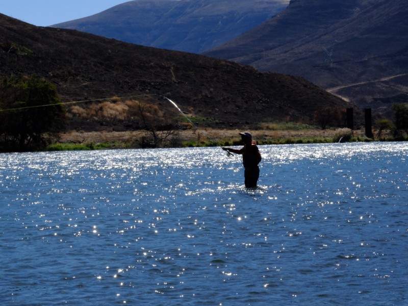
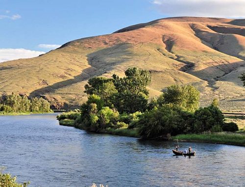
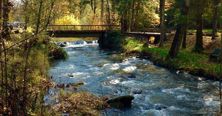
Photo by Emily DeCarlo. The author swings a fly on the Lower Deschutes.
And this early in the morning, with the canyon still cloaked in semi-darkness and over 20 miles of fishable water below me, staying hopeful is easy. Even though I’m already halfway down a run that should hold fish, and the last 30 to 40 swings have brought nothing but cold hands, I’m able to look at that midstream boulder below me and picture a fish on either side of it.
So I take a few steps down and send the fly across the run. It lands with a light splash on the water’s surface and a surge of nervous confidence runs up the line, down the rod and into the bones of my hand. I mend once and can feel my offering getting deeper for a few seconds. Then the line tightens as the fly starts its broadside dance across the current. By watching the tip of my line—the fly itself hidden from view—I can tell that it is about to pass within a foot of the boulder. With this realization my guts tighten and my vision narrows. The world as I see it condenses to a square foot of water. The expectation builds as my line straightens out beneath me and I imagine the take. Wait for it. Then…nothing. The small black fly just hangs there, and for a fleeting moment in my mind’s eye it transforms from a dancing, seductive creature to a lifeless hunk of feathers and fur. So I cast it out again, aiming for the far side of the boulder this time and erasing that brief moment of hopelessness from my memory.
Thirty minutes later I get to the bottom of the run. I reel up and walk back to the boat, where the passengers eye me with discontent. I can tell they are both cold, and that they’re wondering why we’re on the water this early in the morning. I can’t blame them. Even the swallows are still cooped up in their adobe huts, waiting for the sun to hit the water before venturing out for breakfast.
Back in motion, I push forward on the oars, heading toward the left bank where the sun’s warmth is starting to spill over canyon walls and onto the river’s surface. Holding us in this exquisite spot, my hands thawing out on the oar grips, I offer up a plan: “There’s an island just around the corner…should be in the sun right now. What do you say we stop there for a little while?”
“About time,” she says. “Pretty sure my toes are frozen.”
Looking around, Emily and I recognize exactly where we are. We floated this same stretch of river a year ago to the day, but something feels different. The river itself looks familiar, its horseshoe bends and Volvo-sized boulders in precisely the same spots as the year before and the years before that, but the canyon that contains it all seems changed. Blackened.
Blackened because 2018 was the worst fire year in recent memory for the Lower Deschutes. Between June and September of this year, three significant wildfires rolled through the Wild and Scenic river canyon.
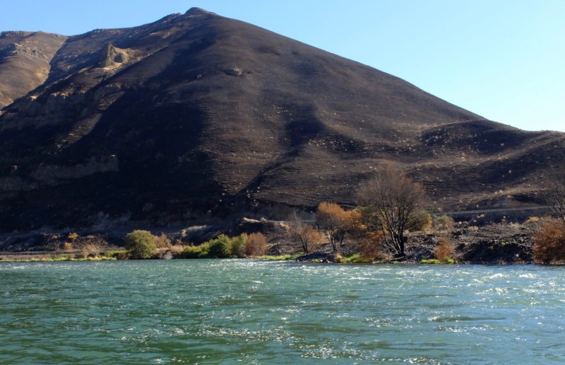
Photo by Emily DeCarlo. While some healthy trees remain standing in the lower 20 miles of river, most of the vegetation along the riparian corridor and on the surrounding hillsides was thoroughly torched over the summer.
Jeff Kitchens, who works as Field Manager for the BLM’s Prineville District, describes this year’s fire season as unprecedented.
“Judging from the comments I received,” Kitchens says, “people who have been actively recreating and living around that river for the last half-century haven’t seen a year like this before, where we had that much of the river corridor burned in a single year.”
“I mean we have a very frequent fire return interval because of the grasses,” Kitchens continues, “so we do on average see one large fire in the river corridor annually. But we had very large portions of our river corridor burned consecutively, one after the other, so that by the end of this calendar year we saw large portions of all four segments of the Lower Deschutes burn, whether on one or both sides of the river.”
First there was the Boxcar fire, which was reported on June 21 after a lightning storm passed through the area. It started less than a mile upstream from Maupin and, after merging with the South Junction fire (another lightning-caused fire), it spread into the river canyon and over thousands of acres of grass and farm land above the canyon. No lives or serious structures were lost, however, and the fire was declared 85% contained by June 28.
Just three weeks later, on July 17, another fire started on private land southeast of The Dalles. Known as the Substation fire, it was human-caused, although the official cause is still under investigation.
Fueled by wicked summer winds, Substation grew out of control in a hurry. Within the course of a few days, it had run through more than 18 miles of sagebrush, grasslands and wheat fields, jumping the river from Wasco to Sherman county (two of the largest wheat producing counties in the Northwest). On July 18, just a day after it began, Oregon Governor Kate Brown declared the fire a national emergency and troops were called in from the National Guard. By that point it was already considered the number one priority fire in the nation.
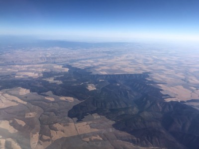
Photo by Lincoln Graves, courtesy of KATU. Taken on July 22, an aerial photograph of the Lower Deschutes Canyon and its confluence with the Columbia shows the scope and severity of the Substation fire.
It was on that same day that 64-year old John Ruby died fighting the fire. Finding himself unable to choose between sitting idly by or following evacuation orders while the blaze approached his neighbor’s wheat field, Ruby attempted to cut a fire line with his tractor. He was found lying next to his scorched tractor around 2pm that afternoon.
By July 21 the winds had slackened, allowing crews to make progress containing the fire by pushing it into the river canyon and away from the communities above. And by the evening of the following day, the Substation fire was 92% contained.
But for residents of Wasco and Sherman counties, the end of fire season was still not in sight. On July 26th, while crews were still working to fully contain the Substation fire, a piece of farming equipment ignited near Dufur, starting the Long Hollow fire immediately to the south of the Substation fire. Although it only burned an area half the size of the Substation fire, it took out all of the buildings at the historic Harris Canyon Ranch, including the iconic Harris Canyon water tower, which has been a familiar landmark along the lower river since 1912.
Other structures that were destroyed during the Substation and Long Hollow fires include a couple of composting outhouses and the last surviving boxcar on the east bank.
Many of the public recreation sites that access the river along segments 3 and 4 were closed for days at a time while the Substation and Long Hollow fires passed through. And since July and August are peak months for recreating on the Lower Deschutes, rafting outfitters and other small businesses based in river communities like Maupin felt the effects of these closures.
“It was tense and a little scary for a couple weeks there,” says Kate Wallace, who, along with her husband Andy Kreipe, owns Deschutes River Adventures in Maupin.
According to Wallace, it was still a good summer for their raft rental and guiding operation, especially since the Boxcar fire that affected the popular day stretch above town was contained before rafting season really kicked off. But she says they did see a significant dip in people using the lower segments of river (3 and 4) later in the summer.
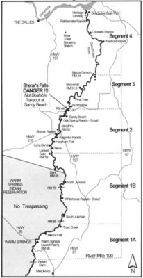
Photo courtesy of BLM. A map of the Lower Deschutes shows the river divided into four segments. While all four burned this summer, segments 3 and 4 were impacted most severely.
“The attention that the fires got in the media maybe scared people more than it should have,” Wallace says, explaining that she and her husband were responding to phone calls about the fires long after they had been put out. Even after the smoke cleared, she says, many people were afraid to go down into segments 3 and 4 and “it was just sad to see nobody using that stretch, and to see permits still available on weekends, which is usually not the case down there.”
“[But] to be very honest,” Kitchens says, “I am glad that we closed those access points in conjunction with law enforcement when we did. I think that those that had the foresight to shut down access when Substation occurred saved lives. You look at the intensity of the fire that rolled through there, and not allowing people down in there was the right choice.”
Kitchens also points out that of the more than 350,000 acres that burned in Sherman and Wasco counties this summer, a significant chunk of that was private land.
“For all the benefits that these fires may have to the ecosystem,” Kitchens says, “we cannot forget the thousands of acres of private land and crops that were lost. You think about the number of days that fire threatened communities over and over again, whether it was Maupin or Grass Valley or Dufur…it really took a toll on those communities, and it’s important to remember that.”
Floating through this surreal landscape, we can’t help but imagine what it must have looked like in late July. In places it appears the flames roared all the way down to the river’s edge, torching the willows and alders that line the bank. Emily’s camera snapping all the while, we picture century-old junipers in flames, their trunks splitting open to expose veins of crackling, boiling sap. Deer must have fled into the steeper side canyons, we reckon, while the sheep sought protection on sheer, rocky cliff sides and resident birds flew north to the Columbia. The fish alone were safe from the devastation, finding sanctuary in the cool depths of the river.
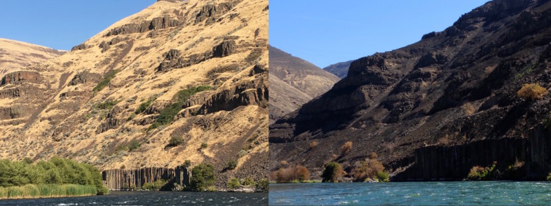
Photos by Emily DeCarlo. Taken from slightly different angles, these photos show the same hillside as it looked on Sept. 2, 2017 (left) and Sept. 2, 2018 (right).
The lack of people on the river adds an element of desolation to our surroundings. Labor Day weekend should be peak season, but aside from a handful of diehard steelheaders and a few rafts, there’s hardly anyone down here. To put things in perspective, we barely managed to secure boaters passes for these dates last year, snatching up the last two available out of the 214 that the BLM gives out each day from May 15-Oct. 15. This year, there were still nearly 200 passes available as of Aug. 31.
Staying close to the bank, we drift by some of the more popular campsites. One looks more like a neglected fireplace than a spot to set up camp for the night. Coal-black skeletons of torched hardwoods remain in place, their canopies the color of an eternal fall and their lifeless roots covered with a thick coating of ash. Every now and again a gust of wind kicks up a grey cloud of dusty cinders.
Then something catches Emily’s eye. “Look over there!” she shouts, pulling the camera away from her face. I follow her pointer finger to an opening in the charred trees and its obvious enough what she’s looking at. New growth. The more we look the more we see, bold and vibrant against the burnt backdrop. Some shoots are already over a foot tall, reminding us how wholly alive this canyon still is and giving us a preview of what all of this will look like come Spring.
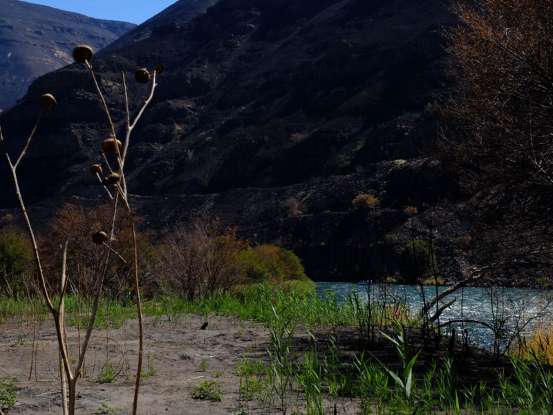
Photo by Emily DeCarlo. New growth sprouts up through the ashes.
Revitalized and delighted by the sight of green grass, we push down around the bend to anchor up at the island I had mentioned. Protected from the unruly blaze by a wide channel on either side, there are still plenty of healthy trees to hang a hammock from. And after eating a quick lunch of hot and spicy noodles, that’s exactly what we do.
Long overdue for a nap, Emily hops into the hammock to get some rest while I grab my rod from the back of the boat. The dog follows me, knowing exactly where I am headed and why I stopped here in the first place: there’s a good-looking run on the other side that just might hold a steelhead.


