Tribes and conservationists cheer Corps of Engineers decision that brings closure to a hard-fought campaign on the Yakima River
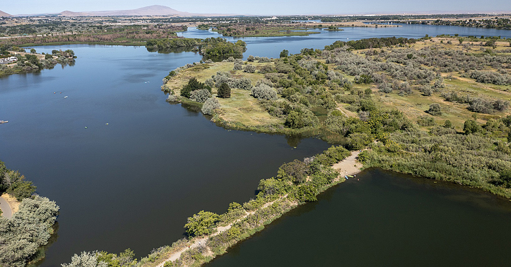
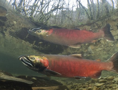
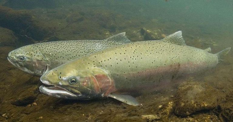
Heated pool: Warm, stagnant water created by Bateman Causeway invites predatory fish that feed on juvenile salmon and steelhead. Photo: Resources Legacy Fund
By Nathan Gilles. December 16, 2025. After more than 80 years of impeding the migration of salmon, the Bateman Island Causeway at the confluence of the Yakima and Columbia rivers is scheduled for removal beginning Dec. 22.
The U.S. Army Corps of Engineers Walla Walla District announced that Dec. 21 will be the final day of public access to the island before contractors begin installing safety fencing in preparation for the causeway’s removal, which is expected to start Jan. 5, 2026.
The demolition of the Bateman Causeway follows decades of science demonstrating the structure’s negative impact on local salmon and steelhead populations. It marks a significant victory for local tribal nations and salmon recovery efforts in central Washington.
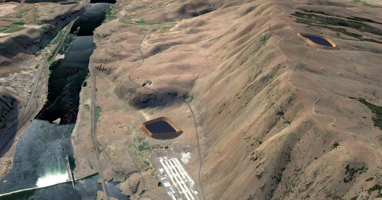
The 550-foot-long, 40-foot-wide earthen causeway connects the central Washington city of Richland to Bateman Island, a naturally occurring island once visited by explorers Lewis and Clark. The island sits in a shallow delta at the mouth of the Yakima River where the river flows into the Columbia.
The causeway is believed to have been built between 1939 and 1940, mostly likely illegally by a local farmer wanting access to Bateman Island in order to graze cattle.
Later, when the island and the causeway were opened to the public, both became popular among local residents as the causeway allowed them easy access to the island. However, while allowing for the flow of people, the causeway has restricted the flow of water to the detriment of native fish.
Positioned in the delta at the southern end of Bateman Island, the earthen structure prevents the warmer waters of the Yakima River from mixing with the cooler waters of the Columbia.
This has created a stagnant pool of warm, oxygen-depleted water dangerously unsuitable for both in-migrating adult and out-migrating juvenile salmon and steelhead. The conditions are ideal, however, for invasive predatory fish that prey on juvenile native fish waylaid by the delta’s slow, warm waters on their journey to Pacific Ocean.
The causeway also created conditions for mosquitos and harmful algal blooms to flourish.
In November, the Corps of Engineers awarded a $1.2 million contract to Pipkin Inc., an East Wenatchee-based company, to remove the artificial structure.
The project is being undertaken in partnership with the Washington Department of Fish and Wildlife, the Confederated Tribes and Bands of the Yakama Nation, the Washington Department of Ecology and the Mid-Columbia Fisheries Enhancement Group.
Victory for Tribes
“We’re excited and not just for our fishery efforts, but the whole ecological benefits it [removing the causeway] is going to bring,” said Joe Blodgett, who leads the Yakama Nation’s Yakama/Klickitat Fisheries Project.
“The causeway has caused a lot of disruption in the water flows, and the result of that has been the warm water, the increased predation, mosquitoes and the algae growth,” Blodgett told Columbia Insight. “Now everything’s going to benefit and start functioning as a normal system again.”
The Yakama Nation and the State of Washington have invested heavily in restoring salmon populations throughout the Yakima River Basin.
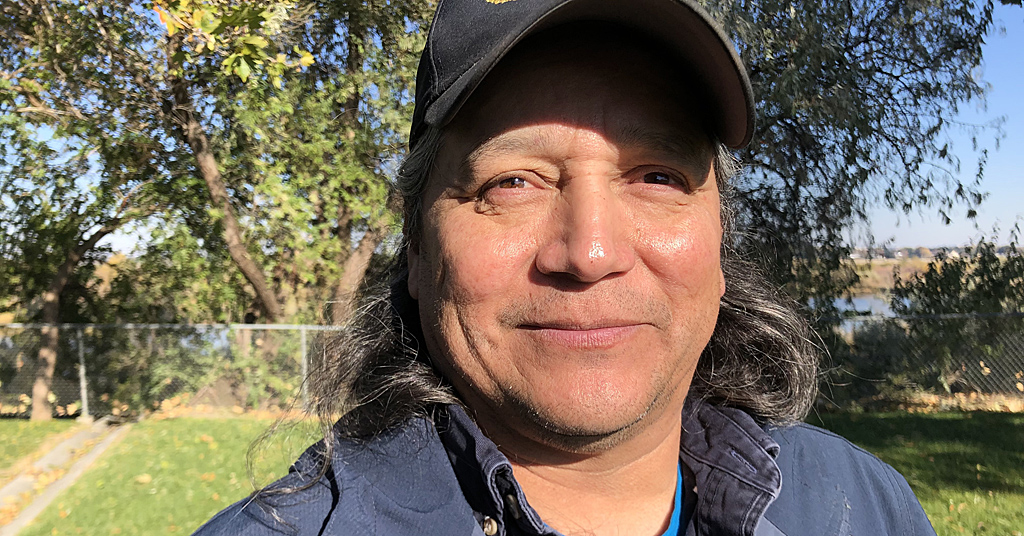
Joe Blodgett leads the Yakama/Klickitat Fisheries Project. Photo: Nathan Gilles
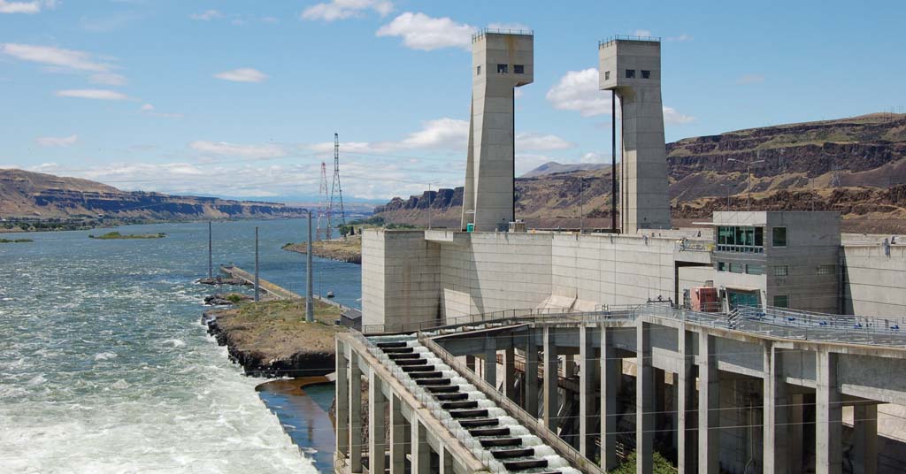
Sitting at the mouth of the river, the Bateman Causeway has long hampered these upstream efforts, said Mike Livingston, regional director for the Washington Department of Fish and Wildlife.
“This causeway is a bottleneck for fish,” Livingston told Columbia Insight. “They have to pass through the area [around the causeway] twice in their life history, once as juveniles and then as adults when they return. For the juveniles it’s a predatory factory. For the adults it artificially increases the water temperature.
“All of the investments that we’ve done in the upper basin are hinging upon the fish being able to successfully get to and from the Columbia.”
Science and inaction
As Columbia Insight reported in 2023, the path from recognizing the Bateman Causeway as an ecological problem to its removal has been long and fraught, mixing compelling science with decades of inaction followed by slow public deliberation.
The first study suggesting Bateman Causeway was creating a “thermal barrier” for migrating fish was published in 1986.
In the mid-1990s, scientists commissioned by the Bureau of Reclamation flew over the Yakima River Delta aiming infrared sensors at the waters below. This led to the 1997 publication of a detailed heat map showing how warm waters were pooling around the island, providing visual confirmation of what migrating salmon were enduring.
Seven years later, in 2004, the Army Corps of Engineers published its own report that reached the same conclusion. The report called for the causeway’s removal.
The report, however, largely gathered dust. Another decade slipped by before the publication of the next significant study on the causeway.
That study was led by the Yakama Nation, Mid-Columbia Fisheries and Benton Conservation District. It also concluded the causeway had to go, as did a follow-up study in 2016.
These two studies kicked off a lengthy public comment period between local residents and government and tribal officials about how best to remove the causeway. That work led to the current removal effort.
“It’s been a really long effort and lot of people have contributed to it,” said Livingston, who spent nearly a decade involved in the effort to remove the causeway. “I’m just happy we’ve finally reached this point where we can improve the ecosystem for fish and for people.”
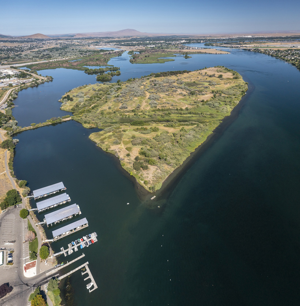
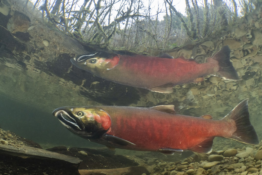
Heart-shaped box: At the confluence of the Yakima and Columbia Rivers, the causeway to Bateman Island creates a slack water trap for migrating fish. Photo: Resources Legacy Fund
The lengthy public comment period, while frustrating to many, appears to have helped resolve local opposition to the causeway’s removal.
“Well, obviously, during this whole process there was frustration because things don’t ever move as fast as you’d like them to,” said Blodgett.
But, Blodgett says, the process was necessary for both listening to the concerns of local residents and government officials, as well as helping explain how removing the causeway would help fish and the local ecosystem.
“We know that things take a while,” said Blodgett. “But we’ve definitely done a lot of studies and understand the benefits that this [removing the causeway] is going to bring. So, we’re looking forward and being optimistic and thinking that this is going to be a big advantage to a lot of our efforts here in the Yakima Basin.”
For millennia before European contact, Bateman Island served as a vital fishing and trading hub for the region’s original inhabitants. Evidence for human occupation of the island dates back 16,000 years, according to a U.S. Army Corps of Engineers report.
Today, the island is considered culturally significant by the Yakama Nation, Confederated Tribes of the Umatilla Indian Reservation, Wanapum Band, Confederated Tribes of the Colville Reservation and Nez Perce Tribe.
The Yakama Nation became co-managers of the Yakima Basin’s fisheries with the Washington Department of Fish and Wildlife following the landmark 1974 Boldt Decision, which re-affirmed Washington Tribes’ treaty reserved rights to half the catch of salmon and steelhead fisheries, with the Tribes and state co-managing the fisheries.


Nathan, perhaps you can get a better answer than I can, since the Corps has been ignoring my comments. I cannot post the photo here, but if you can pull up the area on Google Earth, March 2024 photo, you will see a very large plug of silt that has been building for years on the south (left) bank of the Yakima. While this photo is at a lower water period, it is likely only 2-3 feet below the normal level of the lake. The Yakima is not going to suddenly break through this plug, as it is likely20 feet of accumulation since the lake was finished in 1955 or so. After this years flooding, it may have added another foot there. Trees and shrubs have already established on about half of the silt. This plug will have to be removed in order for water to flow freely again on the south side of the island, and even if removed, the river may have other ideas. As the Walla Walla District Wildlife Biologist from 1985 through 2012, I have spent many hours in this area and have watched it silt in
Great article, finally the road/like will be removed