Accustomed to working in silos, land trusts are realizing fractured efforts to save the environment won’t cut it
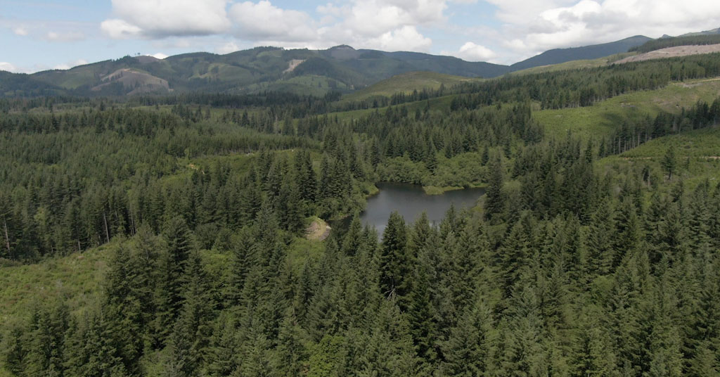
Going extinct: Formed by Kwoneesum Dam, the 10-acre Kwoneesum Lake in southwest Washington blocks fish from spawning habitat. Thanks to a collaborative effort, it will be removed next year. Photo: Resources Legacy Fund
By Grant Stringer, May 4, 2023. For almost 60 years, a dam tucked into a creek on private timberland in southwest Washington has cut off miles of habitat for endangered salmon and steelhead.
The dam will be demolished next year and the surrounding ecosystem restored thanks an unlikely alliance of East Coast philanthropists, a timber giant, tribal scientists and a budding network of conservation-minded land trusts.
The removal of Kwoneesum Dam, which stands northeast of Camas, Wash., is part of a major trend in conservation being led in the Columbia River Basin.
Here, Pacific Northwest land trusts are collaborating with new partners to shore up climate resilience throughout the region.
Scientists say areas that can weather the worst of climate change, such as protected watersheds and mature forests, will become critical to biodiversity and human communities.
Local land trusts have banded together and made it their mission to protect—and connect—these areas.
In doing so, they’re attempting something new: aligning climate action on a regional scale.
“There’s something way, way bigger going on with this,” says Dan Bell, land trust director at the nonprofit Friends of the Columbia Gorge, of the recent moves to join forces and consolidate resources in the fight against climate change.
Fractured efforts
In 2019, Columbia Land Trust, based in Vancouver, Wash., bought Kwoneesum Dam and a surrounding 1,300-acre parcel for about $3.24 million from Weyerhaeuser, the Seattle timber company. Co-funders included the Washington state government and the national Land Trust Alliance, based in Wash. D.C.
Columbia Land Trust and the Land Trust Alliance are part of a regional network of trusts calling itself the Pacific Northwest Resilient Landscapes Initiative, which announced its first projects to conserve essential lands in 2020.
Together, they’ve identified and helped protect about two dozen areas in the Northwest, from coastal rainforests to Oregon’s high desert.
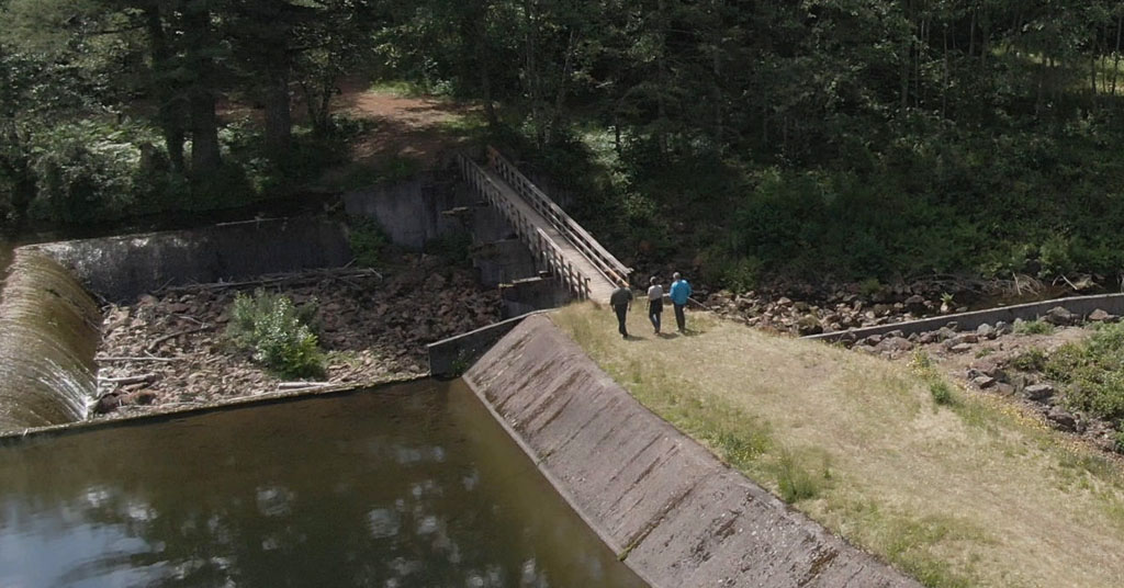
Blocking motion: Kwoneesum Dam is a 45-foot-high earthen structure on Wildboy Creek, which flows into the lower Washougal River, a tributary of the Columbia River. Photo: Resources Legacy Fund
These lands provide critical sources of water, diverse ecosystems, connected habitats and fire-resilient forests. In some cases, they’re also managed to allow for some timber production and ranching to support people as well, says Owen Wozniak, a Land Trust Alliance project manager who steers the initiative.
To pick which lands to protect, they’re using a scientific tool developed by the Nature Conservancy that maps resilient lands throughout the United States.
Friends of the Columbia Gorge also used the map when charting about 30 resilient areas in the Columbia River Gorge. The Gorge Commission’s new draft climate plan prioritizes these lands for conservation.
Bell says its another example of collaboration for resilience, which bucks the tendency of nonprofits and Gorge governments to work on separate climate plans, in silos.
“To some degree, that fracturing is very real,” says Bell.
Wozniak says the nature of climate change requires regional cooperation between groups like land trusts. For instance, salmon and other fish migrating through the Columbia River Basin are deeply threatened by a combination of dams in three states, climate-fueled heatwaves and low streamflows.
Land trusts are tackling massive issues like these “by working at a scale that somewhat makes more sense,” he says.
‘Great experiment’ in conservation
The project around Kwoneesum Dam is a case study in conservation for climate resilience, says Cherie Kearney, conservation director at Columbia Land Trust.
The dam has served no purpose since the 1980s, when the first in a line of wood products companies bought it and the surrounding land. Fish have no way to navigate over the dam. Cowlitz Indian Tribe scientists plan to begin removing the dam next year.
The area now functions as a bridge between state-owned lands amid a patchwork of timber farms in southwest Washington’s Cascades foothills.
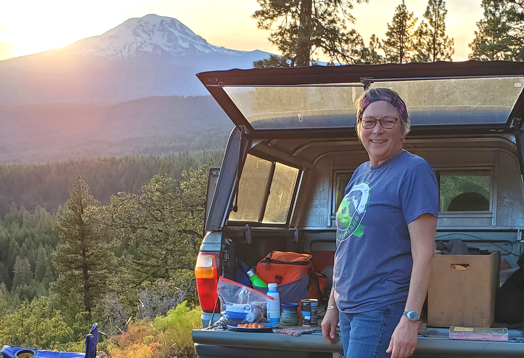
Peak partner: Cherie Kearney specializes in bringing stakeholders together. Photo: Columbia Land Trust
Kearney and her team will manage the land for sustainability by keeping mature trees from being logged and helping the Cowlitz Indian Tribe protect the riparian ecosystem.
The Pacific Northwest Resilient Landscapes Initiative doled out about $70,000 for the project and helped pay for two others spearheaded by Columbia Land Trust in Washington.
These include almost 5,000 acres along the Klickitat River in the central part of the state now conserved in partnership with the Yakama Nation.
The initiative has helped protect about 20 other resilient areas in the region, including a 32-square-mile corridor in Oregon’s coastal rainforest; a desert expanse in the state’s southwest corner; an island of private land in Idaho’s Caribou-Targhee National Forest at risk of development; and a mosaic of habitats in central Washington.
It’s a “great experiment” in conservation, says Wozniak.
He says the work hinges on a thriving ecosystem of land trusts in the Pacific Northwest that’s probably the strongest of any region in the United States.
Focus on ‘resilient lands’
Wozniak and Bell are both thrilled with the Nature Conservancy’s mapping tool that estimates the resilience of U.S. lands on a granular level.
That map is the backbone of the Gorge Commission’s key, 2035 goal to conserve 70% of “above average” resilient lands in the Columbia River Gorge National Scenic Area spanning Oregon and Washington.

Transactions manager: Owen Wozniak. Photo: Land Trust Alliance
The plans are detailed in the commission’s draft climate plan alongside measures to slash greenhouse gas emissions.
About 63% of these resilient areas are already conserved, according to the draft plan.
The 32 areas include river deltas, the Gorge’s many creeks and peaks from The Dalles to Dog Mountain.
Bell says he’s pleased with the plans.
He also applauds the commission for bringing a wide variety of people and groups to the table in developing the plans, including Friends of the Gorge.
“Collaboration is key,” he says.
Not just key, it appears, but increasingly common. And vital.
Columbia Insight’s reporting on biodiversity in the Columbia River Gorge is supported by the Autzen Foundation, Pacific Power Foundation and Ripple Impact NW.

![]()




Great collaboration between CLT & Cowlitz Tribe.
Another one bites the dust…dams.
Gorge Comm. Goal to conserve 70% resilient lands in NSA is commendable.
THe question is increasingly becoming not just how to “preserve” our ecosystem resources, but how are humans to co-exist with and learn to live within the limits of earth’s resources.