Climate change means larger atmospheric rivers could lead to billions of dollars in damages. But how good are the predictions?
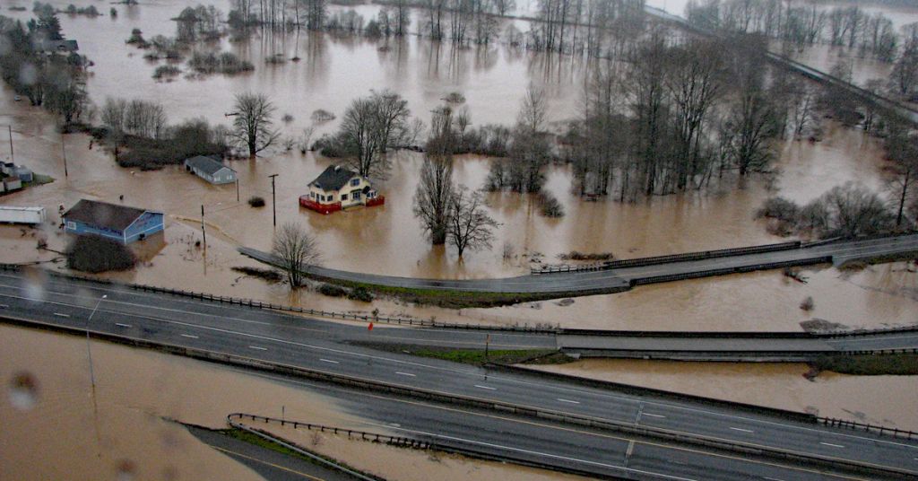
Catastrophic cost: In January 2009, a 20-mile section of Interstate 5 was shut down in Lewis County, Washington, after record snow was followed by torrential rain and flooding. Photo: WSDOT
By Nathan Gilles, October 27, 2022. In August of this year, The New York Times ran a feature story titled “The Coming California Megastorm.”
The story described the results of a study published that same month in the journal Science Advances predicting that climate change increases the likelihood that an incredibly large storm will hit California in the coming decades, creating a “megaflood” that will displace millions of people and lead to $1 trillion in economic losses.
This “megastorm,” similar to one that hit California in the winter of 1861-1862, will in reality be a series of very massive storms making landfall one after another and lasting for weeks.
The storms will be fed by atmospheric rivers, so-called “Pineapple Expresses” that start in the tropical waters near Hawaii.
Atmospheric rivers are aptly named. Like rivers on the ground, atmospheric rivers move water. But instead of moving liquid water, they move water vapor, vast amounts of it.
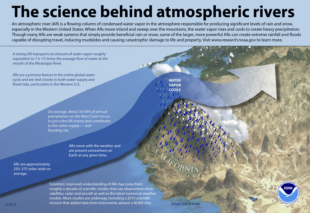
Forming about one mile up in the atmosphere, these rivers in the sky are roughly two miles deep, 250-500 miles wide, and hundreds to thousands of miles long. When they make landfall in California, Oregon and Washington, the water vapor they carry can turn into torrents of precipitation that can fall at 1 inch or more an hour and last for days on end.
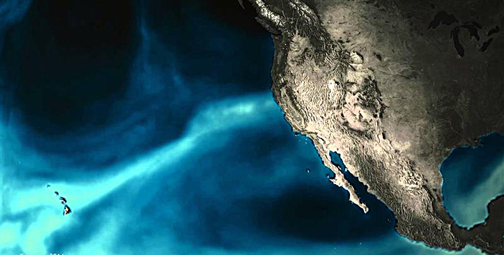
Pineapple path: Atmospheric rivers bring precipitation from the tropics to the West Coast. Illustration: NOAA
While the study and Times story only cover atmospheric river predications for California, scientists agree: climate change means larger, more frequent and hence more destructive atmospheric rivers will impact the entire West Coast, leading to billions of dollars in damages in all three coastal states.
And although nothing similar to the California “megaflood” scenario has been examined for the Pacific Northwest, according to recent studies some of the hardest hit areas are expected to be in Oregon and Washington.
But while the scientific consensus is that atmospheric rivers will become more destructive all along the West Coast, this is about where the consensus ends.
Research findings don’t agree on where exactly these destructive storms will make landfall and how far inland they might penetrate.
Some predictions suggest the Pacific Northwest will see more atmospheric rivers. Others do not.
What’s more, researchers say, future predictions probably aren’t complex enough to determine the scale of destruction that larger atmospheric rivers could bring to the region.
But this doesn’t mean the predictions are over-estimating damages. If anything, say researchers, their estimates are probably low-balling future costs.
From beneficial to hazardous
When atmospheric rivers make landfall on the West Coast, they often run headlong into the region’s mountain ranges. When they do, their water vapor can cool and fall, providing much needed precipitation in the form of both rain and snow.
In fact, atmospheric rivers are responsible for about 30-50% of all precipitation that falls in Oregon, Washington and California, according to the National Oceanic and Atmospheric Administration.
This precipitation can be especially beneficial after long periods of drought.
And although the historic record is replete with its share of destructive atmospheric rivers—like the atmospheric river that hit near Sacramento in 2017 and led to the evacuation of 190,000 people downstream from the Oroville Dam—most atmospheric rivers that make landfall on the West Coast are considered beneficial, according to scientists.

Rain man: Alan Rhoades. Photo: Lawrence Berkeley National Laboratory
This is likely to change.
Under future climate change, landfalling atmospheric rivers on the West Coast are likely to “shift from being ‘mostly or primarily beneficial’ to ‘mostly or primarily hazardous,’” according to a study published in 2020 in the journal Geophysical Research Letters.
Why this is likely to happen breaks down to a simple physical mechanism: warmer air can hold more moisture.
“The idea is that for every degree of warming, the water vapor holding capacity of the atmosphere increase by about 6-7% percent,” says study lead author Alan Rhoades, hydroclimate research scientist at the Lawrence Berkeley National Laboratory in Berkeley, California.
This means, says Rhoades, that the size of the atmospheric rivers making landfall are expected to be larger. And this is exactly what his study found.
Using an advanced computer model known as an earth system model, Rhoades and colleagues ran climate simulations—hypothetical scenarios based on the very real physical laws that create weather and climate—to see how atmospheric rivers might change by the end of the century if emissions stay constant and global warming continues.
The researchers found that while the number of atmospheric rivers created over the tropical Pacific actually drops, the size of those atmospheric rivers increases, as does the number atmospheric rivers making landfall on the West Coast.
Due to this increase in size and frequency, landfalling atmospheric rivers shift from being mostly beneficial to mostly hazardous, according to the study.
Categorizing destructiveness
Like other storms, atmospheric rivers have their own scale.
Categories 1 and 2 are generally considered “mostly or primarily beneficial.” These, says Rhoades, are the so-called “drought-busting” storms that bring much needed rain and snow. This water is also generally within a range that can be handled by dams and reservoirs.
Move up in scale and it’s another story.
Precipitation from category 4 and 5 atmospheric rivers can’t be stored as easily in reservoirs, and instead tends to produce “extreme runoff” (aka flooding) and are considered “mostly or primarily hazardous.”
Category 3 is something of a mixed bag. These storms can be both good and bad depending on a whole series of circumstances, such as how much precipitation has already fallen.
Under future climate change, the number of category 1 and 2 atmospheric rivers decreases by about half of what they are been historically. Whereas, categories 3, 4 and 5 all increase, according to Rhoades’s study.
In fact, if nothing is done to stop global warming, the study concludes, by the end of the century, category 3 atmospheric rivers could increase by 27%. Whereas, categories 4 and 5 atmospheric rivers are expected to increase by 2 and 3.5 times respectively.
While this growth might not look like much, it’s important to consider these numbers in context, says Rhoades.
“Every time you get a subtle uptick in these category 4 and 5 ARs [atmospheric rivers] you start to see flood damages double,” says Rhoades.
The historical record bears this out.
Historical flooding and flood damages
Using flood insurance claims filed by homeowners with the National Flood Insurance Program from 1978 to 2017, a 2019 paper in the journal Science Advances found that atmospheric rivers cost the Western United States about $1 billion dollars a year in damages.
In fact, over the 40-year period the study examined, a whopping 84 % (roughly $42.6 billion) of the $50.8 billion in total flood damages that occurred in the region were due to atmospheric rivers.
While the study looked at the 11 states that make up the Western United States, the vast majority of these damages occurred on the coast in Oregon, Washington and California.
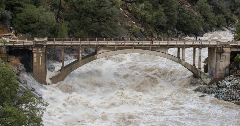
Troubled waters: South Yuba River during the atmospheric river event across Northern California on January 9, 2017. Photo: Kelly M. Grow/CA Dept. of Water Resources
The study also found that costs associated with damages increased as the size of atmospheric rivers increased. Here’s where things get really interesting.
Just 13 Category 3, 4 and 5 atmospheric rivers produced nearly $27 billion dollars in total damages over the 40-year period.
Like the predicted California megastorm, these atmospheric river storms were multiday events, lasting as long as 11 days straight. Nonetheless they make up just a fraction of the total study period.
In total, these 13 storms comprised just 65 days but accounted for over 58% of total insured losses filed over the 40-year period.
Leading events included five atmospheric rivers that made landfall in Washington and Oregon between 1986 and 2009, costing the two states nearly $11 billion dollars. Though, the study notes, damages were probably lower than they might have been because some of the storms landed in sparsely populated areas.
“What’s important from a flood insurance standpoint is it’s these [Category] 4 and 5s that are driving most of the flood damages,” says Rhoades.
Predicting damage
In a study published last year in the in the journal Weather and Climate Extremes, Rhoades and colleagues combined this historical analysis of damages with future climate predictions to determine future costs associated with the expected growth of atmospheric rivers under climate change.
Unsurprisingly, because Category 4 and 5 atmospheric rivers are expected to increase with warming temperatures, the paper found that these large storms are also driving predicted future losses as well.
The paper considered multiple warming scenarios, including futures with 1.5 °C (2.7 °F), 2 °C (3.6 °F) and 3 °C (5.4 °F) of warming, concluding that for each 1 degree Celsius (1.8 degrees Fahrenheit) of warming annual flood damages increased by about $1 billion.
[perfectpullquote align=”full” bordertop=”false” cite=”” link=”” color=”” class=”” size=””]“If we continue to build in floodplains then things will get worse.”[/perfectpullquote]
Rhoades’s study is just one predicting a large increase in costs associated with atmospheric rivers.
A study published in August in the journal Nature Scientific Reports found flood damages associated with atmospheric rivers are likely to rise from a current average of about $1 billion a year to as high as $3.2 billion a year by the end of the century if nothing is done to halt emissions and warming.
“We had very close agreement in the results,” says study’s lead author Tom Corringham, a research economist at the Scripps Institution of Oceanography at UC San Diego, about his study’s agreement with Rhoades.
The agreement is significant because unlike Rhoades’s studies, which used just one model, Corringham’s paper used 16 models to arrive at its future damage predictions, increasing the odds that what’s being predicted will one day come to pass.
Corringham is also the lead author of the 2019 historical analysis in Science Advances.
Corringham’s 2022 paper estimates damages on a county by county basis, again for all 11 western states.
Here, too, the largest increase in damages is likely to occur within the coastal states of California, Oregon and Washington. (Though two Nevada counties also see large damages associated with atmospheric rivers.)
In fact, the study found the Columbia River Basin will see some of the largest increases in damages of all regions examined.
“What’s interesting about the Columbia River is that it creates a break in the mountains so atmospheric rivers are able to penetrate inland there,” says Corringham.
The hardest hit Washington and Oregon counties include Washington’s already flood-prone Lewis County, Seattle’s King County and Oregon’s Columbia County near the mouth of the Columbia River. Though Lewis County will see the most damages associated with atmospheric rivers—with damages predicted to reach $330 million a year—all three counties are expected to see flood damages double by 2090 under a high-warming scenario.
This doubling is also predicted to be statewide with Oregon experiencing roughly $390 million and Washington experiencing roughly $880 million in total damages annually by the end of this century, according to data produced by the study.
However, says Corringham, there’s still a lot of uncertainty about where atmospheric rivers might make landfall in the future.
Some model results suggest more atmospheric rivers will land above the 45th parallel, near Salem, Oregon, while others predict this is less likely.
“There is a lot of uncertainty as to what will happen with the track of these storms” says Corringham. “The general prediction is that they should move to higher latitude. But it’s uncertain. The models don’t agree on that.”
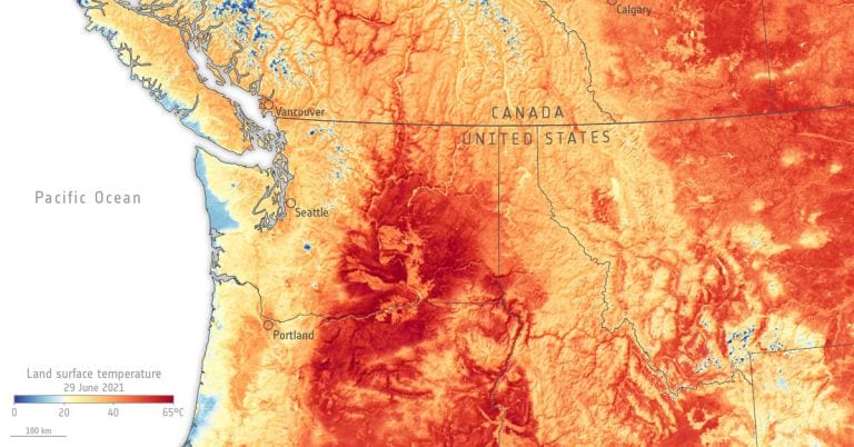
Elements of this image furnished by NASA
The one thing the models do agree on, says Corringham, is that storms driven by atmospheric rivers will get larger as the climate warms. Though how much larger is also uncertain.
Both Corringham and Rhoades note their projects lacked the computing power to determine if a “megastorm” could make landfall in the Pacific Northwest in the future.
However, climate change is likely to increase the risk of flooding in the region for another reason: disappearing snow.
Why less snow means more flooding
A study published last year in the journal Hydrology and Earth System Sciences concluded the climate change increases the likelihood of extreme flooding throughout the larger Columbia River Basin.
“We found that at basically every location [in the Columbia River Basin]—except the lower main stem of the Columbia [River]—that we would expect the maximum flood events to increase in magnitude in a warmer world, and that was surprising,” says study coauthor, climate researcher Phil Mote, vice provost and dean of the Graduate School at Oregon State University.
The increase in flooding, according to the study, is largely driven by warming temperatures forcing precipitation to fall as rain rather than as snow.
Historically mountain snow, or snowpack, has acted like a natural reservoir.
But as temperatures continue to rise and precipitation switches from snow to rain, all that water isn’t stored. It flows immediately into a watershed’s rivers and streams.
If dams and reservoirs can’t slow these waters, flooding will result.
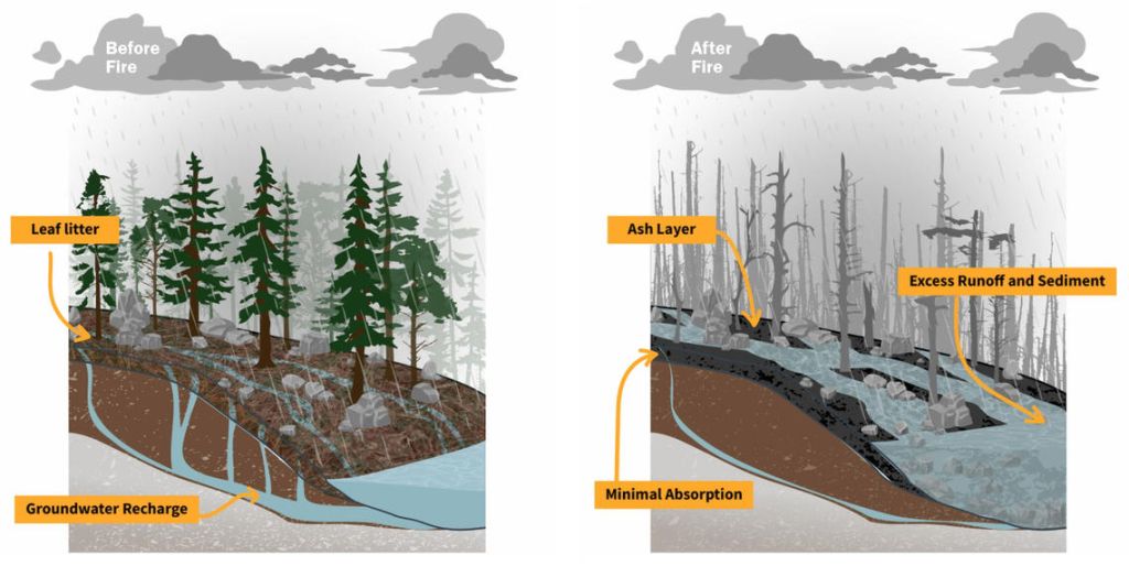
Fires don’t help: Before a fire, forests act like a sponge and a water filter. After a fire, forests respond to rainfall as if the ground is covered in a layer of plastic wrap, making flooding worse. Illustration: USGS
Among the study’s more interesting finding, the researchers note that by the end of this century, large 100-year floods (floods with just a 1% chance of occurring in any given year within a 100-year period) are likely to increase in size by 40% where the Willamette River meets Portland. Further upstream on the river, these rare, large floods are likely to increase by 60%, according to the study.
The study also found that flooding is expected to start earlier in the year and last longer.
Corringham and Rhoades also concluded that warming temperatures would lead to more rain and less snow.
In fact, according to both researchers, atmospheric rivers are getting warmer as air temperatures rise, meaning they will be more likely to dump vast amounts of rain rather than snow. This could lead to rain-on-snow events during which warm rains effectively wash away mountain snowpack, something atmospheric rivers tend to do in the Pacific Northwest already, according to Mote.
“One thing I would say about the literature on ARs [atmospheric rivers] is there is so much focus on California where they do deliver precipitation that can in many cases restore [water levels], but that’s not true in the Northwest,” says Mote. “They [atmospheric rivers] are almost always wet storms that strip off the existing snowpack and leave us with less water.”
Mote and his colleagues’ study didn’t examine the role atmospheric rivers are likely to play in future flooding. However, atmospheric river events were there in the climate simulations and resulting precipitation data used in the study. They just weren’t parsed out of the data, so to speak.
But although atmospheric rivers weren’t considered in Mote’s study, his study has two very clear advantages over Rhoades and Corringham’s research: it’s not only Pacific Northwest-specific, it’s also a lot more detailed.
The analysis not only uses climate models to determine how much and where precipitation is likely to fall in the future, it uses a hydrology model to determine how that falling precipitation is likely to flow within the complex topography of the Pacific Northwest.
Predictions likely lowball losses
But Rhoades and Corringham’s research might be lacking still more key details.
Both researchers’ what-if future scenarios assume that population numbers don’t grow.
“It’s sort of an experiment saying that if the world stayed the same and all that happened was climate change how would atmospheric rivers change and how would that change the damages?” says Corringham.
What this means is that the future scenarios in the two studies assume by extension that more housing won’t be built in new or existing areas that could experience future flooding. And this is probably not a safe assumption.
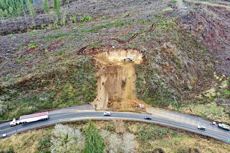
Taking a toll: A January 2021 landslide interrupted traffic on U.S. 30 near Astoria, Oregon. Photo: OR DOT
“The models are predicting that atmospheric rivers are going to get stronger over time. And if we know that more people are coming into the West, then our estimates are actually kind of conservative because we would expect greater damages,” says Corringham.
On the flipside, says Corringham, research like his might also be over-estimating damages because it assumes a world in which nothing is done to prevent damages, for instance, moving housing outside of floodplains, prohibiting future building in floodplains and updating dams and reservoirs to withstand future flooding.
“If we’re smart about where we develop in the coming decades, then we may actually be able to reduce the damages relative to our projections,” says Corringham. “If we continue to build in floodplains then things will get worse.”




Phil Mote has spoken to the Gorge Commission. He is vey credible. The basic issue s we have to reduce global warming. I like the clarity of this article and predictions of more atmospheric rivers. Good writing.