U.S. Forest Service decision to swap land in Government Camp would transform commercial impact on Mount Hood. Community members on north side of the mountain are ‘aghast’ at deal
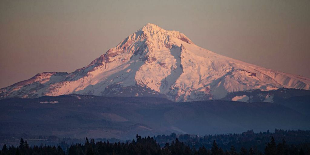
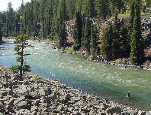
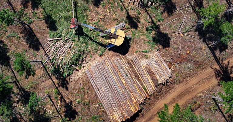
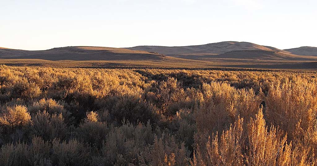
Peak promise: After years of wrangling a deal may be in place to undertake large-scale develop on Mount Hood. Photo by The Oregonian
By Ted Sickinger, The Oregonian/OregonLive, February 9, 2021. The long-running financial feud over a land swap that could transform development on the shoulders of Mount Hood hit a significant milestone this week as the U.S. Forest Service issued a final environmental analysis of the deal and a draft decision on proposed terms.
If this sounds familiar, it’s because some form of this grand bargain involving a swap of federal land in Government Camp for acreage owned by Mt. Hood Meadows at Cooper Spur has been in the works for two decades.
After years of dispute, Congress mandated that the Forest Service go ahead with a swap in 2009. But the deal has been repeatedly stymied by disputed appraisals, community and congressional concerns, new clarifying legislation, mediation, litigation and what many consider a slow walk by the Forest Service.
This is the first time, however, that the swap appears to be entering the home stretch with the Forest Service publishing a draft decision laying out the terms it sees as equitable. The decision is subject to a 60-day objection period, but in theory, it could be finalized by this summer.
Mount Hood National Forest Supervisor Richard Periman said in his decision posted Thursday that the terms satisfy congressional intent and provide significant public benefits. Mt. Hood Meadows officials called the decision “fair and accurate” and said “it is important that we recognize that this draft decision is in the public interest.”
“While there is still a ways to go, we are excited by the progress made to date and for the many potential opportunities completion of this historic land exchange will bring to the communities of Mt. Hood and to Oregon,” said Matthew Drake, chief executive of Mount Hood Meadows Oregon.
[perfectpullquote align=”full” bordertop=”false” cite=”” link=”” color=”” class=”” size=””]A community group says Forest Service appraisals “grossly undervalue” the land in Government Camp.[/perfectpullquote]
Community members on the north side of Mt. Hood, meanwhile, are aghast. After two decades trying to solve this puzzle, they say the deal doesn’t come close to satisfying the aim of Oregon’s congressional delegation or their own vision of a so-called “clean sweep” that would protect the area around Cooper Spur from development and direct all future building activity to Government Camp.
“It’s way worse than I thought it would be and it’s a terrible deal for the public,” said Heather Staten, executive director of Thrive Hood River, a conservation group in the Hood River Valley. “If this doesn’t solve the problem that Congress got involved to solve, which is to protect the north side, then all that has happened is that the government has facilitated a sweetheart deal for one corporation.”
In short, they intend to keep fighting.
Mike McCarthy is an orchardist whose great-grandfather homesteaded in the upper Hood River Valley in 1910. His family has been involved in efforts to stop further development at Cooper Spur and protect the watershed since Mt. Hood Meadows started contemplating a destination resort there in the 1970s. He says his mother was an early environmentalist in the area and he had hoped to see a deal done before her death in 2015.
“Now,” he said, “I’m hoping we’ll finish it before my death, whenever that is.”
The deal
The proposal calls for the Forest Service to transfer 67 acres of prime real estate for residential development in Government Camp to Mt. Hood Meadows. Company officials say that’s enough land for 144 building lots, though some estimates put it higher.
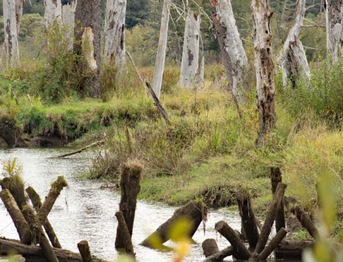
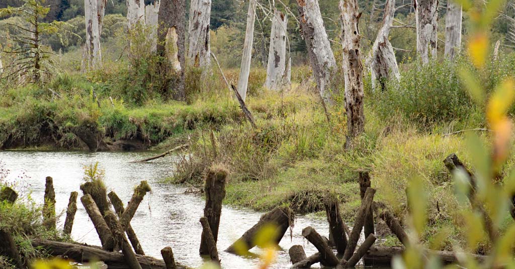
In exchange, Meadows would relinquish 605 acres of forestland on the north side of the mountain. That land, along with 2,700 acres of existing federal lands, would become a protected riparian area designated as the Crystal Springs Watershed Special Resources Management Unit. The Forest Service intends to add another 1,700 acres of land to the Mt. Hood Wilderness area between Cooper Spur and the Tilly Jane campground.
Yet opponents remain wary of one ownership proposal: The deal calls for Mt. Hood Meadows to retain ownership of Cooper Spur Mountain Resort, which comprises 159 acres of land, an inn, log cabins and other facilities. Meadows would transfer the Cooper Spur ski buildings and equipment to the Forest Service and relinquish its permit to operate it.
However, the Forest Service would seek a new operator of the ski area under a permit of up to 40 years. And that could be Meadows again, if it sought the permit.
According to appraisals approved by the Forest Service, the land in Government Camp is worth $3.76 million, while the land it would acquire at Cooper Spur is valued at $4.1 million. To equalize those values, Meadows would be paid $338,940.
Appraisals questioned
The entire deal hinges on the fair market appraisals, the key basis for determining whether the public is getting a good deal for the land, whether Meadows is being treated equitably, and ultimately how much land, if any, that Meadows would keep on the north side.
The community group and their lawyers say the Forest Service’s appraisals once again “grossly undervalue” the land in Government Camp. They say that undermines the public interest, and scuttles the original intention by leaving Meadows with about 159 acres of land on the north side, where it could pursue further development.
“The Forest Service and Mt. Hood Meadows chose to negotiate behind closed doors, rely on flawed appraisals and fundamentally alter the deal without the support of conservation groups, recreation clubs and local residents that supported them over two decades,” said Ralph Bloemers, the lawyer who has represented Thrive for two decades.
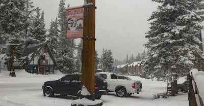
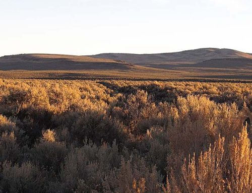
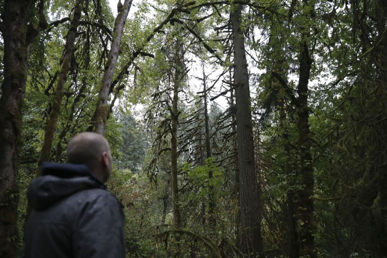
Change-up area: 144 new buildings lots could be opened up in Government Camp. Photo by David Prasad/Creative Commons
As originally envisioned when proposed to the Forest Service in a 2005 agreement between Hood River County, the residents committee and Mount Hood Meadows, the swap involved 120 acres of federal land at Government Camp for all 770 acres of Mt. Hood Meadows’ land at Cooper Spur. But that “clean sweep” deal got hung up over controversy over the original appraisals.
Four years later, Oregon’s delegation pushed Congress toward a permanent fix in the 2009 Omnibus Public Lands Act, which mandated the trade happen within 16 months. But by 2014, the deal had gone nowhere, and Oregon lawmakers began to prod the Forest Service to make it happen after residents sued to force the swap.
The Forest Service hired an appraiser from Alabama to evaluate the properties. In summer 2017, the appraiser valued the Government Camp parcels at about $5 million and the Cooper Spur land at $9.5 million, using properties in Hood River, Sandy, Redmond and Medford to value the land in Government Camp.
Thrive and Bloemers’ Crag Law Center hired their own expert from Portland to review the federal appraisals. He found “significant errors” that undervalued the land in Government Camp and overvalued Mt. Hood Meadows property at Cooper Spur.
After mediation, the Forest Service ordered a new round of appraisals. The federal appraiser’s new report in December 2019 used properties in West Salem, Camas, Vancouver and Ridgefield to value the 107 acres of land in Government Camp at $5.7 million. After deducting unusable land due to required buffers, new roads, existing easements and other building constraints, the remaining 67 acres of Government Camp land was valued at about $85,000 an acre.
The Forest Service reviewed and approved those appraisals last year, prompting another round of reviews by Crag’s appraiser. They delivered that review to the Forest Service earlier this week.
Again, they claimed to find significant flaws. In particular, they say the federal appraiser failed to deduct unusable land from two of the comparable properties he examined to value the Government Camp property, and in essence, simply divided the sales price by the gross acreage.
They cited numerous issues, including that the federal appraiser:
- Undervalued two of the comparable properties by between 75% and 100% on a per acre basis when he failed to note that up to half the land in question was not developable.
- Used one comparable property in West Salem where housing prices are typically low, and certainly not comparable to the limited supply of developable land in the mountain resort.
- Applied the faulty valuation on the comparable properties—a value per gross acre—to the net acres of usable land at Government Camp.
- Failed to adjust for appreciation on the majority of sales that were negotiated one and a half to two years prior to closing.
Crag’s reviewer ultimately determined that the Government Camp property would be better valued at between $128,333 and $165,200 per buildable acre. Using a lower value of $125,000 an acre, that’s the equivalent of $8.3 million, 46 percent higher than the value in the federal appraisal.
The Forest Service’s draft decision on the land swap is now based on only 67 acres of land on the west side of Government Camp. The federal appraisal values that plot at $3.76 million, while applying Crag’s valuation would put it closer to $5.6 million.
Greg Leo, a spokesman for Mt. Hood Meadows, declined to delve into the specifics of the Crag’s review of the federal appraisals, but said the disagreement would be aired out during the Forest Service decision process, and the appraisals have to conform with very strict rules on government land trades.
There’s another way to look at the deal. Meadows says the 67 acres at Government Camp will accommodate about 144 building lots. Based on the Forest Service approved valuation of the land, that’s about $26,000 per lot. There will be extensive engineering, infrastructure and other costs associated with developing the land. But comparably sized lots in the area that have recently sold in Government Camp—albeit with road and utility access—have gone for up to 10 times that price.
What’s next?
The deal is now open for a 60-day objection period in which members of the public who participated in the planning process can voice their concerns to the Forest Service.
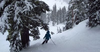
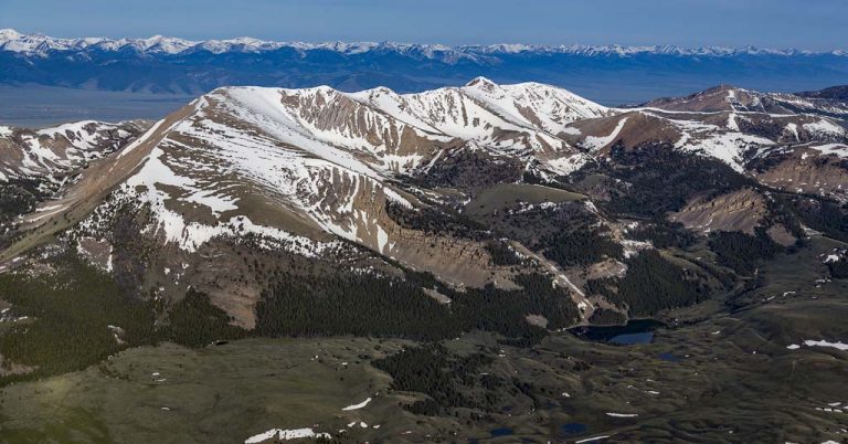
Never enough: If the deal goes through, powder days could become more crowded at Mt. Hood Meadows. Photo by Eli Duke/Creative Commons
Heather Ibsen, an agency spokeswoman, said it didn’t receive Crag’s review of the transaction until last week, so hadn’t completed a detailed review. But she said Crag and the citizen’s group, like other entities, will have the opportunity to participate in the process.
Neighbors’ overriding concern is that because of the “faulty” appraisals, Meadows could be left with 159 acres of land at Cooper Spur and potentially pursue future development. They point out that the company circulated a memo in 2017 contemplating a significant expansion of the Cooper Spur ski area as part of the process. That included expanded parking capacity, a new quad chairlift operating year round, new ski runs and additional lodge and food service capacity.
Meadows would be giving up its permit for the ski area as well as associated equipment as part of the deal outlined by the Forest Service. But nothing in the deal stops the company from submitting a proposal to operate it again when the Forest Service looks for new operators. If successful, the company could reinitiate its expansion efforts as well, said Staten, of Thrive.
“We had two goals: directing development to Government Camp, and providing us certainty about the future,” she said. “By retaining this land, it undermines the certainty for the future. There’s still a bunch of development potential.”
Back to court?
Ibsen says the so-called clean sweep was never mandated by Congress, and that the agency has never received a formal expansion proposal for the ski resort. She points out that some of the land for the expansion will be wilderness area after the land exchange is completed, and not open to recreational development.
Meadows, meanwhile, says 156 of the 159 acres of the land it would be left with after the exchange would be subject to highly restrictive forest zoning regulations. “There are no further development plans other than to continue the existing allowed uses for the subject properties,” said a statement from the company
That’s not reassuring for advocates, and if the deal goes through as contemplated, it may end up back in court. Staten said Thrive is “willing to avail itself of all options,” and she wonders whether Oregon’s Congressional delegation plans to live up to its previous commitments to protect the north side.
Hank Stern, a spokesman for Sen. Ron Wyden, said Wyden is aware of the issues being raised about the appraisals.
“He wants to ensure the Congressional intent of his 2009 Mt. Hood Lands Act is met to preserve the north side of the mountain and that fair appraisals are conducted,” Stern said.
Rep. Earl Blumenauer said he was encouraged that the process had reached a new milestone, but said a full public review of the underlying data and impacts were critical.
“From the beginning, the goal was to have a fair land exchange that protects the north side of the mountain,” he said in an emailed statement. “It is my expectation that all parties will work together to make that happen, and soon. Oregonians have waited long enough.”
Columbia Insight is publishing this story as part of the AP StoryShare program, which allows newsrooms and publishing partners to republish each other’s stories and photos.


