

By Susanne Wright. Nov. 29, 2018. Does time travel exist? Well, not quite, but the new Historic Columbia River Highway State Trail offers a glimpse into the past that comes close to bending time and space. The project is an ambitious reconstruction of the original 1913 Historic Columbia River Highway, which was the first scenic highway constructed in the United States. Bordering Interstate 84, the 73-mile-long State Trail begins at the Sandy River Bridge in Troutdale and ends near milepost 88 in The Dalles. Upon completion, the paved Trail will be open to pedestrian and bicycle use only, inviting hikers and bikers to travel along the same route that visitors used over a century ago.
There are currently three sections open to the public, totaling roughly 13 miles, and construction on the newest segment of Trail, which crosses Shellrock Mountain, is well underway. And while it’s no time machine, the three-mile stretch from Wyeth to Lindsey Creek recovers spectacular river views, features historically accurate stone bridges and reveals some forgotten treasures of the past.
Crossing Shellrock
This summer, I was invited to tour the Shellrock Crossing site as part of a 26 member team comprised of the private, state and federal agencies involved in the Trail’s construction. Our guide was Knud Martin, Project Engineer for the Federal Highway Administration.
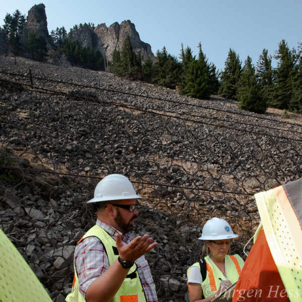
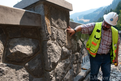
Standing beneath Shellrock Mountain, the author takes notes as Knud Martin explains some of the design concepts behind the newest segment of Trail. Photo by Jurgen Hess.
Our tour began at Wyeth Trailhead, where Martin pointed out additions such as a bike repair and water station, a restroom, information kiosks and pollinator habitat. He explained that other trailheads, also called “Gorge Hubs”, will open in Troutdale, Cascade Locks, Hood River, Mosier and the Dalles, encouraging visitors to explore these communities.
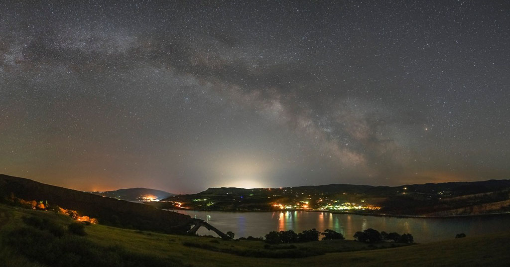
As we set out, I was immediately awestruck by the natural beauty of the Columbia River Gorge. It turns out my reaction was the result of a deliberate plan dating back to 1913.
In the dawn of the 20th century, when the Historic Columbia River Highway was still just a drawing on a map, engineer and visionary Samuel Lancaster was consumed with a dream to showcase the very best the Columbia River Gorge had to offer: “On starting the surveys, our first business was to find the beauty spots, or those points where the most beautiful things along the line might be seen in the best advantage, and if possible to locate the road in such a way as to reach them.”
The Oregon Department of Transportation (ODOT) has honored, wherever possible, the original design and aesthetic of Lancaster’s roadway. Katelyn Jackson, ODOT Community Affairs Coordinator, explained that “while laying out the alignment for the new Historic Highway State Trail, the team worked hard to develop a trail using the same design philosophy. In fact, the team often asked, ‘what would Samuel Lancaster do?’”
Coming up on the tour’s first prominent feature, Shellrock Mountain, it was evident that honoring Lancaster’s vision must have challenged the team as they contemplated how to build the Trail across it. A steep talus of loose, unstable rock, Shellrock Mountain is a common source of rockslides in the Gorge, and building roads around it has been an engineering problem for the ages. An Oregonian article from 1915 claimed it was impossible, stating, “It cannot be did!”
Today’s engineers confronted the same tough choices as Lancaster in his day, with one additional complication: Interstate 84. “The rockfall areas were the most difficult to design,” said Molly Davis, an engineer for David Evans and Associates. Her biggest challenge was protecting trail users from rockfall on one side and Oregon’s longest freeway on the other.
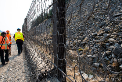
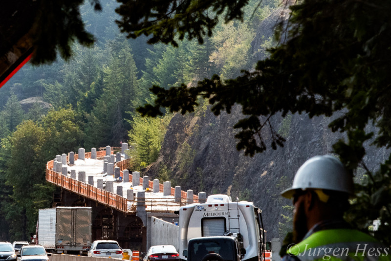
The Brugg catchment fence protects hikers and bikers from rockfall. Photo by Jurgen Hess.
Most of I-84 has a 10-foot shoulder, but Shellrock Mountain narrows it to a mere four feet, where it meets an 8-foot retaining wall that protects the highway from rock hazards. Shoehorning a new trail in between “a hard place and a highway” required impressive engineering. Despite the construction challenge, it was decided to build the new trail on top of the existing retaining wall using a Brugg catchment fence to contain falling rock.
The fence was treated with natina, a color treatment process used on all metal along the Historic Highway State Trail. The natina stains the metal an earthy brown, which helps it blend in with the natural surroundings of the Gorge.
Addressing the high concentration of low-elevation pikas living on Shellrock Mountain, ODOT’s Mike Odom said, “we tried to minimize the impact to the Shellrock talus slopes, both not to impact the pika habitat and for slope stability, by using a bench fill type of construction.”
Lucky for me, the Trail across the talus slope came with an unexpected treat: a rush of cold air releasing from the base of the mountain. Already suffering under the summer sun, I was relieved by the same thermodynamic mechanism that attracts pikas to Shellrock Mountain in the first place.
The site also offered a recaptured view of the Columbia River, and looking further up Shellrock Mountain, I could see a remnant of Wagon Road, a relic dating back before the construction of the 1913 Historic Highway.
New Trail, Same Approach
As we trekked east, Martin explained the team’s efforts to reuse and repurpose things that were onsite and part of the original project, including rocks, fencing and retaining walls: “We had a scavenger hunt attitude to reuse material.” Felled trees were left in place to provide habitat for the Larch Mountain Salamander, for example, and salvaged trees from the Eagle Creek Fire were used to create more wildlife habitat.
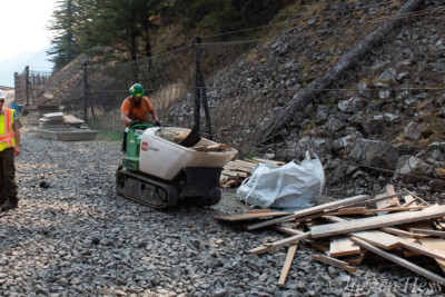
A worker scavenges for used form boards to be ground up and used for mulch along the project. Photo by Jurgen Hess.
Lynda Moore, who works with the U.S. Forest Service’s Columbia River Gorge National Scenic Area Restoration Team, shared her team’s concern about soil compaction “due to historical use as well as construction traffic, and a lack of organic matter.” To mitigate these potential revegetation problems, Moore said she will mix shredded woody material from onsite logs and left-over construction lumber into native soil in specific focus areas. In other places, the material will be used as a top-dressing for weed control and water retention.
Beginning in 2014, Moore and her restoration team have been collecting plant propagules on what she calls a “hyper local level”, meaning directly from the footprint of the planned project. Collecting seeds and cuttings on an annual basis allows them “to have a rolling or continuous stock of restoration plants available.” Some of the species, such as western swordfern, are difficult to grow, so the team utilized the Dorena Genetic Resource Center in Cottage Grove, a federal facility that specializes in the propagation of native species. The plant stock will eventually be returned and planted at specific sites along the Trail.
Another notable “reuse and repurpose” gesture is the return of northwest lumber baron Simon Benson. ODOT’s Katelyn Jackson explained how construction of the Trail made accessing the site of the Simon Benson Plaque possible.
“The original plaque was placed along the old highway to recognize Simon Benson’s contribution and dedication to the construction of the Historic Highway,” Jackson said. “It was relocated to the Starvation Creek Trailhead in the late 60’s and remains there today. The team decided to replicate the plaque and install it in its original location.”
Summit Creek Viaduct
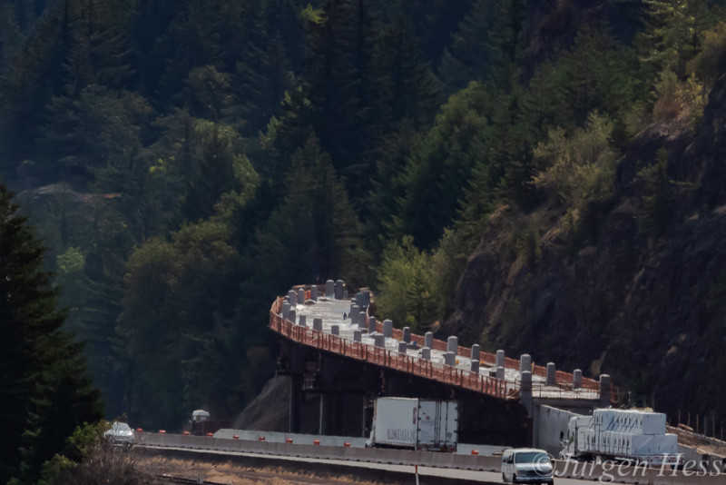
The viaduct climbs up toward Mossy Road and away from the interstate. Photo by Jurgen Hess.
Our tour was frequently interrupted by the passing of massive dump trucks and construction equipment, but the biggest hurdle we faced was climbing a 16-foot ladder in order to access the 500-foot-long Summit Creek Viaduct.
The viaduct, which features a retro, 1920’s-era design, curves snugly around a sheer rock face and climbs 40 feet from the lower elevation Trail up to Mossy Road. A great example of the unspoiled scenery that travelers enjoyed nearly a century ago, Mossy Road is tucked away from the interstate in a peaceful pocket of forest.
Lindsey Creek Bench Cut
Guard rails of locally sourced stone add to the Trail’s historic appeal. Photo by Jurgen Hess.
What goes up must come down, however, and engineers faced another construction complication in bringing the Trail back down to the level of the interstate. Seeking a solution, ODOT’s engineers looked back to how early Historic Highway designers steered across sheer rock walls, and they adopted the technique known as “cliff face construction”. Rock blasting along the cliff east of Mossy Road created space for the Trail, and master rock masons constructed a historically accurate guard rail using locally sourced stone and 100-year-old techniques.
Tourism Boost
Scheduled to open in the summer of 2019, the newest segment of the highly anticipated State Trail should serve a as a boost for the local tourism industry. But there are two sides to that coin. Towns like Cascade Locks, Mosier and the Dalles might appreciate the uptick in tourist dollars, but many locations throughout the Gorge are already struggling to deal with overcrowded parking lots and congested trails.
ODOT’s Katelyn Jackson said the agency has sought to address this concern by launching the Columbia Gorge Express in 2016. This is partly in response to “concerns about safety and access to the I-84 Multnomah Falls parking lot.” This year, the Columbia Gorge Express provides access not only to Multnomah Falls, but also to Cascade Locks and Hood River.
Managing agencies are currently working together to find ways to mitigate traffic congestion in the Columbia River Gorge. Photo by Jurgen Hess.
As a multi-agency planning effort, the Historic Columbia River Highway Congestion and Transportation Safety Improvement Plan will recommend projects and programs to improve safety, reduce vehicular congestion and enhance visitor experience for all transportation modes on the Historic Highway. The project planning area includes the Historic Highway along the waterfall corridor from Women’s Forum to Ainsworth State Park. Recommendations from this plan will be ready for public comment in the coming months.
Upon reaching the east side of the Shellrock Mountain crossing, our tour coming to an end, we looked toward the next phase in the construction of the Historic Columbia River Highway State Trail: the iconic Mitchell Point Tunnel. Trying my best to block out the roar of traffic along I-84, I thought about what it must have been like to travel through the tunnel in the 1920’s, and closing my eyes, I couldn’t help but imagine the distinct sound of a Model T coming my way. Ahooooooga!


Good to hear how much care is being taken with flora and fauna.
I keep wondering what it will be like to ride that hike/bike trail with all that freeway noise. And how much noxious fumes will users breathe in between Portland and HR?
Are there plans to create campsites for the many new users, or are they expected to use motels and hotels?
Hi J Nelson,
Thank you for your questions. The fact is, yes, there is freeway noise as your cross the trail, an unavoidable matter. What makes up for it are the stunning views of the Columbia River Gorge lost to travelers for over a century. It really is a delight to experience the unspoiled beauty, bridges, and forest canopy of the original highway.
Overnight camping is not allowed anywhere along the Trail. Biking or hiking travelers can seek lodging in the Hub towns of Troutdale, Cascade Locks, Hood River, Mosier, and The Dalles–all communities that welcome visitors.
Sincerely,
Susanne Wright, staff writer for Columbia Insight
Do you know the timeline for completing the entire 73-mile trail?